-
Quiet Week Ahead
After an eventful stretch of wintry weather, we will finally catch a break, as essentially zero meaningful precipitation is expected, and the only potential weather-related impact in the coming week is fog. Tuesday AM is the one to watch for… Continue reading
-
A chance to catch up
After nearly a week straight of frigid air, moderate to heavy snow, and dangerous wind chills, there is finally some light at the end of the tunnel. We got some sunshine early today, and despite it still being brutally cold… Continue reading
-
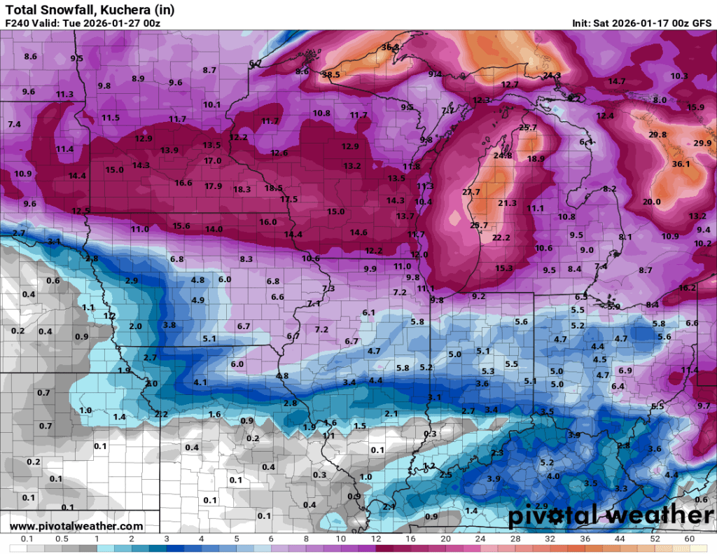
Big Storm to our South
Models have finally settled and are going through all of the phases we are used to seeing, including a decrease in totals across the board as the storm approaches. It will be exceptionally cold with this storm, so we may… Continue reading
-
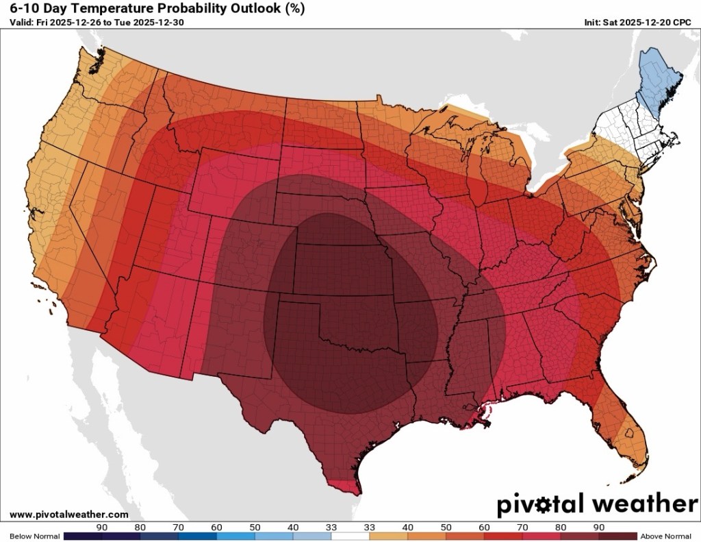
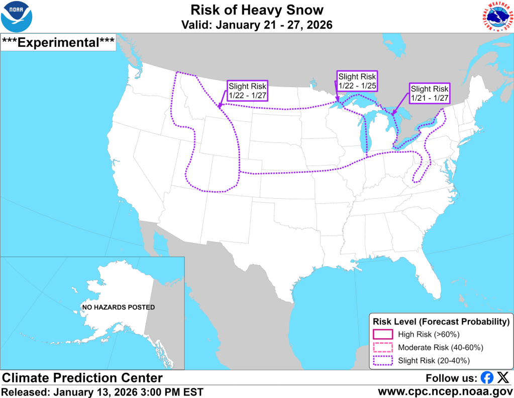
Serious Cold Coming?
You should be well aware of the sustained slight risk of heavy snow in the 8-14 day hazard outlook for nearly a week. I’m still not convinced about the snow, but I am not just confident, but almost concerned at… Continue reading
-
Winter Revving Up
Lake-effect snow begins tomorrow to our west, and the cold air that’s prompting it will stick around for at least the next week or two. As a result, we will have several chances to accumulate snow during that time, including… Continue reading
-
Where is Winter?
While certain aspects of northern Indiana winter have been here all season (that’s you, permacloud and wind), one thing has been missing for weeks now: snow. Looking back at the data from 2025, not only are we falling behind on… Continue reading
-
Tranquil, for the most part
Once our clipper system moves through today, things look pretty tame until perhaps the middle of next week when our next potential system may arrive. Temperatures Overall, temperatures over the next week or so look normal to slightly below. Toward… Continue reading
-
Huge Swings Coming…
Warning: Crazy weather (even for Indiana) ahead! Continue reading
-
Minor Ice Potential Friday
I hope you were able to enjoy the warm air yesterday. My car said it was 54°F yesterday afternoon, but my backyard thermometer peaked at 49.8°F. Either way, it was great! Models have backed off on the truly warm air… Continue reading

-
Winter Solstice
Days officially start getting longer again starting on Monday! Tomorrow marks our last sunset before 5:16 PM. By the end of the month, sunset is back to 5:23 PM. Sunrises start getting earlier January 6th. Tomorrow is technically our shortest… Continue reading