In my 2024-2025 Winter Outlook, I mentioned two things to watch for in December: early snow/cold and volatile temperature swings. So far in December, we have managed approximately 5.0” of snow and an average temperature of 28°. That average temperature is 4.3° below normal, but it needs some context.
In the first two weeks of December, we have seen truly arctic air, but we’ve also seen well above-normal temperatures. The high thus far for the month is 54° on the 8th. It looks like we will come very close to this tomorrow. The low from the month is 7° from this past Thursday.
Remember last December? It was one of the warmest on record, with the warmest day of the month falling on Christmas Day when we topped out at 58°. The average temperature was 37.9° (7.8° above normal). December 2023 only saw about 1.5” of snow, too.
So far, December 2024 has been much cooler and snowier than last year, but what does that mean for the rest of the month? Thanks to the weak La Niña, the temperature swings we’ve seen are likely to continue. Things look like they will be trending cooler again by late next week, which could mean more snow. The most recent 8-14 day hazards outlook showed a slight risk for heavy snow December 21-23, including areas downwind of Lake Michigan. You can see this outlook below, and many others, on the Medium Range Outlooks page.
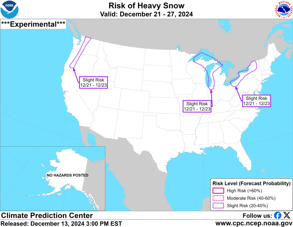
This outlook hasn’t been as good this year as last, but I’ll pay attention when it shows a slight snow risk. If it shows moderate or high risks, I’ll really get interested. I worry that this potential lake effect event could be driven by a predominantly westerly wind, which would keep the snow just north of the IN/MI state line again. That’s the one thing I expected in December that hasn’t happened but once. Granted, that one time it did happen was when we ended up with 3-4” of snow area-wide.
With La Niña slowly taking over, I still expect storm systems to slide further south, keeping us on the cold side of storms (more system snow) and leaving us with more of a northwest wind off the lake (more lake-effect snow) rather than a west wind. This trend of systems sliding further south happens every winter. I thought it might happen sooner, but it hasn’t happened yet. One of the biggest issues limiting snow in December has been available moisture. It has been very dry, and most systems that have passed have been moisture-starved.
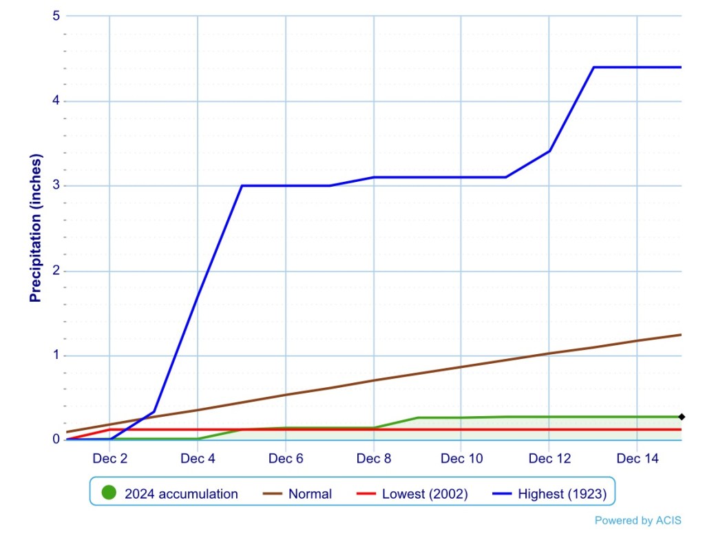
As the graph above shows, we are below normal in terms of precipitation so far. I’ve measured about 0.40” of rain in the last 12 hours, which will help, but we’re still only about halfway to our normal for this point in December—and that’s with the snow earlier in the month.
If you’re hoping for a white Christmas and more wintry weather, I think there is still a good chance for both in the next few weeks.

Leave a comment