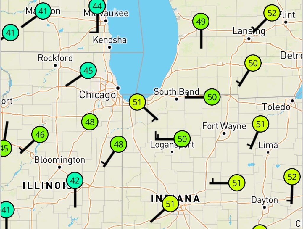
Today looks cloudy and breezy early, but I think we will see some breaks in the clouds as we get closer to lunchtime.
Unfortunately, the breaks in the clouds won’t last long, as more rain is expected tonight and especially tomorrow. Today’s highs will only go up a few degrees, but we are already sitting at close to 50°, meaning we should top out in the low to mid-50s.
Rainy, Windy Sunday on tap
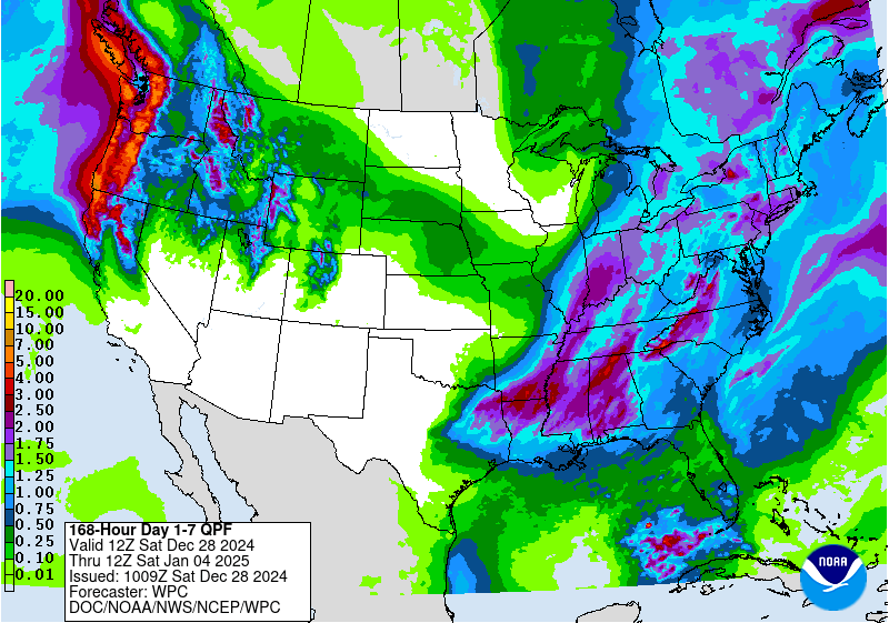
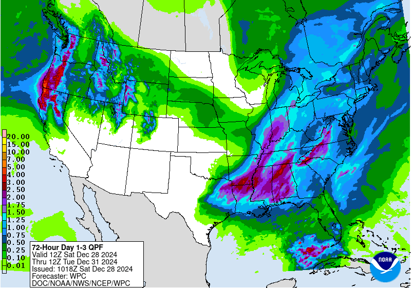
Tomorrow looks quite wet, and we should end up with some healthy totals when all is said and done. We haven’t had many days since July with more than 0.50” of rain and almost none with more than 1.0”, and we should end up close to 1.0” when all is said and done. This will be it for a while, though, as we will begin a gradual cool-down starting tomorrow.
Potential winter storm?
If you are a night owl, you may have seen my post late last night featuring the latest 8-14 day hazards outlook. You can find this outlook on the Medium Range Outlook page anytime, but I’ve also included it below.
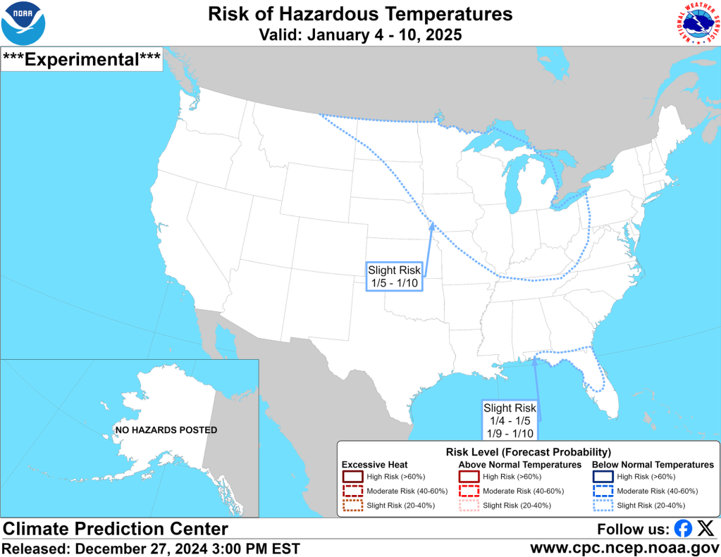
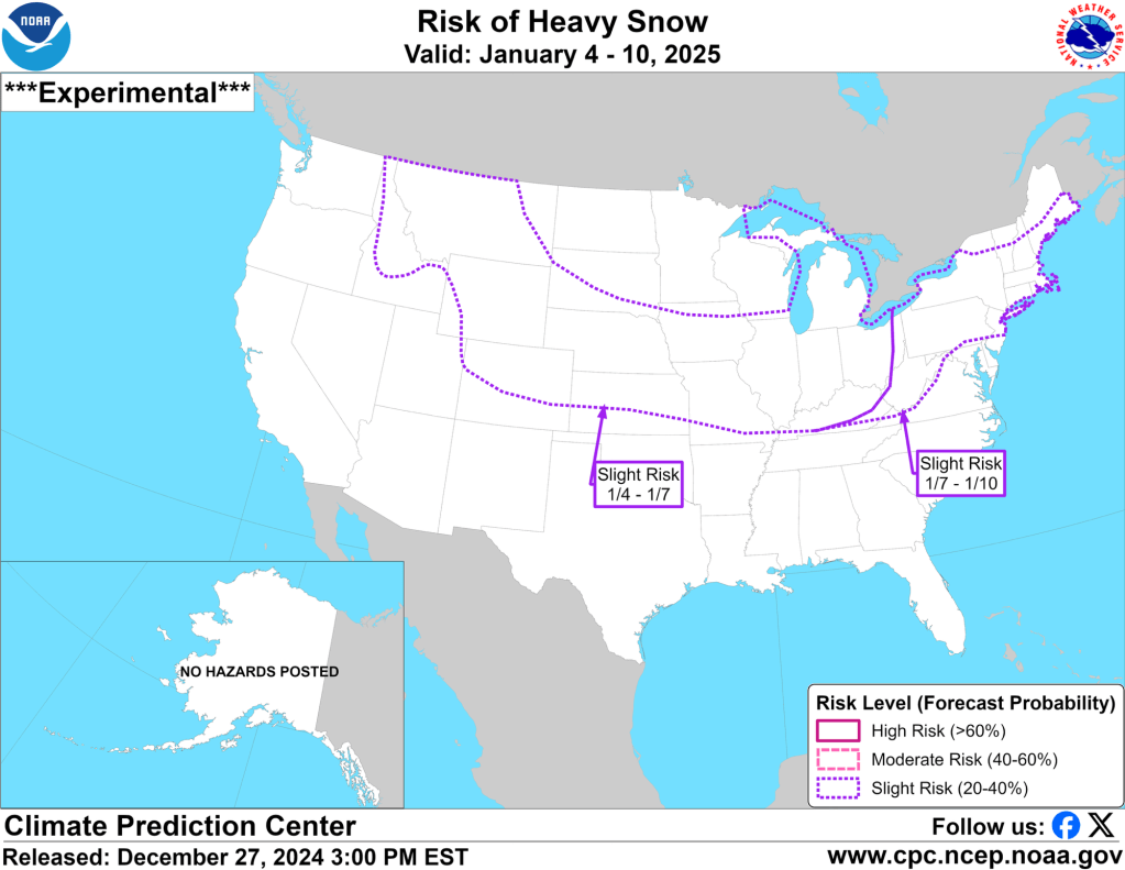
This is one of those things that is still firmly in “meteorological la-la land,” but as I have mentioned previously, I really like this outlook, and as the winter wears on, I believe it becomes more accurate. This is the first time all winter it has shown a risk of below-normal temperatures and a risk of heavy snow together over our area. This is also one of the first times it has shown what appears to be a synoptic event (system snow) and not lake effect. The predicted cold and snow combination is rare, even for this outlook, and lends credence to its viability.
Generally speaking, as the potential system gets closer, it shifts north and west. So, at this range, if I had to put serious money on it, I’d say parts of Minnesota, Iowa, northern Illinois, Wisconsin, and Michigan have the best odds of cashing in on a winter storm as we head into the second week of January.
Wild swings in models
Still, forecast models, especially the GFS, have struggled with consistency beyond a few days recently. The GFS shows very cold air and snow on one run and warmer weather with little, if any, snow on the next run. The ECMWF (European) model has been more consistent and is typically better at verifying than the GFS. The Canadian model is almost always biased toward too much snow, but it has fallen in line with the ECMWF, with more consistent cold and snow by mid-January.
Given the wild variance with each run, I have been waiting to post anything until there was some agreement amongst models, so it was good to see the hazards outlook sync up reasonably well with the ECMWF. However, to the best of my understanding, the hazards outlook utilizes the GFS, which only had cold and snow in one model run yesterday (wild inconsistency), so I am more than a bit concerned that the next run of the hazards outlook will shunt the cold and snow north and west or remove it altogether.
You can see the GFS and European model runs above and hopefully understand why I am not convinced the cold next week is a slam dunk. Unfortunately, we will have to wait until Monday for the next hazards outlook. However, we will get a new run of the other models every 6 hours—and I’ll check in on them regularly. Cross your fingers we can start getting consistency and agreement amongst models and runs.
Brighter days ahead…well, longer anyway…
Good news! Today will be approximately 30 seconds longer than yesterday! On January 1st, we’ll add 0:45 seconds of daylight, and by the end of the month, we’ll add over two minutes of daylight each day. The morning of January 28th will also feature our first pre-8 AM sunrise of the year!
-pw

Leave a comment