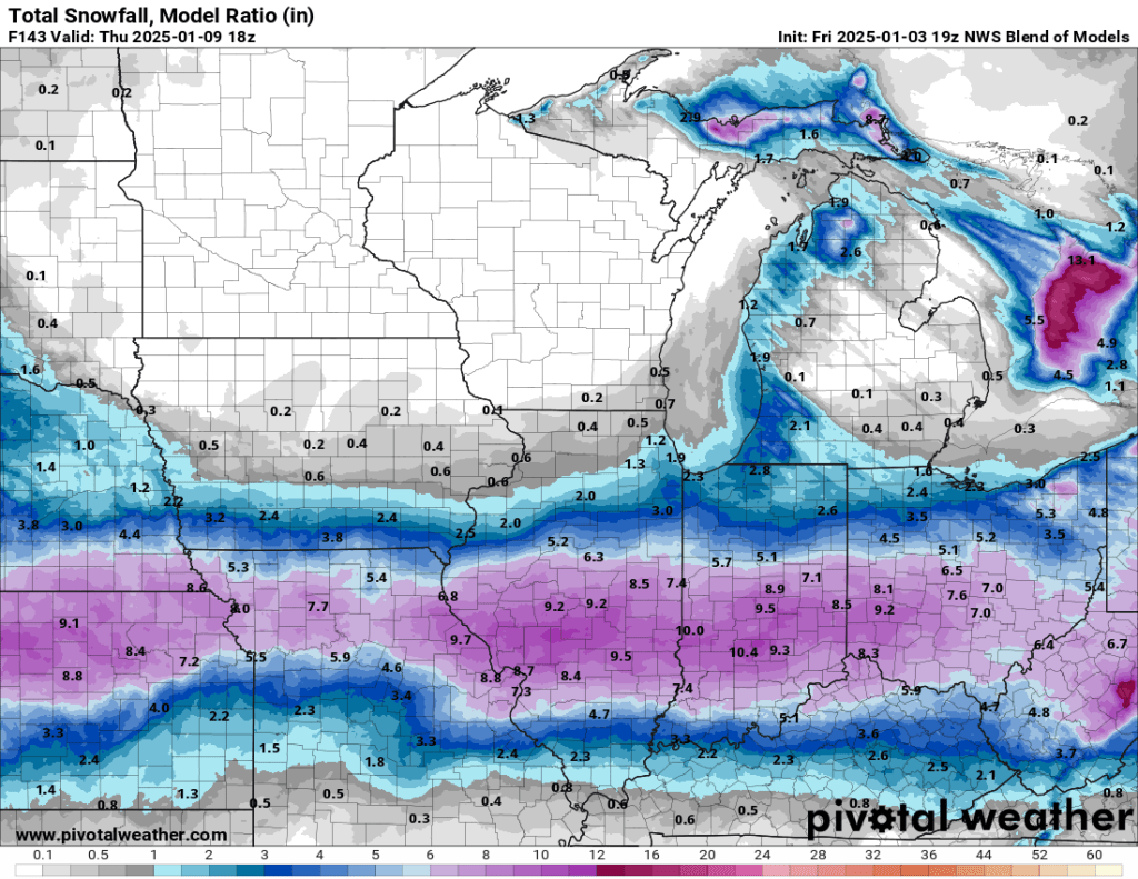
Alas, it isn’t in northern Indiana’s cards this time. Travel with extreme caution if you have interests in the Indianapolis metro area and surrounding communities, especially south of Indy, late this weekend and early next week. Widespread 5-10” accumulation is expected from Indianapolis south toward Evansville, where more ice is expected to mix in.
Locally, there will be little, if any, impact. Once the storm passes, we could see some light lake-effect snow, but that will likely remain isolated to our west. It will be cold next week, but without a blanket of snow, we may not approach “severe” or “extreme” cold for January in northern Indiana. Highs in the teens and lows in the single digits for a few days toward the end of next week can be expected. The wind may drop wind chills below zero, but it is probably not enough to prompt disruption to area schools/businesses.
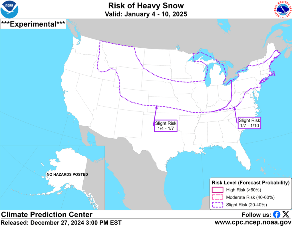
We will miss out on this storm, but I want to point out that the Hazards outlook from several days ago verified quite nicely. You can see for yourself below. This should be a good tool once again this winter.

The snow today, especially this evening, was picturesque, but as expected, it hasn’t accumulated much. I will say that out on my walk tonight, there were several slick spots where tire treads had melted then re-frozen and gotten covered with snow. Take it easy out there tonight.
Snow showers should taper off tonight, and we might get lucky and see a few peeks of sun by tomorrow afternoon.
-pw

Leave a comment