
We could see a little lake-effect snow Wednesday and Wednesday night (1-2” at best as of now), but we will need to keep an eye on a system Friday night into Saturday that could bring light to moderate accumulation.
Surprise, surprise, the GFS and Euro disagree. The latest run of the GFS has a more extensive system encompassing the entire state in a stronger and more northern solution. The Euro has the snow suppressed well to the south and is far weaker overall.
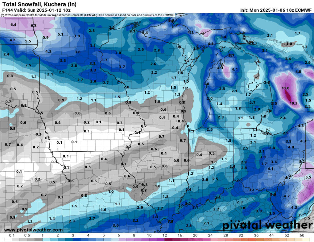
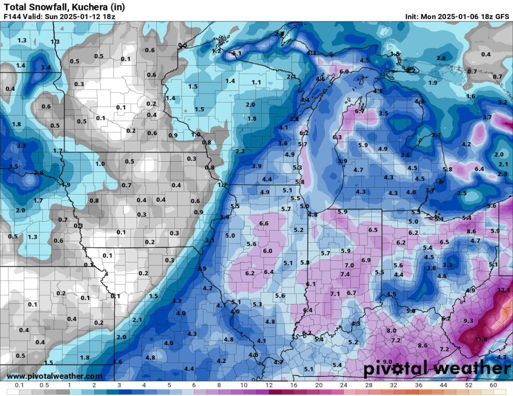
There were hints of this potential winter storm in both models a few days ago, albeit at a much greater range, so it will be interesting to see how things evolve over the next day or two. This storm also has the potential to bring accumulating snow to north Texas and even northern parts of several Gulf states, especially if a more southern solution materializes. At this time, a southern solution and more snow downstate seem most likely.
I continue to see indications of increased storm activity in the Midwest and Great Lakes as we head into the middle and latter parts of January. The newest CPC outlooks for the last two weeks of January are intriguing.
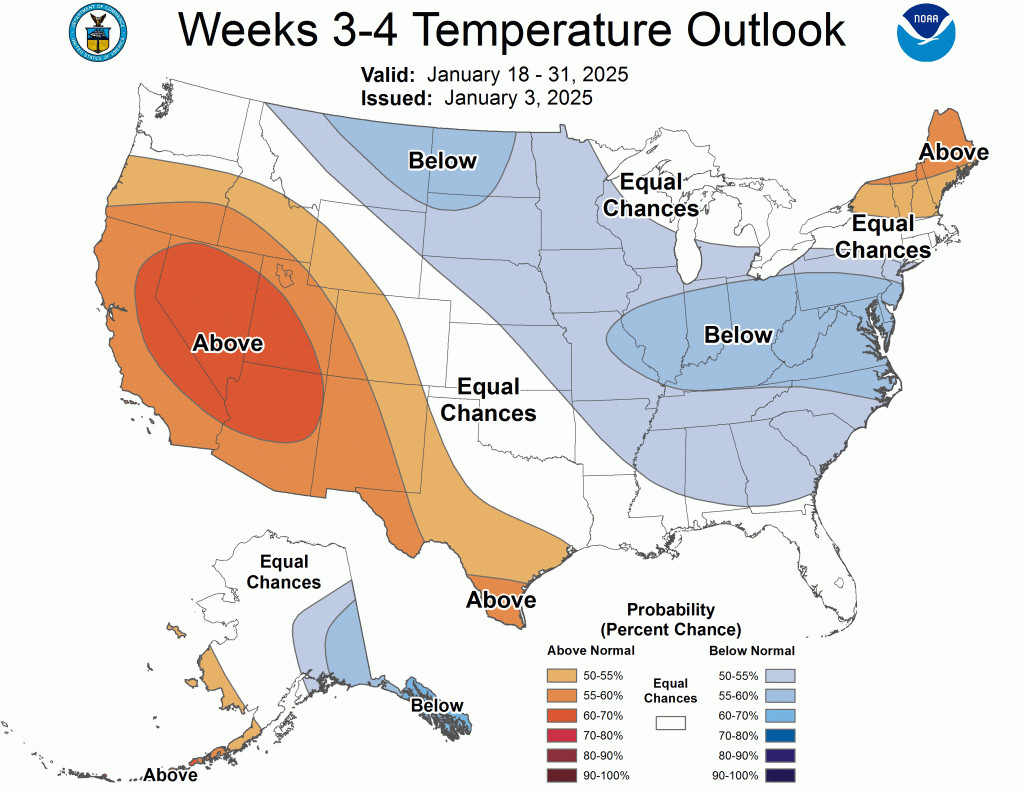
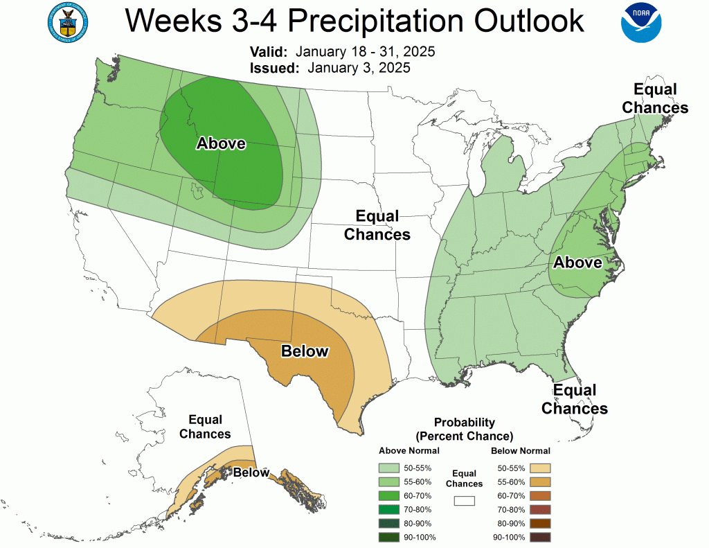
For the first time all winter, this outlook places Indiana and Michigan in an area with a high probability of both below-normal temperatures and above-normal precipitation. We’ve had several instances of below-normal temperatures, but during each of these periods, the outlook for precipitation greatly favored below-normal amounts. Furthermore, another long-range tool, the EPS weeklies, released data today, and it mirrors the CPC outlooks.
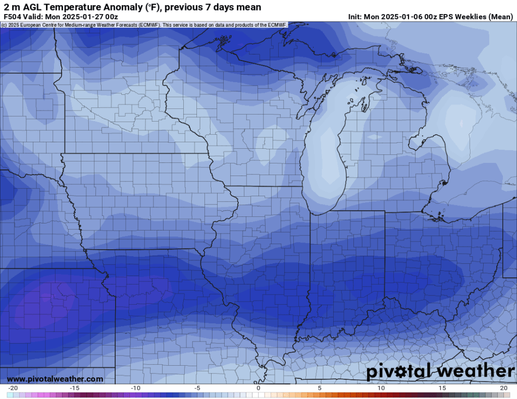
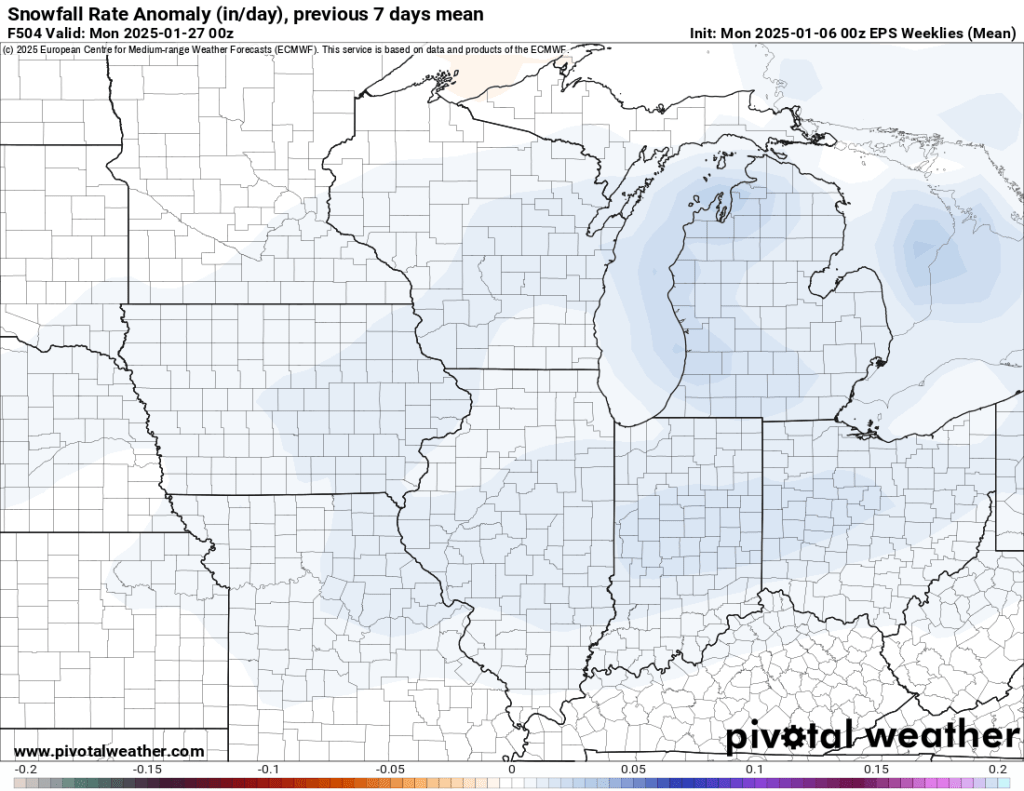
The week of January 20th looks exciting to me right now and I have a hunch that the winter storms developing before then may only swipe our region until then. There are signals that we could warm up and dry out again as we head into February. However, “warm up” is a relative term as the upcoming three weeks leading up to February will likely have below-normal temperatures. A cold and stormy pattern is settling in for January, and it should only be a matter of time before we start cashing in on some system snow. Lake Michigan remains ice-free mainly, so we’ll need to watch for lake-effect snow events following our synoptic (system) events.
-pw

Leave a comment