I mentioned a system approaching late this week and early this weekend a few days ago. At the time, the GFS and Euro were split. Now, these models have come into good agreement and our convection allowing models are also able to see the system and have solid agreement as well.
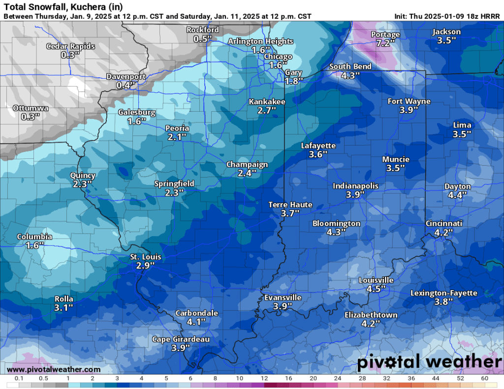
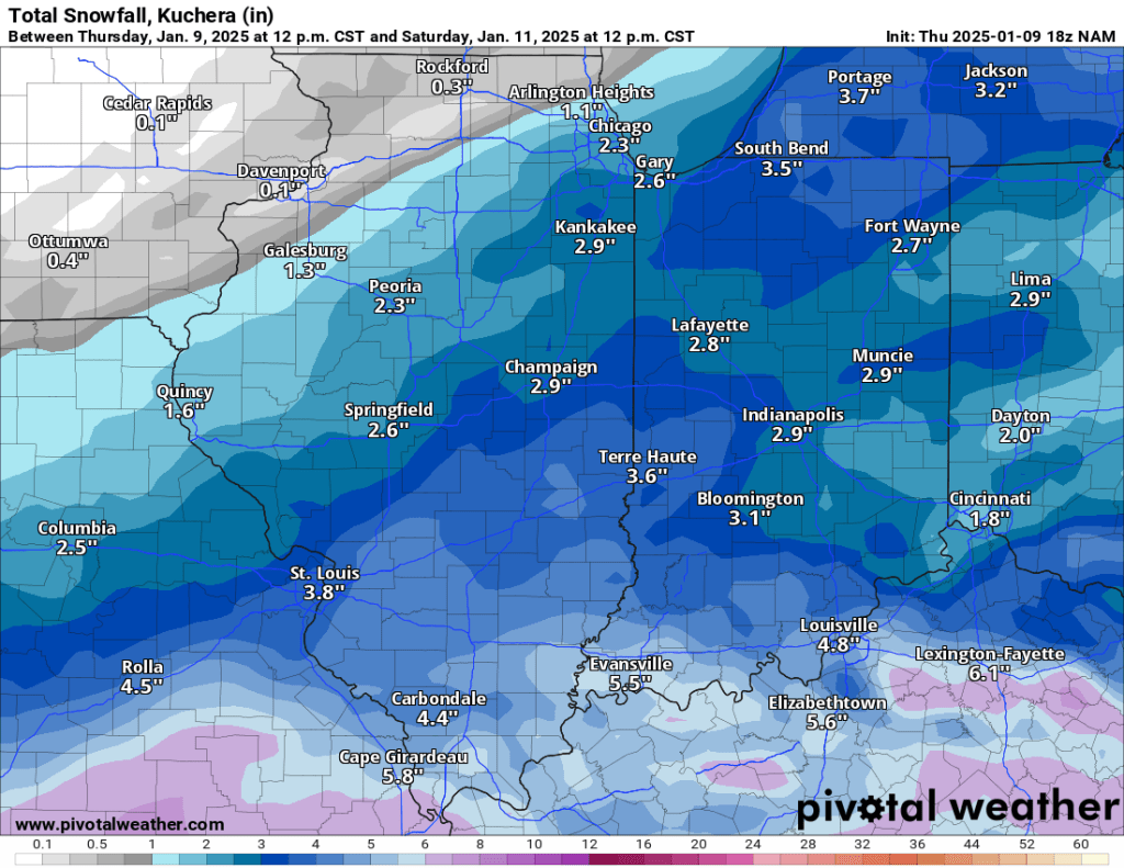
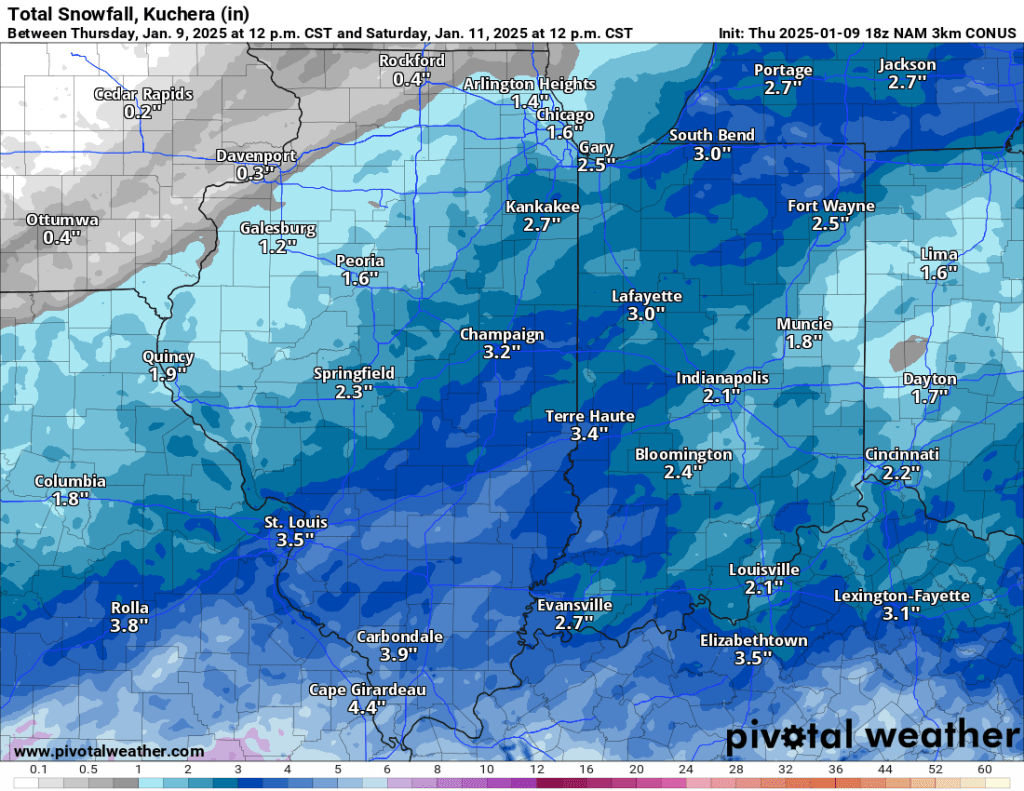
All three convection-allowing models (CAMs) are calling for 2-4” of snow in our area by 1 PM Saturday. The snow should begin tomorrow morning as flurries and snow showers before picking up a bit as we head into afternoon and evening. This system is on track to match the system from early December, which also dropped 2-4”. Nothing major, but enough to get out and shovel once or twice, and good reason to take it slow on the roads Friday afternoon and evening and into Saturday morning.
The snow will stick around this time, too, as a reinforcing shot of cold air is expected early next week. This should drop temperatures into the single digits overnight, and windchills below zero are certainly on the table next week.
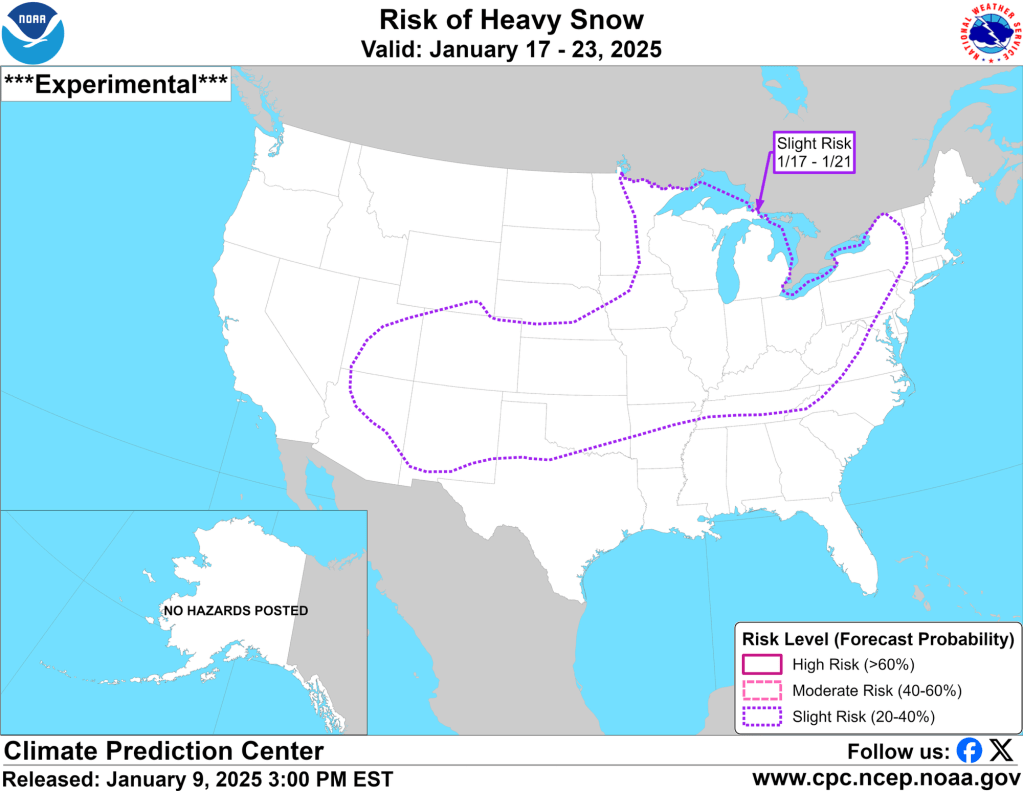
I also mentioned the week of January 20th as one to watch, and sure enough, the last two runs of 8-14-day hazard outlooks have shown a slight risk for heavy snow across our area from January 17 to 21st. You can see the latest outlook below.

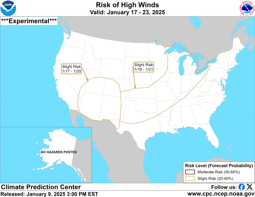
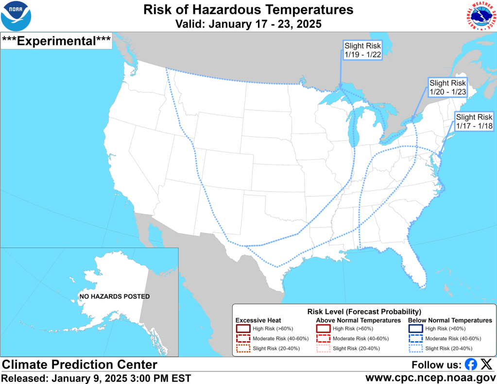
It’s not just snow that’s forecast for mid- to late January; high winds and excessive cold are also possible.
Enjoy the snow over the next 48 hours. Our pattern looks like it will remain active over the next week and could peak around January 20th. Beyond this, I still see signs of a thaw, but my confidence is low.
–pw

Leave a comment