
The winter storm early next week and accompanying snow are now gone from medium-range forecasts. However, it now makes a little more sense why. Dry air has eaten away at just about every snowy system we’ve seen this winter, which has reduced accumulations at times.
Warm air holds more moisture than cold air, and our cold air lately has been very dry. Next week, even colder air is expected to move in, and it will be even drier than what we’ve seen so far. The pending extreme cold isn’t the only reason our snowy forecast has changed, but it is a big part of it.
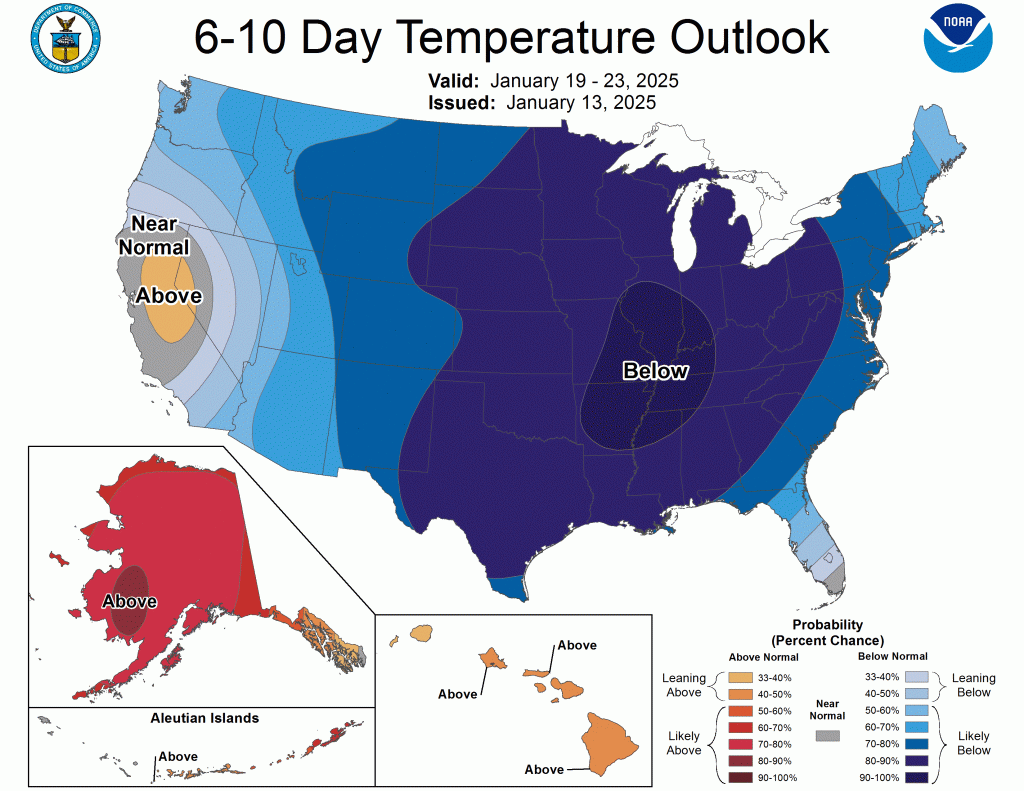
The latest CPC outlook has maxed out the chance of below-normal temperatures in our region in the 6-10 day timeframe.
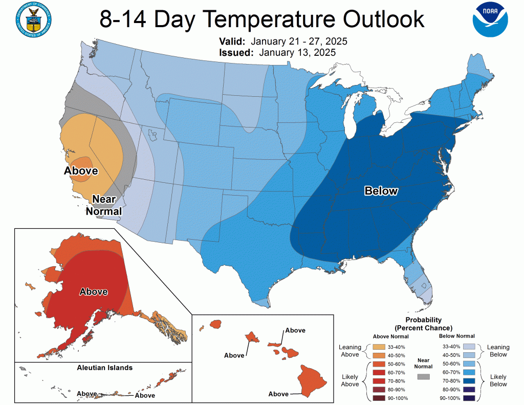
There is some relief in the 8-14 day range, but not much.
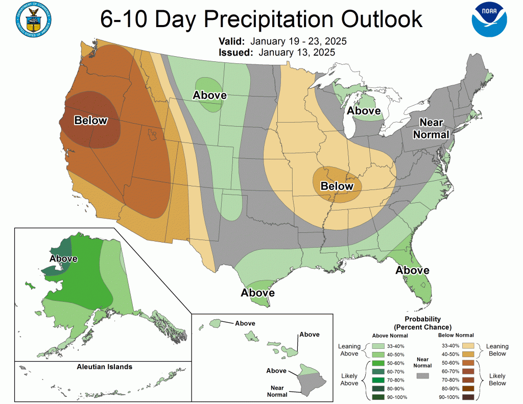
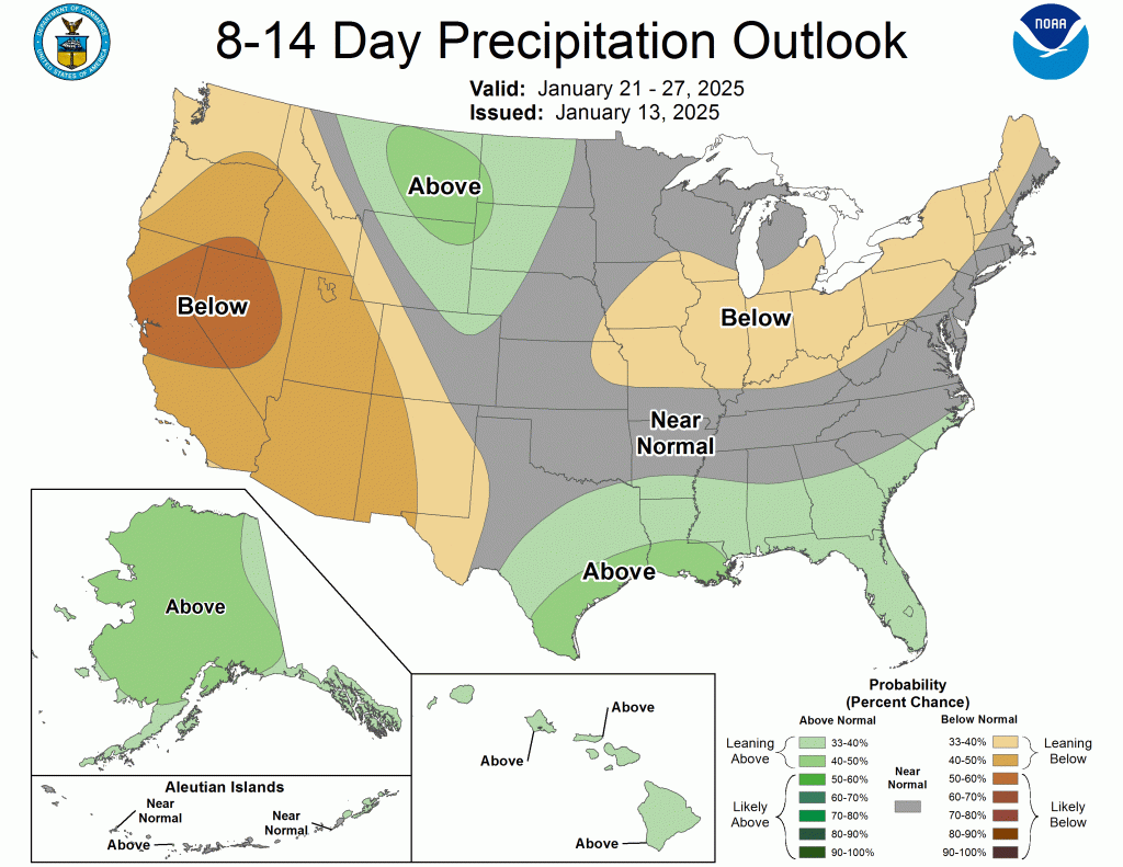
The precipitation outlook for both timeframes is unsurprisingly leaning dry for our area.
It’s bitterly cold now, with temperatures hovering around 10°F, but they will more or less stay this way until rising into the upper teens tomorrow afternoon. Wednesday will be cold as well, but by Thursday, we should finally get above freezing. Friday, we could approach 40°, but Saturday will begin our cool down with highs back around freezing. By Sunday, we are likely back in the teens, and then the real cold should arrive.
I’m hesitant to give actual numbers at this range because they tend to rise as they average out and we get closer. However, if the actual temperatures next week are within five or even ten degrees of what they are forecasted to be now, there would likely be disruptions to local schools and businesses next Tuesday morning—and potentially Wednesday, too.
We’ll fine-tune things as we get closer. I hope you enjoyed the sunshine today. Tomorrow, we’ll see more clouds and a few snow showers or flurries before, hopefully, some more sun on Wednesday.
-pw

Leave a comment