
The “winter storm” that was brewing is still coming, but not much of a storm and won’t feature much winter. Rain is expected to arrive in the second half of the day tomorrow and extend overnight into part of Friday. A few snowflakes could mix in late Friday as things wind down.
The weekend now looks quite pleasant, with clearing skies and a high of around 40°F on Saturday and at least some sunshine and highs in the mid- to upper 40s on Sunday. You read that right; we could make a run at 50°F on Sunday.
The pattern still looks very active over the next few weeks and warm over the next week or so.
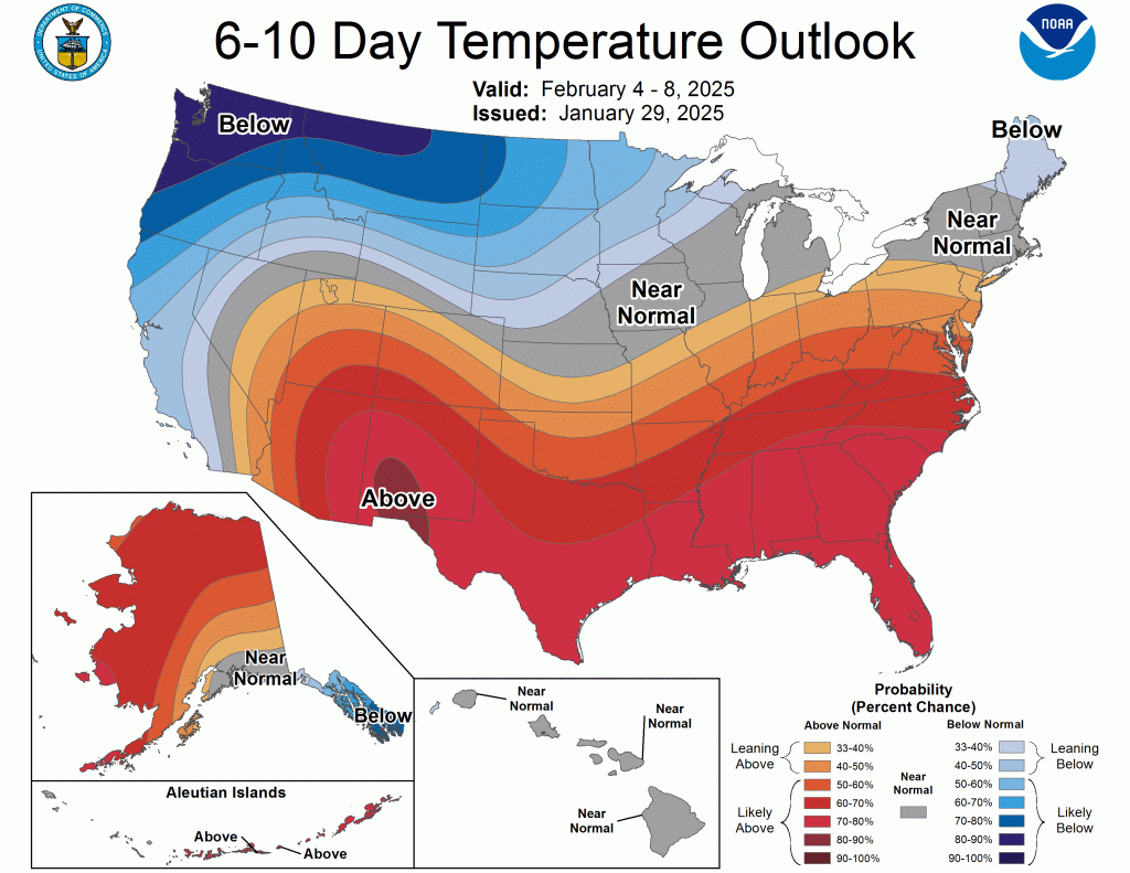
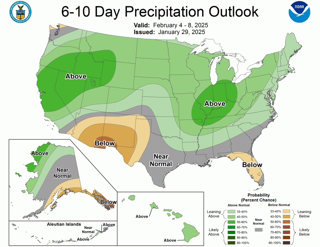
I’m not posting the 8-14-day outlook because it has really struggled lately, which speaks to the continued volatility we’ve been expecting in the forecast. It was only a week or so ago that we were below zero, and tomorrow and Sunday, we will be 50° warmer. We are also expecting a half inch or so of rain over the next few days.
I’m not throwing the towel in on winter yet. Still, at this point, I will swallow my pride and admit that it would take a very significant and improbable series of snowstorms over the next few weeks to reach the 47” I called for in my winter forecast.
Enjoy the relative warmth of the few days. This spring tease won’t last long.
-pw

Leave a comment