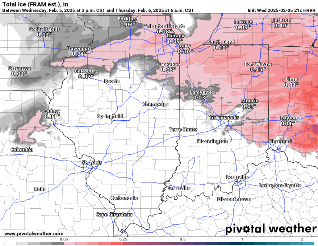
Wednesday PM update
Models have trended slower all day, meaning the wintry precipitation will start later. There is also some concern regarding dry air and a general lack of moisture on the northern fringes of the storm—both of which could lead to lower ice amounts or even a busted forecast.
These trends have also resulted in one significant change from the NWS regarding our Winter Weather Advisory—the start time has been pushed back from 7 PM to 10 PM. The advisory still runs through 10 AM.
Tomorrow morning’s commute will likely be impacted, but I still don’t believe it will be anything major. Based on all I see, I expect 0.05” +/- 0.03” of ice accumulation (accretion). Temps will moderate above freezing by mid to late morning, and road crews have done a tremendous job pretreating the roads, so I suspect impacts will be minimal. Nonetheless, it will likely be quite slick out tomorrow morning, especially on untreated and elevated surfaces, so give yourself some extra time to scrape the windows and safely arrive at work or school.
Wednesday AM update
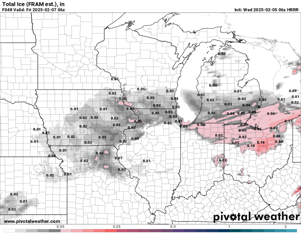
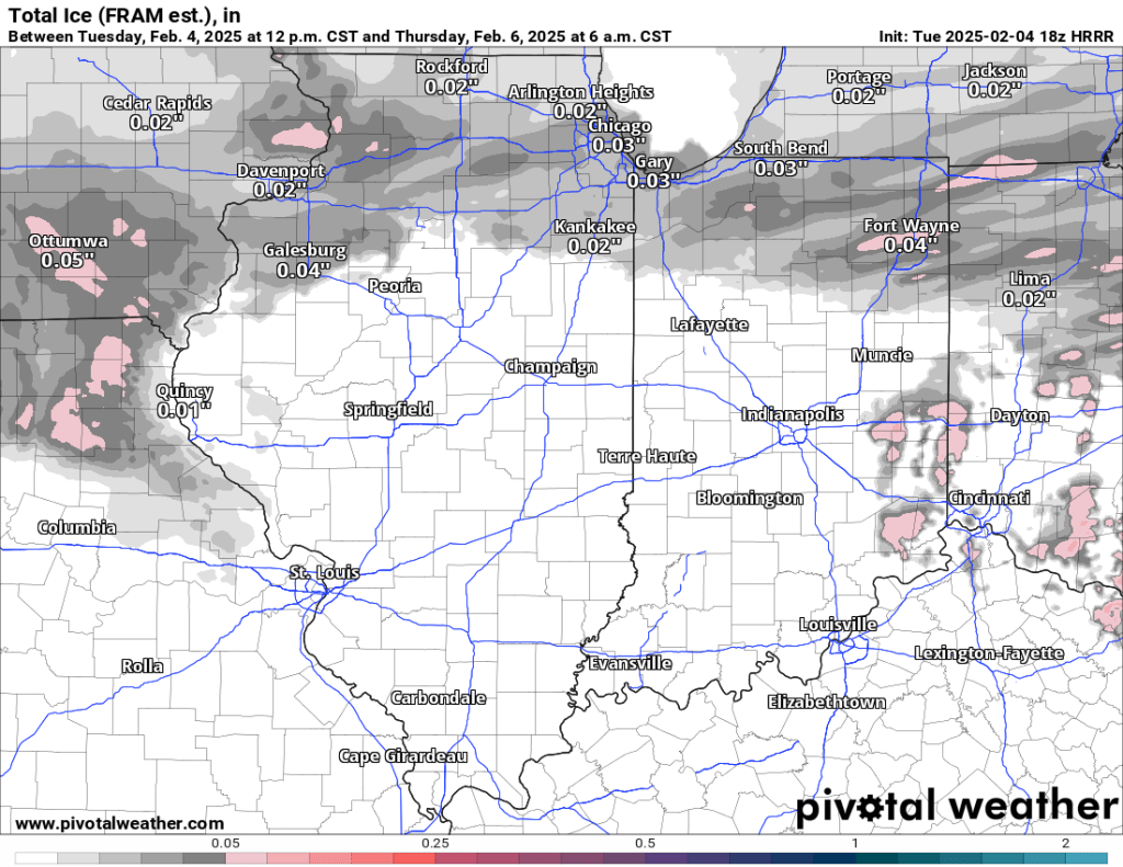
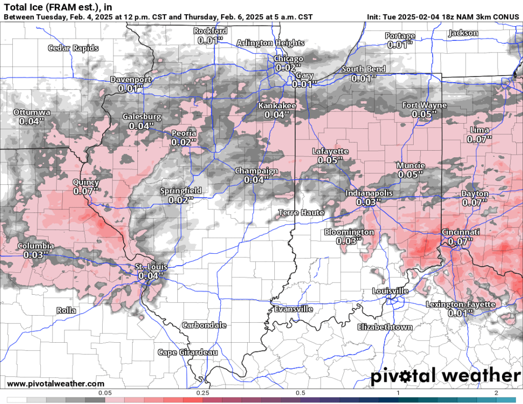
Overnight model runs have finally come into better agreement across the board. At this range, it appears that we could see freezing drizzle, occasionally mixing with freezing rain, this evening into very early Thursday morning. There will be slick spots tonight and early tomorrow. 0.05” to as much as 0.10” of ice is possible, especially on elevated surfaces. Temperatures are expected to hit about 40° by tomorrow afternoon, so any impacts will limited to late tonight and early tomorrow. My inclination is toward the lower end of the 0.05-0.10” range and I still prefer the NAM and especially HRRR model solutions.
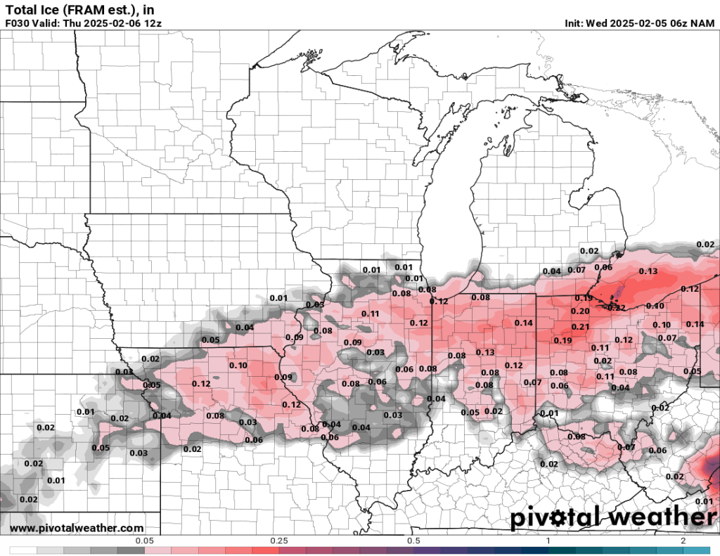
A Winter Weather Advisory goes into effect from 7 PM tonight through 10 AM tomorrow. I don’t think this will be a huge deal. You can expect slick roads for a few hours overnight tonight and possibly into the Thursday morning commute. Areas on the higher end of the 0.05-0.10” range may see some school and business disruptions.
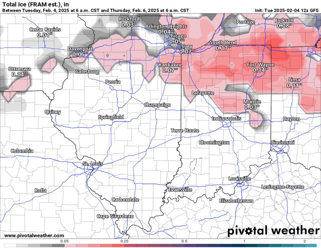
Tuesday PM update
Models have maintained their forecasts for the most part since this morning. The global models (GFS and Euro) are more bullish and local with ice. Here are the latest forecasts for 7 AM Thursday.
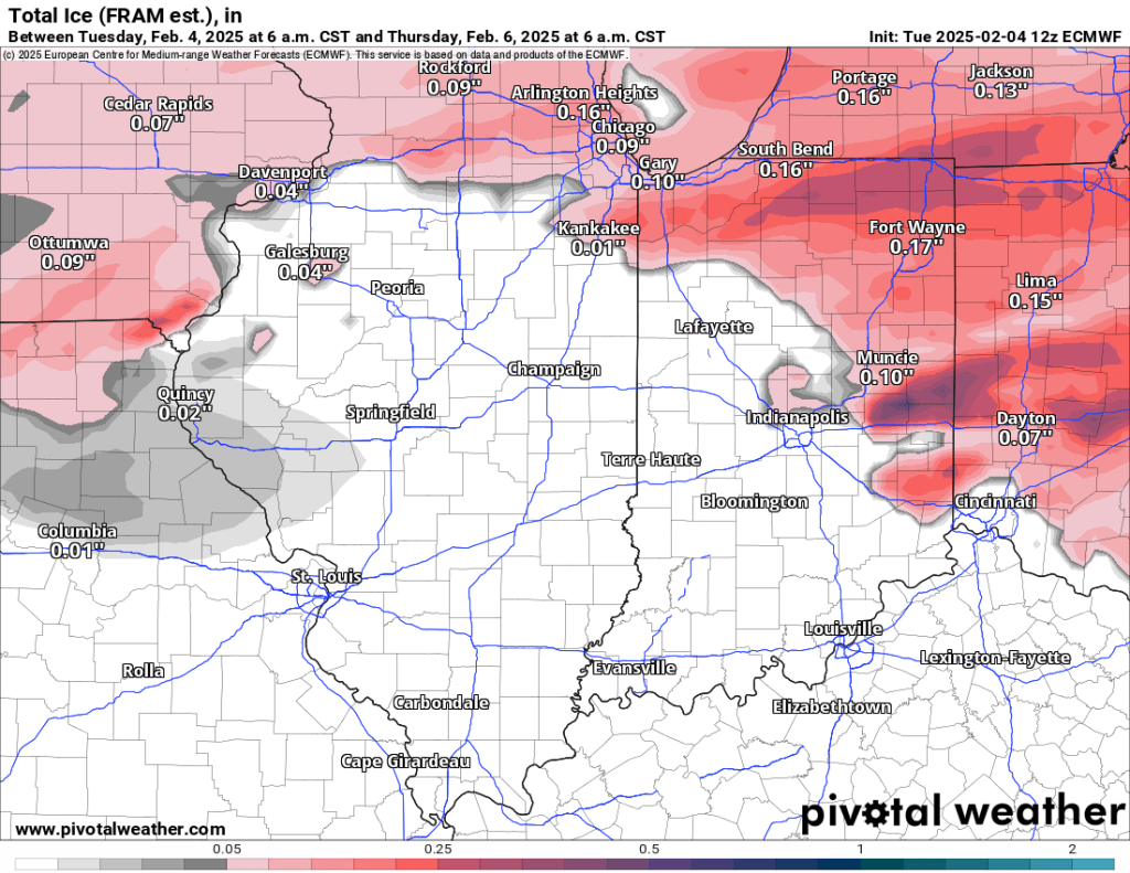
The CAMs are further south and have lower amounts overall. Again, here are the latest forecasts for 7 AM Thursday.
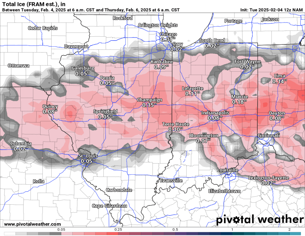
Like last night, I’m still leaning toward the CAMs, as even the global models have backed off totals and shifted somewhat south. Previous model runs can be seen below. I’ll have more updates tomorrow.
Tuesday AM update
The medium-range models (GFS, Euro) have remained consistent with overnight runs keeping the freezing rain Wednesday night in our area. Several more shorter-range CAMs (NAM, NAM3km, HRRR) have come into focus as well, and they are consistently keeping the freezing rain both further to our south and with lower totals. I’d lean in favor of the CAMs at this point.
Monday PM (original)
Wednesday night into Thursday morning is looking increasingly interesting. Our major mid-range models have been sniffing out a late-week wintry mix, including freezing drizzle or rain, for several runs now. As we get closer, the details are becoming a bit clearer.
Tomorrow will be much cooler than today, with highs only in the mid to upper 30s. Wednesday, precipitation could vary between rain, snow, and freezing rain before a stretch of freezing drizzle or freezing rain is possible Wednesday night into Thursday morning.
You can browse the amounts of freezing rain accretion from the latest runs of several models below. There is pretty good agreement with timing and slightly less agreement with amounts. The higher amounts are likely overdone.
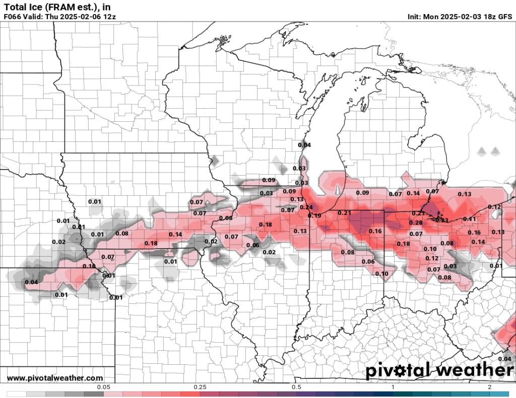
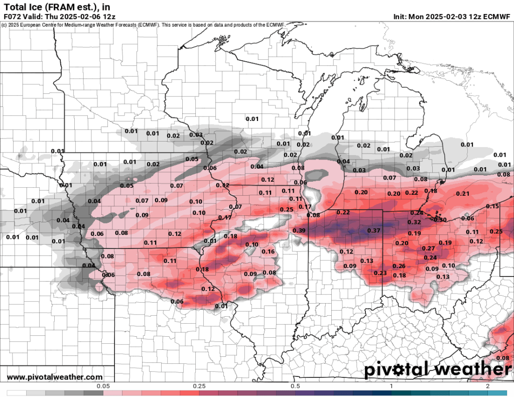
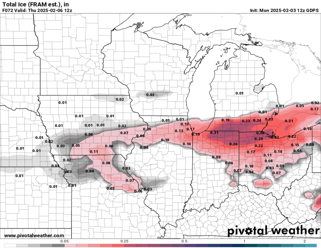
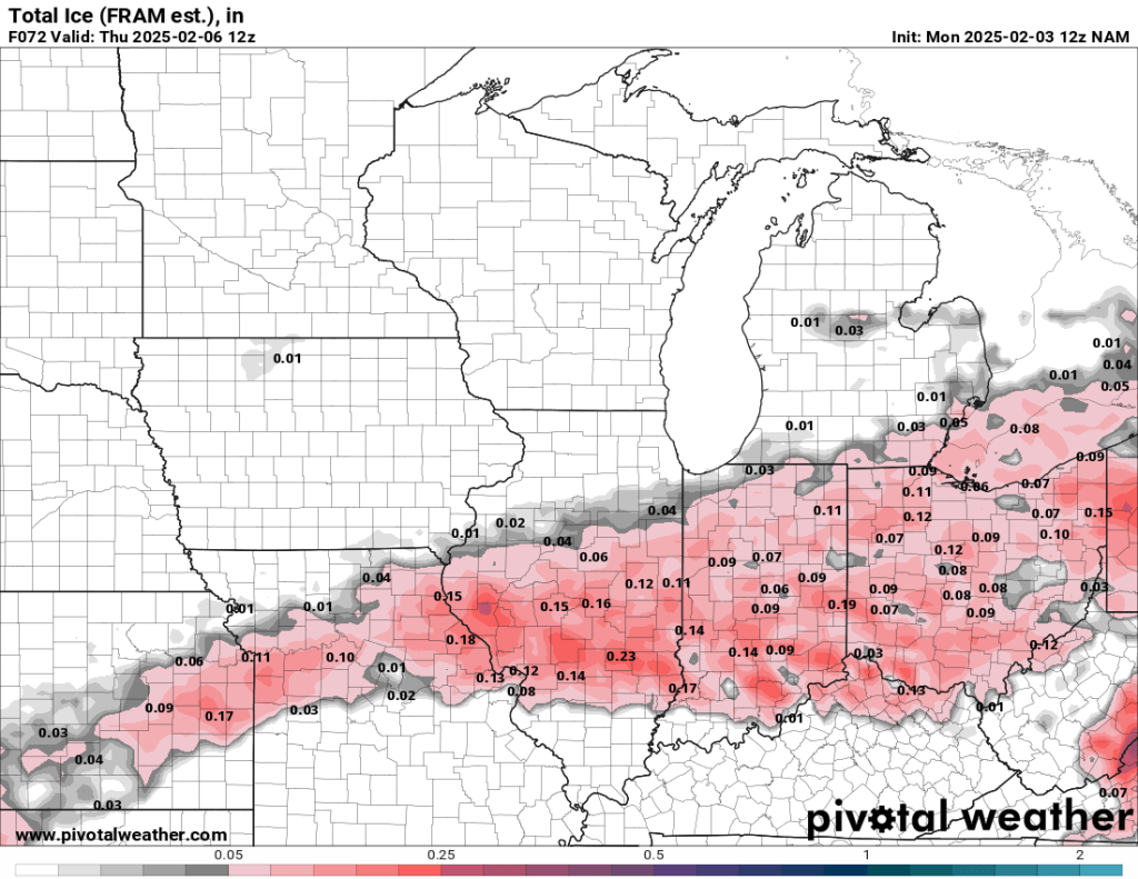
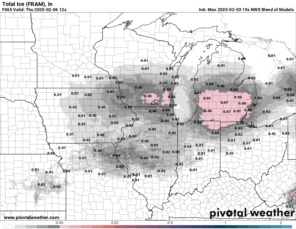
Two things to note: the blended model is much more conservative and probably more realistic than most models. I trust the NAM, the only mid to short-range, convection-allowing model available, and it takes the bulk of the ice to our south. Trends over the next 24 hours will be really important to watch.
If fog is the #1 most difficult-to-trust forecast, freezing rain is #1A, so I wouldn’t go too crazy planning for any significant travel disruption just yet. And this will not be a crippling ice storm, no matter what. Should we get 0.05-0.10” of ice, the timing would have the most significant influence on potential school and business disruptions. Typically, anything over 0.10” will cause at least mild to moderate disruptions. If we get beyond 0.25”, power lines and tree limbs breaking become a concern
Right now, the timing is such that the Thursday morning commute could be affected. Amounts are currently expected to fall within that 0.05-0.10” range, but they could be higher or lower. We need a few more model runs and time to bring things into focus and add confidence to our forecast. I will update this post a few times before Wednesday.
After today, we should all remember that we still have at least two months of wintry weather left. Here’s a very scientific timeline of our current position in winter:

Have a great evening, and watch out for those weather weenies touting crazy ice and snow totals over the next two weeks.
-pw

Leave a comment