Saturday AM Update
The models were consistent overnight, and this morning, nearly all of them except the HRRR kept the majority of the ice to our south and east. That being said, three temperature zones will determine precipitation type: surface, 0-100 feet above the surface, and roughly 100-10,000 feet above the surface.

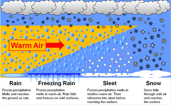
The temperature in each zone will determine the precipitation type we see. That orange-colored “warm air” is frequently called the warm nose, and it is ultimately what determines precipitation type. Even this morning, there is very low confidence in how far north the warm nose advances, and as a result, who sees what kind of wintry precipitation.
I’m hanging with the HRRR as it handled a similar situation earlier this week quite well. Here is the latest from the HRRR:
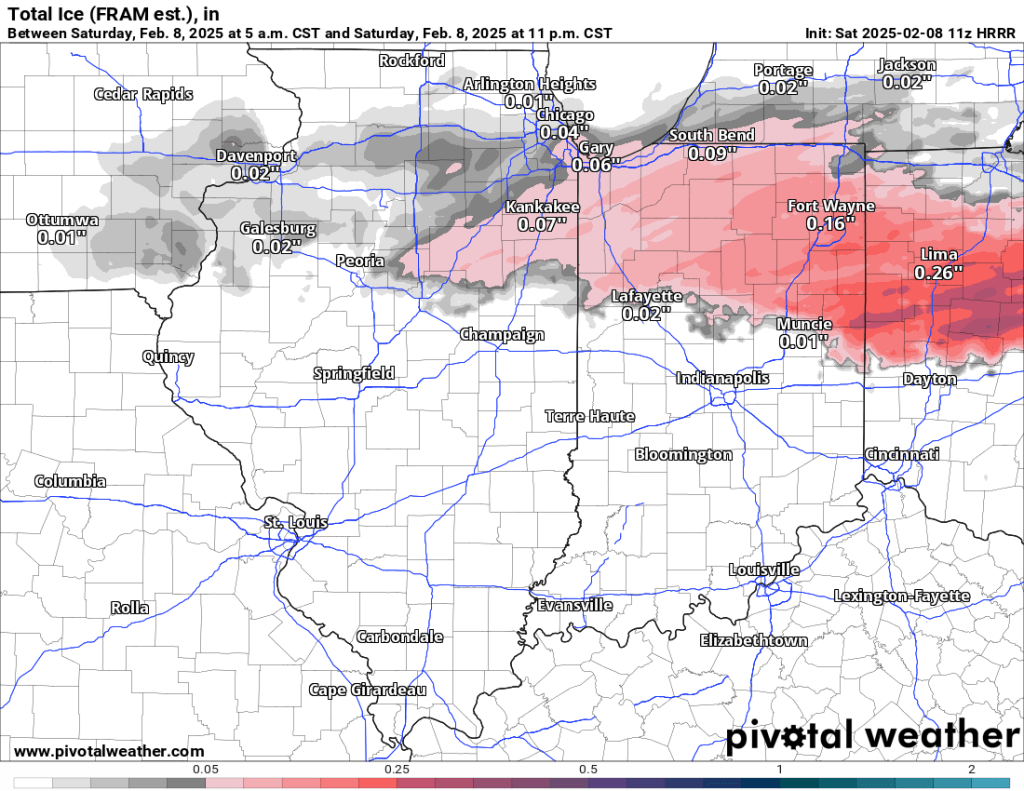
The HRRR shifts most of the ice to our south and east but still keeps a tenth of an inch of ice or less here. I’ll maintain 0.05-0.10” locally, but the trend has been lower ice totals, indicating more mixed precipitation (snow, sleet, freezing rain, freezing drizzle) with no dominant type.
A Winter Weather Advisory will go into effect at 1:00 PM and last through 11 PM. Michigan counties were left out because of the uncertainty around precipitation types, and we are on the northern edge of the advisory.
We need to get through today first, but there is a chance of snow accumulating early and again late next week, with the latter potentially having light to moderate accumulation. Recent trends have shifted the heaviest snow to our north and west but haven’t been consistent, so there is little to no confidence in any current solution from global models (Euro heavier accumulation but near Chicago, GFS lower amounts but more of a local impact).
Friday PM Update
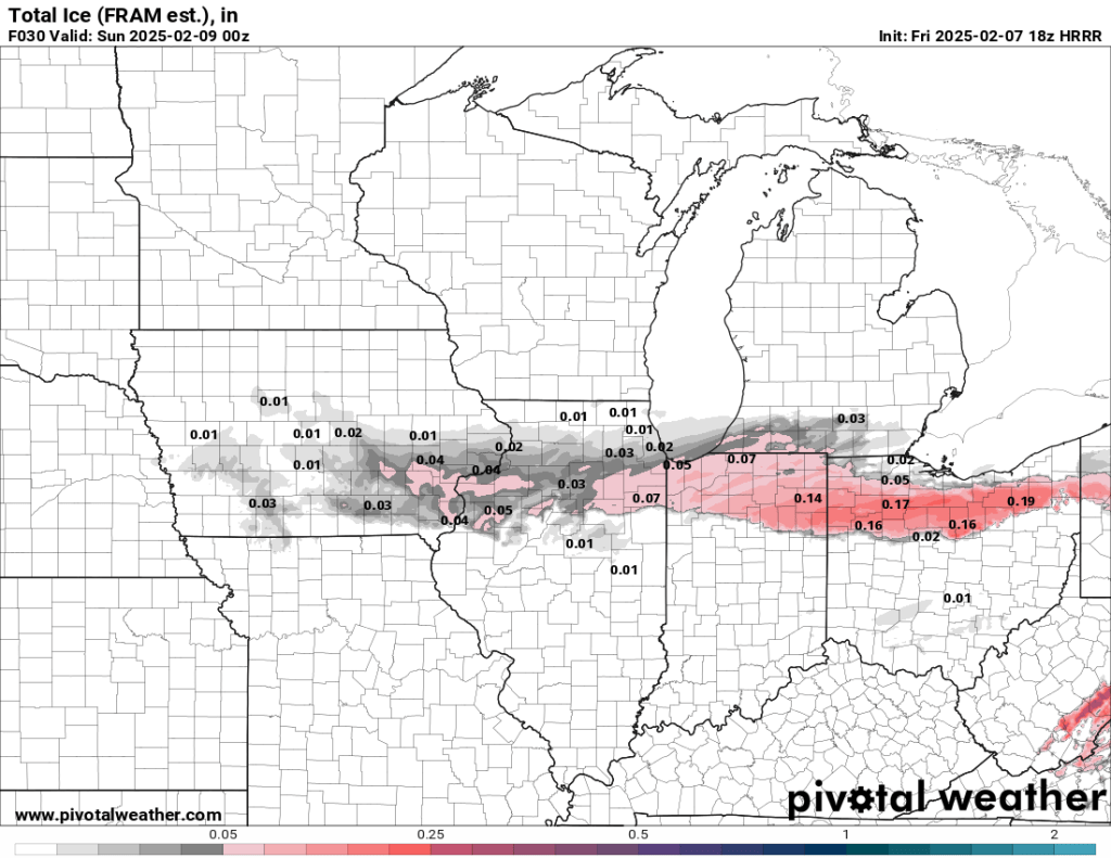
The latest runs from most models, including nearly all CAMs (except the HRRR that did well with the ice earlier this week), have shifted the ice south of Goshen. Areas like Syracuse and Warsaw would be on the northern edge of the ice, and Goshen, Dunlap, and Elkhart would see more mixed precipitation, leaning heavier on sleet and snow. Though, even if we do see mainly snow and sleet, it wouldn’t amount to more than an inch or two. This is a more recent trend, so the overnight model runs will be key in identifying whether these runs are outliers or a trend that will stick. No matter what, tomorrow afternoon isn’t going to be the best time to be out on the roads if you can help it.
Original Post
Chances are good that we will see more ice tomorrow afternoon. The best guess right now is between 0.05” and 0.10” of ice accumulation, which is possible between noon and 6 PM tomorrow. I’d lean on the lower end of that estimate, but as we saw earlier this week, even a few hundredths of ice can cause travel woes. With our last ice event, the HRRR model handled it well. Here’s a look at the latest run of that model:
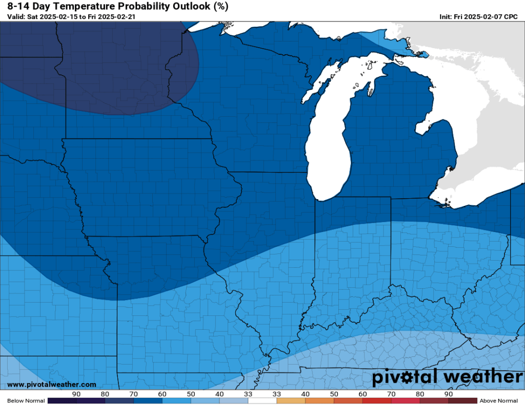
We’ve been warm overall for the last few weeks, but that will change over the next two weeks. In the temperature department, we will soon be trending below normal again. I don’t see subzero temps in the next two weeks, but we could drop into the single digits at times overnight.
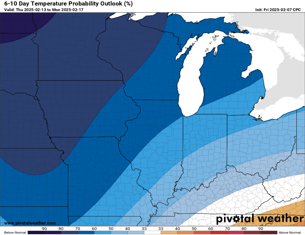
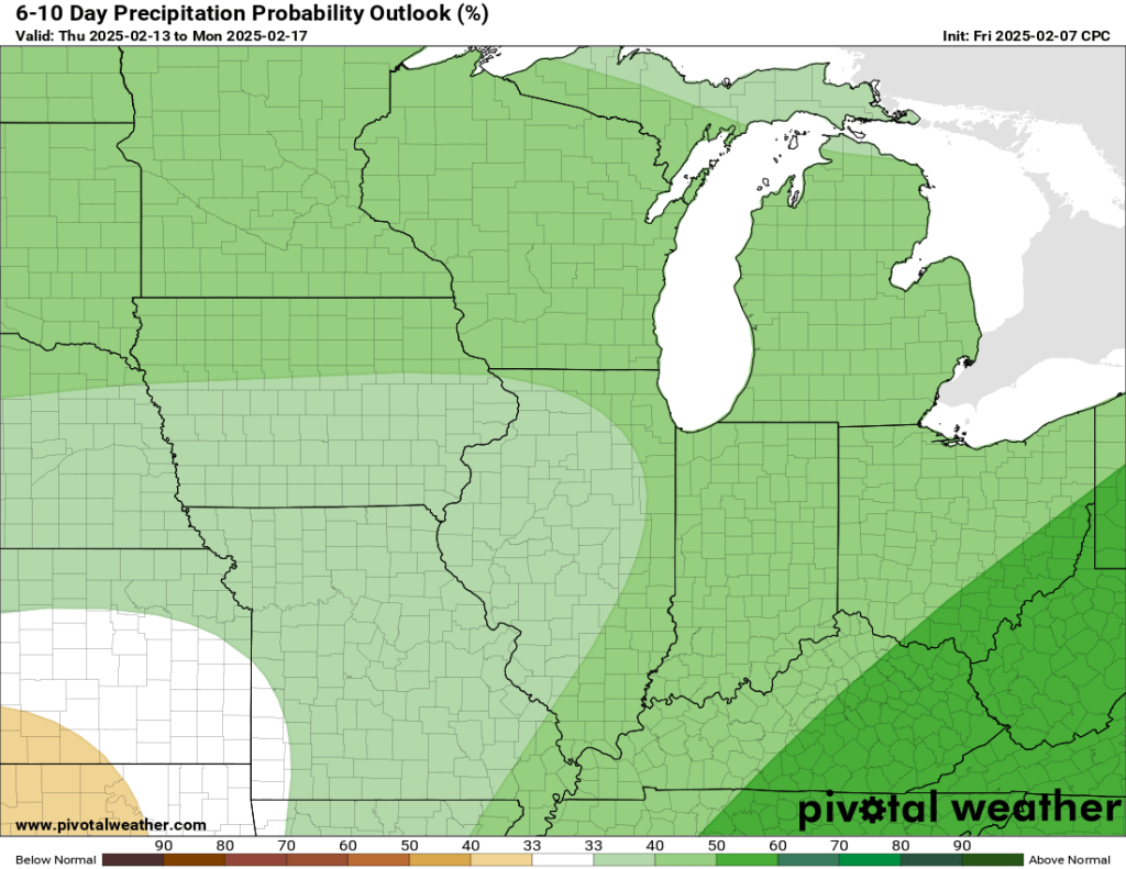
Signals also indicate a good chance of above-normal precipitation over the next two weeks.
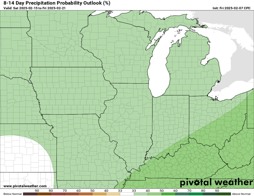
Overall, the odds are good for seeing a more active, wintry pattern unfold over at least the next two weeks. We are definitely not done with winter yet. That said, even though there is a chance for some snow next week, I don’t see any significant events unfolding within the next 7-10 days.

Leave a comment