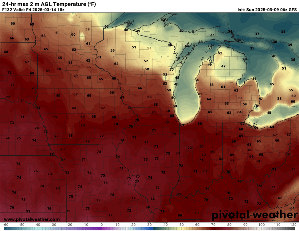
A spring preview begins today and will last through the next week. During this time, you can expect primarily pleasant weather with temperatures reaching 60°F or better each day and peaking late this week with highs that could approach 70°F.
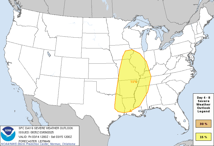
As mentioned earlier this morning, we will need to monitor the potential for our first round of severe thunderstorms on Friday. Odds are, the storms will stay to our south and west, but if the warm, moist air speeds up or spreads any further north than currently expected (and some models are starting to show this), we could be in play for all modes of severe weather.

Timing will also be a key factor. Right now, the front with the storms is expected to pass overnight, and it lacks the sun’s energy, which is generally needed this time of year in our area for storms to pack a punch.
In the meantime, enjoy the next three days. They should be about as good as they get this time of year around here.

And we all know what can still happen in April (I won’t mention that “S” word). I will say that, for now, it looks mild beyond next week as well—but confidence in that is low.
–pw

Leave a comment