Day one of a two-day severe weather outbreak is underway. Fortunately, most of the bad weather will stay to our west and south. The first day of the outbreak is focused on the middle of the country, but the fringe includes our area.
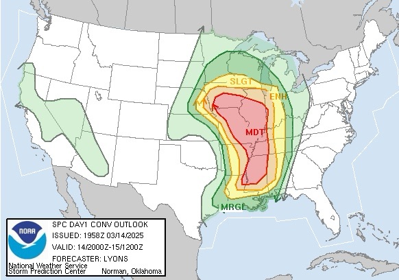
There is a great deal of uncertainty regarding just how far north and east the storms will get after the sun goes down tonight. Our chances for storms have increased, but I’m not too concerned about severe weather locally.
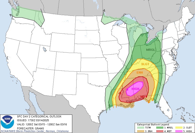
Tomorrow, the severe weather threat is further away. Actually, parts of Mississippi and Alabama could see a fairly significant tornado outbreak.
There is a chance for rain early and again later tomorrow, but we should see plenty of dry time. Tomorrow will be very windy, with gusts over 50 mph expected, prompting a High Wind Watch from 12 to 6 PM. We should still be warm tomorrow and could even eke out another 70°F reading.
We cool down to normal or even slightly below normal on Sunday before warming up again for a good part of next week.
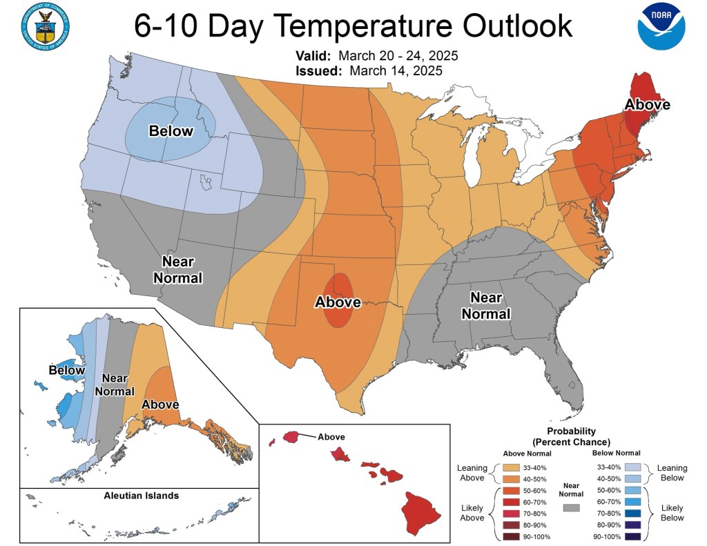
Beyond next week, the theme remains warm overall.
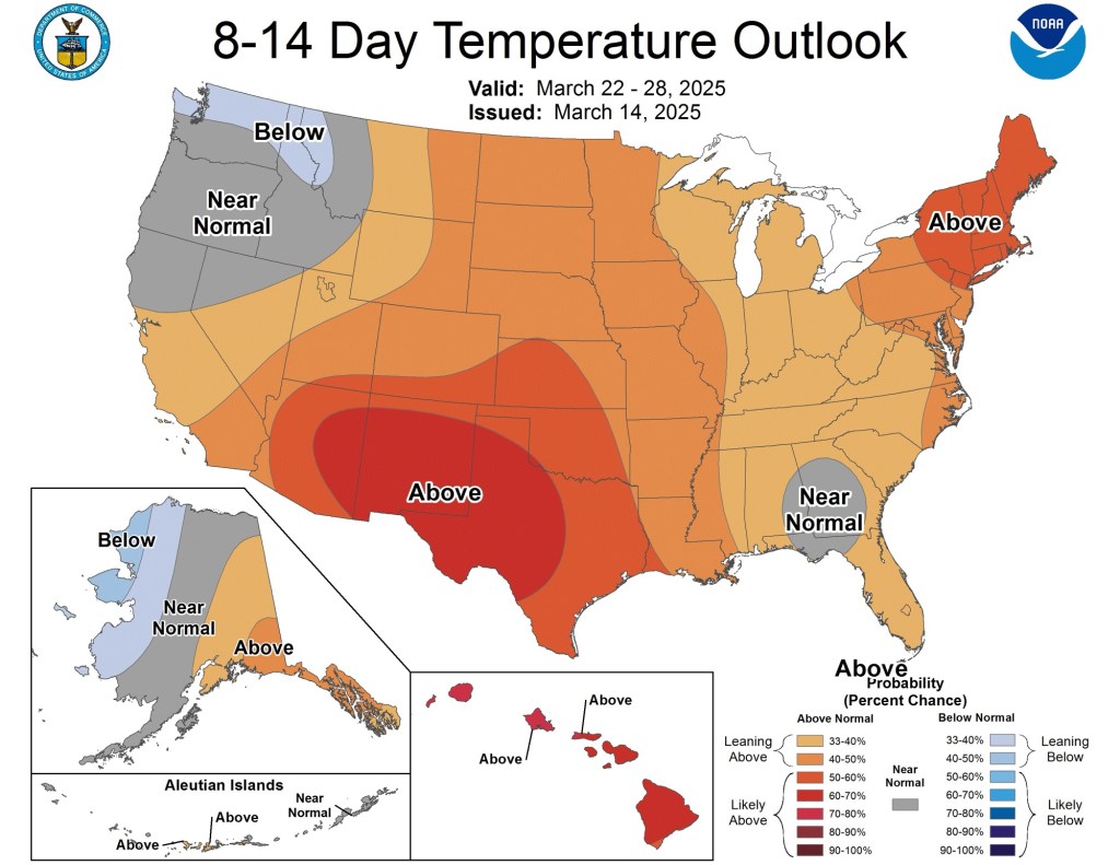
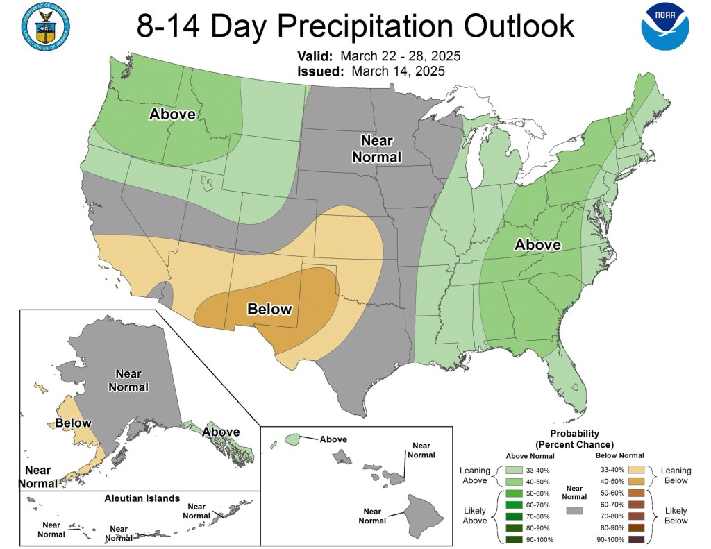
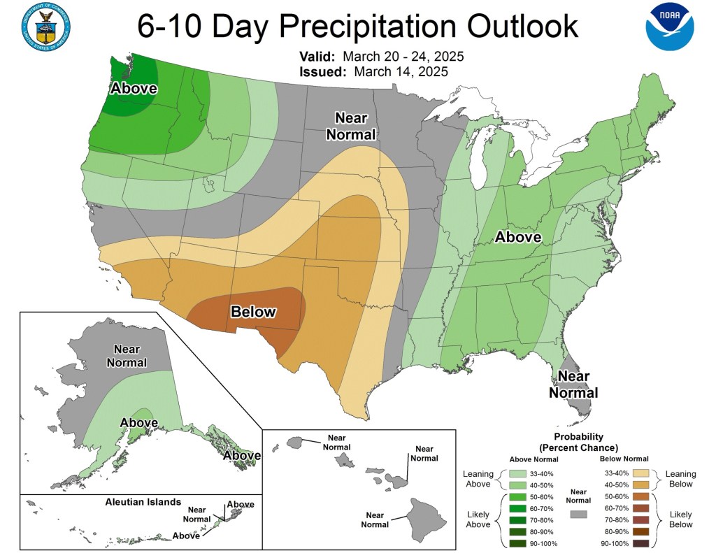
Confidence is relatively low beyond a week, so take these with a grain of salt. Looking further down the road, it looks like we will return to normal in the temperature department while remaining above normal in terms of precipitation.

Leave a comment