
Sun Early PM Update
Storms have initiated near St. Louis, MO and will continue to head our way over the next several hours.
Skies may clear up a bit over the next few hours, but we won’t completely clear off.
Storms should arrive around 5 PM and will move through in less than an hour.
You may want to stow anything that could blow around outside, but other than gusty winds, I wouldn’t expect widespread damage. Storms will have brief heavy rain but will be moving too fast to cause much in the way of flooding.
I’ll keep an eye out and post a few updates directly to Facebook as storms approach—especially if the storms appear to be stronger than expected. A tornado watch was just issued for south-central Indiana.

Sun AM Update
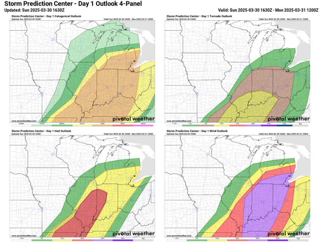
There have been no major changes to the outlook for severe weather this afternoon and evening. Straight-line wind will be the most prevalent threat, with gusts over 60 mph possible.
The big question now is whether storms will be cellular or congeal into more of a line. Either way, straight-line wind is still the main threat, but if storms stay cellular (individualized), we could see a supercell or two that could drop large hail. An isolated tornado is possible, but the best kinematics for that are to our south—and a major tornado outbreak is not expected there either.
Storms will move quickly and pass through in about 30 minutes. The timing of the main event is 5-8 PM, with showers and a few rumbles of thunder lingering for another hour or two after the main batch of storms passes.
Original Post Sat PM
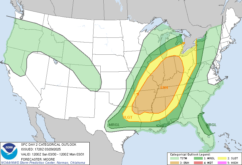
Today’s SPC update did not change much locally. There was a slight expansion north of the enhanced risk area (3/5) to include Goshen. Nonetheless, we remain on the extreme edge of the risk area, and as you will see below, the risk of severe weather is really focused on central and southern Indiana.
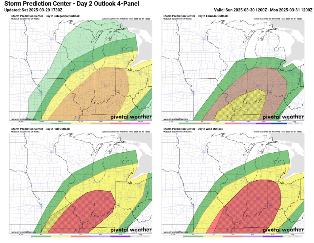
The main threat locally will be straight-line wind gusts, but there is a slight chance for other modes of severe weather, including a quick, spin-up tornado or two. The front will move through quickly, and right now, it looks like that will happen sometime between 7 PM and 11 PM—this window of time will be fine-tuned in tomorrow’s update.
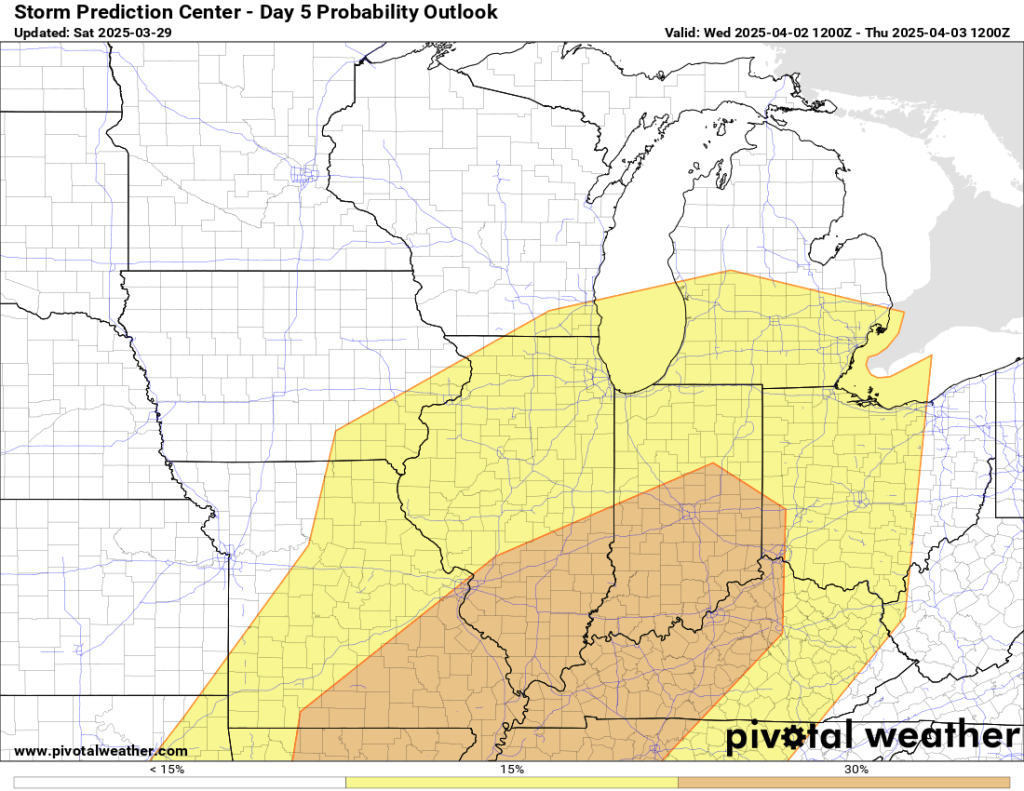
There is another chance for severe weather Wednesday.
The last midrange outlook post from roughly a week ago mentioned some ups and downs and that, despite the possibility of a cool down at the end of March, the next few weeks looked warm. However, the outlook for all of April was closer to normal overall, which likely means a good amount of above- and below-normal temperatures—aka typical spring weather.


We’ll see a brief cooldown on Monday and Tuesday before we return to the mid-60s. There is more potential for severe weather on Wednesday, and temperatures will return to the upper 50s the rest of next week. The week ahead looks active, with multiple chances for rain and thunderstorms. However, beyond the next 7 days, it looks cool and relatively dry.


I’ll have another update tomorrow afternoon regarding the severe weather potential for tomorrow evening. Enjoy the mild evening.
–pw

Leave a comment