
The final chapter in one of the more eventful periods of severe weather in recent memory closed last night. After a somewhat surprising and perhaps overachieving severe wind event on Sunday (3/30/25), the Storm Prediction Center (SPC) was already looking ahead to another event for the following Wednesday. Seventy-two hours in advance, the SPC had a large area of 15% and 30% covering much of the Ozarks, southern Great Lakes, Ohio Valley, and Gulf states.
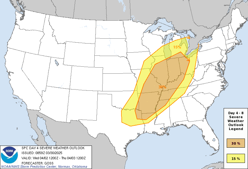
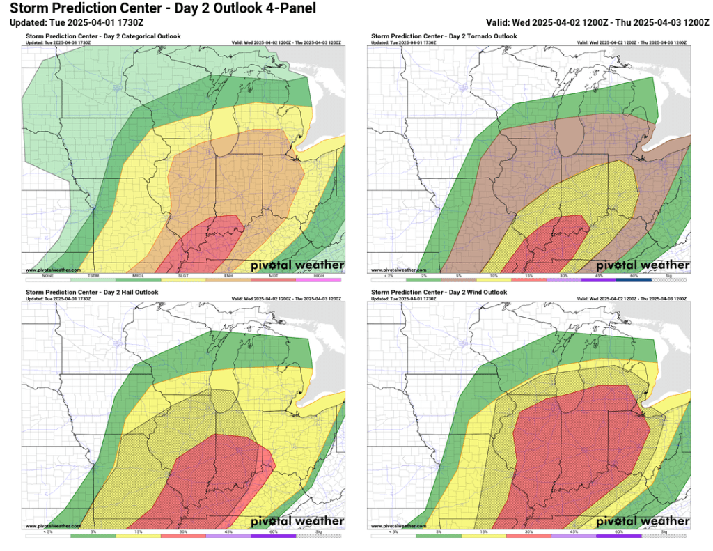
This outlook, combined with the events of the past Sunday, led to an exceedingly well-advertised Wednesday event. Monday’s SPC outlook upped the ante with a large area of enhanced risk (3/5), and by Tuesday afternoon, an area of moderate risk (4/5) had been added.
By Tuesday afternoon, doubt was beginning to creep in locally regarding early morning convection and its impact on the availability of ingredients for big storms later that evening. That doubt became the truth because we saw quite a bit of shower and thunderstorm activity Wednesday morning. I recorded 0.77″ of rain from midnight through early afternoon.
By midday, the intensity of the storms expected in the evening was seriously doubtful. Skies remained cloudy, and temperatures stayed in the 40’s for much of the day.
Then, around 5:30 PM, skies began to at least partially clear as a warm front surged northward through our area. A tornado watch was posted but terminated just one county south of Elkhart.
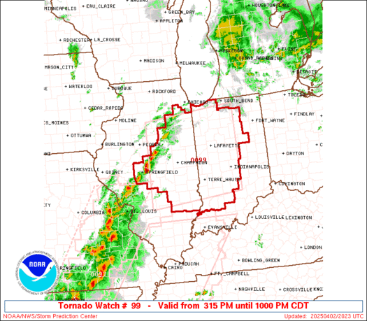
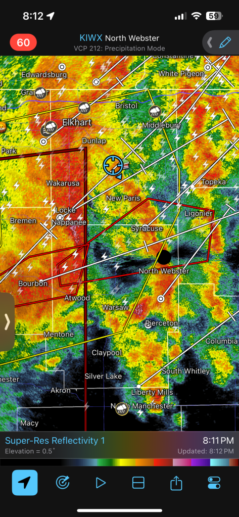
By 6:15 PM, temperatures had risen to near 60 degrees, and dew points were well into the 50s. Storms were developing rapidly in central Illinois and cruising northeast at over 50 miles per hour toward the border with Indiana. Nearly the entire line of storms had a severe thunderstorm warning, and there was one cell with strong enough rotation to warrant a tornado warning.
This storm continued northeast and the tornado warning was extended into St. Joe county.
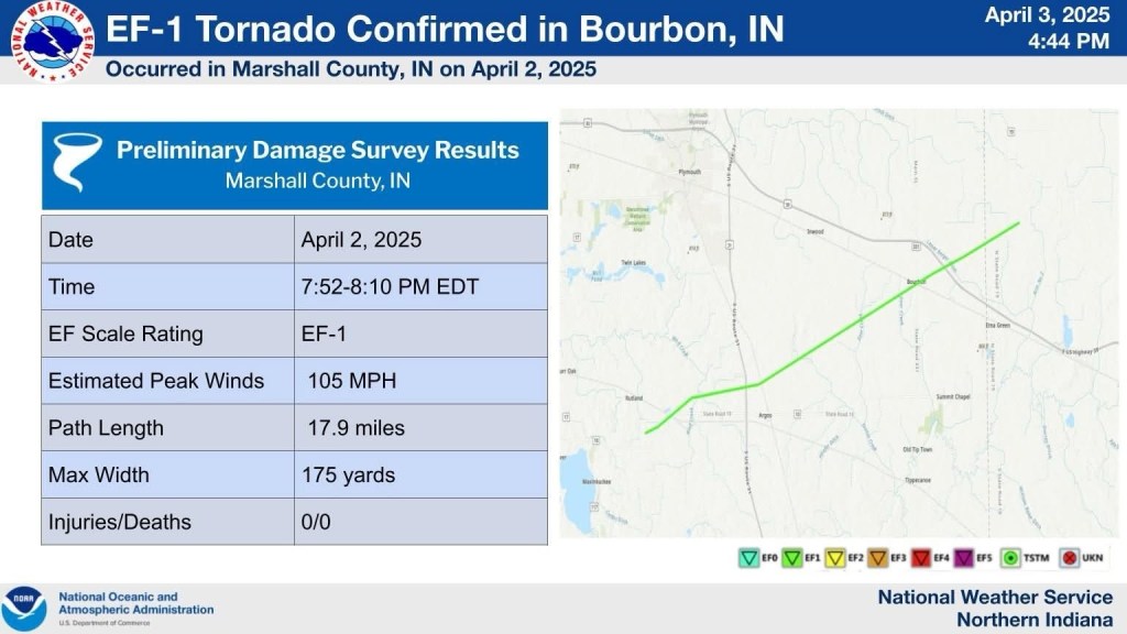
By 7:30 PM, sirens were wailing in Osceola, and numerous severe thunderstorm warnings and one newly Tornado-warned storm were heading straight for Bourbon.
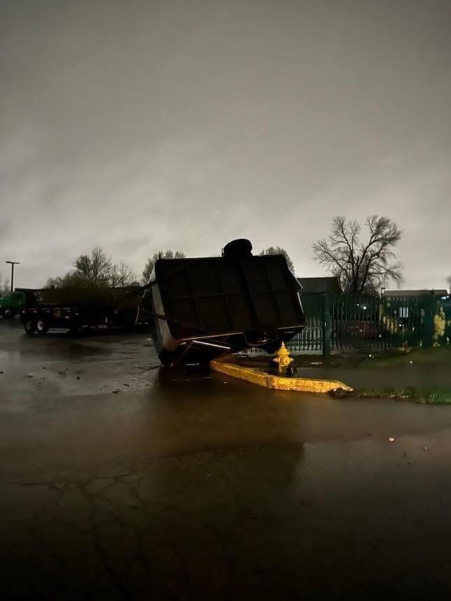
This storm produced a tornado over Bourbon, causing extensive damage.


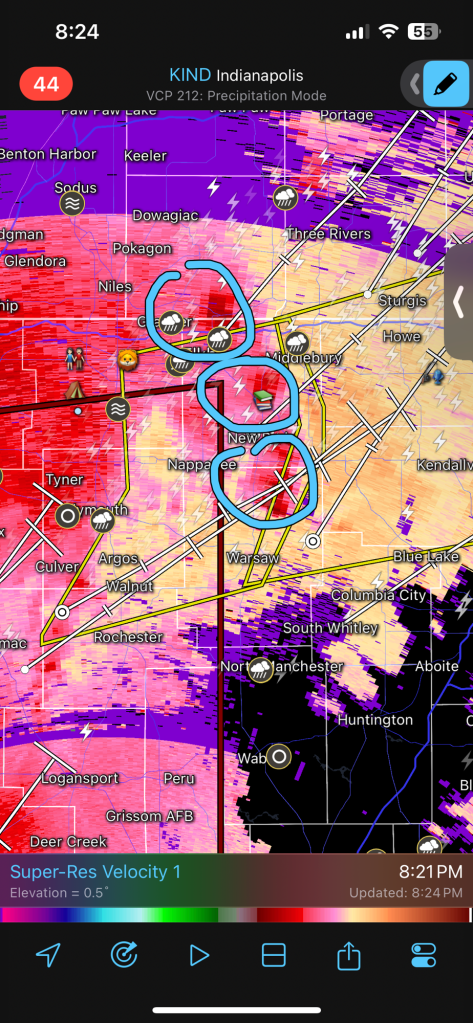
At the same time, a severe thunderstorm was passing through Goshen, but thankfully, it only produced sporadic wind gusts approaching 60 mph (just shy of 57 mph, according to my ultrasonic anemometer).
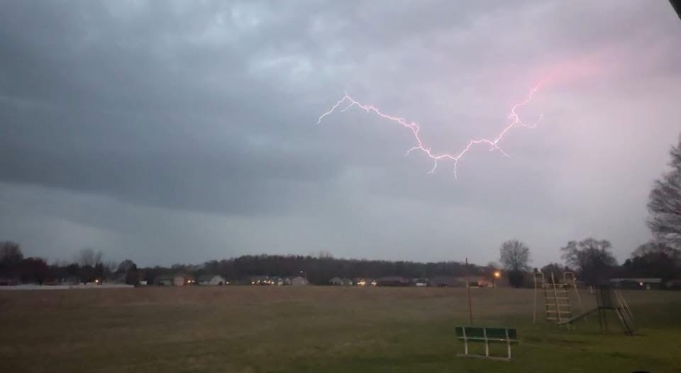
However, the radar indicated several weak to moderate rotation areas all over northern Indiana. I have no doubt there were multiple funnel clouds in Elkhart and Kosciusko counties last night.
Several videos captured what appear to be shelf and/or funnel clouds over Goshen, Warsaw, and Syracuse last night.
(M. Rowe – Facebook)
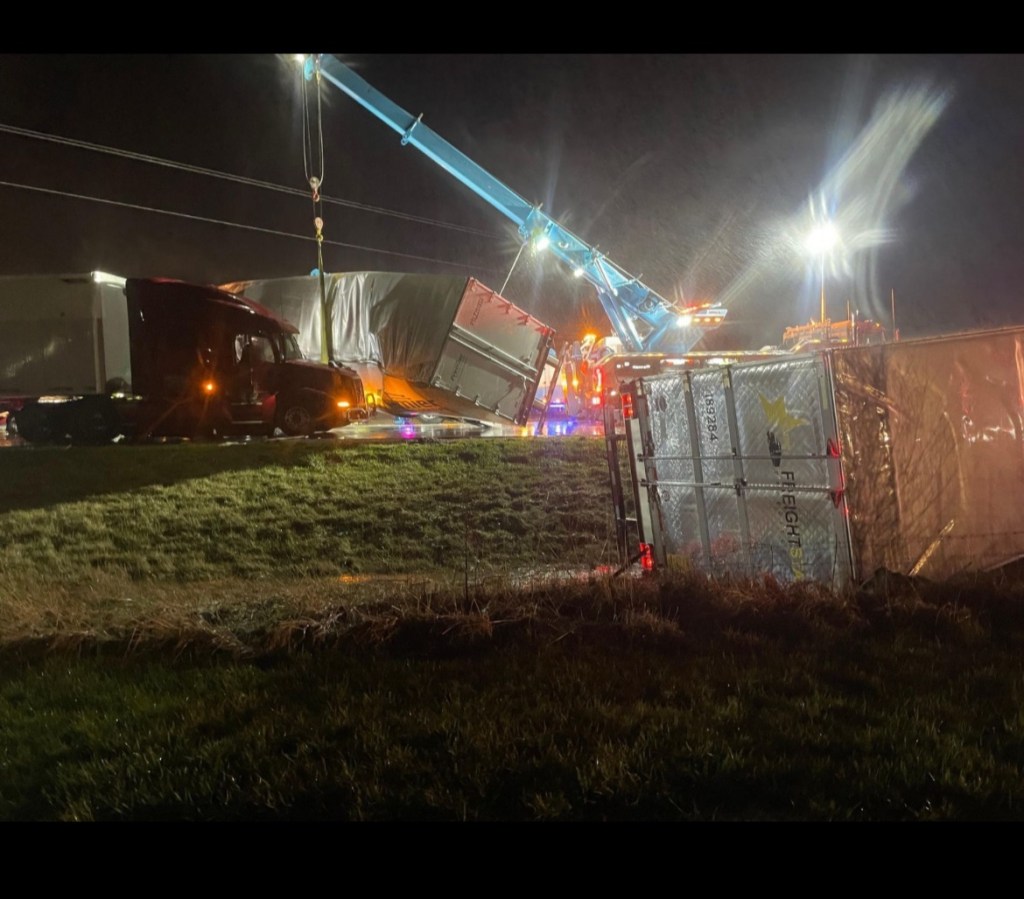
Storms were more or less through Goshen by 9:00 PM, but things were just getting going down near Indianapolis. Between Brownsburg and Speedway, a confirmed EF-2 (111-135 mph wind) tornado touched down. The tornado did not stay on the ground long but prompted additional warnings as it moved northeast toward Noblesville.
The same storm became reorganized only a few minutes later as it moved just north of Muncie.
This same energy prompted even more tornado warnings and spawned two more confirmed touchdowns in western Ohio.
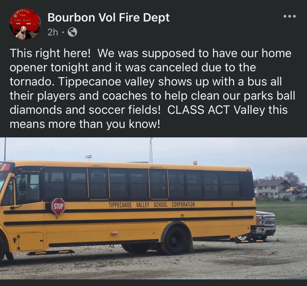
It was a wild night, but could have been much worse. It is great to see the good side of humanity shine through in times like these, especially when it happens close to home:
On a personal note, I want to thank you all for your support, comments, photos, handshakes, and encouragement. When I started at Purdue for a bachelor’s in meteorology, I definitely didn’t see it panning out quite like this—but right now I wouldn’t have it any other way. I look forward to sharing my passion with anyone willing to listen for each and every significant weather event here in Goshen for as long as I can.
Your likes, views, comments, and especially shares are greatly appreciated as I attempt to grow this little project. My goal is not just to share information but hopefully to help teach you how to gather it yourself and use it to make your own educated decisions. If you ever have any questions, please ask!
–pw

Leave a comment