Friday AM Update

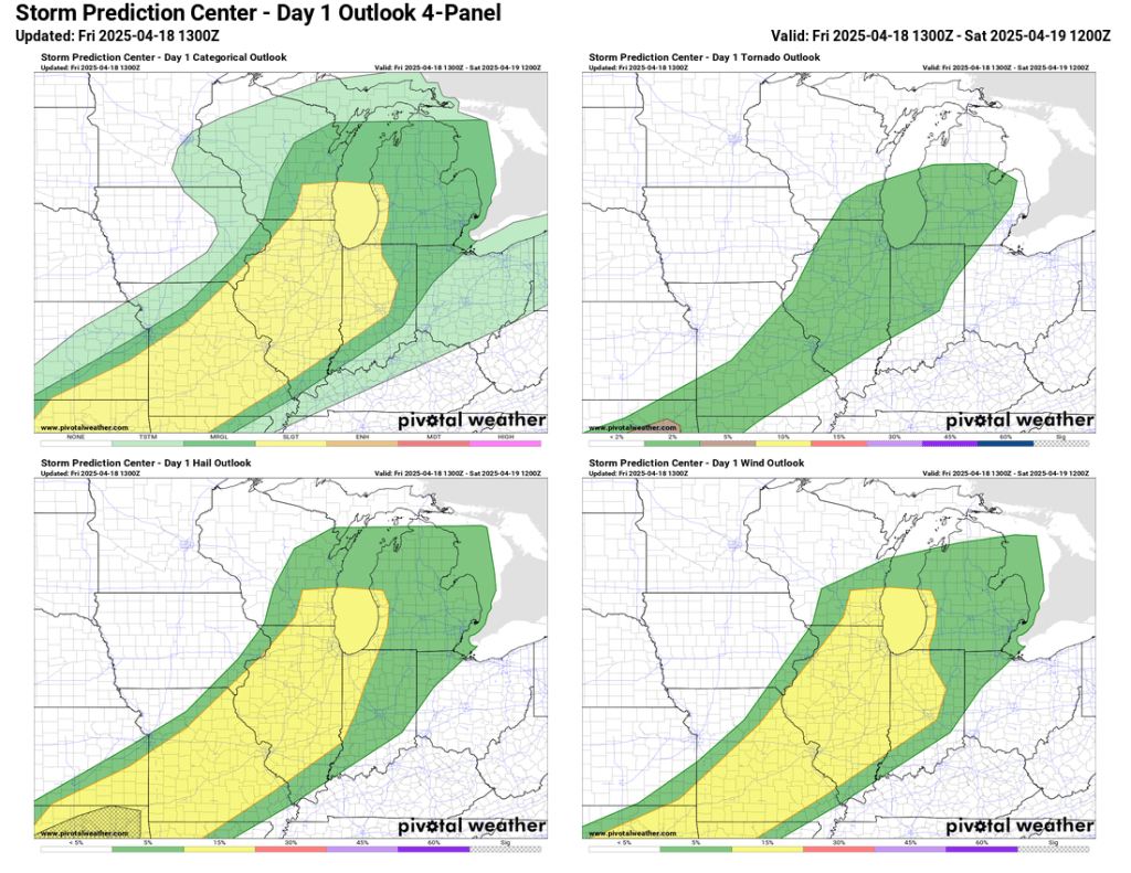
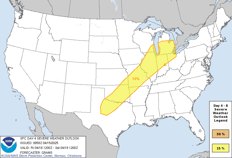
Widespread severe weather is not expected locally, but a few isolated strong to severe storms are still possible tonight. The latest update from the SPC has essentially removed the slight risk from our area. Unless something changes with the afternoon SPC update, this will likely be our last update to this post.
Thursday PM Update
Timing for tomorrow’s storms looks like late evening, but don’t be surprised to see some showers and even a rumble of thunder tomorrow morning. We should have several hours of dry time tomorrow afternoon and it will be windy and warm.
The SPC has made a few minor updates to its outlook for tomorrow evening. The area of slight risk on the northeastern edge was trimmed, and northwest Ohio has been removed.
The tornado risk for tomorrow remains low, but a tornado watch is currently in effect in Nebraska and Iowa due to the energy that will be headed our way tomorrow night. Still, gusty winds and hail appear to be the greatest threat with this round of storms.

The overall threat of widespread damaging storms tomorrow night is considerably lower than it has been with the last two rounds.
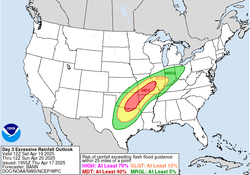
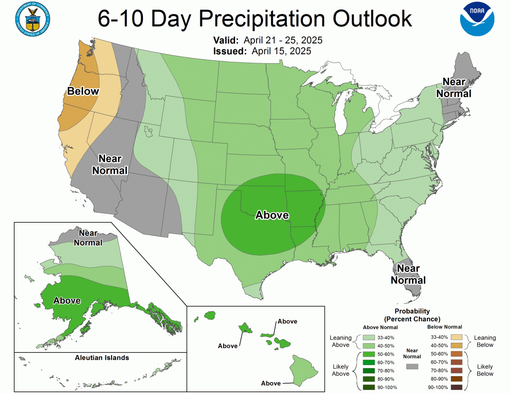
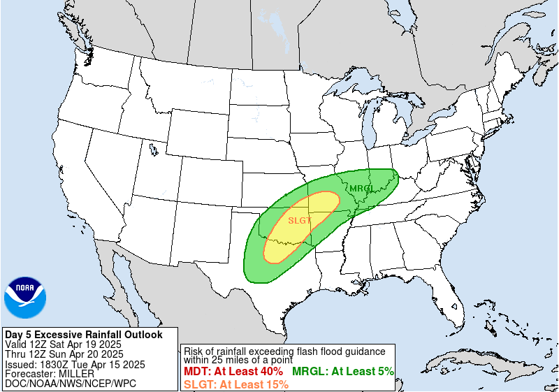
Only minor changes have been made to the excessive rainfall outlook locally. However, parts of Missouri, Arkansas, Oklahoma, and Texas have been upgraded.
Wednesday PM Update
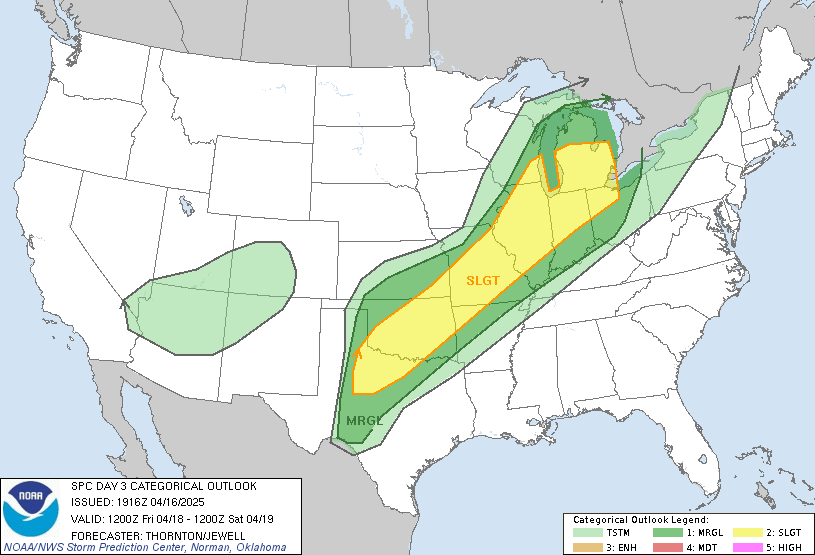
No major changes to the SPC outlook. As you can see below we are still firmly in the area of slight risk. So far, there hasn’t been an area of higher than slight risk assigned. This threat seems far less tornado-focused and more on hail, heavy rain, and gusty winds.
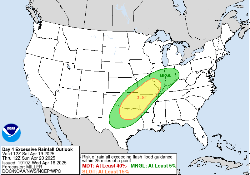
One slight change from the WPC was the expand the marginal risk of excessive rainfall. It still doesn’t quite reach us, though.
In case you missed it, a fairly powerful solar storm is underway and we might be able to see the northern lights tonight!
Original Post (Tues PM)
It’s been quite a while since the last post, thanks mainly to benign weather and spring break. Things look like they’ll get a little more active and warmer as we head into the second half of April. Also, Thursday will be our last morning, with a sunrise of 7:00 AM or later until late August!
Today looked and felt more like November than April. Gusty winds blew mainly light rain sideways at times, keeping temps in the low to mid-40s despite occasional peaks of sunshine here and there. The good news is that this could very well be our last cold, windy, and rainy day until next fall. We’ll be cool again tomorrow, but we should see plenty of sun.
By Thursday, we should be back into the 60s, and Friday should top 70°F. Beyond that, high temperatures should stay in the mid-50s or warmer for the foreseeable future.

After a brief warm-up into the 70s on Friday, a cold front is expected to pass Friday evening and could bring another round of severe weather. Yesterday’s data wasn’t nearly as impressive-looking as the last two rounds of severe weather, but the SPC has maintained an advanced risk of severe thunderstorms five days out. Today, the day four outlook hasn’t changed much, and a risk for severe thunderstorms remains.
Saturday may bring another round of moderate to heavy rain to places south of us that saw incredible amounts of rain a little more than a week ago.
That does it for today. I’ll update this post at least once a day through Thursday. If things look interesting, there will be multiple updates on Thursday and Friday as data rolls in.

Leave a comment