We are temporarily seeing a break from the rain. There is some patchy drizzle for now, and it is breezy, but more substantial rain and thunderstorms are trying to reach us.
Not too long ago, there were a few tornado warnings near Champaign, Illinois, but all that remains now is a tornado watch to our southwest. It was nearly 80°F there today—a far cry from the low 50s we managed only about 150 miles away.
The environment in our area is not favorable for severe weather, but if this energy holds together, we could see some decent downpours.
I’m up to approximately 0.39” in my backyard as of 7:30 PM, and expect more later this evening and tonight. Another quarter inch or so is about all we can expect.
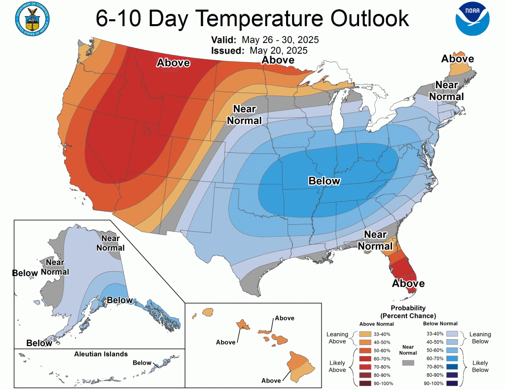
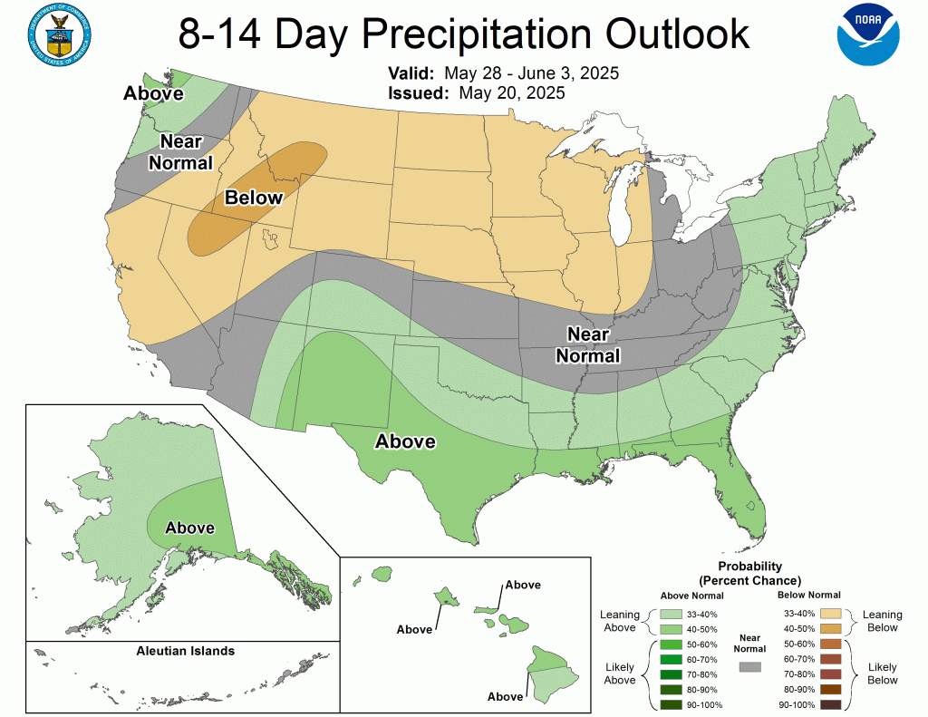
Cool weather will likely continue through the end of May. The latest CPC outlooks strongly favor below-normal temperatures in much of the Great Lakes.
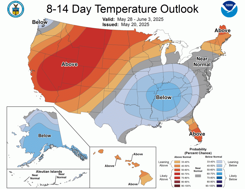
However, just beyond this range, a quick flip to warmer-than-normal temperatures seems possible.
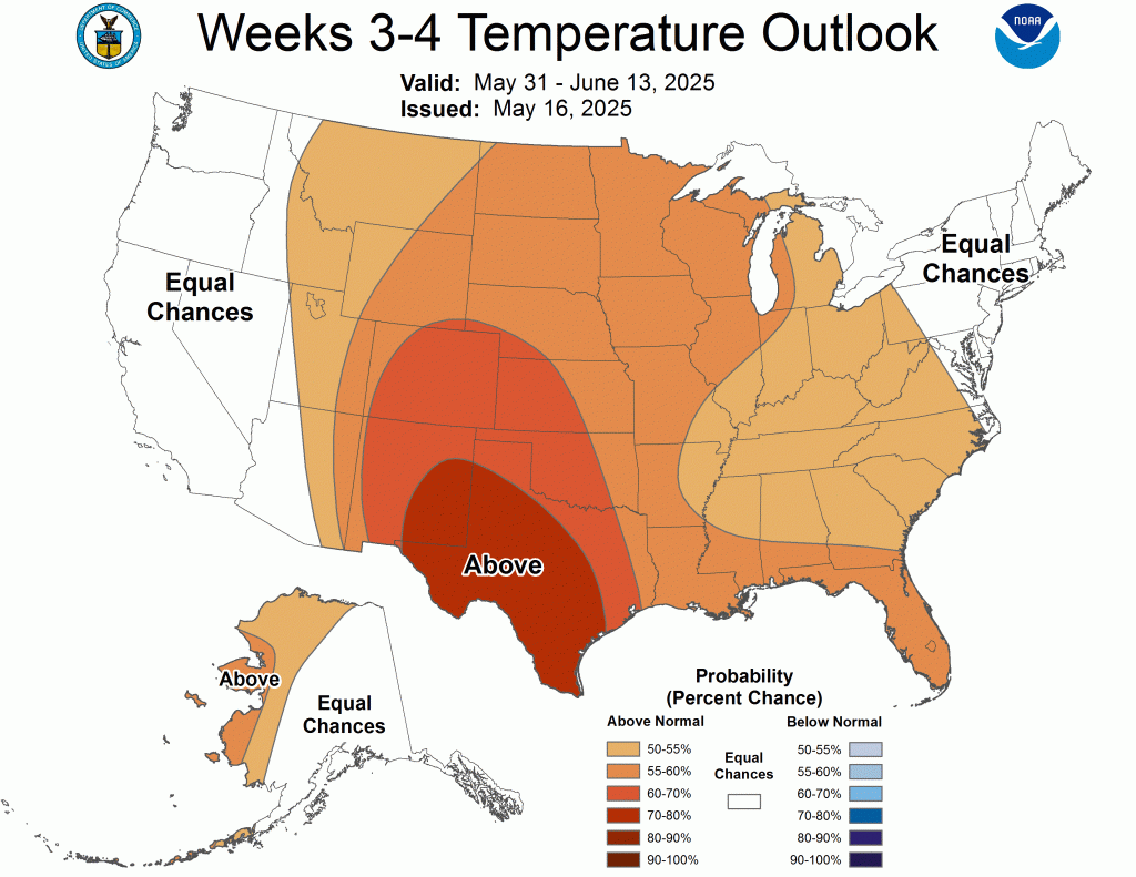
Eventually, our temperature pattern will balance out and stay warm, and we’ll be ready for a few days like today during our next inevitable stretch of hot and dry weather as summer sets in.
It won’t be exactly calm or dry over the next two weeks, but it doesn’t look particularly stormy either.
The SPC outlooks are relatively quiet for the next few days, and no significant outbreaks of severe weather are expected through the next week or so.
–pw

Leave a comment