July 2025 thus far
Goshen, along with much of the Midwest and Great Lakes, has been mired in a prolonged stretch of above normal temperatures with normal to slightly below normal precipitation and varying levels of humidity. None of this is unexpected this time of year around here, though we are creeping up on a drought and temperatures have been quite warm. Here is how July 2025 thus far stacks up to normal for records dating back to 1914:
July 2025 average high: 86.5°F
Climatological average: 83.5°F
July 2025 average low: 66.3°F
Climatological average: 62.8°F
July 2025 average temp: 76.4°F
Climatological average: 73.2°F
July Total Precipitation: 0.59”
Climatological average: 2.02”
2025 precipitation to date: 19.6”
Climatological average: 21.75”
Despite it feeling, and looking, rather dry, we aren’t too far off the mark overall. And just one or two summer thunderstorms can catch us right back up. I think that’s been the biggest issue for us this summer. We aren’t far off normal values, but most of that rain has come in short spurts spread out over weeks or even months.
The rest of July
Fair week is going to be hot and humid (no real surprise there). There’s no real signals for the overall hot and humid pattern to break down beyond fair week either.
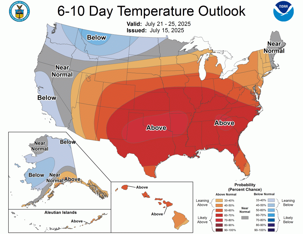

If anything, this latest outlook favors an expansion of the warm and likely humid air through the end of July. In fact, the hazards outlook is already picking up on the combination of heat and humidity next week as can be seen below.
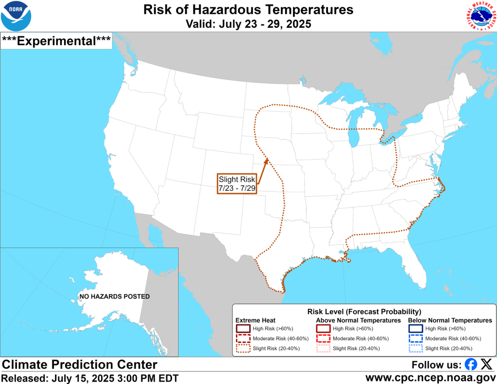
That is a massive area of a slight risk of extreme heat and it is currently forecast for nearly a week. Interestingly, the precipitation outlooks from the CPC favor chances for above normal precipitation.
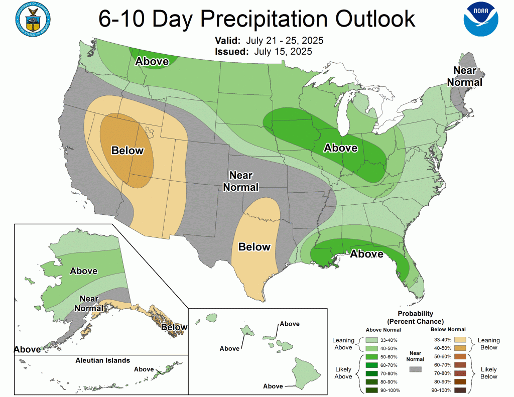
I suspect these are factoring a truly tropical airmass conducive to those scattered afternoon showers and storms more common to Florida than Indiana expected over the next two weeks or so. However, I believe there is a factor that these models can struggle with which is the onset of a drought. It can be very difficult for storm systems to overcome dry air in place once it has been there for some time. Here is the current drought monitor:
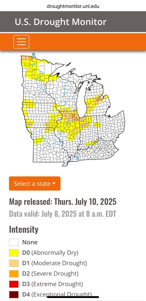
It will be interesting to see how the update coming later this week expands those D0 and D1 zones over our area.
The rest of the summer
To be honest, I don’t put a lot of faith in these long range outlooks, but than can give some insight into the overall trends over the coming weeks and months. We are due for an update to these maps soon, but here are the latest three month outlooks:
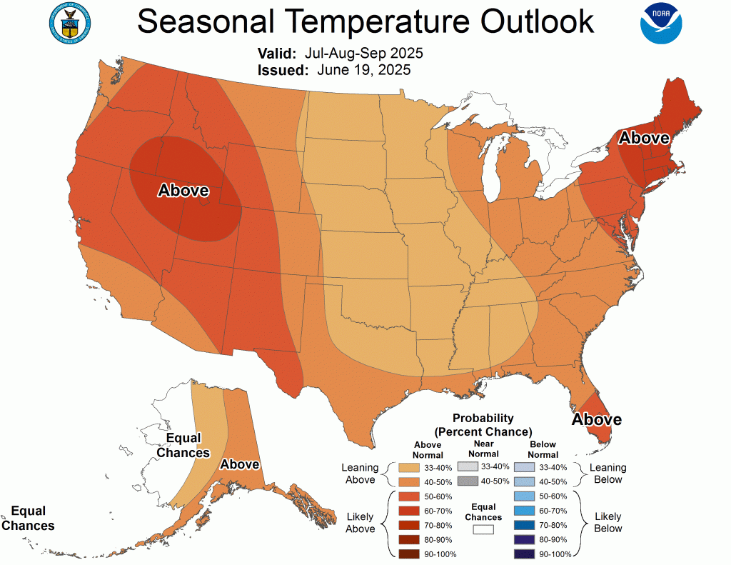
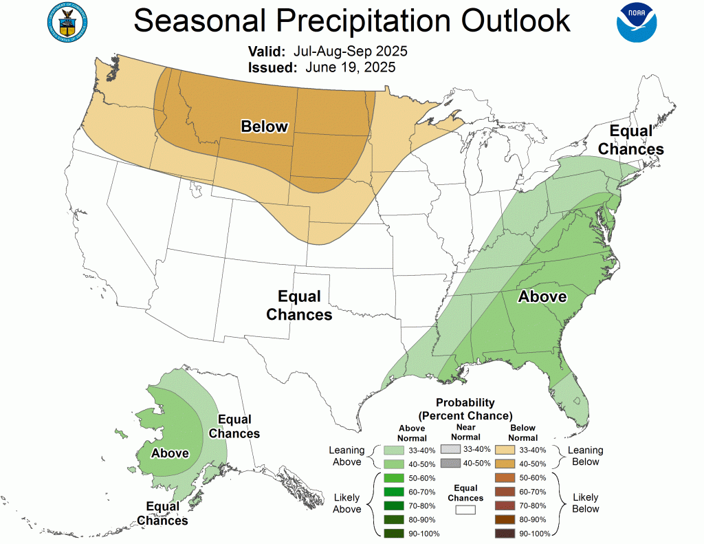
Overall, these outlooks indicate the warm air is sticking around for awhile. Keep in mind that these temperature outlooks are relative, meaning, 10° above normal in July is warmer than 10° above normal in September. Equal chances for precipitation sounds about right.
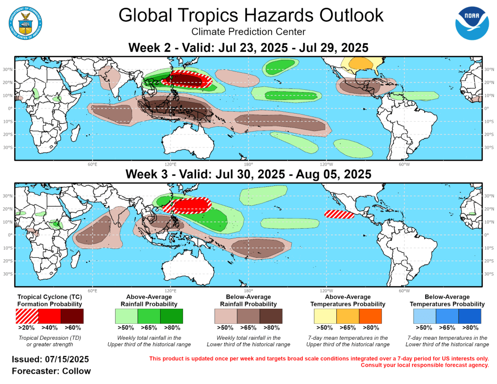
Tropics Update
I know many of you have family, friends, and even property of your own down in Florida (myself included). You may have heard of a potential hurricane developing later this week. That’s not exactly true. A storm is expected to develop, but as of now looks like it would only reach the Tropical Depression stage (tropical depression, storm, hurricane is the progression) and be a rainmaker without a ton of wind or storm surge.
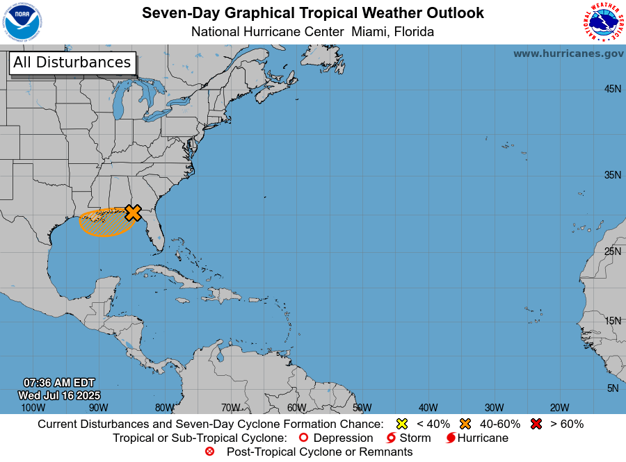
The next two weeks still look very quiet in the gulf.
I hope you’re enjoying the dog days of summer. Just a reminder that the average high temperature 6 months from now is 31°F with a low in the teens.
-pw

Leave a comment