
Updated 8/9
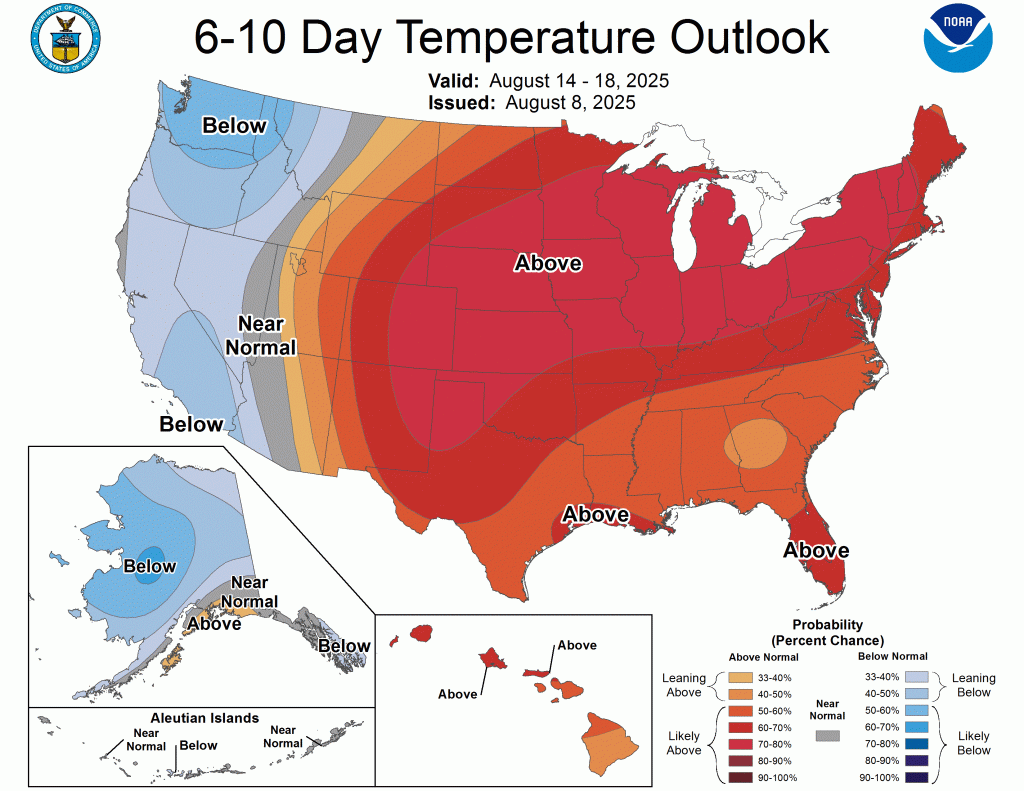
I have added the latest temperature outlooks and they have gotten even warmer over the next two weeks. Another run at 100°F heat index values is possible next week. We could meet or exceed Heat Advisory criteria after all.
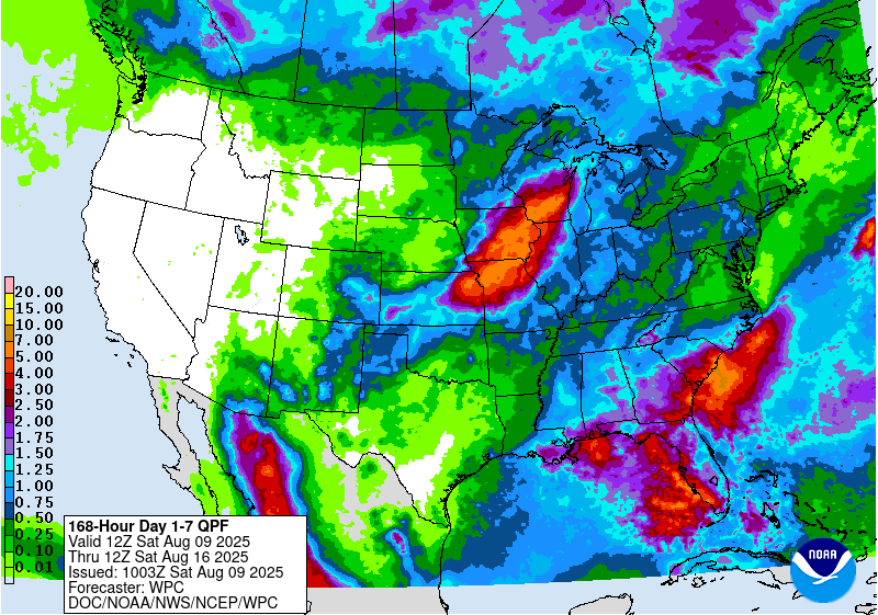
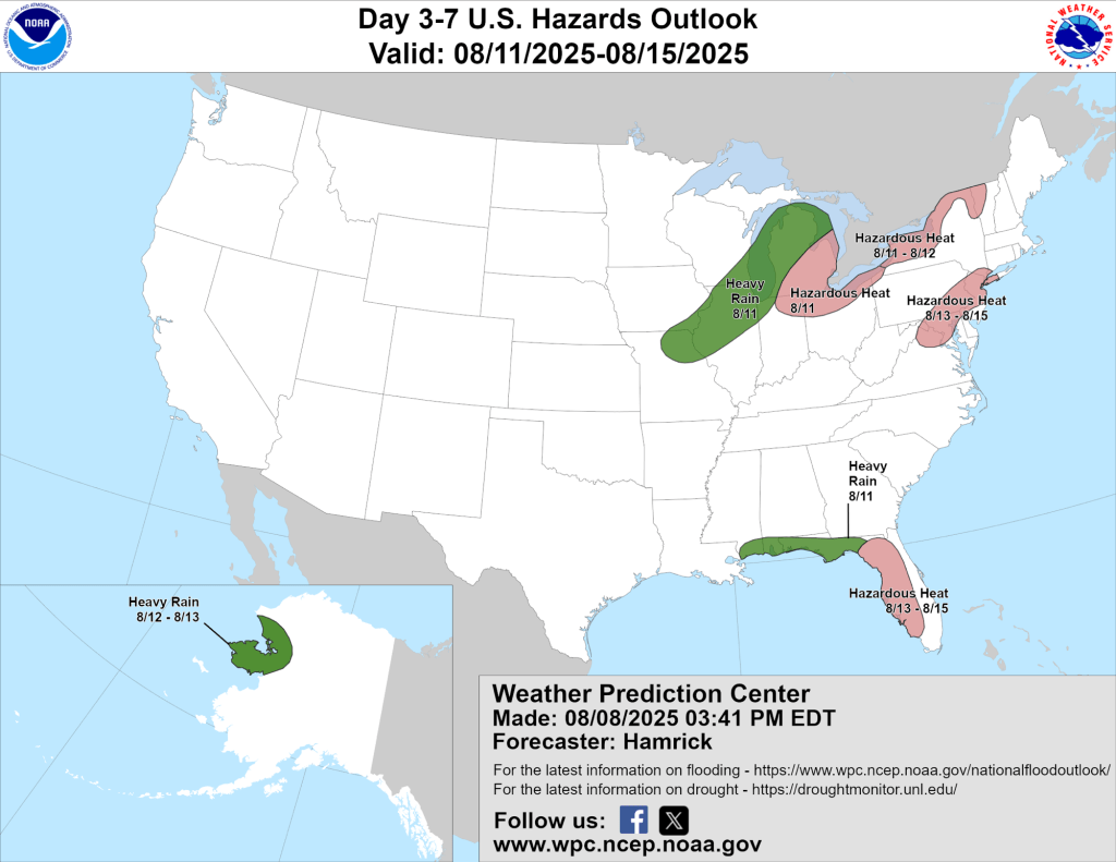
The precipitation outlook has completely reversed and gone from average to above average, to below. Suffice it to say, overall, the next two weeks look very hot and very dry. One thing to watch, a large area of heavy rain is expected just to our northwest over the next week or so. Subtle shifts in its location could send a little more rain our way.
Original Post (edited, with updated outlook images)
Another round of upper 80s to low 90s is coming along with renewed humidity, making things feel a little warmer. We might not meet thresholds for a Heat Advisory this time, but it will still be “air you can wear” for several days starting as early as tomorrow and lasting into early next week (at least).
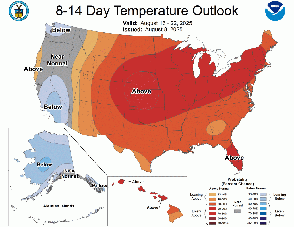
If the CPC outlooks are to be believed, the heat and humidity could last well into the second half of August.
In the “way too early to believe” department, early outlooks for this winter show our area experiencing above-normal precipitation and “normal” temperatures for most of the winter. This will undoubtedly change as we get closer to winter, but early indications show moderate signals for a potentially snowy winter ahead.
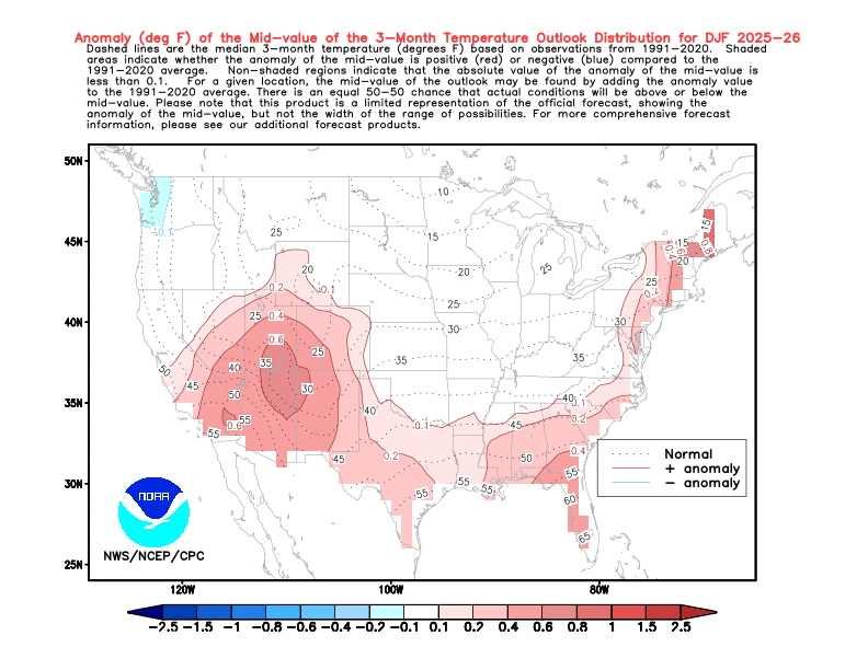
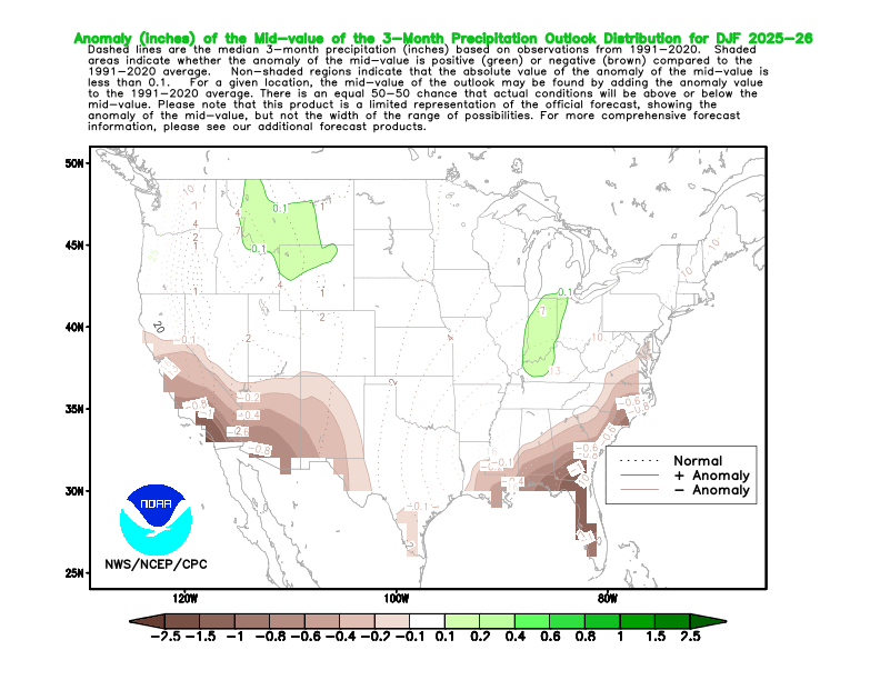
For the record, I am putting little to no stock in these outlooks, but I will keep an eye on things as we progress through the fall. By the way, fall looks warmer than usual, further adding to the doubt surrounding these outlooks predicting a seasonably cold and snowy winter ahead.
-pw

Leave a comment