The low clouds have managed to hold on now for two full days longer than expected. That has helped keep temperatures down a bit more than expected, too. For most, this has been a welcome change from the oppressive and extended stretch of 80-90 degree weather with humidity that made it feel closer to 100 degrees most days.
Outside of the roughly 1.5″ we got earlier this week (which was almost a bit of a surprise, albeit a pleasant one), we haven’t had much rain in the latter months of the summer. However, most of Elkhart County has stayed out of even the lowest end of the drought monitor (abnormally dry) for the bulk of the summer. We haven’t seen extended stretches of smaller amounts of rain, but we have seen widely scattered days with moderate to heavy rain that have kept us close to seasonal norms. In fact, June ended nearly 1.5″ above normal, and July just over 0.5″. August typically nets us about 4″ of rain, but I’ve only recorded 1.87″ so far this month.
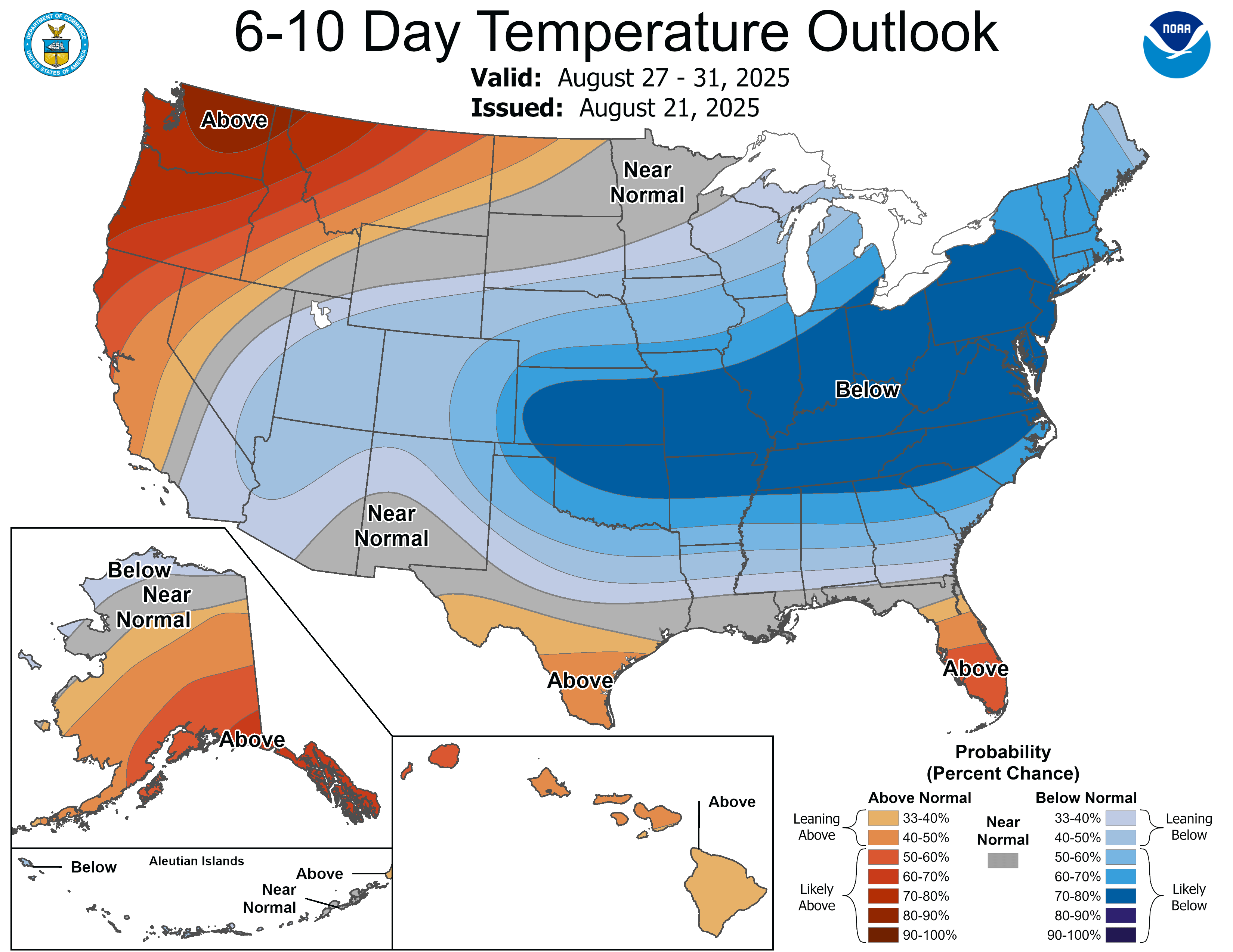
The next few days look a little warmer, with some foggy mornings possible before quickly being burned off as temperatures rise back to around 80 degrees. There is a slight chance of rain on Saturday afternoon and evening, but there isn’t much rain in the forecast beyond that. We should cool down even more next week. Lows will be in the low to mid 50s most late nights and early mornings, and we will likely even dip into the upper 40s once or twice next week.
Looking ahead, the dry weather is likely to continue.
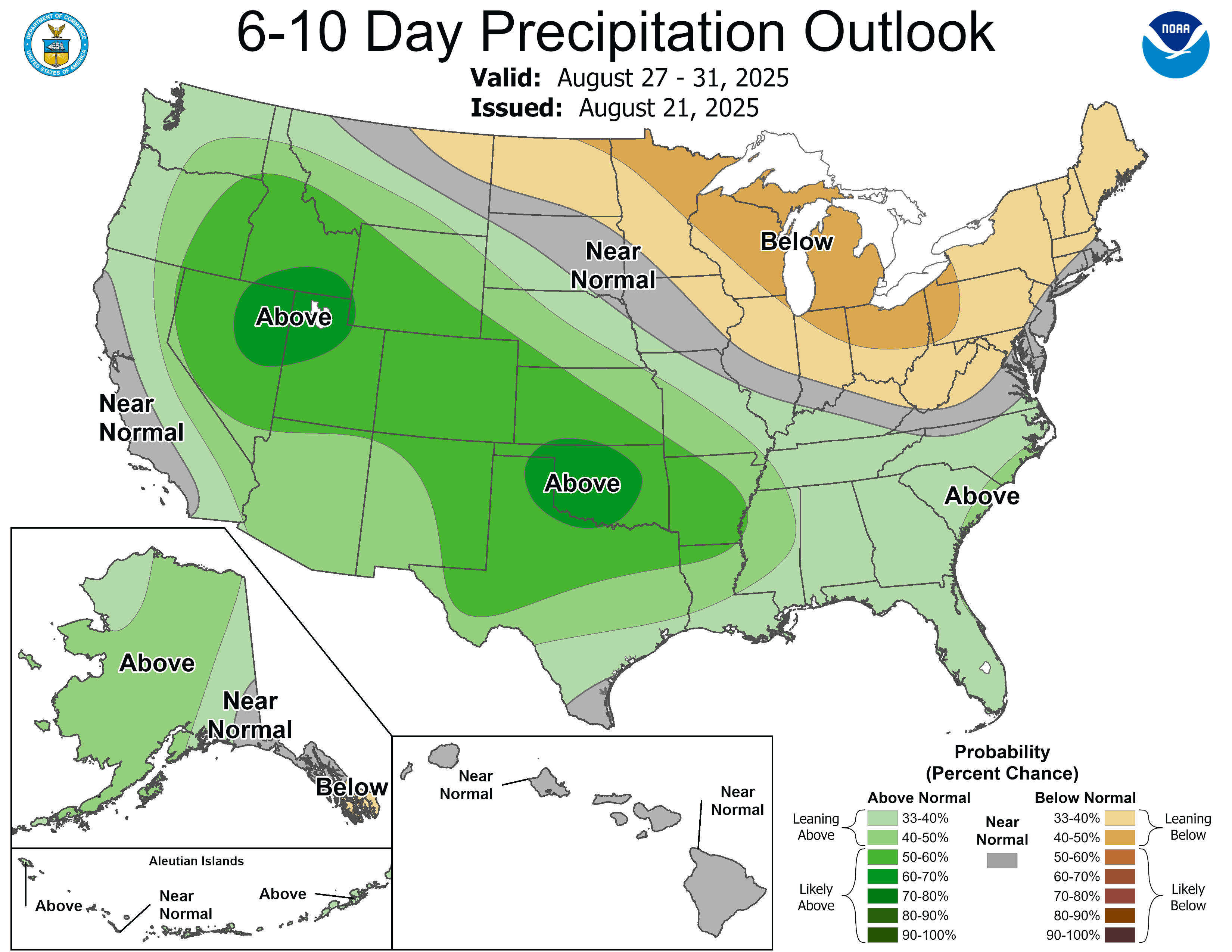
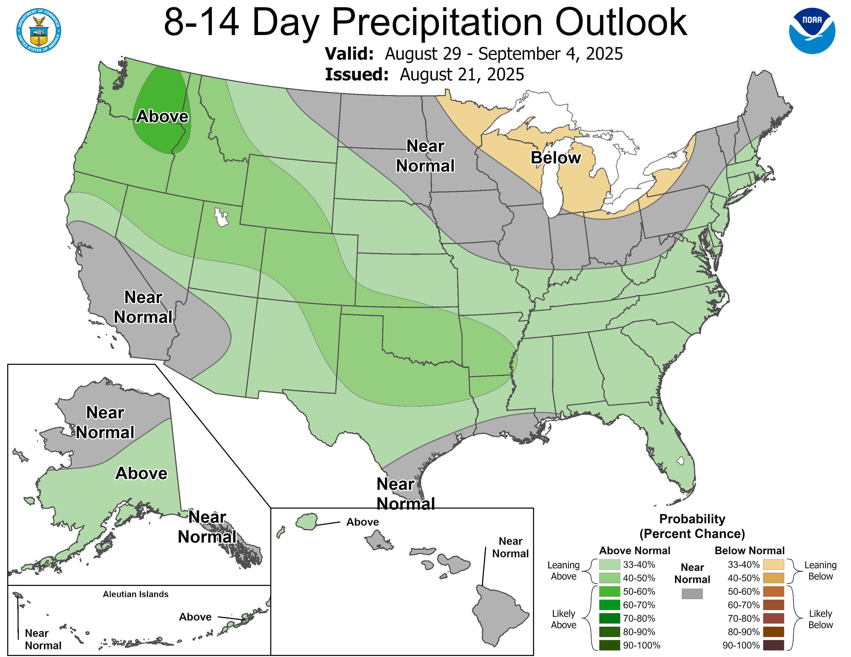
We can also expect the cooler weather to stick around for at least the next week to ten days.
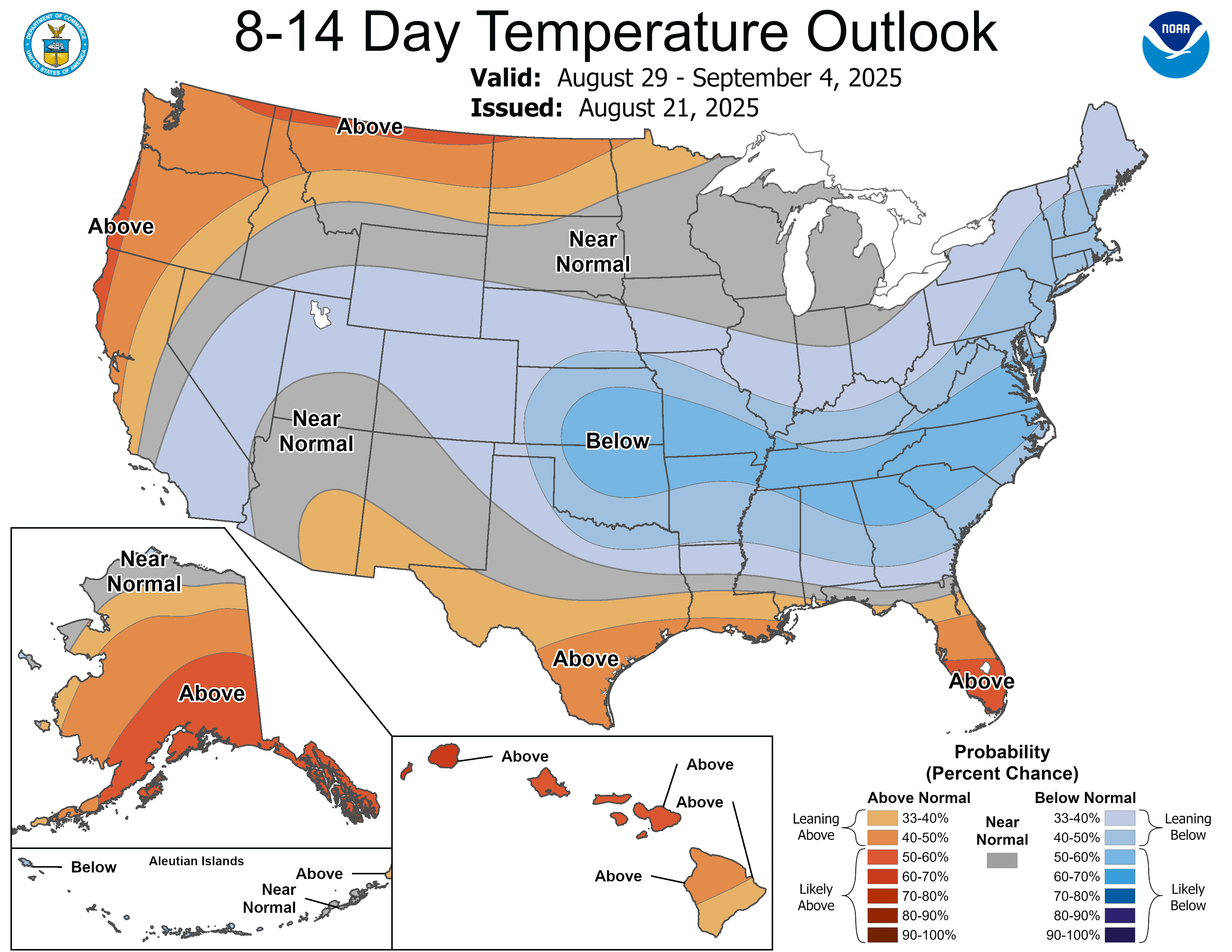
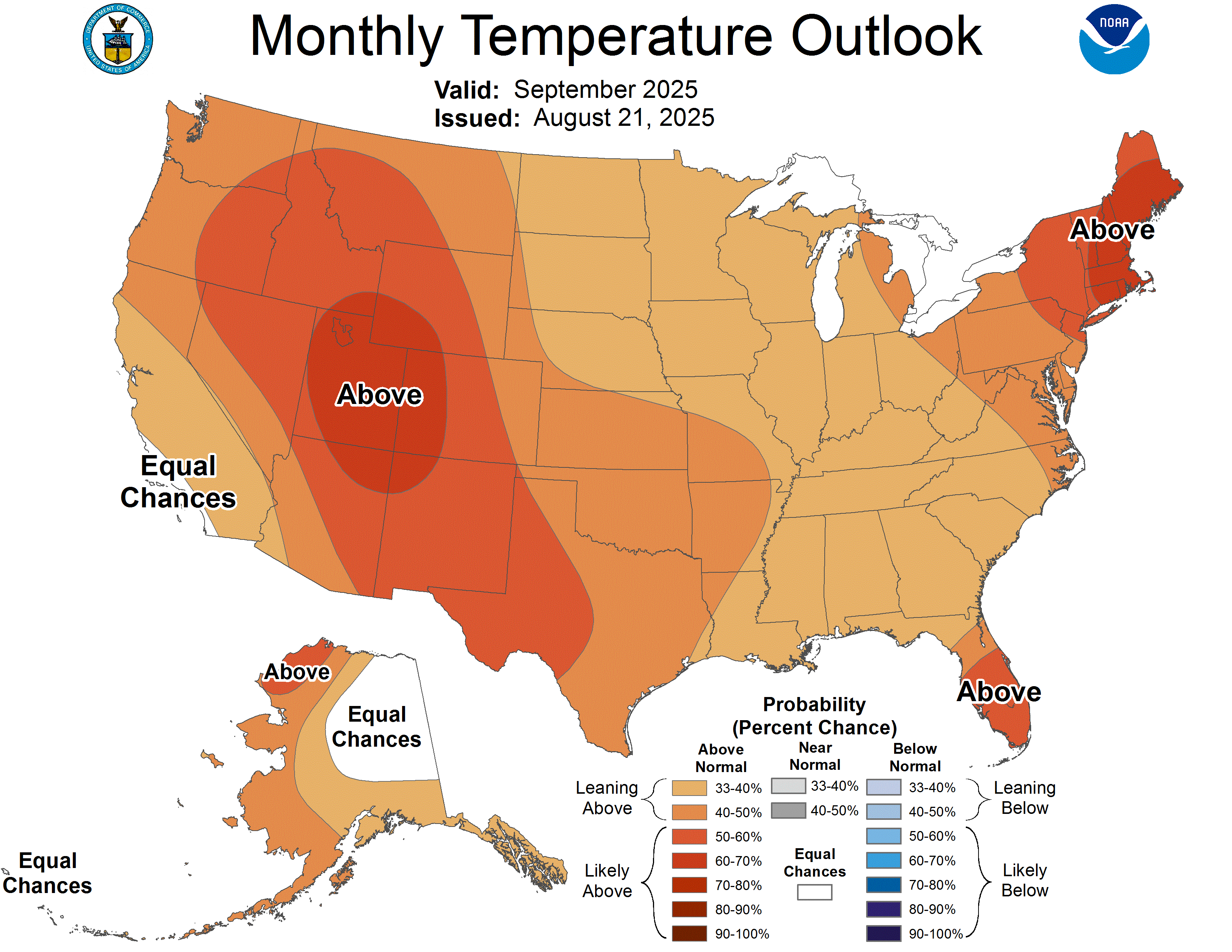
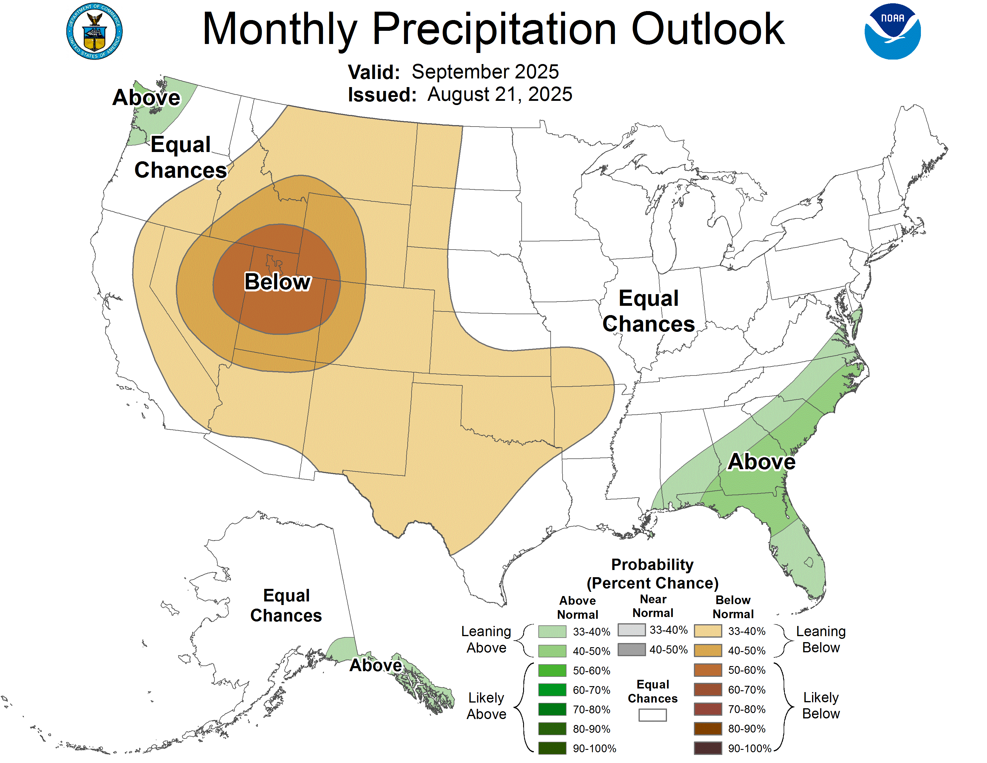
Early indications for just beyond this range suggest a return to above normal temperatures for the month of September with equal chances for above or below normal precipitation.
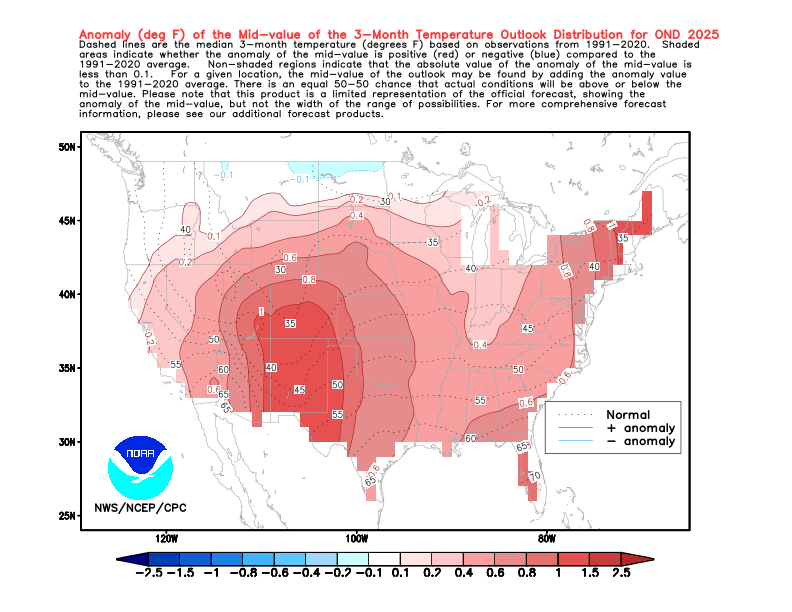
Looking even further, data indicates the warmer than normal overall pattern continues through fall.
For what it’s worth, meteorological winter looks closer to normal in terms of temperatures–which would be a change from the past two winters that were warmer overall with very little snow. The early half of winter is still forecast to be anomalously wet, but I wouldn’t get too excited for early-season snow just yet.
Snow sounds a little crazy given it was in the 90s just a few days ago, but we are rapidly losing daylight (over 2.5 minutes per day at this point) and the cooler days and nights will be here to stay before long. Sunsets before 8 PM start September 11th and won’t return until the last week of March.
I hope you can enjoy the 70s and 80s while they last.
-pw

Leave a comment