
Gorgeous weather is expected through at least Monday, and most likely Tuesday as well. Wednesday, especially late, will be our transition day. Until then, you can expect lots of sunshine, cool and crisp mornings followed by warm afternoons and early evenings before temps slide again just in time for s’mores around a bonfire. Highs today will reach the low to mid 70s and are only expected to rise a few more degrees tomorrow through Tuesday to about 80°F. Lows will be around 50°F.
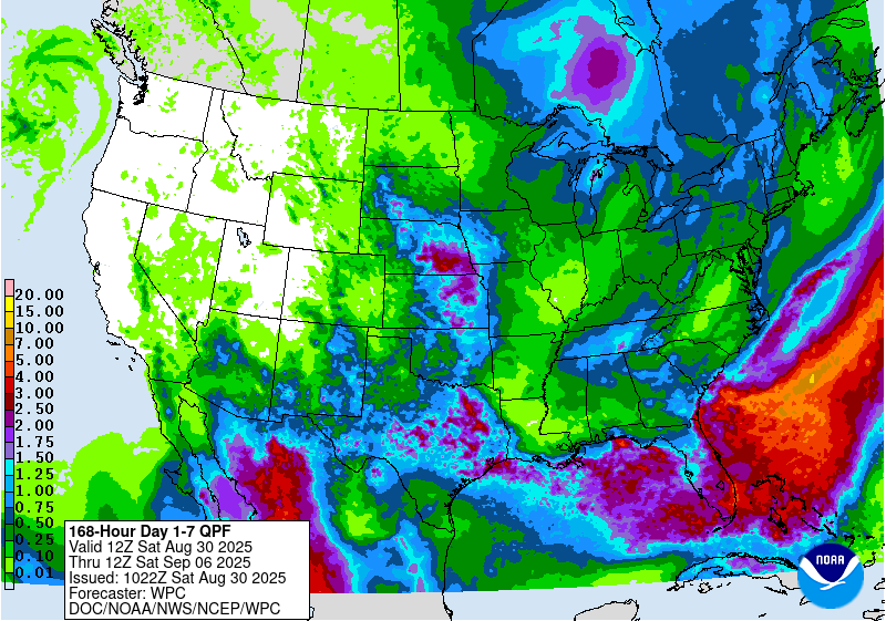
Wednesday should also be warm, but a strong cold front bringing air straight from northern Canada (again) is expected to pass before Thursday morning. This could prompt a few showers and storms and likely represents the only meaningful chance for rain in the next week based on what the data is showing now.
The timing of the cold front will determine how many potential records we tie or break late next week. If the front passes and the cold air infiltrates before midnight Wednesday, there is a good chance we will see a record-low maximum temperature and record-low minimum temperature both Thursday and Friday.
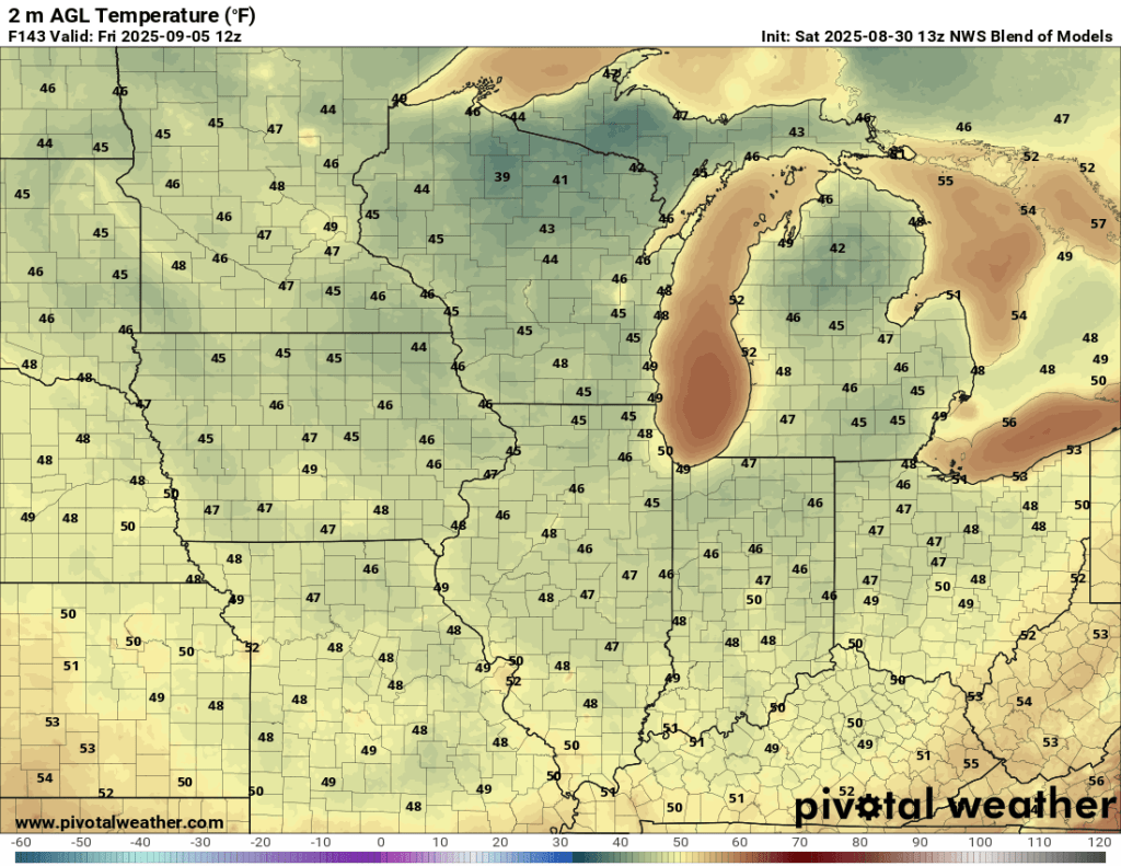
The record low maximum temperature on Thursday is 67°F (2010). I suspect we will still be above that in the wee hours of Thursday morning before temperatures fall throughout the day, so we will not break this record. The record low minimum temperature on Thursday is 42°F (1997), and if we clear off before Thursday night, it might be in play, but we probably stay a few degrees warmer. Friday itself looks chilly with a high struggling to crack 60°F.

The record low maximum temperature for Friday is 64°F (1988), and based on current data, we have a good chance of tying or beating that record. Friday’s record low minimum temperature is also 42°F (1957) and is probably safe. Suffice it to say, the end of next week looks like our next “fall preview,” and a significant one at that.
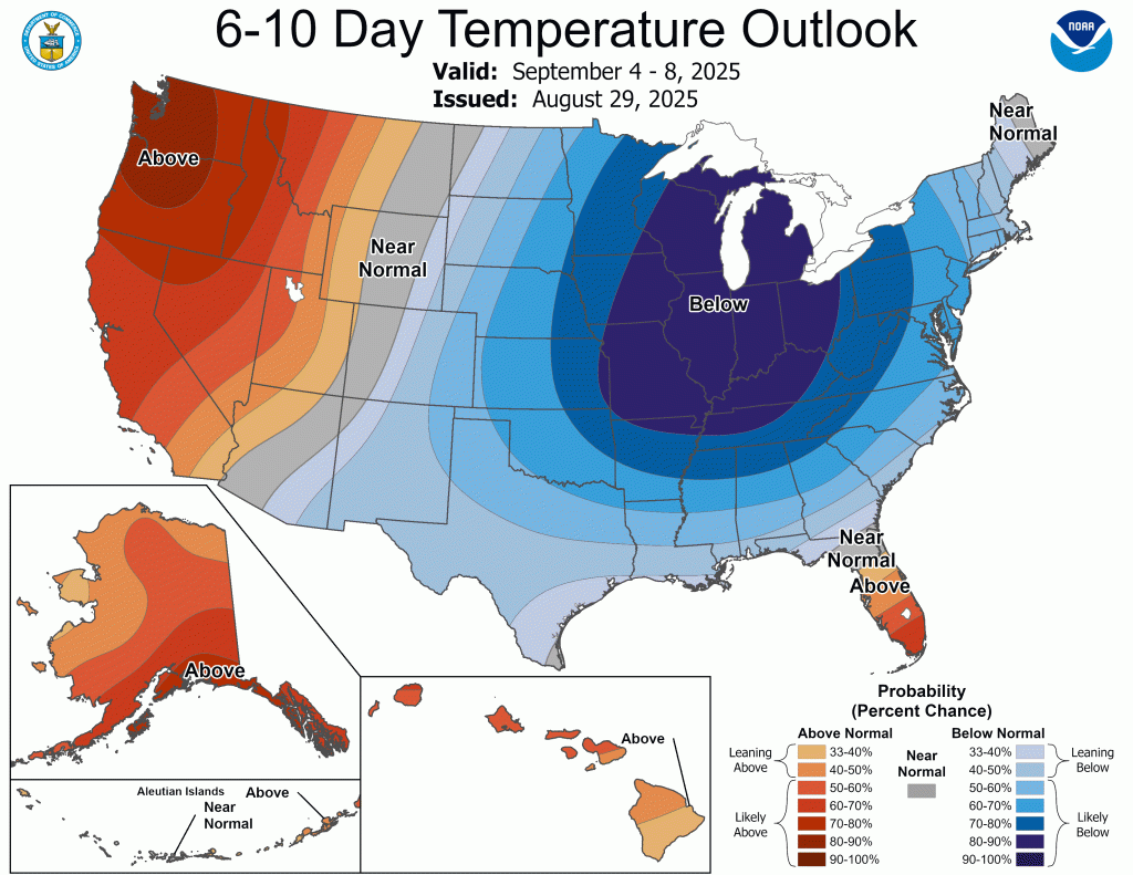
Temperatures are expected to moderate somewhat beyond this range, but still look cool. The dry weather looks to continue as well.
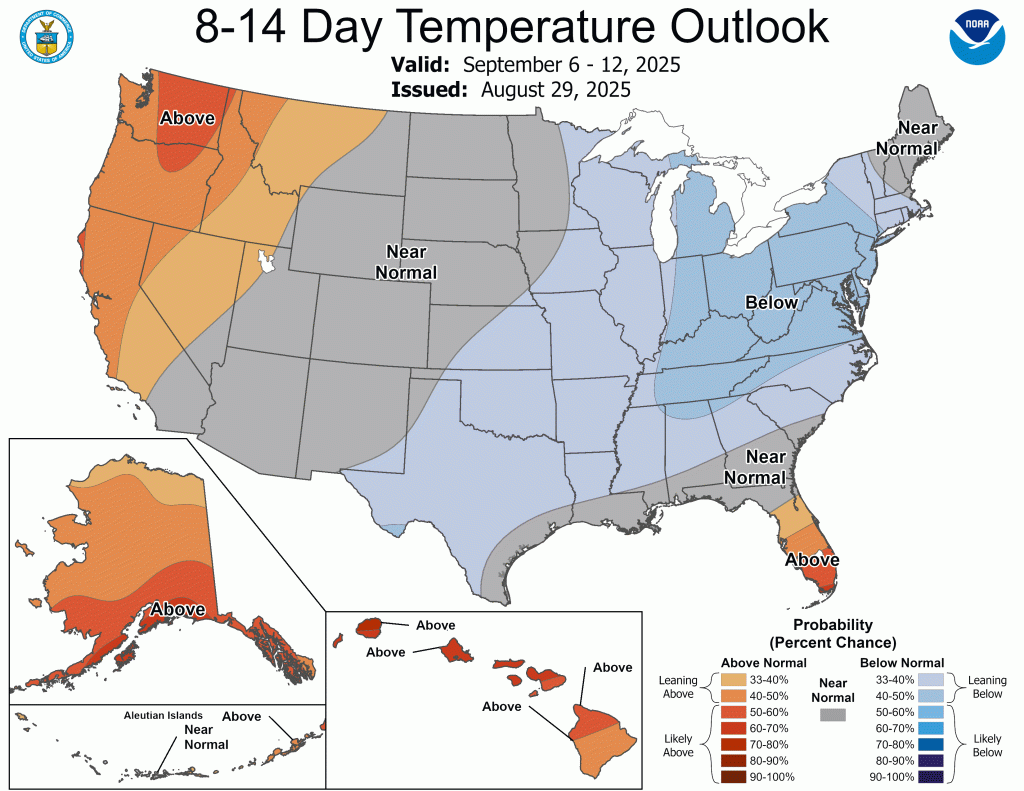

This could mean an earlier transition to fall foliage changing colors, but history would say that we probably still have one or two more warm spells yet to come. The last 90°F has come in late September about 75% of the time in the previous 20 years. These repeated pulses of arctic air could be enough to buck that trend for this year and lock in the cool weather for good, but I wouldn’t count on it just yet.
As we close out August, I wanted to point out that even though this has been a very dry month, it’s nowhere close to setting a record. I’m sitting at 2.02” in my backyard for the month so far, and with no rain in the forecast for the rest of the month, that’s almost certainly where we will stay. That would be the third driest August in the last 25 years (1.95”, 2004, 1.96”, 2024) and would tie the 25th driest all-time (2.02”, 1971). The driest August on record in Goshen was 0.42” in 1969. The average total in August is 3.28”, putting us well below normal and continuing our trend of below normal precipitation for this calendar year. In fact, only two months thus far in 2025 have ended with above normal precipitation: April and June.
Again, I hope you can enjoy the beautiful weather and prepare for (much) cooler weather to come.
–pw

Leave a comment