Welcome to a special edition of the blog. I’ve moved to a weekly blog during our recent stretch of incredibly nice but benign weather. However, I wanted to share what the data is showing and how it has been trending.
Back on August 30th I made a post about a gorgeous Labor Day weekend to come followed by a cool spell, and lastly mentioned some climatology—namely that our last 90°F+ day has come in September frequently over the last 20+ years.
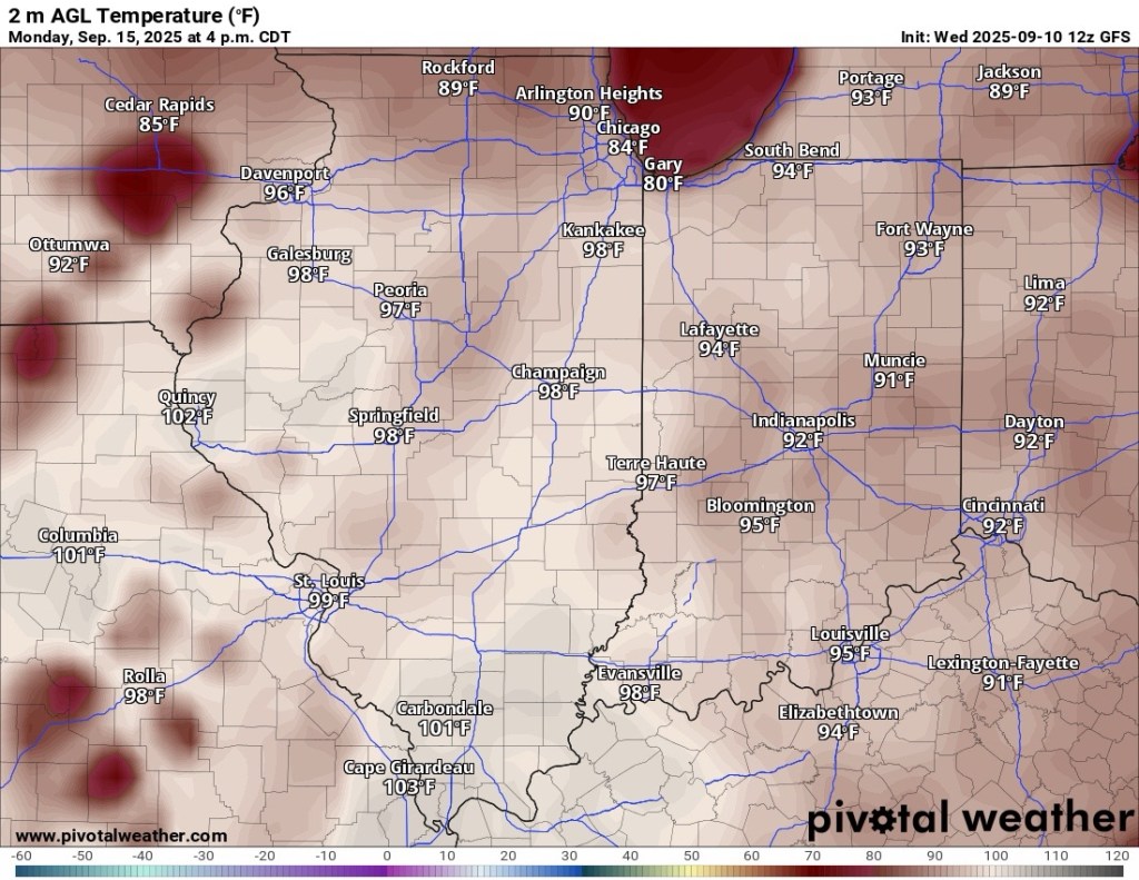
Well, we had a glorious Labor Day weekend and we just finished up a stretch one of the coolest late August and early September periods on record. And right on cue, temperature forecasts continue to rise late this weekend and into next week when we could make another (final?) run at 90°F.
I don’t buy the GFS and it’s crazy hot temps below, but upper 80s are definitely in play. If everything goes right, 90°F is not out of the question early next week.
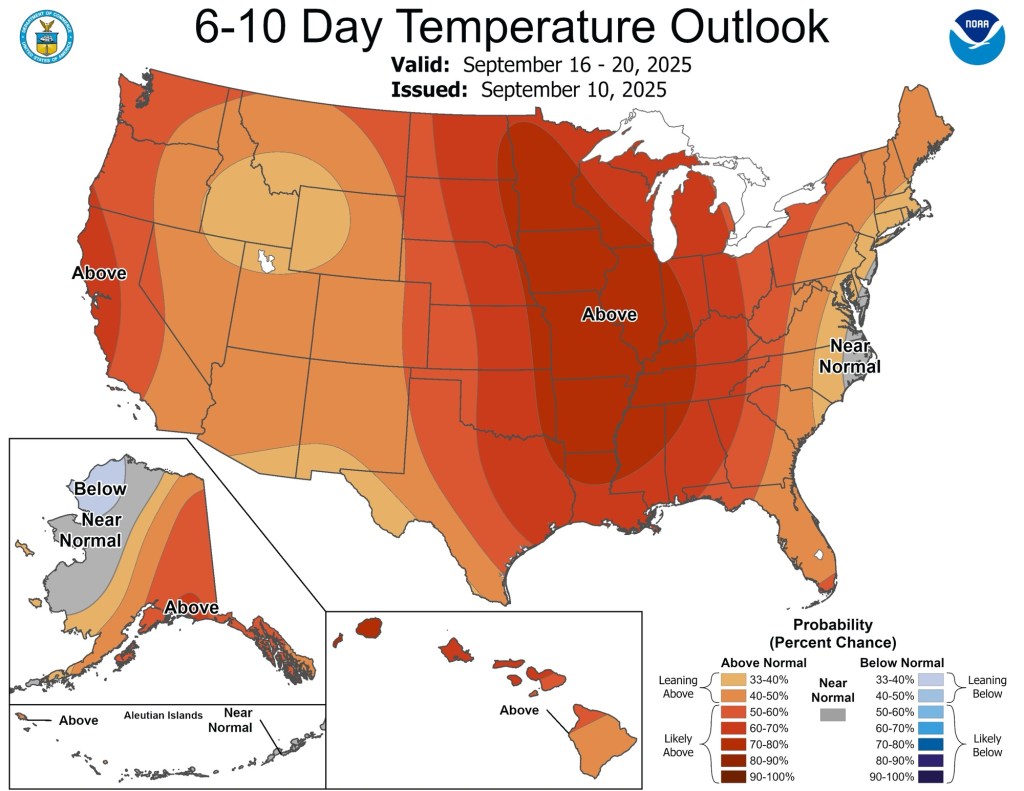
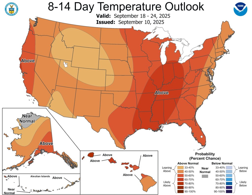
The warm and dry weather will probably be with us for a while—likely through much of September.
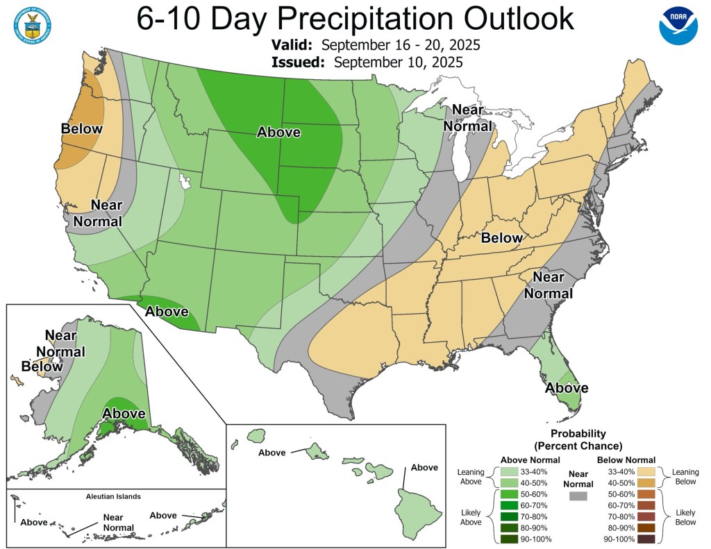
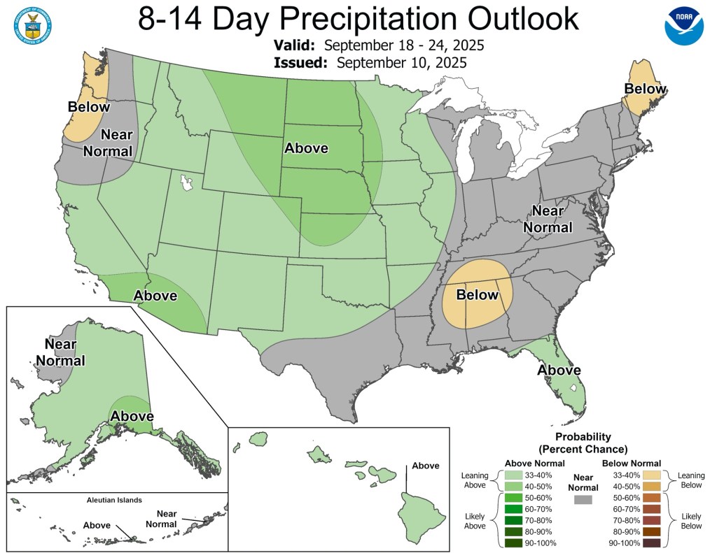
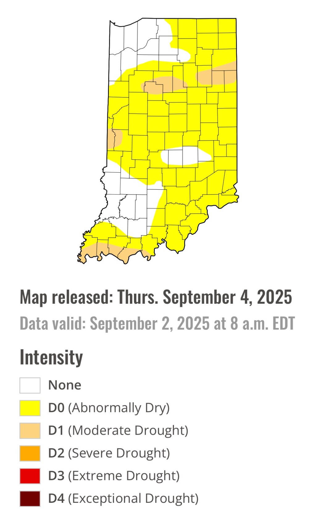
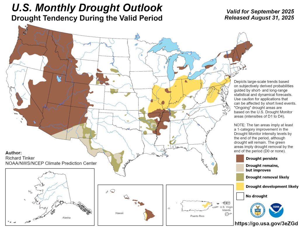
It’s been very dry and there is little to no rain in the forecast for the next 7-10 days. This had led to a fairly rapid expansion of the early stages of drought spreading into the Midwest and Great Lakes. Over the next week or two, this is only expected to get worse.

Suffice it to say, the next week at least looks very warm and very dry. While unlikely, some models are hinting that we would go from record low temperatures late last week to record high temperatures next week. I don’t have a lot of confidence in setting any records next week, but it does look legitimately hot.

Leave a comment