One of the driest stretches of late August and September on record has come to an end with the rain over the last 24-48 hours. 0.79″ today and counting has us nearing 2.00″ in the last week. A low-pressure center spinning north of us today is responsible for this afternoon and evening’s rain, and as it slowly drifts eastward, it will shift the winds out of the north tomorrow.
The northerly breeze, plus cloud cover and more possible rain, will result in a cool (chilly?) day tomorrow that will struggle to get out of the 60s. Thursday looks cool as well, but by Friday, we should start to clear up and warm up. Mid to upper 70s Friday afternoon looks likely, and the rest of the weekend should be well into the 80s. Humidity will remain low, which should keep things relatively comfortable despite the renewed warmth.
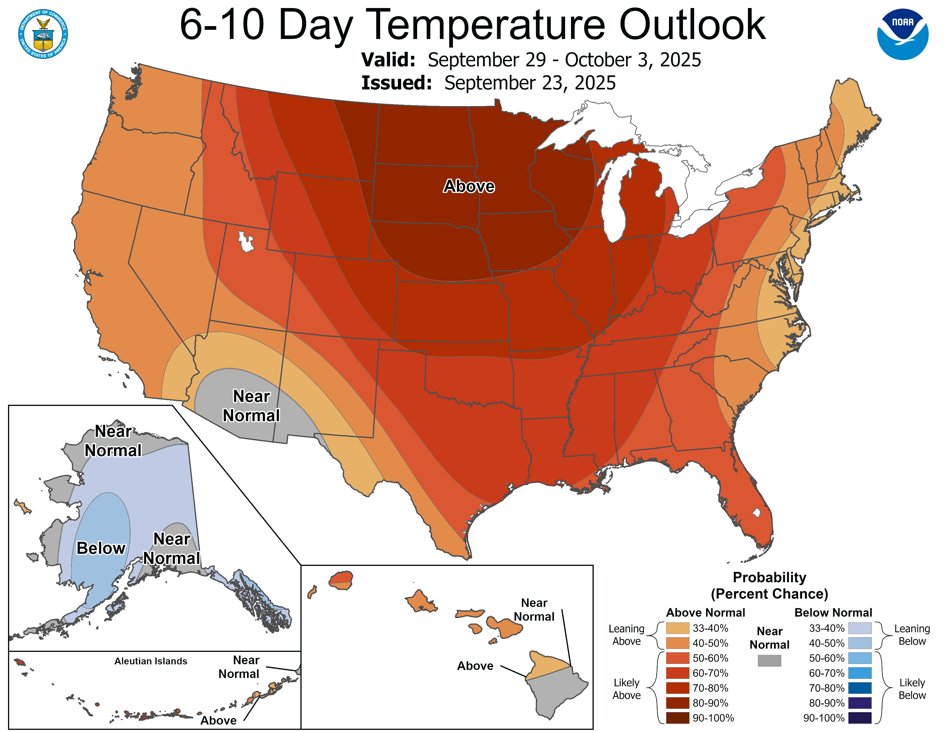
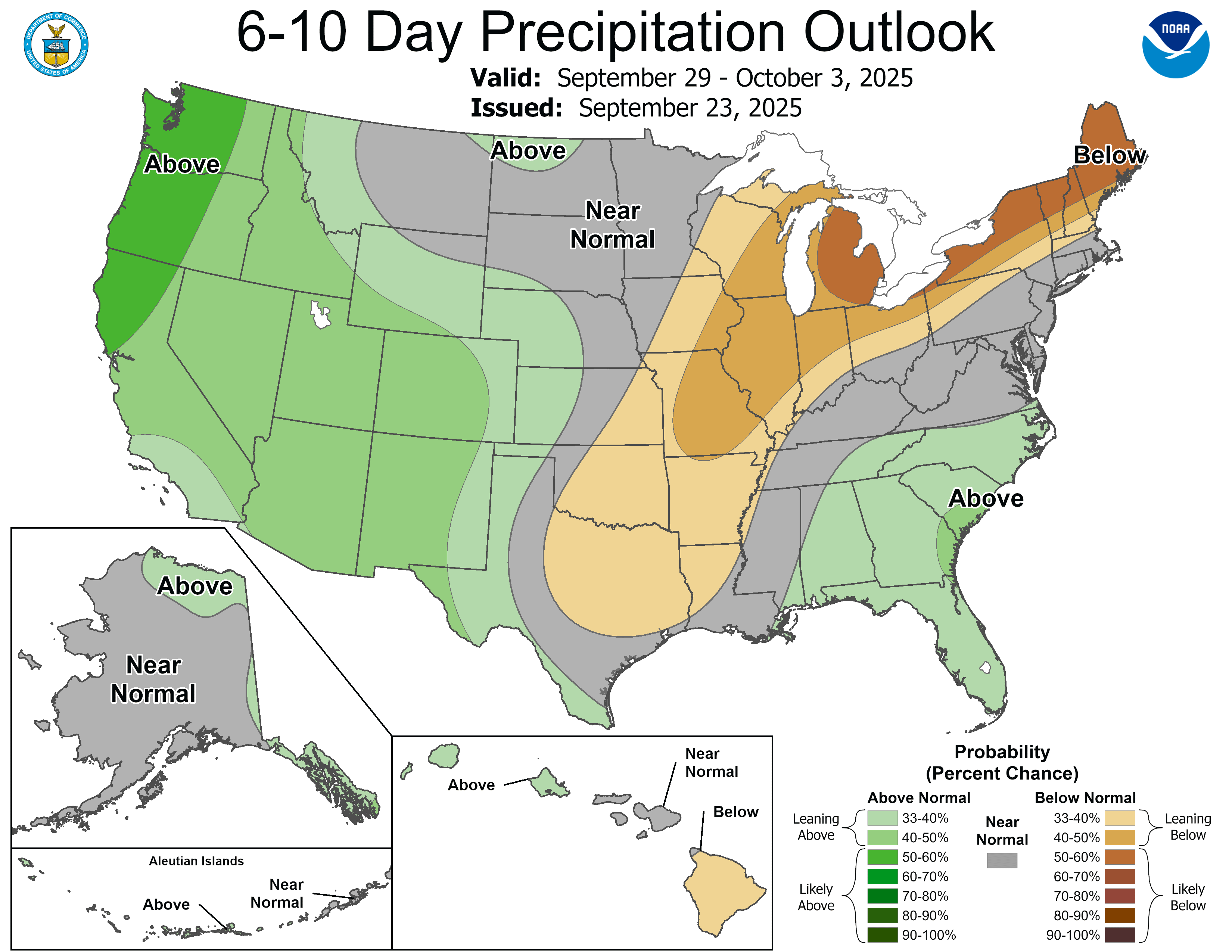
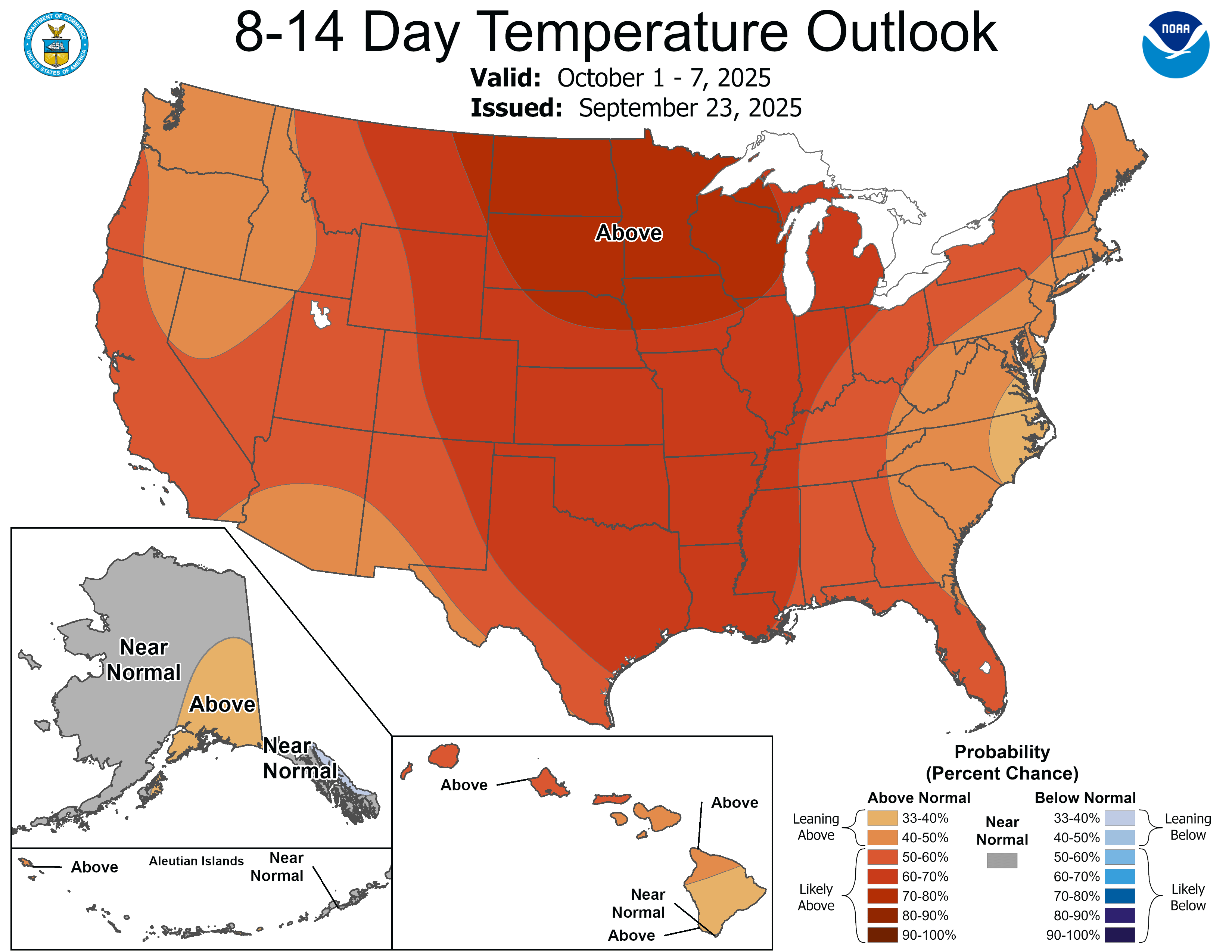
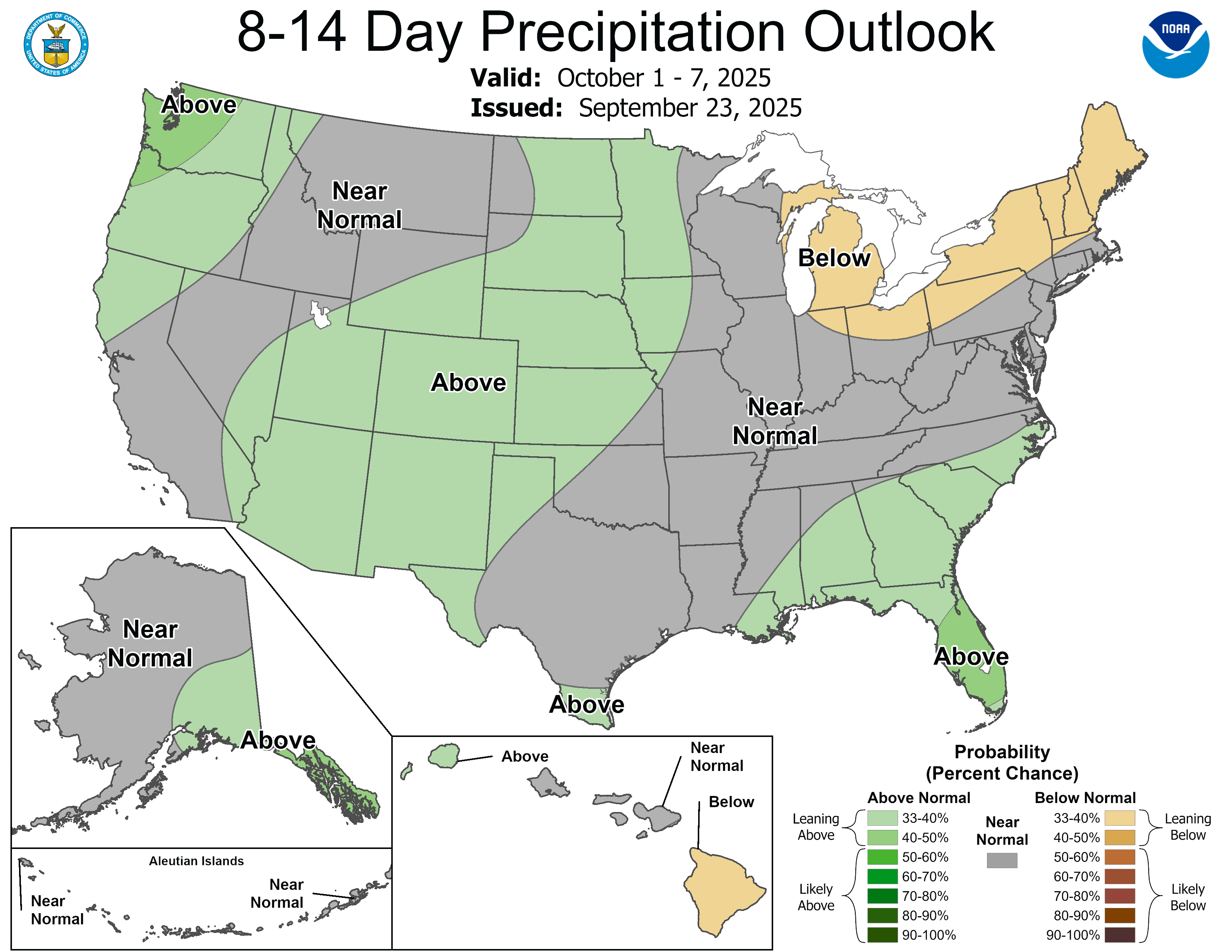
Both the 6-10 day and 8-14 day outlooks are currently calling for the above normal temperatures and below normal precipitation to continue.
We are rapidly approaching the expected time for fall foliage, and the weather will impact things (perhaps speed it up). We are also losing daylight rapidly. In fact, we are in the middle of a 10-day stretch when we lose more daylight per day than any other time of year (two minutes and forty-six seconds per day).
That’s all for now. I hope you’re all enjoying the relative warmth while it lasts. I continue to see analog forecasts connecting the coming winter to 2013-2014, which was arguably the worst winter around here since the Blizzard of ’78. It’s still September, and I personally don’t buy into analog forecasting on a grand scale just yet, but winter is coming…
-pw

Leave a comment