
Overall, the weather pattern for the next 7+ days looks cooler than it has been, but very pleasant. Unfortunately, the exceedingly dry pattern also looks to continue.
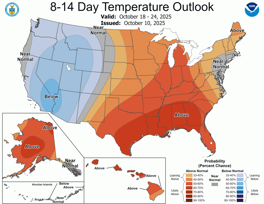
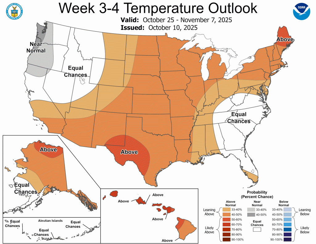
We get briefly warmer later this weekend and early next week with highs reaching the low to mid 70s, but we’ll settle back into the mid to upper 60s for highs by midweek and into next weekend. Our warmer-than-normal weather looks to continue through at least early November. Keep in mind that we’ll still be trending cooler—just not as cold as climatological norms.

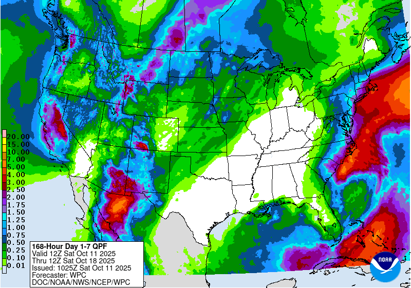
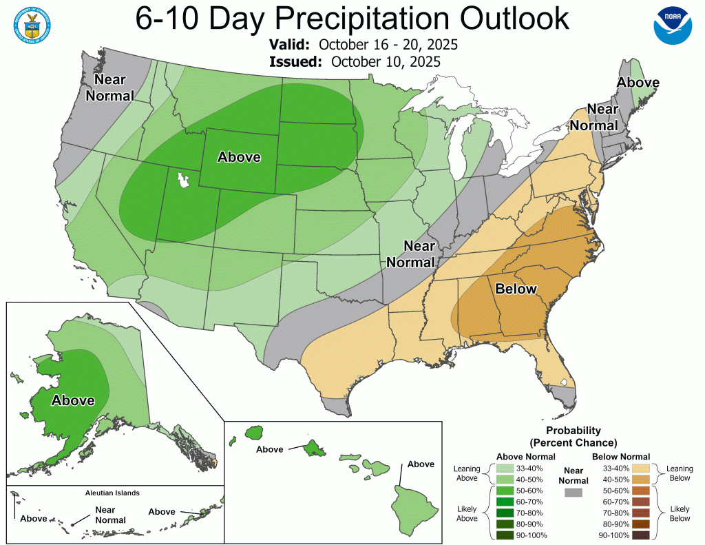
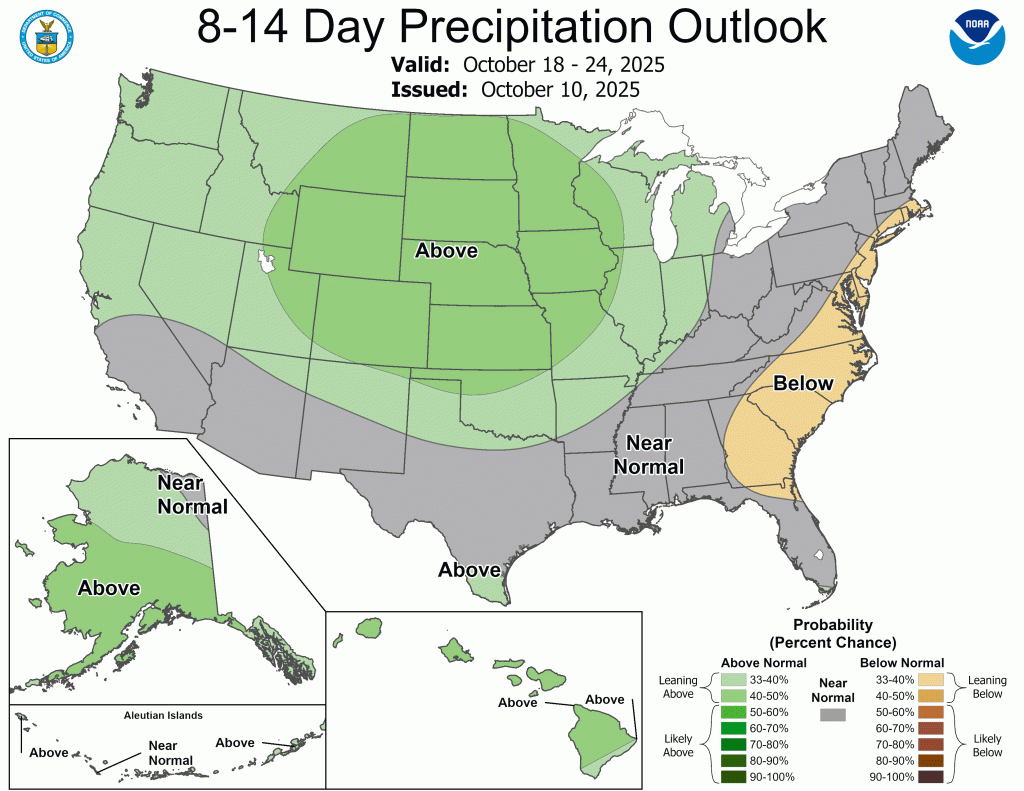
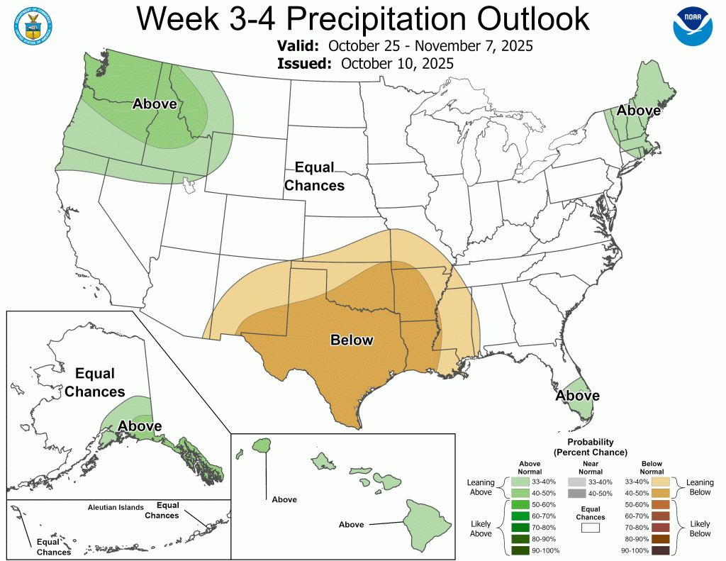
The good news is that our pattern, while warm, does look a bit more active as we head into the second half of October. And believe it or not, we ended September only 0.10” below normal. The problem was it only rained more than 0.25” in a day three times all month. Our drought situation continues to worsen, but there could be some relief as we close out October. There is not strong lean (equal chances for above or below normal precipitation) heading into November yet.
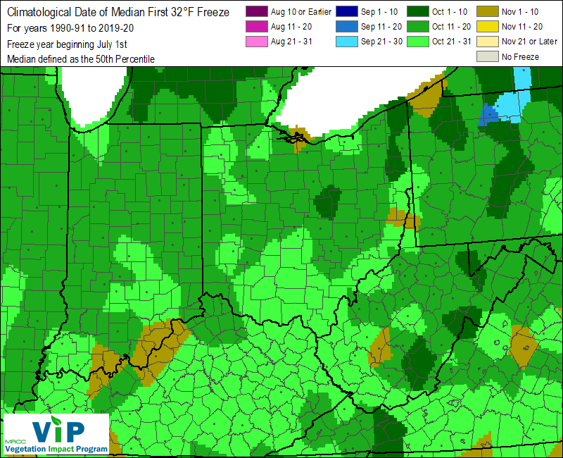
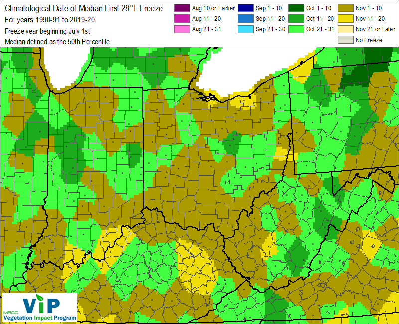
We are officially in frost/freeze season. We had two frost advisories this week, but I didn’t see any in my yard yet. Temps in my backyard just didn’t quite fall enough. Here’s a look at our climatological norms for when to expect our first freeze (32°F) and hard freeze (28°F).
The snow is starting to fly in the Rockies both in the US and Canada.
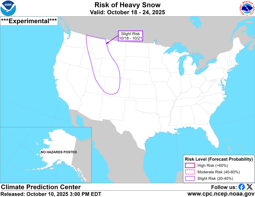
I mentioned some of the signs pointing to an active and cold winter in my last post (you can read about that here), and the early and heavy snow activity in the higher elevations out west only further support the signs pointing toward a more active winter than we’ve seen the last few years. More snow out west could support earlier cold snaps in the upper Midwest and Great Lakes, but there is nothing like that on the horizon just yet. We are still mired in our dry and warm pattern and it will take some time to transition out of it.
-pw

Leave a comment