Forecasts have decreased storm rainfall totals somewhat, but most can still expect 1-2 inches over the next 36 hours. A few spots could still see closer to 3”.

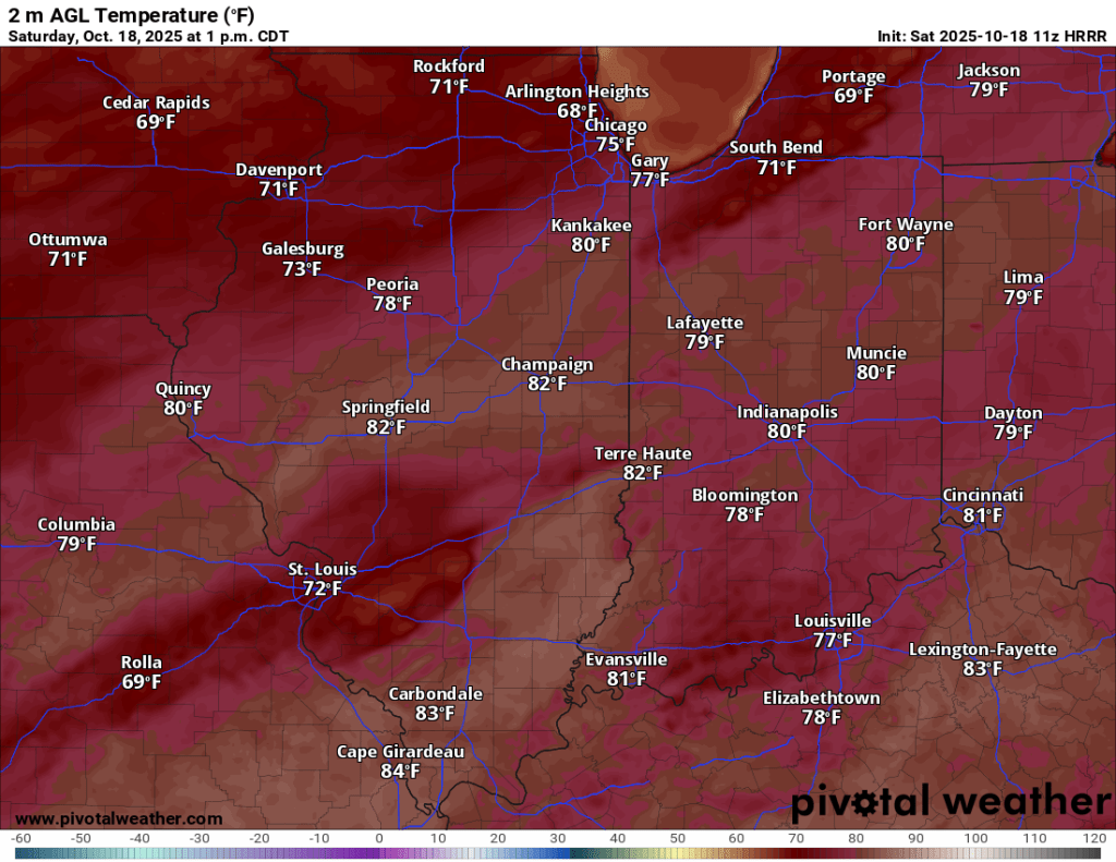
Rain should be scattered and relatively light late this morning through early evening. A few storms with gusty winds are possible, but severe weather is not expected. Wind will pick up as the day progresses, regardless of storm activity, with gusts from the south exceeding 25 mph at times. The wind will be southerly and warm today, helping temps climb into the low to mid 70s for possibly the last time this year.
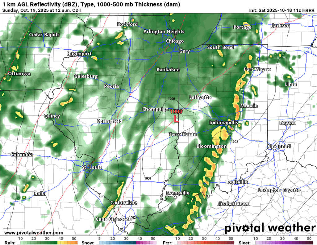
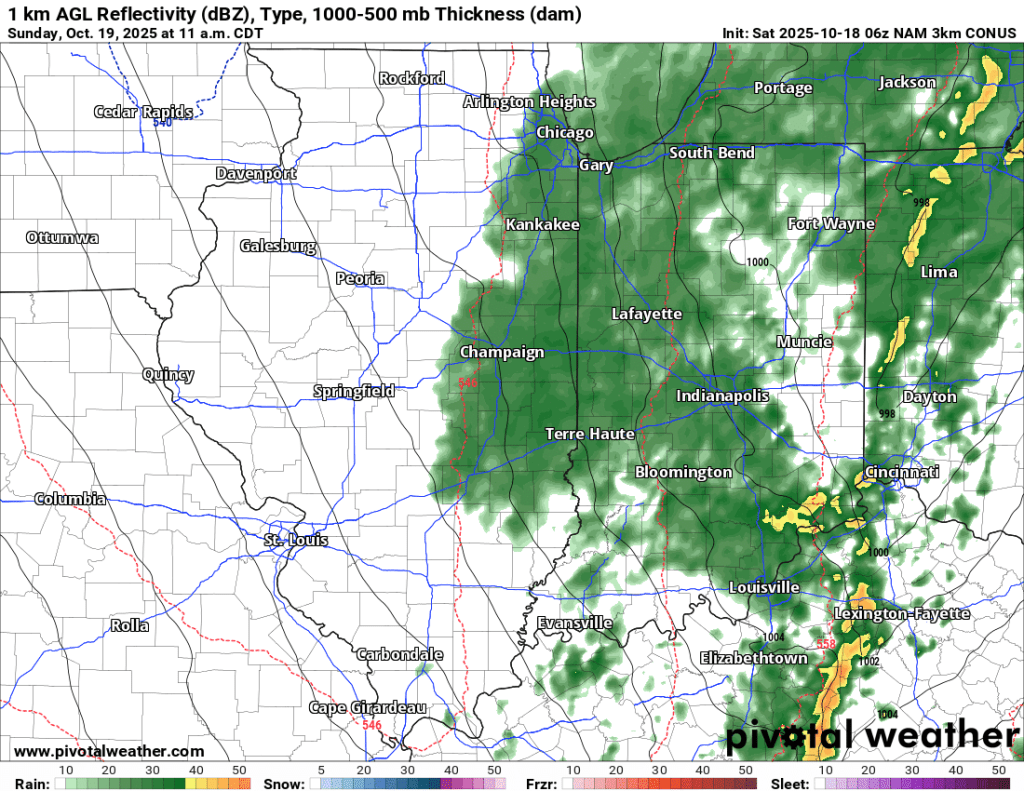
Rain coverage expands tonight and is expected to intensify. Rainfall rates could exceed 1”/hour at times. The bulk of our 1-2” expected total arrives overnight. The peak wind gusts are expected from early tomorrow morning through tomorrow afternoon as the cold front passes and shifts winds from the south to the northwest, ushering in much cooler air tomorrow.
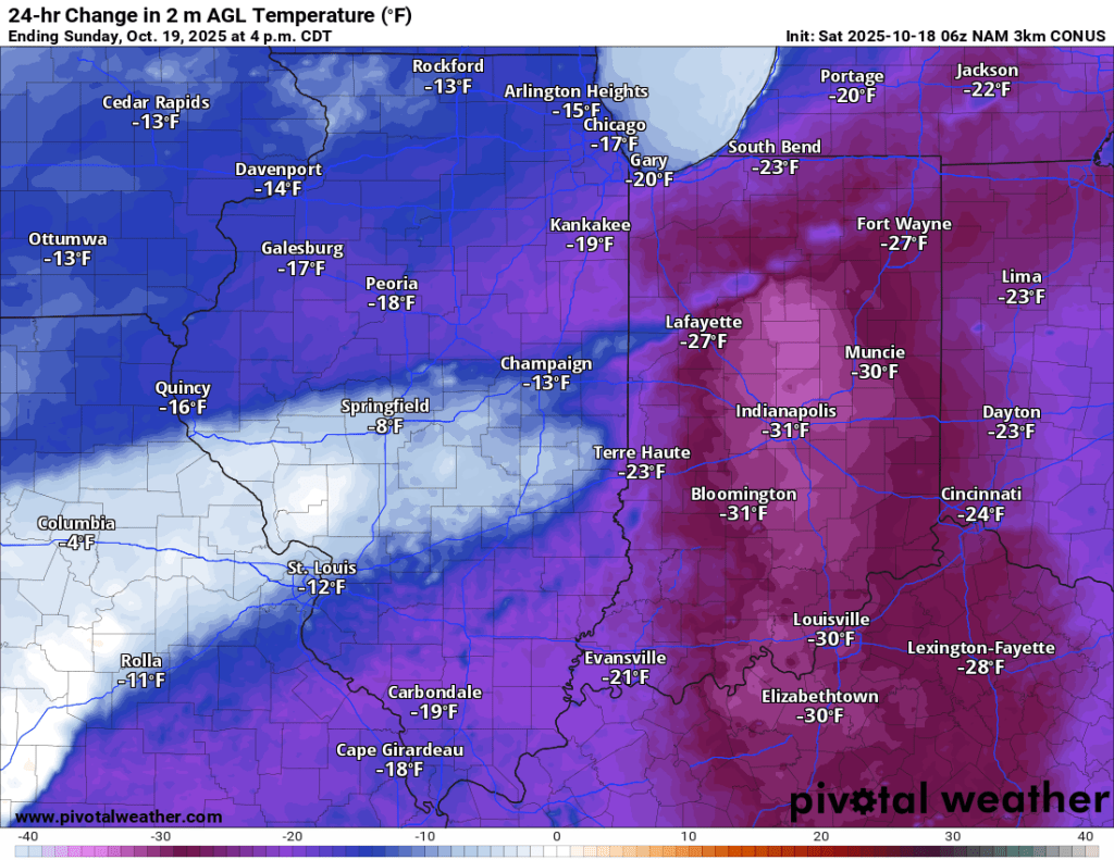
Initial forecasts had the rain ending early tomorrow and clearing up by afternoon, but now I am worried that the rain and clouds will hang on much longer tomorrow. Regardless, temperatures will peak this afternoon in the mid 70s and slowly, but steadily fall a degree or two every hour until Monday morning when we bottom out in the 40s.

The radar is mostly clear in our area this morning with only a few pockets of scattered shower activity. The next few hours will be the only dry ones left this weekend, so now is your chance to clean the gutters and cover things up.
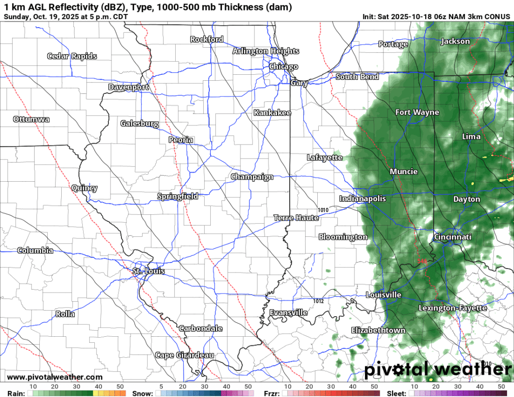
The gallery below shows what the radar could look like over the next 36 hours. This is not “gospel” and only meant to give a general idea of when to expect the heaviest and most widespread rain. You can see the coverage and intensity expand overnight before waning tomorrow afternoon and evening.


Dust off those rain gauges, I’ll be excited to see your local reports. Enjoy the calm before the storm this morning and get that yard work done while you can!
–pw

Leave a comment