It looks like we have entered another fairly long stretch of dry weather with seasonable temperatures (highs around 50/lows around 35), though it will be breezy at times as the week progresses.
Temperatures
A slight uptick in temperatures is in the forecast for the week ahead with highs around 50° early in the week rising a degree or two per day until we reach close to 60°F by the end of the week. Just beyond that range, the overall trend remains warm, but our next system arrives late next week and colder air may wrap around the backside of it (as is often the case as we transition into winter) and bring highs in the 40s next week.

Precipitation
We should stay dry until the aforementioned system arrives late next week. Totals look pretty meager at this time, though 24-36 hours ago they were much higher—so that may flip flop over the week.


Beyond
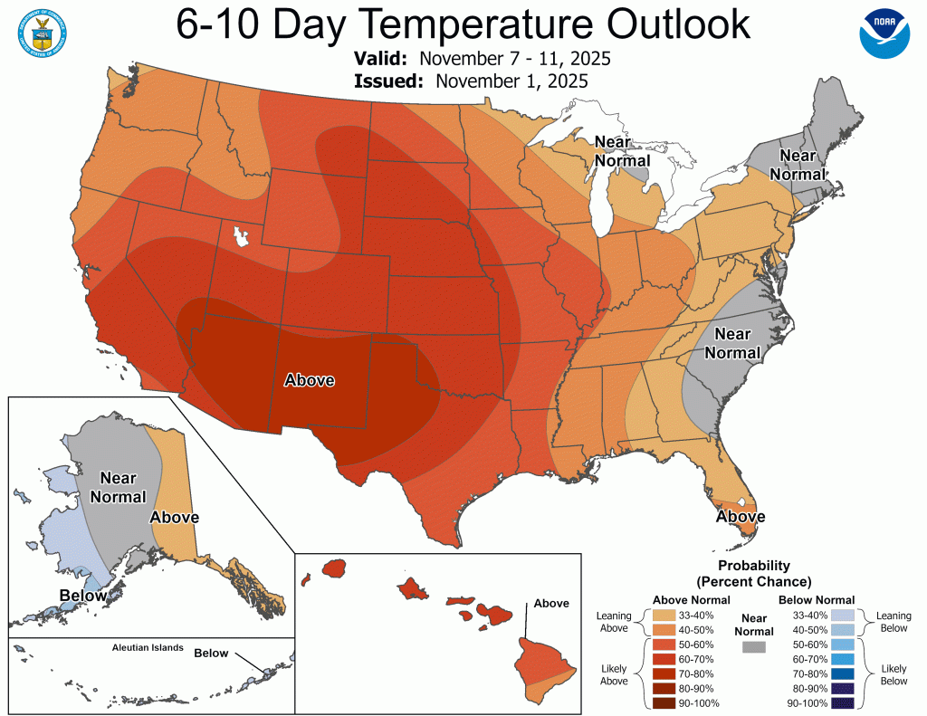
The overall theme remains warm (relatively speaking) and mainly dry. However, things are expected to shift more toward normal in terms of temperatures and above normal in terms of precipitation. We’ve already started that transition with temperatures and there are signals of a more consistent and more active storm track in our area as we head through November and into December.
The last few years we’ve had some snow early in the winter that got most thinking we’d see a decent amount the rest of the way (myself included last year). Unfortunately, that hasn’t happened the last two years as both have ended below climatological norms.
Despite conflicting signs the last two winters, most signals are still pointing to an active winter ahead. I plan to release my winter outlook on Thanksgiving.
Just for fun…
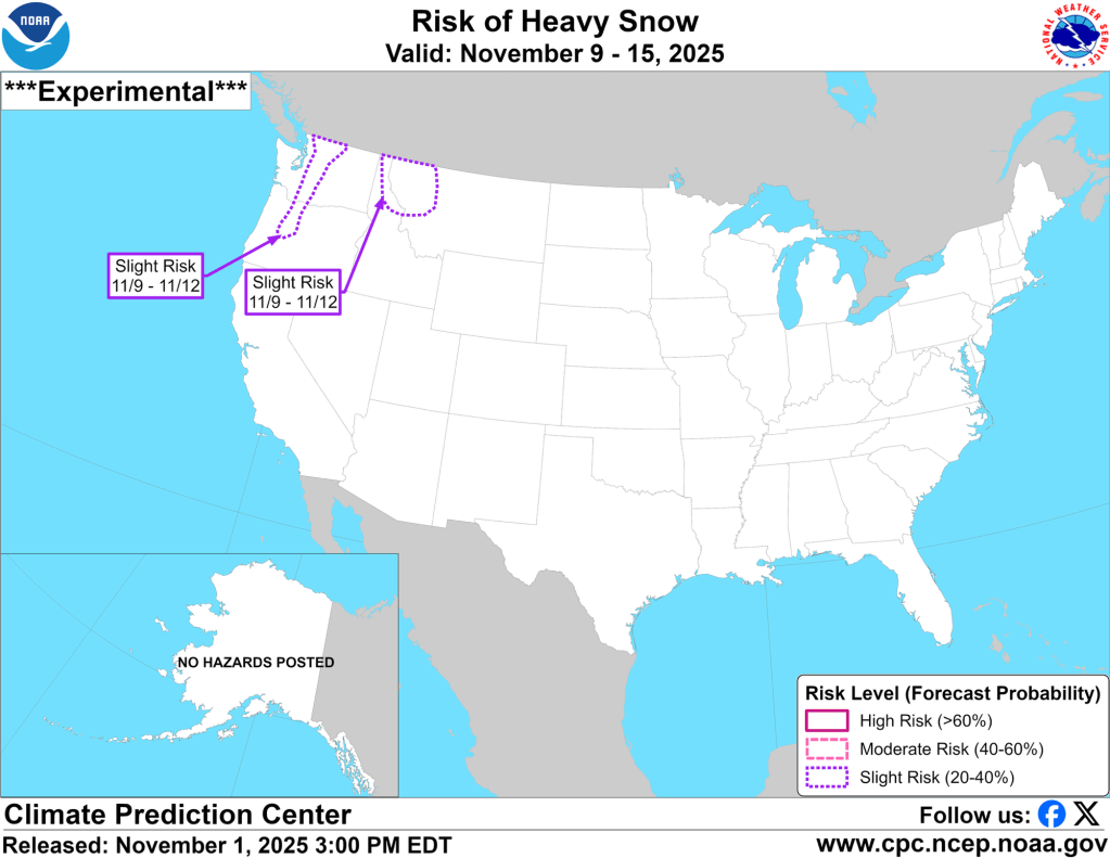
I’ve mentioned signs of an active winter ahead, one of which includes early activity to our north and west.
And, for those of you who might be new here, I don’t believe any forecast model beyond 3 days. The only caveat is the CPC forecast directly above—though it performed rather poorly last year compared to the year before.
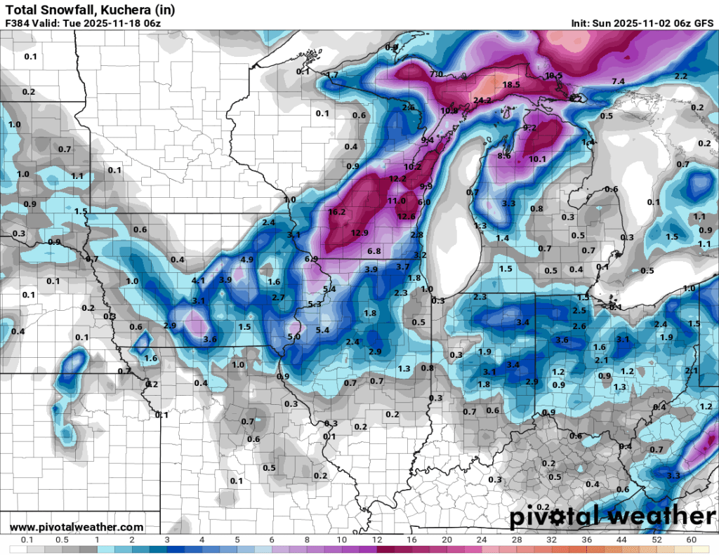
Now, to be 110% clear, I am not posting this because I think it will happen. I only show this to illustrate that some snow is starting to show up in the long range forecasts locally and that is a good indicator that it will be here soon enough. This is the latest run of the GFS model at its maximum range and it shows some snow in the area in mid-November. FYI – the Euro shows no snow anywhere at this range, nor does the previous run of the GFS. Again, it’s just fun to see snow showing up in these models already

Leave a comment