Many have caught wind of a potential bout of wintry weather this weekend, especially those following GoshenWeather.com on Facebook. I just wanted to make a quick post about what is currently showing up in the models, and preface it by saying that there are many, many ways things could pan out, and most do not involve accumulating snow. If you read nothing else, note that while we may see our first snow of the season, it won’t amount to much of anything and we will be back in the 50s by next week.
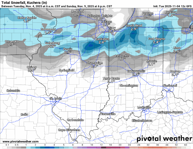
Below you will see the last 6 runs of the GFS (American) model. As you can see, the area of precipitation is actually quite consistent, but the amounts of snow within that area vary widely with each run. That is all to say that there is very little confidence in any snow amounts between now and Sunday night.
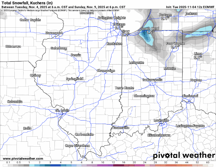
If you’ve been a follower for a while, you know I prefer the European model in the winter. It is often more consistent over a greater range and tends not to overestimate snow amounts like the GFS can —in general, it is just more accurate. This first potential event of the season is no exception. The Euro has been quite consistent in terms of placement and amounts. At this range, I don’t put much stock in either model, but if I had to, it’d be the Euro. You can see below, it paints a very different picture.
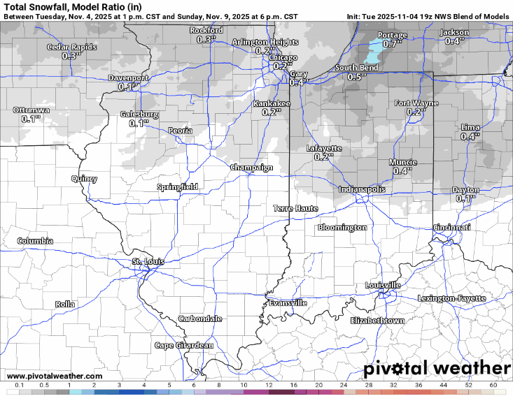
The national blended model is something I have only really used in the last year or two. It is always the most conservative with snow systems, but it can also struggle with the complexity of lake-effect events until just before they occur. This model’s output seems the most likely to me, but I’d like to let a few storms play out before committing too much to it.
The point is, do not believe any single snowfall map you see right now. They change every 6 hours or so, and the changes are fairly dramatic at this range. Until we get within 48 hours, I wouldn’t believe anyone who claims to know exactly what will happen with this, or any other storm this winter. And regardless, we are not talking about a snowstorm. We are only talking about the first snowfall of the season. My guess is even if it does happen, it won’t accumulate much, if at all, this time around. Ground temperatures are still relatively warm and will melt what does fall initially. There is still uncertainty about when the cold air wraps around and changes to snow. Storm track will determine what, if any, lake enhancement there is in addition to lake effect snow. Lastly, the exceptionally dry air in place now must be overcome before any precipitation can fall.
Until these are resolved, there’s nothing to do but accept the fact the following:
- Winter is coming.
- There are only 23 days until Thanksgiving.
- There are only 51 days until Christmas.
- It will snow sooner or later.
- Sunset is 5:34 PM tonight, and was over an hour later a week ago.

Leave a comment