
I’ve been trying to stick to a once-a-week blog entry for the last several months unless there is a storm to track or, as in this case, a potentially significant change coming. In my post last night on Facebook, I mentioned the possibility of the Polar Vortex breaking down and allowing true arctic air to filter in as early as the first week of December. We will know whether that forecast verifies within about 10 days.
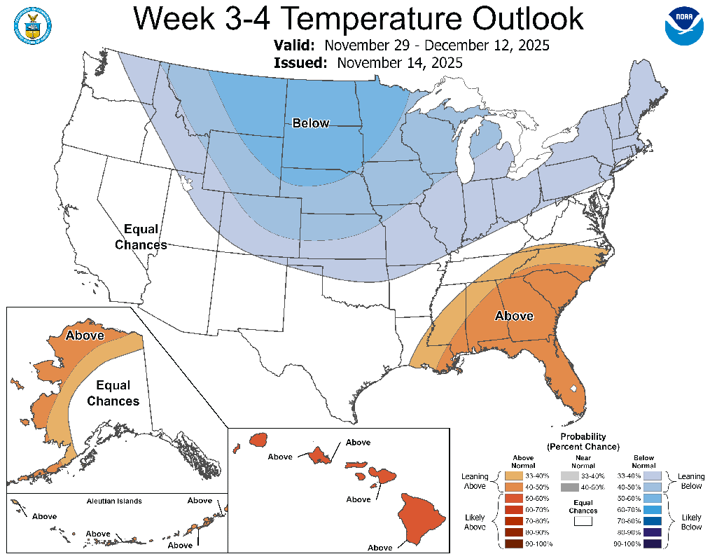
One other thing models have been sniffing out is a potential bout of more wintry weather next weekend. The cold air and possible winter weather associated with it have been getting a lot of traction among the hacks out there, desperate for clicks. You still don’t have to listen to them. However, in my last post, I included the longer-range 3-4 week map from the Climate Prediction Center, showing below-normal temperatures at the end of the month. Those below normal temperatures are now showing up in the 8-14 day outlook, and the signals are even stronger. You can compare today’s 8-14 day outlook and last Friday’s 3-4 week outlook below.
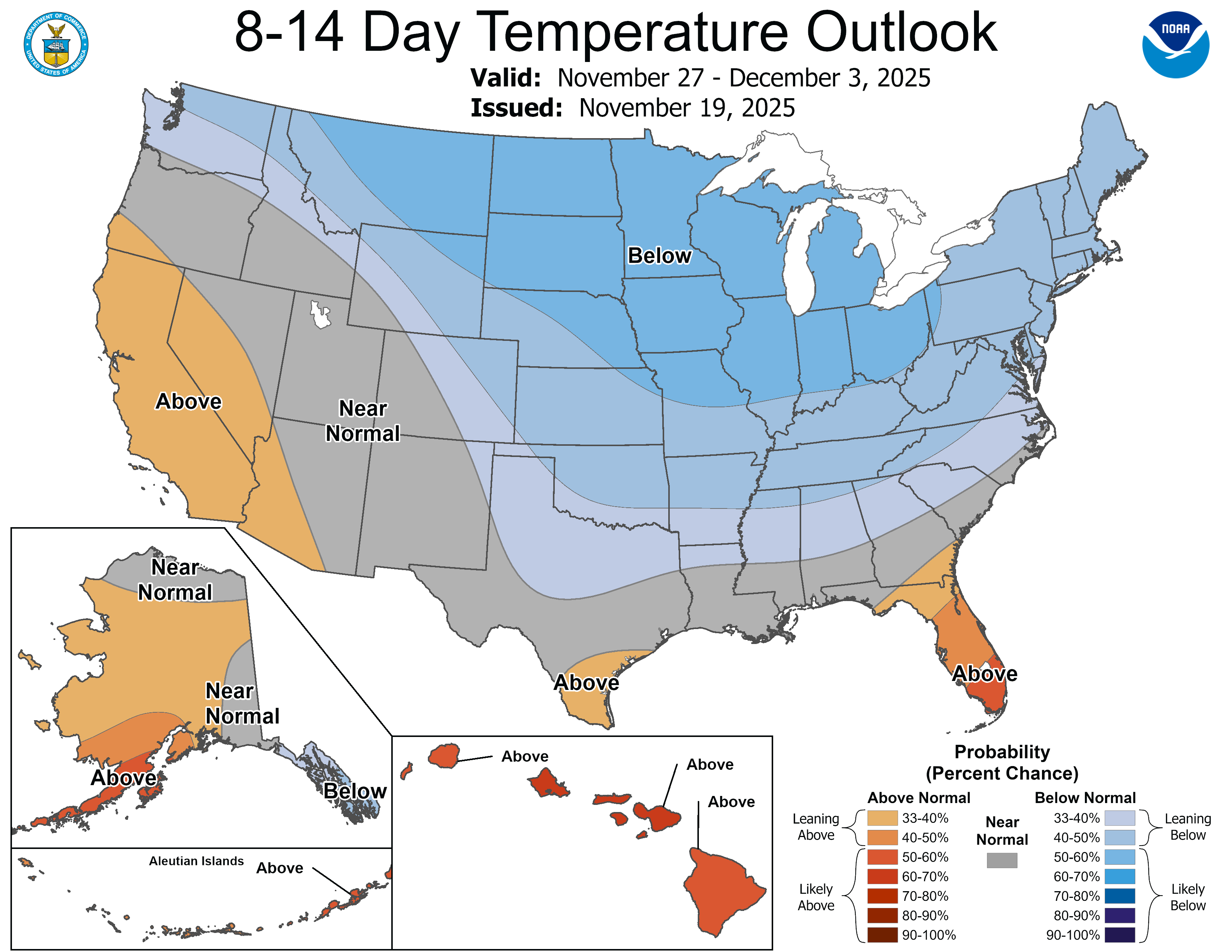
Suffice it to say, the weekend after Thanksgiving should be plenty cold enough for wintry weather. Over the past two days, models have toyed with the idea of a winter storm in the upper Midwest. Generally, the storm’s track has been well to our north, including Minnesota, Wisconsin, and parts of northern Michigan and the U.P. It is very common for storms to follow this path early in the season. However, more runs are bringing the snow further south. Either way, the storm track itself does not seem favorable for a direct impact locally at this time. Nonetheless, depending on where the storm goes, it could reignite the lake-effect snow machine.
I’m not saying a big snowstorm is coming. In fact, I would wager that the odds are best that we don’t see any system snow. That could change, but I’m not convinced just yet — despite some compelling evidence below (keep reading!).
Depending on the storm’s track, we could see some lake-effect snow next weekend. That will all depend on where any potential low-pressure center goes and which way the winds set up behind it. There are a lot of “ifs” and “buts” here, I realize. And storms come and go like this in the models all the time in the winter, and at this range, most never happen. Regardless, a pattern is emerging in the models, and our old friend, the NCEP Hazards Outlook, also provides some support.
Not only is the anomalously cold air noted as seen below, but a slight risk of heavy snow was added to today’s maps for November 30 through December 3.
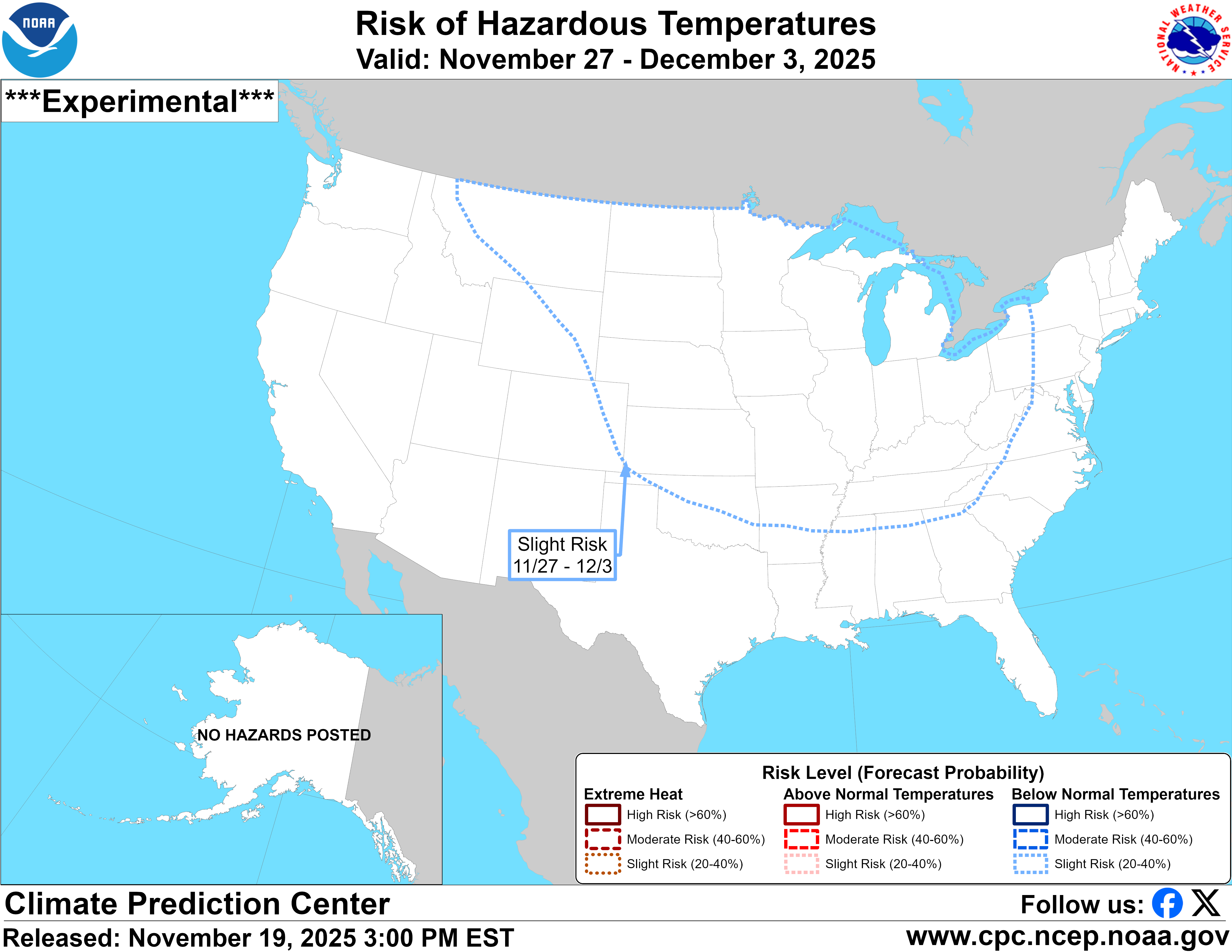
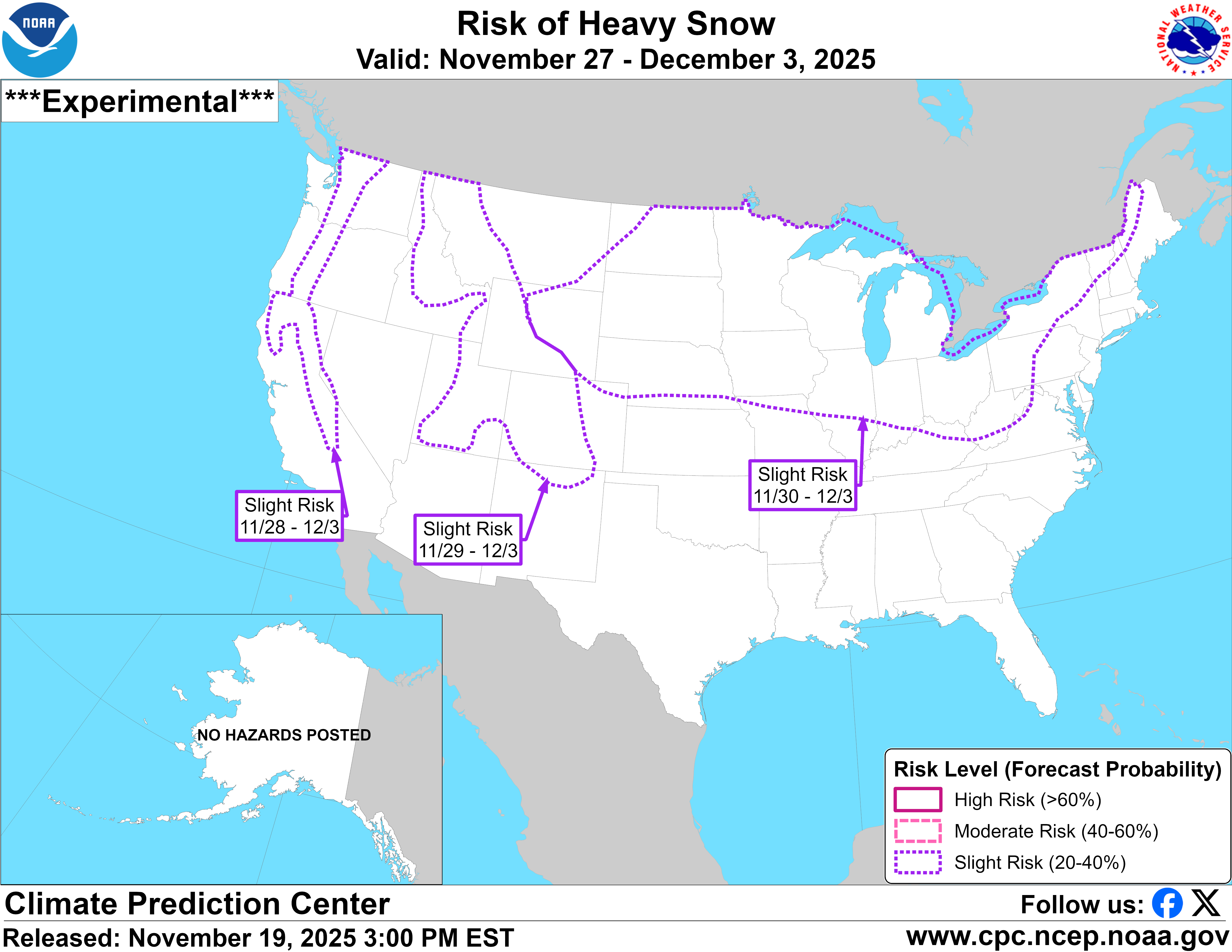
I really like the Hazards Outlook. As far as medium- to long-range models go, this is my go-to for a general sense of where to expect the most significant potential for impactful weather. The beginning of December looks very volatile, and like I said last night, the signs are getting harder to ignore–and here they are!
We have a little over a week before things may start to get interesting, and between now and then, it looks pretty dull and dreary. Clouds will stick around for much of the next week or so, but precipitation should remain light, falling mainly as light rain or drizzle. If you haven’t put up your outdoor decorations or picked up the leaves that have fallen, the next week or so might be your last chance before the weather makes it more difficult. I’ll have another blog post this weekend, and don’t forget to check the daily forecast on Facebook.
-pw

Leave a comment