
Polar Vortex Update
In the last post, I mentioned that the polar vortex was showing signs of breaking down and there was high confidence in a breakdown taking place in late November. The breakdown process has begun. Now, the question is whether or not it will be a complete breakdown or just partial. Forecasts remain bullish on an impressive breakdown. This will disrupt and distort the flow of the polar vortex up north and allow arctic air to pour into the US.
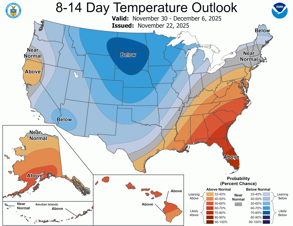
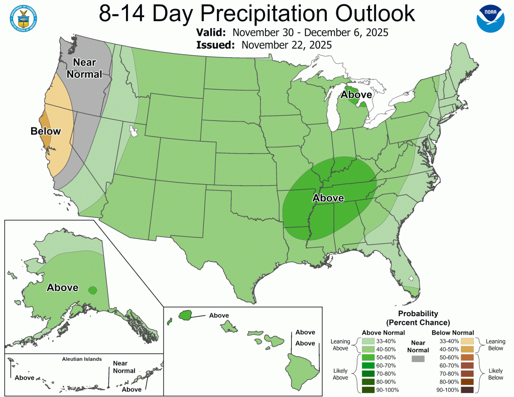
There is support for a colder than normal December from essentially every resource I can find. The CPC outlooks have remained consistent with the anomalous cold, and have shown consistent signals for above normal precipitation. I’m buying the cold at this point, but I’m not sure about the precipitation just yet. Moisture may be hard to come by, which could limit snow accumulation, but that will depend on each storm track. Regardless, the CPC outlooks have been consist with above normal precipitation, too.
For all the naysayers out there, this is worth repeating: A breakdown of the polar vortex hasn’t happened this early in 25 years. Below, you will see the temperature data for the last time the polar vortex was disrupted this early (2000).
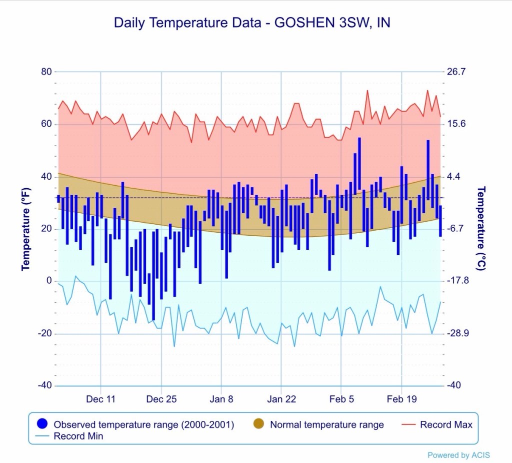
As you can see, the first half of the winter was well below normal and approached record lows on multiple occasions. The snow got started early that winter as well, and was well above normal, with most of the snow falling in December.
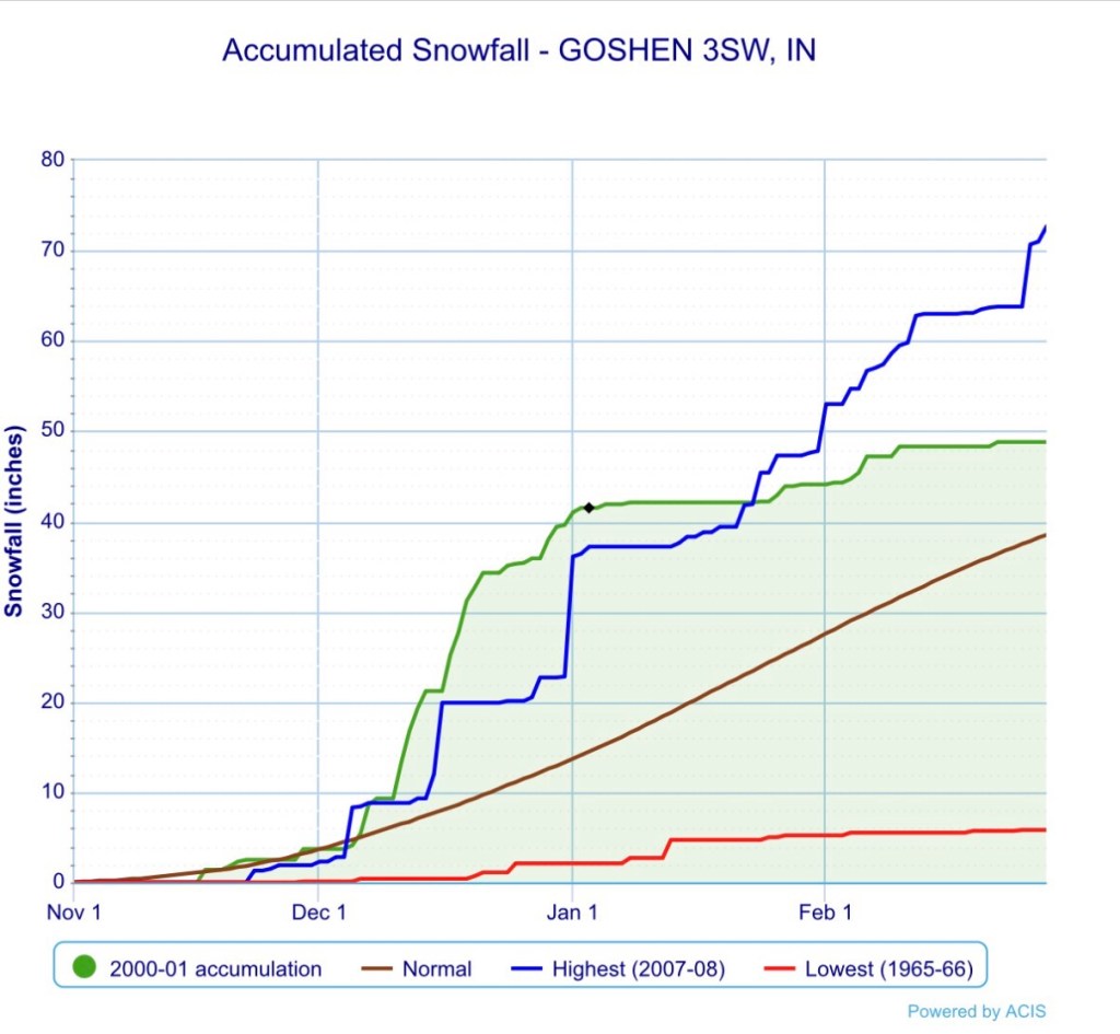
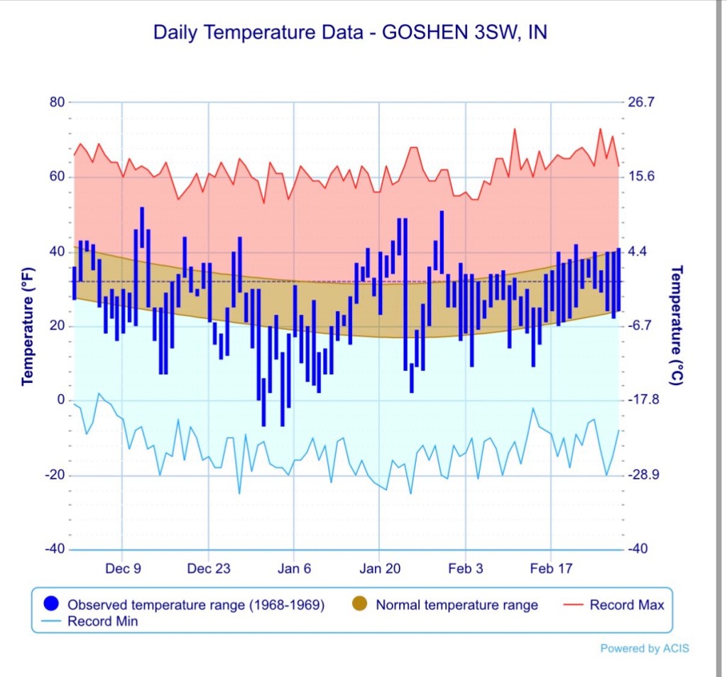
The data above all comes from the winter of 2000-2001, when the polar vortex weakened, but did not fully breakdown. The winters of 1958-1959 and 1968-1969 featured full breakdowns. Both years were abnormally cold, but both also featured well below normal snowfall. You can see their graphs below.
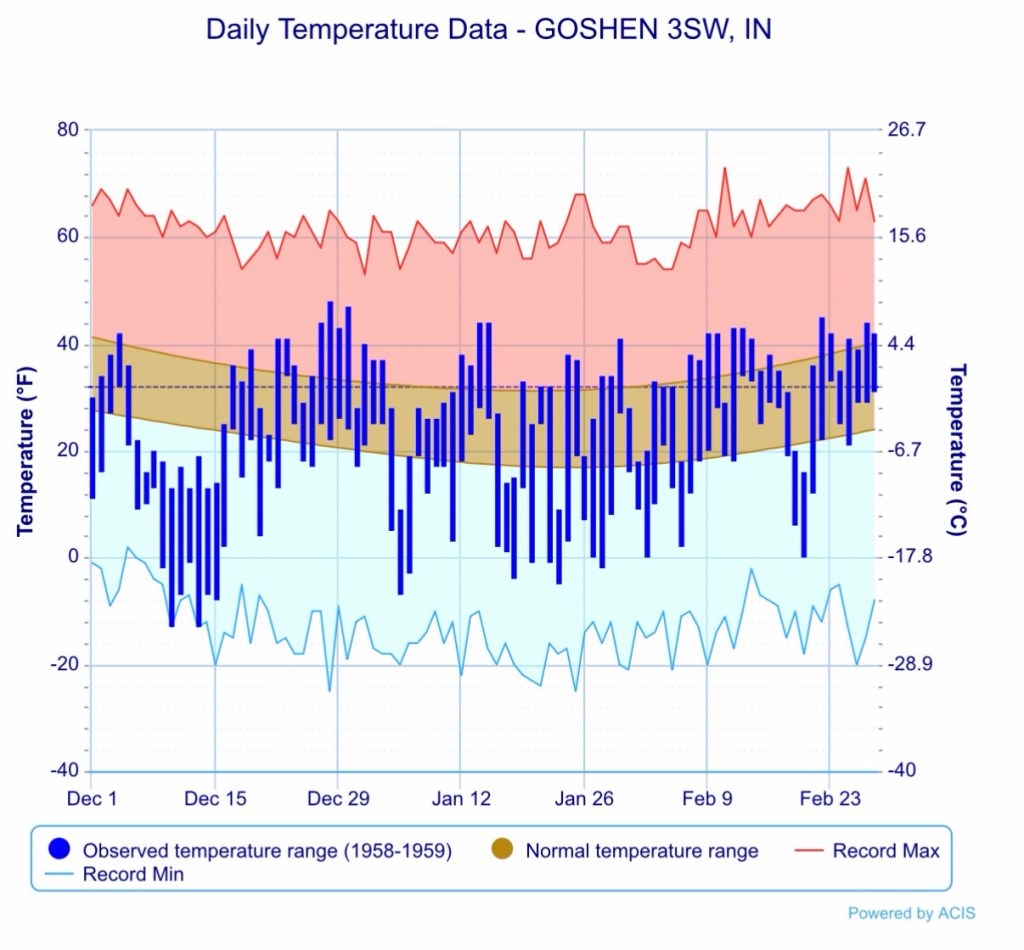
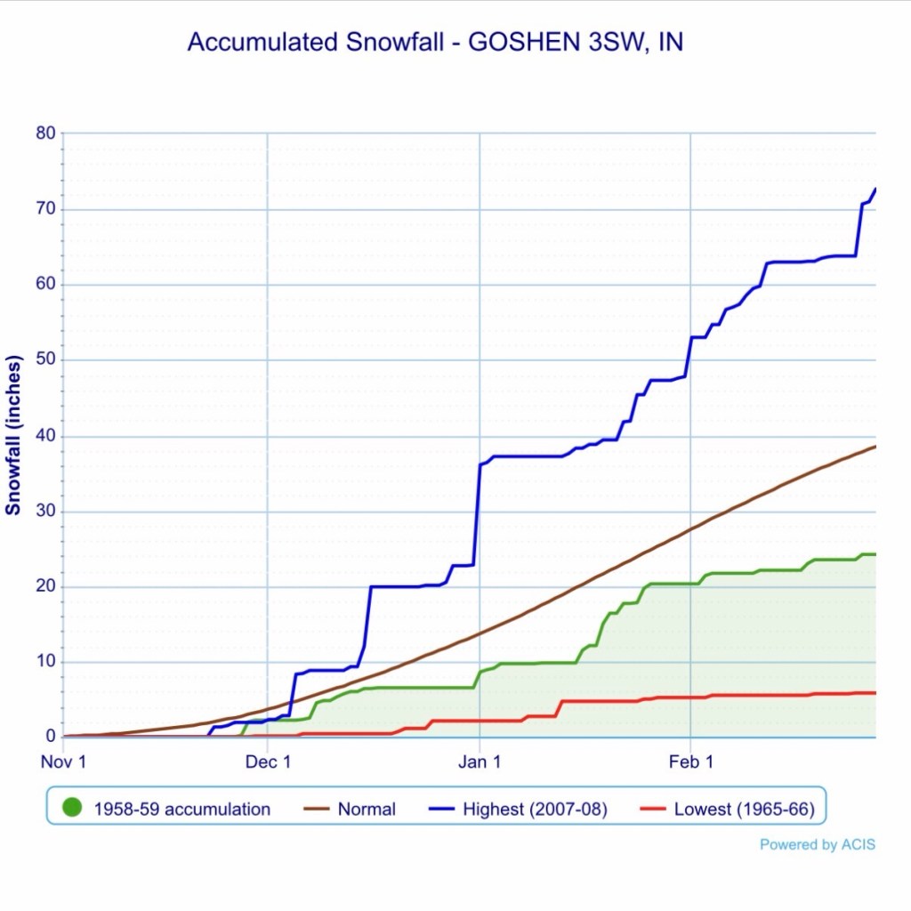
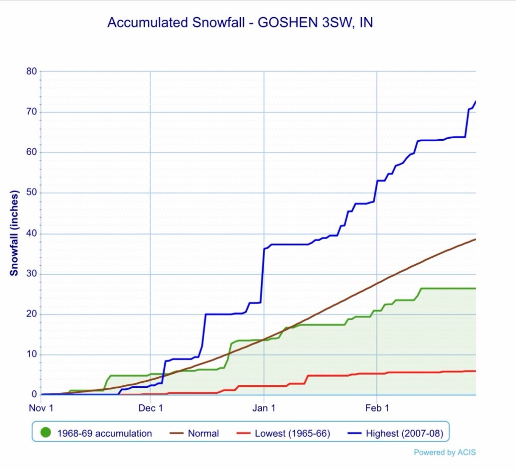
You can see why I am hesitant to buy into the snow based on the data above. A partial or complete breakdown of the polar vortex has happened three times in the last 70 years. 100% of those winters featured below normal temperatures. However, only 33% featured above normal snowfall, and 0% of completely breakdowns had above normal snow—in fact they were both below normal. And all signs are pointing to a complete breakdown of the polar vortex over the next week or two.
December 2025 should be an interesting one. It seems almost certain that we will be cold, but will there be above normal snow or below? That is the question. Now let’s take a look at the week ahead.
Temperatures
Don’t get used to the 50s, they’ll only be around another day or two this week. High temperatures Monday and Tuesday should be around 50°F, and technically Wednesday could too, though that would be around midnight as temps are expected to fall Wednesday into the 30s with gusty winds shifting from southwest to west as our first system of the week passes. High temperatures for Thanksgiving, Black Friday, and Saturday will be in the 30s. Temperatures should moderate to near normal in the 40s by this time next week. Lows next week will range from the mid 40s to mid 20s.
Precipitation
There will be chances for rain beginning Monday night and lasting into Wednesday when temperatures fall and the rain may mix with or changeover to snow. Very little accumulation or rain or snow is expected (0.50” or less rain, and little, if any, snow accumulation). Precipitation chances pick up again late next week into next weekend and look to be mainly rain at this range.
Beyond
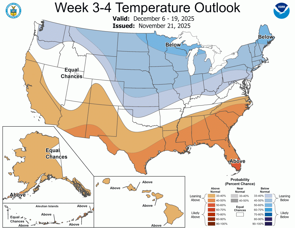
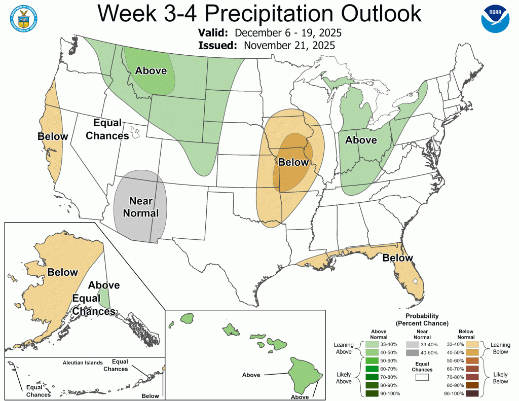
Early December, especially the second week, is when we should start seeing the impacts of the expected breakdown or weakening of the polar vortex locally. Again, below normal temperatures are basically a lock, but snow (or rain) is far from it in my opinion. My guess, based on living here nearly 4 decades combined with my education leads me to believe there will be multiple chances for big system snows as we transition to the abnormally cold weather. The question will be where the available moisture goes and how the lake responds. I see three possible scenarios:
- We get hammered by a weather system or systems that may start as rain but end as heavy snow followed by a lake response and potentially heavy lake effect snow.
- The storm track keeps the snow away, but allows for the lake effect snow to fire up. This would likely keep the lake effect away from Goshen, but not entirely.
- The moisture misses us and the impressively cold and equally dry air establishes itself quickly and we don’t see much of any precipitation.
Honestly, I think all three scenarios are in play, and with this series of events only happening this early three times before in modern forecasting, it will be interesting to see how the models do. If I had to lean one way, it’d be a mix of scenario two and three. I want the snow, and I want to be wrong, but I’m worried that the dry air will win out. This will probably go against what you hear over the next few weeks, as scenario one is common with similar scenarios. This is just such a rare occurrence, with such limited data to compare to, I’m playing the odds.

Leave a comment