Last Update: 11/28/25 8:30 AM
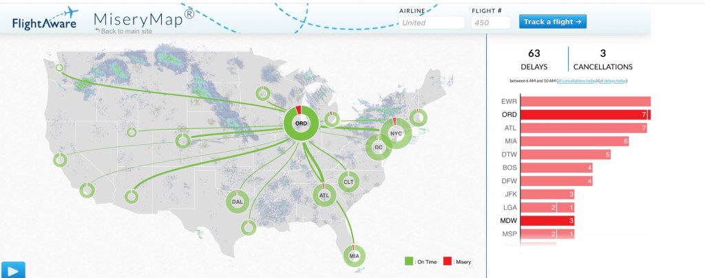
Major airports in the Midwest are in pretty good shape, though O’Hare is seeing delays this morning. New York and Atlanta are seeing delays this morning, too. Be sure to check out Flight Aware’s “Misery Map” for delays.
Travel Impacts Today
Overall: Moderate
Snow: Moderate
Wind: Low to moderate
Temperatures: Low
Windchill: Low
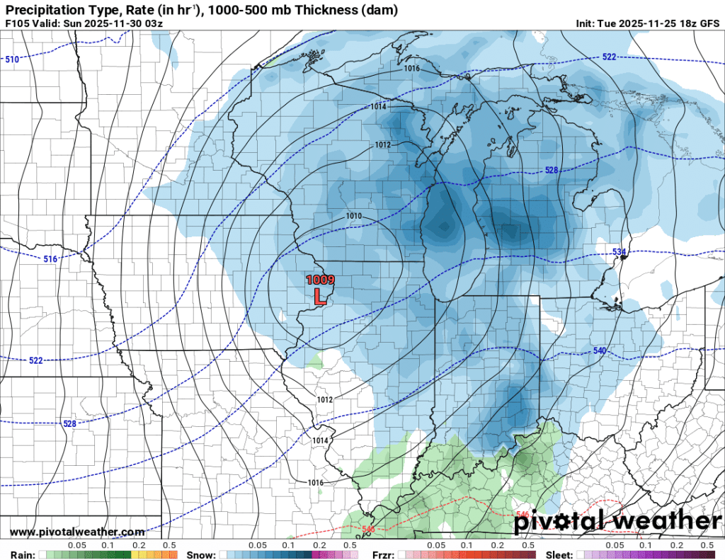
Black Friday 2025: Sometimes the lake effect surprises everyone, and overnight we got one of those surprises. What was expected to amount to an inch or two ended up being more than double that. I measured an average of 5.4” accumulation since 8 AM yesterday at various places in my backyard!
The lake effect snow is still falling but should taper off by this afternoon. Can’t rule out a little more accumulation, especially if we get caught under a heavier pocket or two. It will be a little breezy today, too, with a high around 30°F that will feel more like the upper teens and low twenties.
Black ice was abundant last night and now it is all covered by several inches of snow. Take it slow today!
Travel Impacts Saturday and Sunday
Overall: High*
Snow: High*
Wind: Moderate
Temperature: Low
Windchill: Low
*Trends are being monitored. Lofty totals over a foot are coming back to earth and were never realistic but made for great clickbait from other sources. Our local meteorologists have done a great job not overhyping this and putting out maps that don’t just blindly follow each model run.
Snow picks up late Saturday morning or early afternoon and intensifies late Saturday, overnight, and into Sunday. Several inches of snow is likely and travel will likely be very difficult during this time.
If you are flying out of any nearby airports Saturday or Sunday, you should pay attention to the forecast later today.
Updates to follow.
–pw

Leave a comment