
Updated 11/29/25 6:00 PM
Snow is here and accumulation has begun. I’ll be tracking totals in my backyard below—read on for more details.
Accumulation Totals
Time: Accumulation since last observation (storm total)
11 AM: 0.5” (0.5”)
2 PM: 1.0” (1.5”)
3 PM: 1.0” (2.5”)
4 PM: 1.0” (3.5”)
6 PM: 2.0” (5.5”)
7 PM: 0.75” (6.25”)
8 PM: 0.75” (7.00”)
9 PM: 0.50” (7.50”)
Light to moderate snow will continue into the overnight hours. A Winter Storm Warning remains in effect from 7 AM Saturday through 7 PM Sunday for system snow through Sunday morning, then a lull before lake effect snow is possible later on Sunday into Sunday night.
When: Light to moderate snow is expected to fall tonight before tapering off by early tomorrow morning. Some lake effect snow is possible Sunday evening and overnight into Monday.
Where: Everyone sees snow with this system. The heaviest snow will be in counties bordering Lake Michigan, but significant accumulation is expected well inland as well. If any lake effect develops Sunday evening, it would be isolated to the favored counties within the lake effect snow belts.
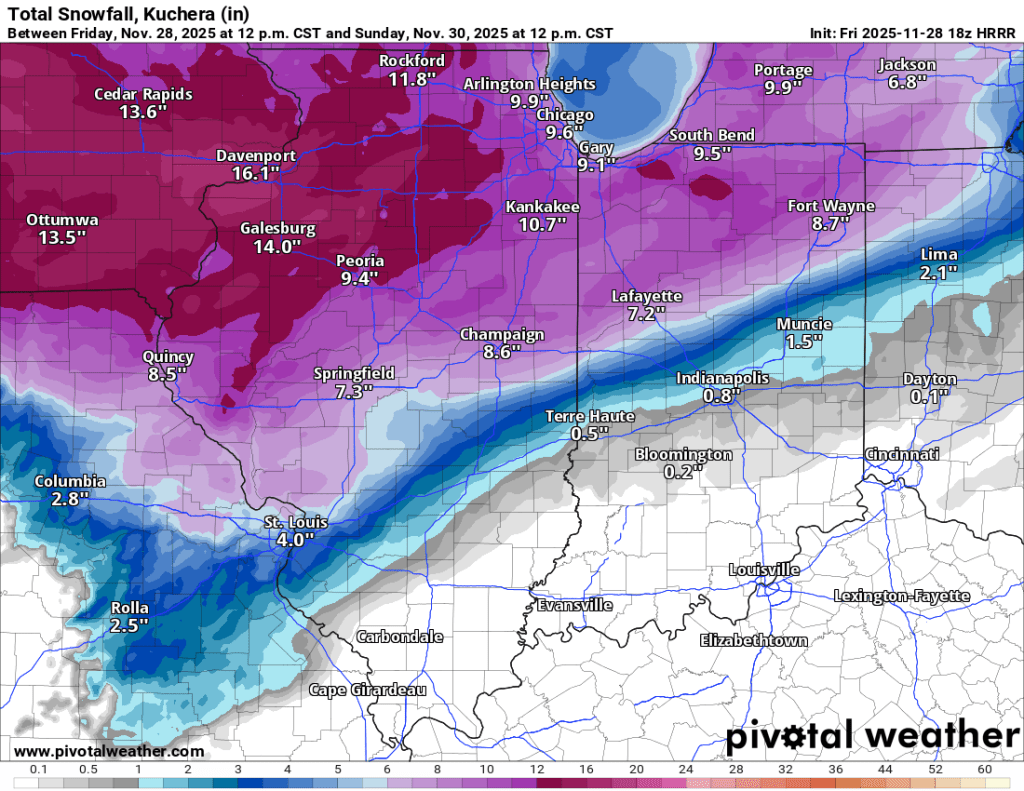
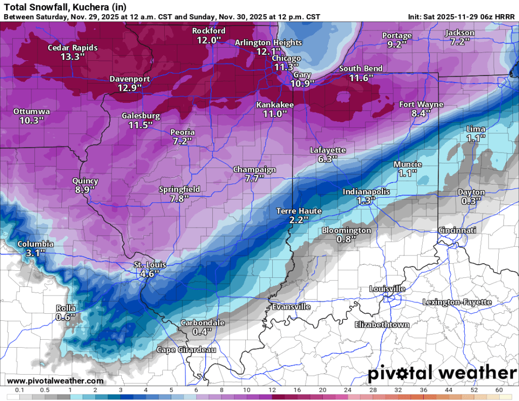
How much? I am expecting 6-8” of wet, heavy snow between early Saturday and early Sunday in Goshen. Compaction will compress the snow and may make it look like less has fallen. If everything comes together perfectly, we could see closer to 10”, but I think odds are better we see the lower end of 6-8”, despite the HRRR model forecast below. I have added the latest forecast for you to compare yesterday to today. I still believe these outputs are a little too high.
Counties bordering Lake Michigan could easily reach double-digit accumulation with some lake enhancement to the system snow.
Chicago, Grand Rapids, and Kalamazoo will see moderate to heavy snow, with airport delays and cancellations expected. Travel on Saturday afternoon and evening is not advised.

-pw

Leave a comment