
Updated 2:45 PM 11/30/25
Sunday Afternoon Update:
Our first few waves of lake effect snow (LES) today did briefly reduce visibility, but they did not amount to much of anything. More LES is trying to work its way down the Lake Michigan toward us, and it should arrive in the next hour or two.
We could see an inch or two out of these occasional snow showers and even a few snow squalls, but the real hazard will be reduced visibility in the heavier pockets of snow.
More snow is possible Monday night into Tuesday and bears watching as it seems it may provide a much better chance for potential disruptions to area schools and businesses depending on specific timing and accumulation than today’s potential LES.
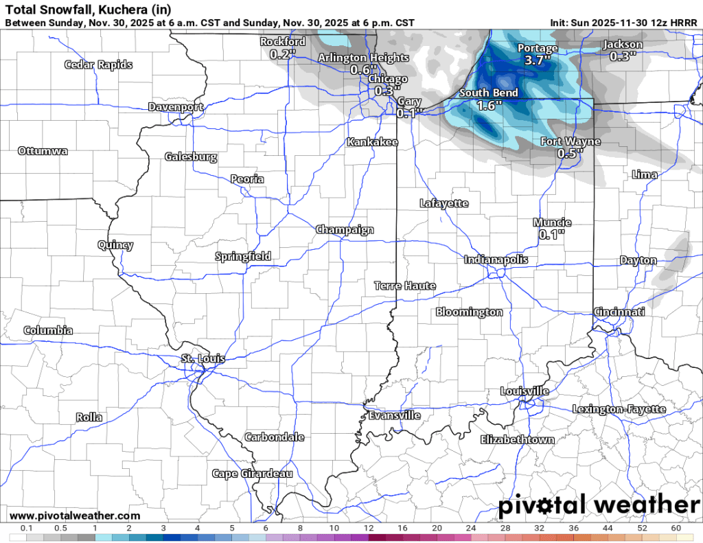
Sunday 11/30/25: My final measurement added another inch to our total, giving me 8.5” in my backyard for the final storm total. Our system of snow has moved out, and lake effect snow bands are already developing over southern Lake Michigan.
The gusty winds today (25-35 mph, with gusts even higher) and occasional moderate to potentially brief but heavy lake-effect snow are why our Winter Storm Warning continues through 7 PM tonight. I’m already clocking wind gusts over 50 mph this morning. Take it easy if you must go out. Windchills are currently in the low to mid-10s.
As our big system snow moves out, it is leaving some eddies of air in its wake, and these could result in meso-lows, the “mini lake effect snow hurricanes” discussed a few weeks ago. Any lake-effect snow (LES) will move too quickly to produce major accumulation, but we could see a few waves form over Lake Michigan and move inland through late this afternoon and evening.
There is genuinely no way to know who will see this LES given the turbulent atmosphere overhead right now, so any of the favored LES belt counties are in the running, including us in Elkhart County. 1-3” is possible, though slightly more could fall if we get caught under multiple bands of LES. Snow should taper off around 7 PM, if not sooner, but the wind could still cause blowing and drifting even if snow isn’t falling. Be on the lookout for school delays, especially in rural districts.
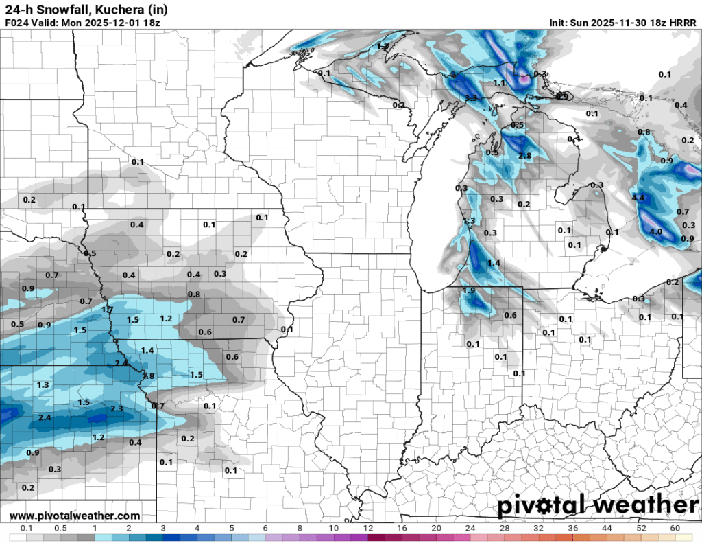
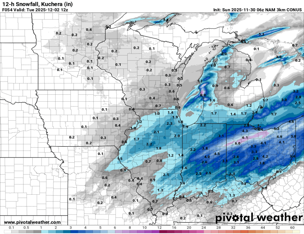
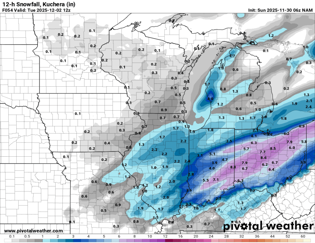
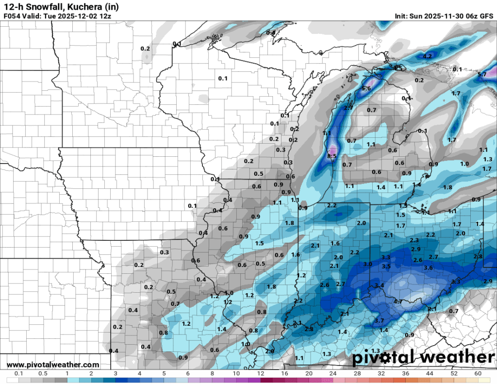
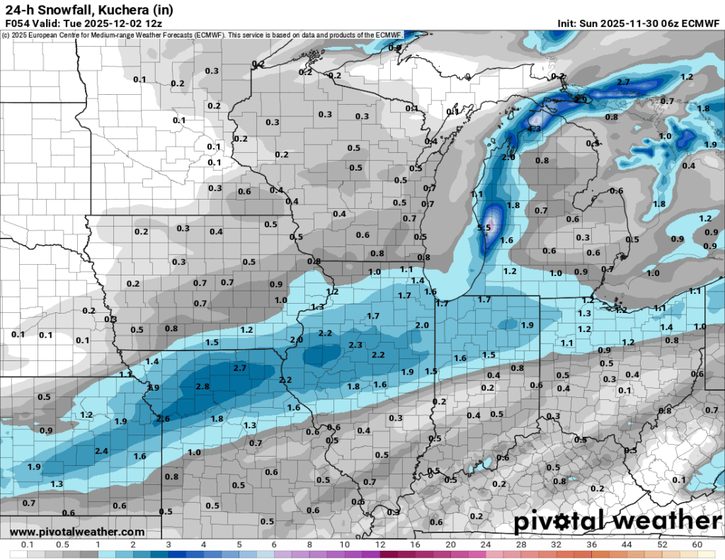
Monday 12/1/25: Another quick-moving system could bring light to moderate accumulation Monday night into Tuesday morning as well. Most models are keeping the bulk of the accumulation to our south, and we should have a better idea of where it ends up tomorrow, but for now, this looks like a 1-2” event locally. You can see a few model outputs for snow below, from 7 AM Monday to 7 AM Tuesday. We’ll find tune this forecast tomorrow afternoon.
And finally, I woke up around 3:30 this morning and took a look outside to see these two ladies hunkering down in the backyard. These does were there for a few hours trying to stay warm.

–pw

Leave a comment