
Another round of light to moderate snow is expected overnight tonight into early tomorrow morning. The general consensus is 1-3”, though some frontogenesis (rapid, short-lived intensification) may occur and result in some isolated spots seeing 4”. It appears that if this happens, it will be well to our south.
Trends yesterday slowly shifted the area of heaviest snow slightly further south and east into Ohio. Trends today have stayed the same.
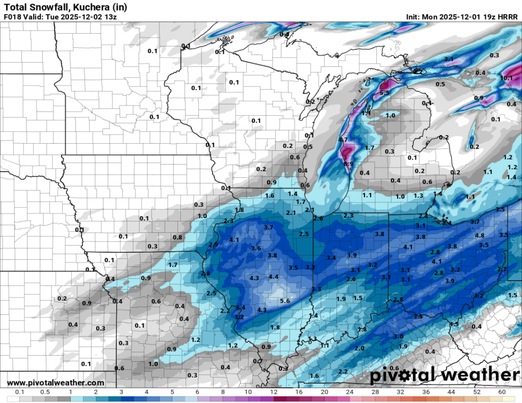
I think 1-3” is entirely appropriate at this point in time. The snow will get started relatively soon, roughly 6 PM, and can be seen approaching the IL/IN state line now.
Snow is expected to remain light for the most part and fall from early this evening through around 3 AM. This should give crews plenty of time to clear the roads, but it will be very cold and slick regardless. Be sure to check local news outlets for potential delays or cancellations.
Looking ahead, despite some minor, nuisance snow showers, we should be in for a break from the heavier snow accumulation for a while.
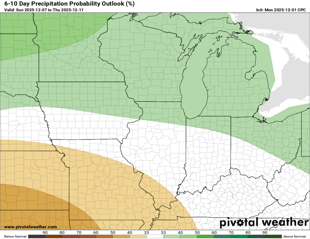
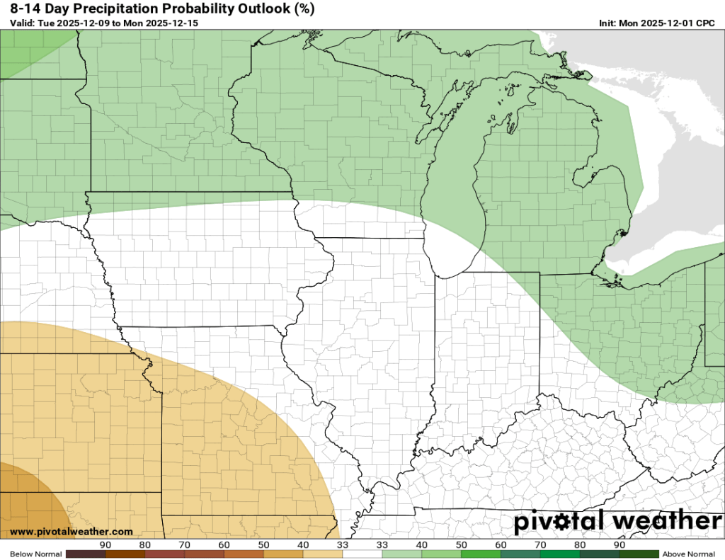
Regardless of precipitation, the early December chill doesn’t look like it is going away anytime soon. We could see temperatures in the single digits later this week and the below-normal temperatures will likely extend through the month of December.
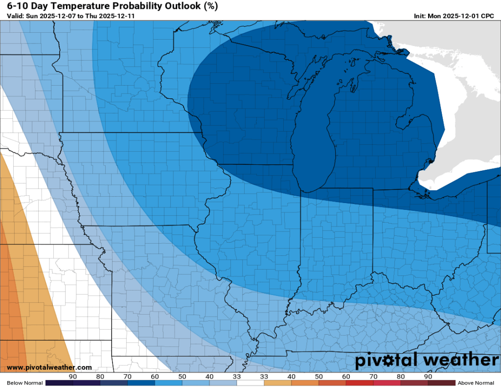

Obviously, to get a white Christmas, we need cold. However, in my Winter 2025/2026 outlook, I mentioned that too much cold air too soon could make it difficult to maintain the moisture needed to make the snow.
We have enough snow now that if we really do stay below normal, and below freezing, we can almost guarantee the snow we have now will still be around in some capacity by Christmas Day. Regardless, I’m not quite ready to guarantee a white Christmas on December 1st.

Leave a comment