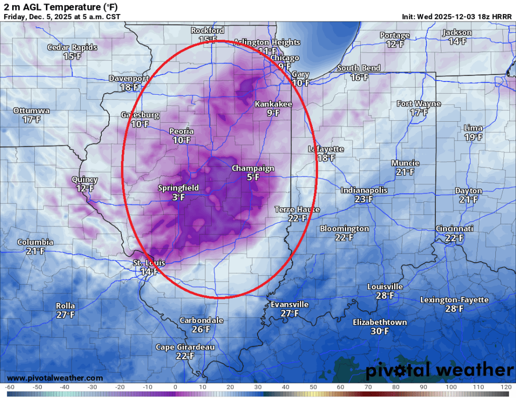
We’ll see some very minor snow showers off and on over the next 36 hours or so, and then things turn sharply colder. Just how cold we get will depend entirely upon how much cloud cover we see. The latest HRRR model run shows clear(ish) skies over much of Illinois on Friday morning, with lingering clouds over us. You can see the area circled in red below is noticeably colder due to radiational cooling.

As expected, colder air temperatures lead to lower wind chill values. Fortunately, the wind is not likely to be a significant factor on Friday morning, which will limit how low wind chills can go. Nonetheless, you can see the area under clear skies has noticeably lower wind chill values, too.
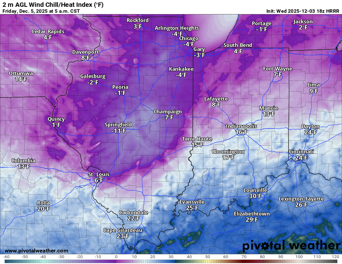
HRRR wind chill forecast 6 AM 12/5/25
This is significant as most area schools have adopted -15F as their wind chill threshold for delays. This coincides with the NWS threshold for a wind chill advisory. This model may be underdone with the cold, too, as it sometimes struggles to account for a fresh snowpack and the effects of radiational cooling and albedo. Regardless, Friday morning is worth keeping an eye on for those with interests tied to potential school delays.
Looking ahead, some light snow is possible this weekend (maybe an inch or so here and there on Sunday), but the next potential storm of note could come between next Tuesday and Thursday.
As mentioned on Facebook this morning, most models keep this storm track to our north and even bring some above-freezing temperatures our way, which could lead to light rain or a rain/snow mix. As the storm passes, temperatures should drop again and could fire up the lake-effect snow machine—the Hazards Outlook is now picking up on this. There is still a lot to sort out and plenty of time for changes, but mid to late next week continues to look to be our next chance for potentially significant winter weather.
Stay warm, friends!
-pw

Leave a comment