We saw temperatures in the single digits and even set a record low (1.8°F) last week. Even colder air is expected to arrive over the next few days. The first shot of cold air comes tomorrow afternoon and evening, and a reinforcing and even colder batch of arctic air will arrive this weekend. Each transition will be breezy, unlike other transitions so far this year. As a result, windchills are expected to be considerably lower this time around, too.

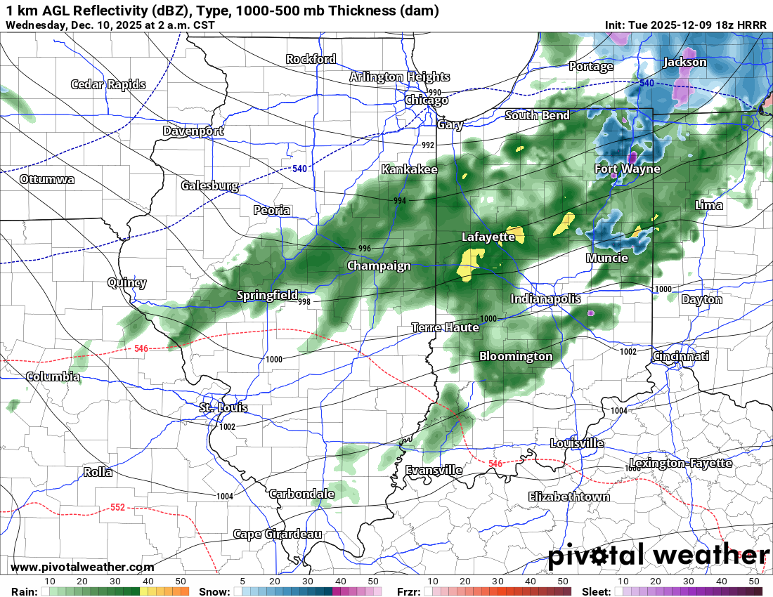
Current model runs forecast temperatures to fall below freezing on Wednesday evening, and they will likely remain below freezing for at least a week. The first transition on Wednesday will be sloppy, with a rain and snow mix very early, then relatively dry but windy, and ending as some lake-effect snow late Wednesday. Little, if any, accumulation is expected.

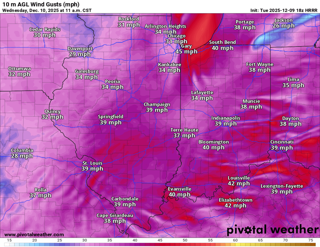
It will be quite windy on Wednesday!

While unlikely, there could be a few isolated areas (including here) that see 2-3″ of lake effect snow overnight Wednesday. However, an inch or less of accumulation is most likely in Goshen by Thursday morning. Temperatures on Thursday will be much colder, with windchills in the teens all day. Anything that melts between now and tomorrow evening will freeze by tomorrow night and Thursday morning. Temperatures will still be within the effective range for salt and other treatments, but untreated surfaces (side streets, county roads, sidewalks, and parking lots) could be slick on Thursday morning.
Things get a little interesting after Thursday, but I’ll hold off on posting any snow maps just yet. A clipper system is expected to pass through early Friday and could bring light snow accumulations. Another clipper system is expected on Saturday, which could also fire up the lake-effect snow machine. Additional light (to moderate?) accumulations are possible with Saturday’s snow. It will stay fairly windy during this period, too.
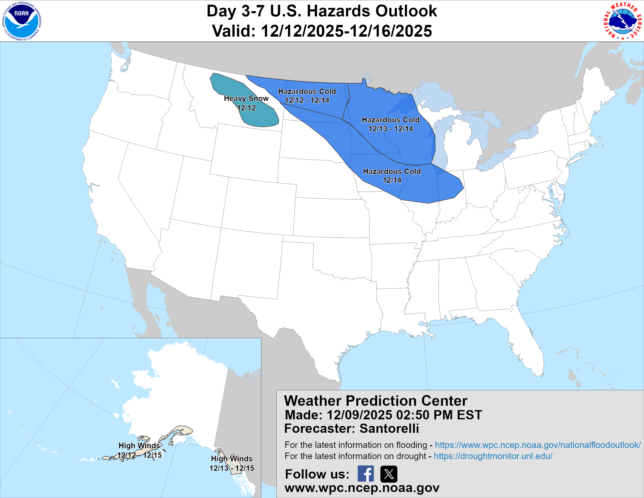
The coldest air of the year will follow the snow on Saturday. Temperatures on Sunday and Monday morning will likely be at or below zero, with wind chills as low as -20°F. Regardless of snow accumulation, temperatures at this range appear low enough on Monday morning to warrant potential school delays.
Stay tuned, updates to follow.
-pw

Leave a comment