Updated 7 AM 12/28/25
Summary
Some of the wildest weather you can get in these parts is on the way. From 60° with scattered thunderstorms to 15° with gusts over 40 mph and windchills near zero in just a few hours. There is also a Wind Advisory for 8 PM today through Monday evening. Read on for more details.
Synopsis
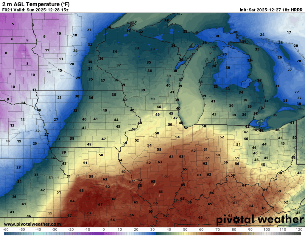
We are in the mid 40s now, but temperatures will slowly creep up into the upper 40s before soaring to near 60° by this afternoon. The record high for today in Goshen is 65° (1984), and that record is (probably) safe, but it will still be incredibly warm.
The tradeoff today will be occasional moderate to heavy rain showers with some thunderstorms possible as well. The Storm Prediction Center has our area in the marginal risk for severe weather (1/5).

There is a very low chance of weak, spin-up tornadoes today in north-central Indiana, but there is not a significant concern. Regardless, to be seriously talking about potentially tornadic thunderstorms shows how strong this storm is.
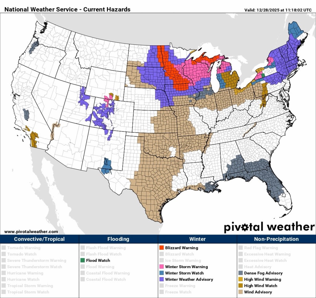
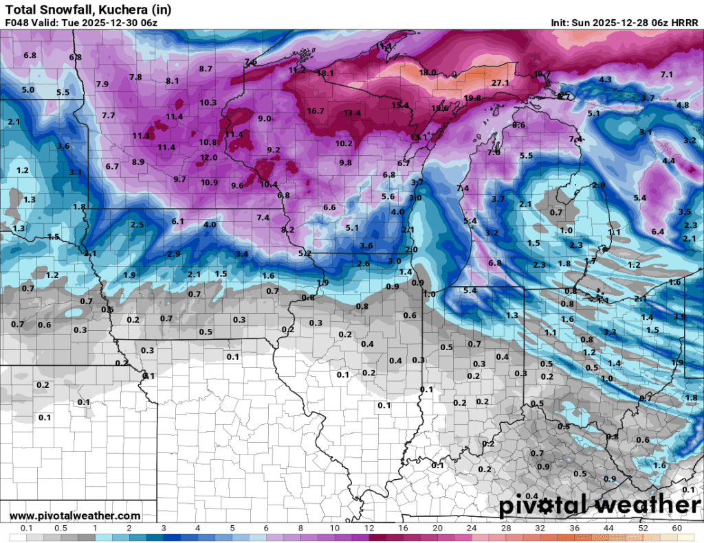
To put things in perspective, while we will be dealing with scattered showers and thunderstorms down here, parts of the Upper Peninsula of Michigan are bracing for an all-out blizzard. Locally, we will be under a Wind Advisory from 8 PM today to 7 PM Monday.
We stay in Marquette each summer, and it is on my bucket list to experience a blizzard or major lake effect snow event up there, and this weekend would check that box! The beach, falls, and forest won’t look quite like they do in these photos later this weekend.


Timing things out: by roughly 10 AM today, we should be close to 50°F, with some of the aforementioned showers and storms around.
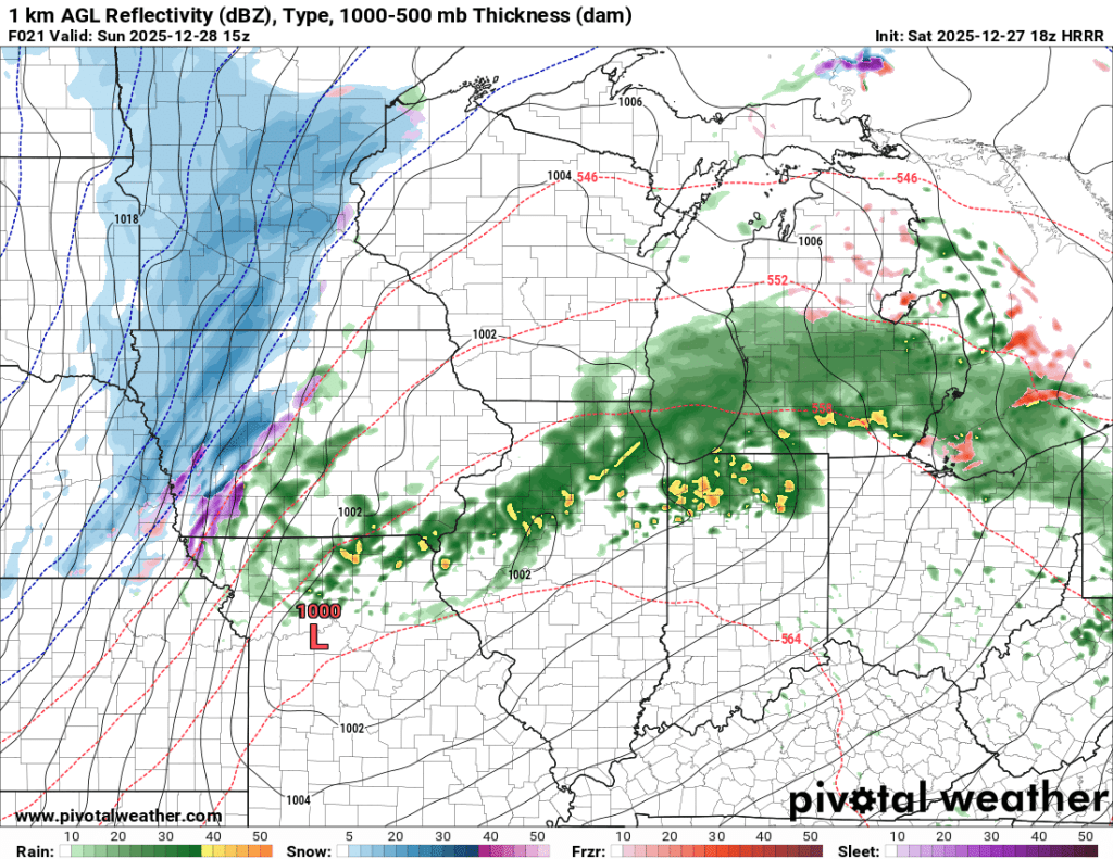
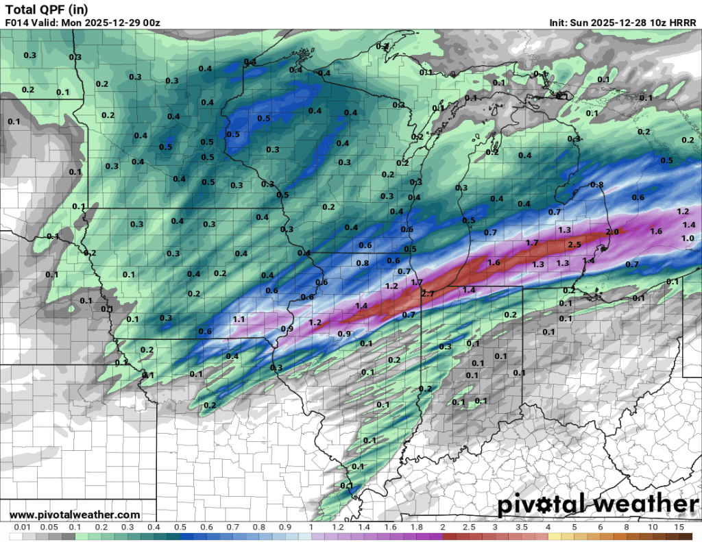
Our best chance for severe weather comes this evening, ahead of the cold front, which won’t arrive until tonight. I will reiterate that our chance for severe thunderstorms is very low, albeit not quite zero. Rainfall totals are most likely to end up between 0.25 and 0.75”, but some could see up to twice that much with the heavier cells, and there could be some minor ponding in these areas. Flooding isn’t a concern, but the puddles will be an issue later on.
As the front arrives, the wind will pick up. Temperatures will tank, and tank quickly. There was concern of a “flash freeze” a few weeks ago that got far too much coverage and was much ado about nothing. This time around, things are different in my opinion.
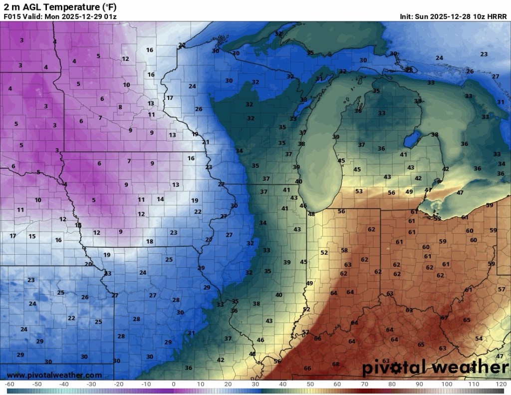
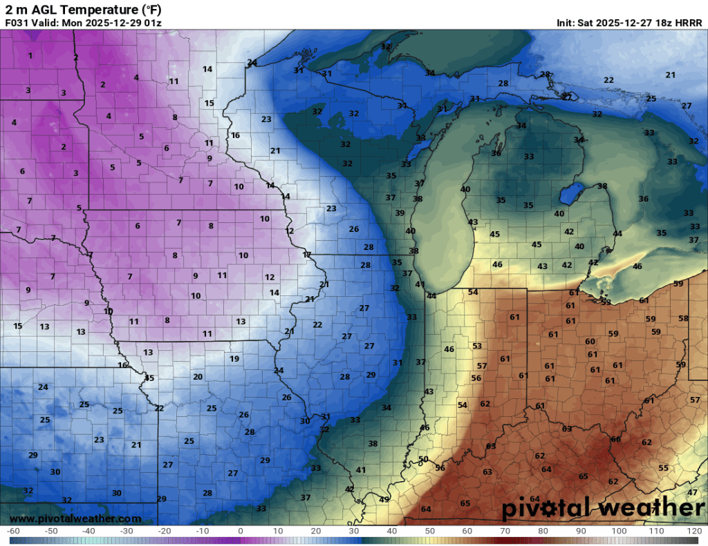
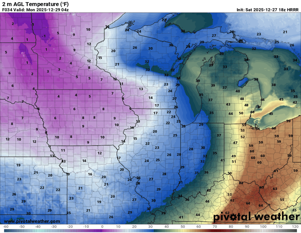
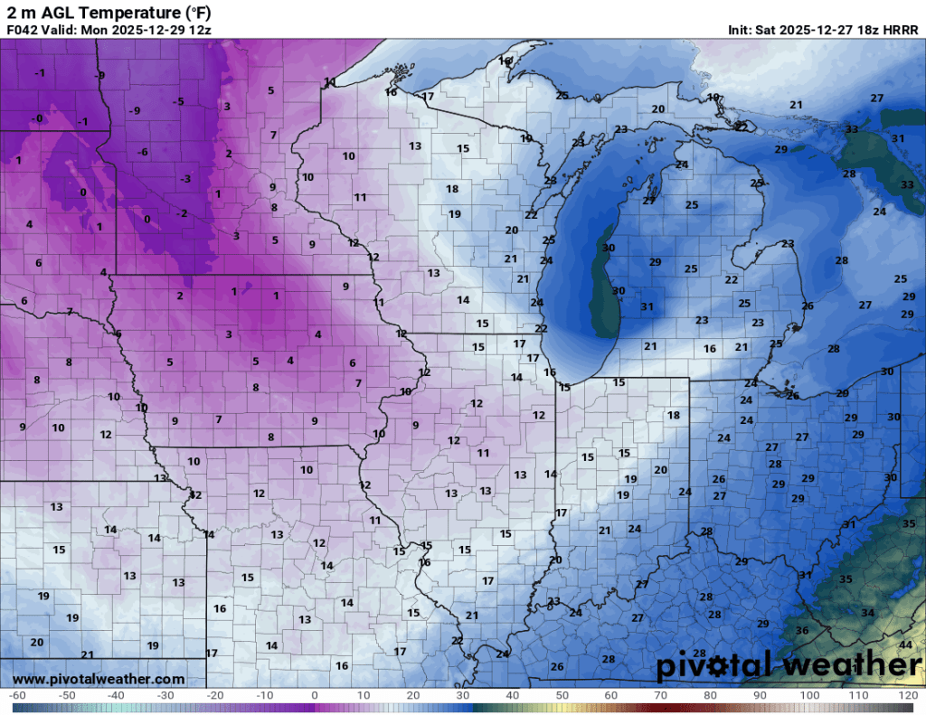
Temperatures in Goshen are expected to drop from near 60°F late Sunday evening into the 10°s by Monday morning. The drop from 60°F to below freezing is expected to take as little as 3 hours. That big a fall is exceedingly rare. See for yourself below.

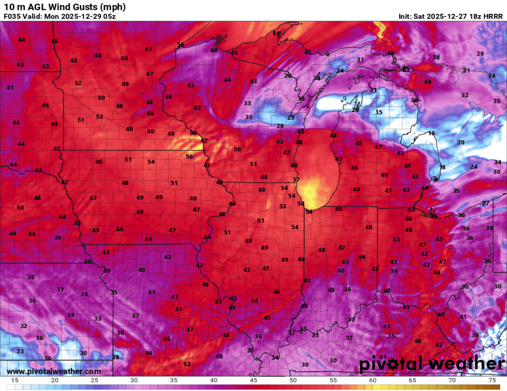
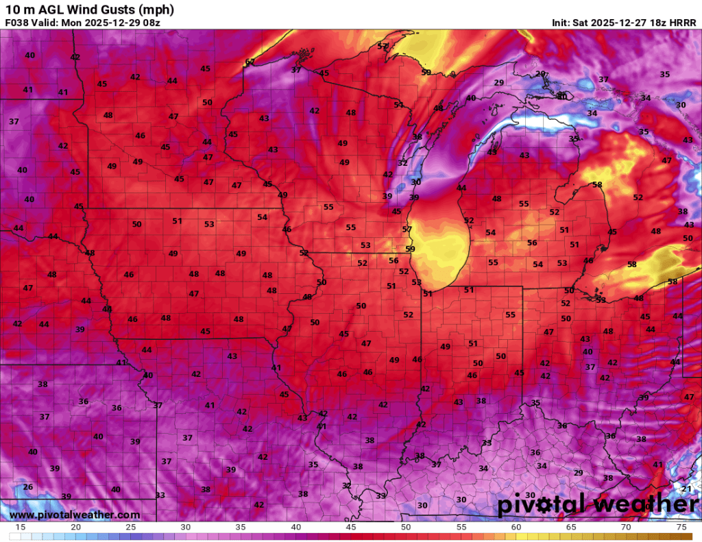
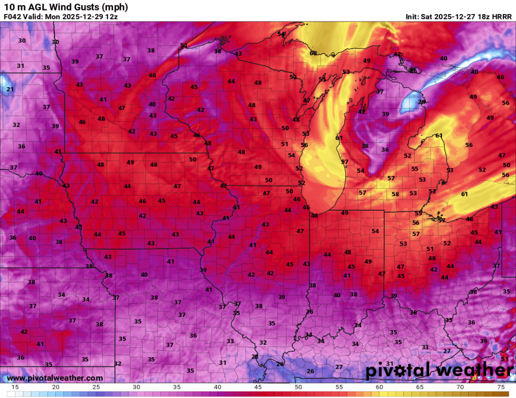
Winds really get going this afternoon, and gusts as high as 55 mph are possible from Sunday evening into Monday morning.
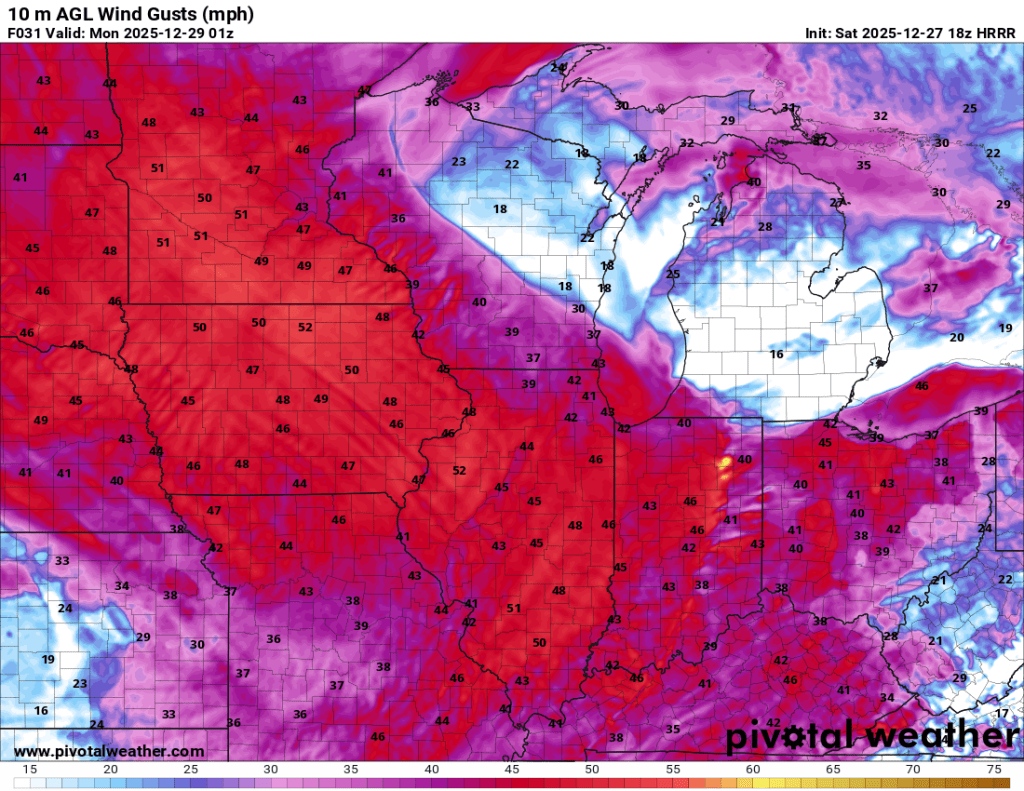
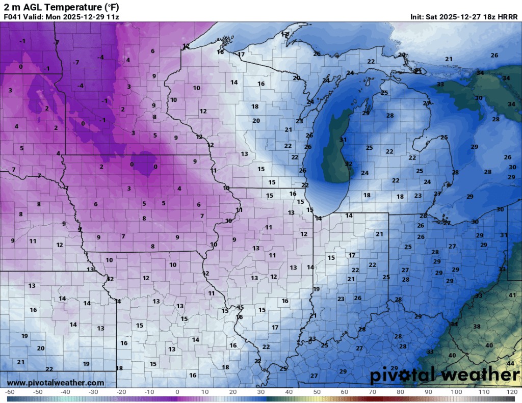
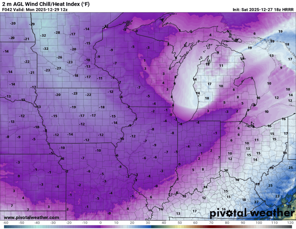
By Monday morning, temperatures will be in the teens, with wind chills at or below zero at times.
Lake effect snow then picks up on Monday morning. I’m still not convinced much of it will make it south of roughly the toll road, but we could still see pockets of heavier snow (snow squalls) Monday evening into Tuesday. Wind direction forecasts are favorable for lake effect snow to come out of the northwest and impact Elkhart County, but lake effect is always a crapshoot. As of this writing, it does not appear that a single dominant band will develop or that any mesolows will form. This is all subject to change, but even in our worst-case scenario, we are only talking about a few inches of snow locally. I’d be happy to get an inch or two, and that’s the consensus at this range.
Phew, that’s a lot to unpack in 36 to 48 hours. If you are traveling early today, expect occasional rain that could be heavy. Showers and a few storms pick up again this evening and night. Temps crash and Monday morning could be slick with or without the snow. By midday Monday, the effect snow should be falling, but it remains to be seen just how impactful it will be. Visibility could be low at times, and there could be slick spots, but this doesn’t seem like a major or even moderate event at this range.
If nothing else, batten down the hatches while you can today. The wind late today and tonight into Monday will be no joke!
Stay safe, warm, and dry friends.
-pw

Leave a comment