Once our clipper system moves through today, things look pretty tame until perhaps the middle of next week when our next potential system may arrive.
Temperatures
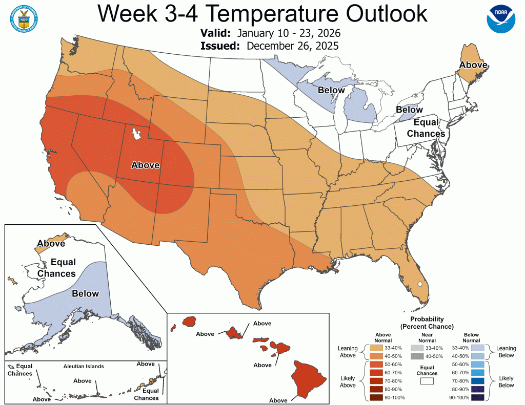
Overall, temperatures over the next week or so look normal to slightly below. Toward the middle of next week, we may see another brief warm up (40s, maybe 50°F?) followed closely by a reinforcing shot of cold air.
I was fascinated by the extremely early and nearly unprecedented breakdown of the polar vortex in late November that helped bring all that early December snow, and also intrigued by what it might mean for the rest of the winter. I feared that the initial breakdown of the polar vortex would act like stretching a rubber band to its limit, then letting it snap back into place, effectively removing the bulk of the frigid air for the winter.
That does not seem to be the case. It would appear that it’s actually playing out more like a bungee cord, with that first drop being what we saw in early December, followed by several more, though slightly less severe, “drops” aka plunges of arctic air.
We’ve already seen the first “after shock” with our trip into the 60s a few days ago, followed by the colder-than-normal but not quite as cold air we’re experiencing now. It looks like this pattern may repeat itself over and over this winter.

I think we can expect quite a few ups and downs in temperatures over the next two months. These temperature swings and their intensity will significantly affect precipitation. The area between the warm air and colder air tends to be where the most active storm track is, further supporting a more active second half of January locally.
Precipitation
Since our heavy snow earlier this winter, we haven’t seen much snow, but we have seen over 1.00” of rain. This further supports my “bungee jumping” theory, and looks to continue over at least the next few weeks.
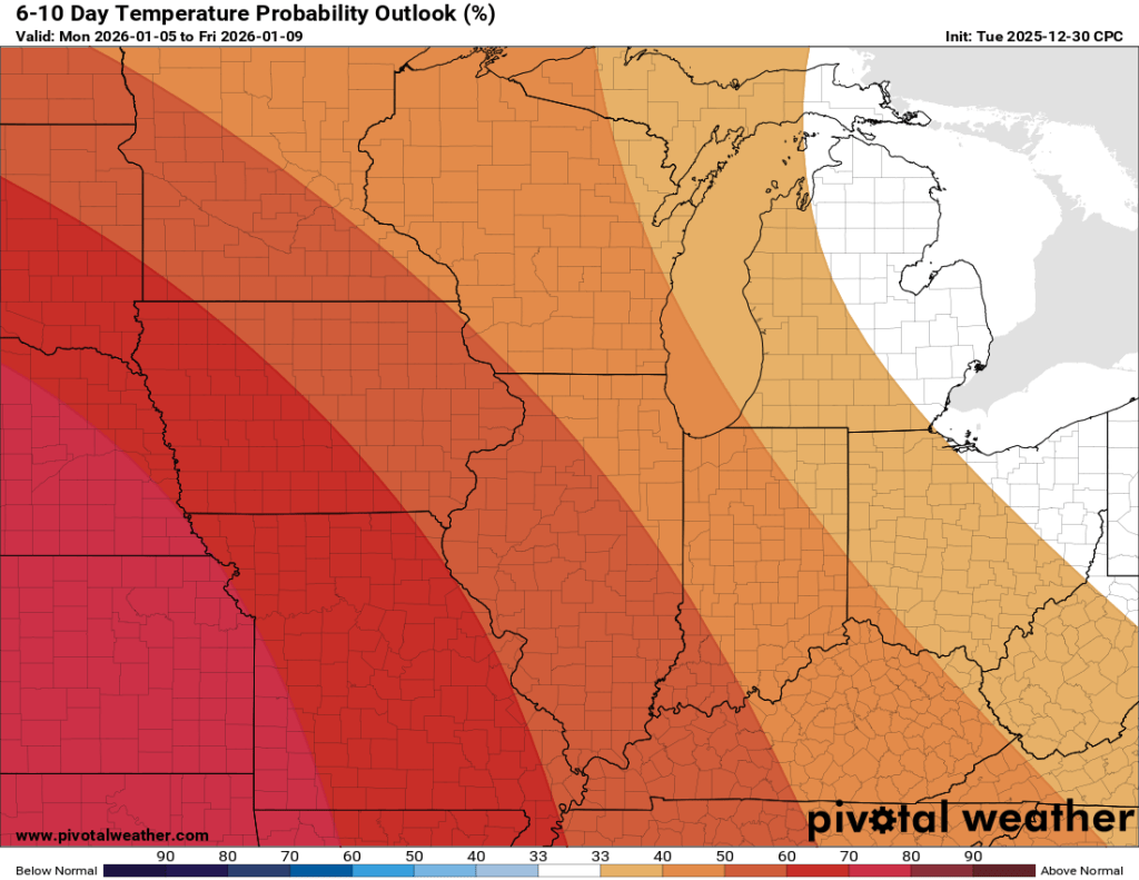
We’ve got maybe an inch or two of snow coming with today’s clipper system, but beyond that, things look pretty quiet for the next week. We could get a glancing blow from another clipper or two sliding past to our north, but our next chance for meaningful precipitation after today doesn’t come until roughly the middle of next week.
The following week or so being quiet is reflected in yesterday’s CPC 6-10 day outlook below.
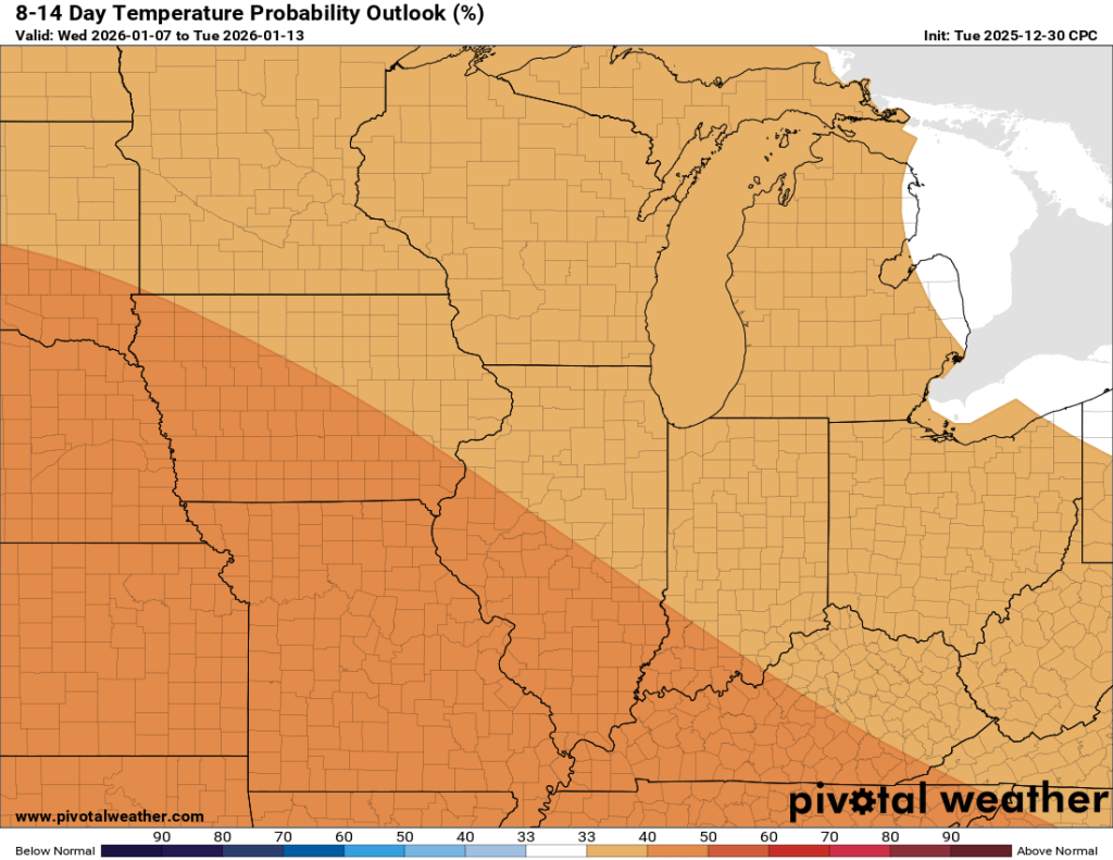
A more active pattern in mid-January has been touted on this page for weeks now, and it is reflected in the midrange outlook.
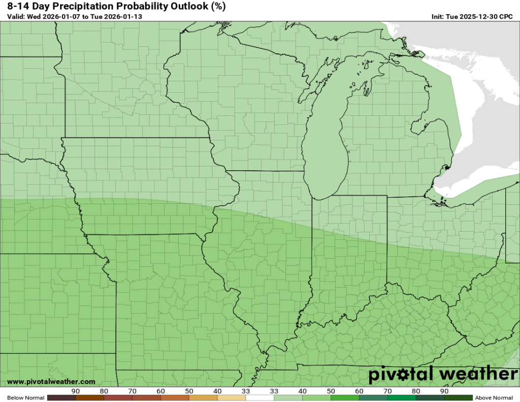
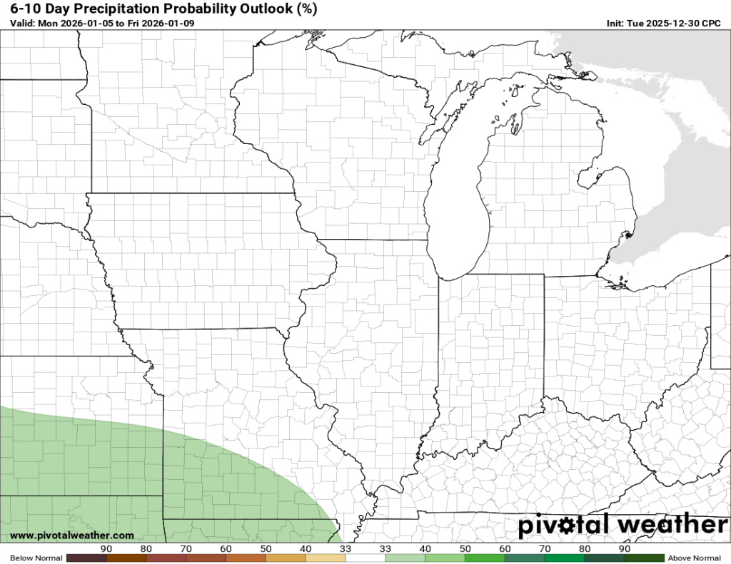
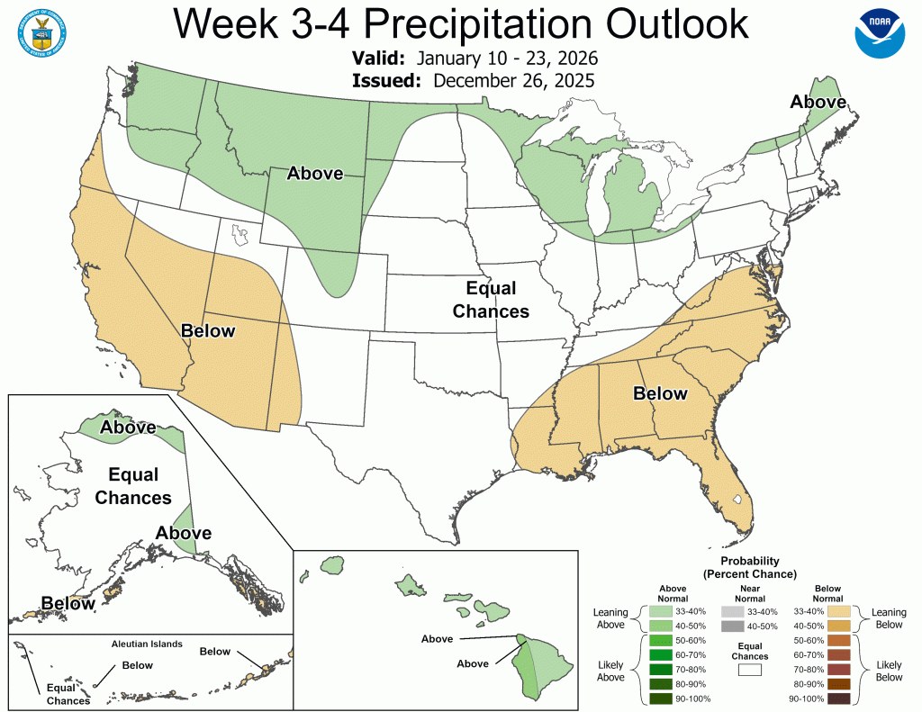
Finally, the long-range precipitation outlook continues this trend.
Not all of the precipitation we will see during the next few weeks will be snow. With temperatures going up and down as much as expected, some rain and even more thunder will almost certainly mix in. There is a lot to like here if you are a snow lover, nonetheless.
Resources
I chose to post the two videos above because they are freely accessible on pivotalweather.com. I’ve included links below, and I encourage you to check them out. There are no secrets here; you can access the same information I can, and if you are interested in the weather, you should be!
Just remember, temperature outlooks are trustworthy a little further into the future, 4-6 days in my opinion. But precipitation models are only good for precision within 2-3 days at most, and even then, 24 hours or less is when you get the most accurate results. The longer you go out, the less precise things get, but trends still tend to play out. Enjoy!
-pw

Leave a comment