You should be well aware of the sustained slight risk of heavy snow in the 8-14 day hazard outlook for nearly a week. I’m still not convinced about the snow, but I am not just confident, but almost concerned at this point, about the coldest air of the season coming in two waves next week.
The first wave arrives tomorrow with some of the coldest air of the season. Temperatures in the single digits are likely at times, along with wind chills as low as -20°F. The second wave is set to arrive 7-10 days later and is expected to be even colder. In fact, should this forecast verify, we would likely see below-normal air temperatures and wind chills of at least -15°F, possibly much lower.
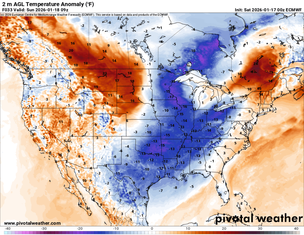
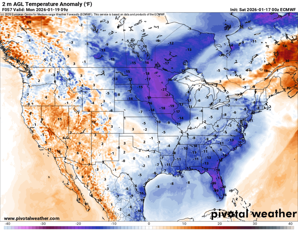
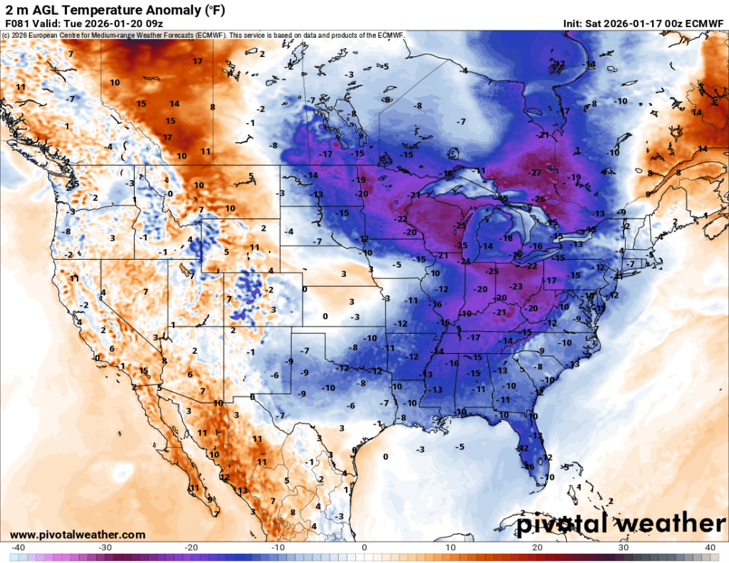
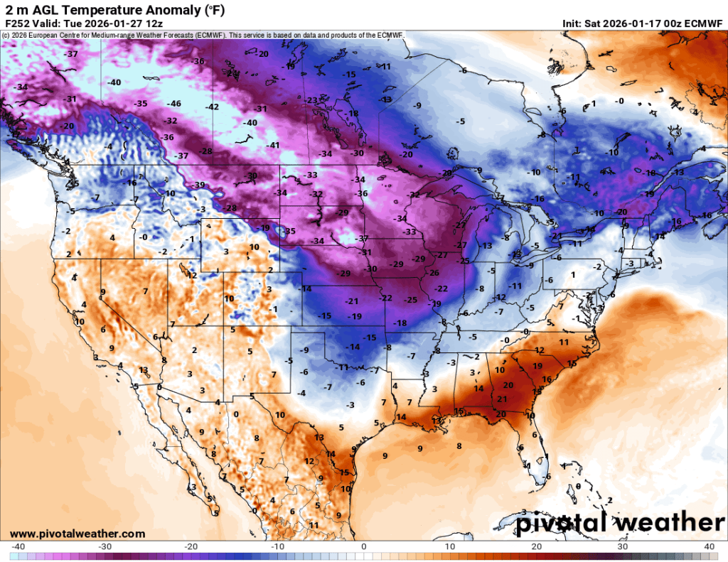
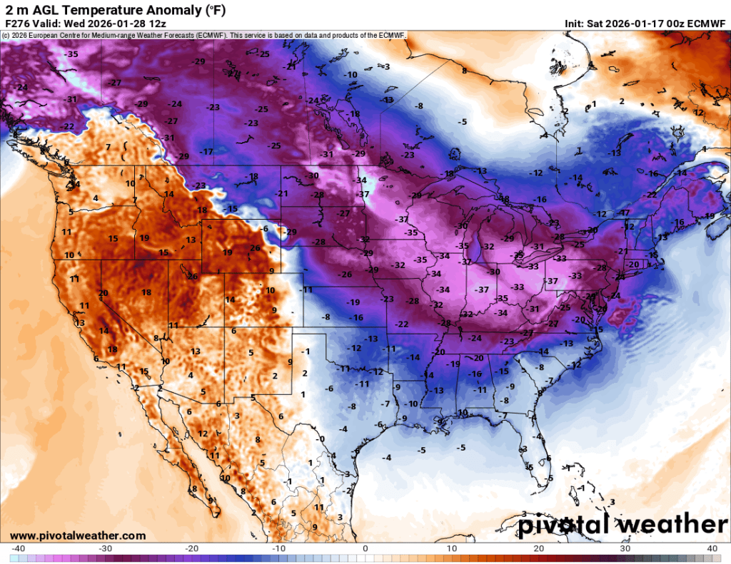
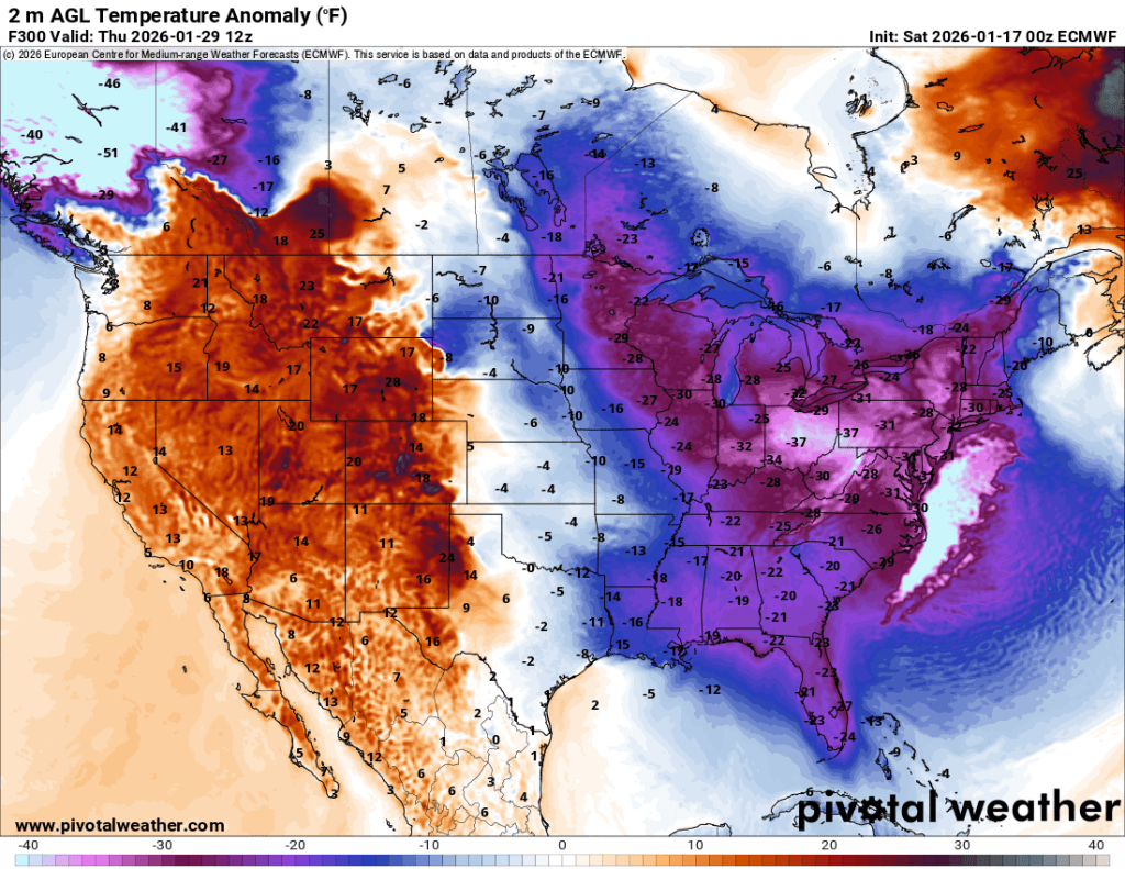
You can see for yourself that the forecasted temperature anomalies are as much as 25-30° below normal. That would put us a few degrees on either side of 0°F, without accounting for wind chill. We haven’t seen much of that level of cold yet this winter. The record lows on 1/27 and 1/28 are in the single digits, and even at this range, I would say they are in serious danger of being broken.
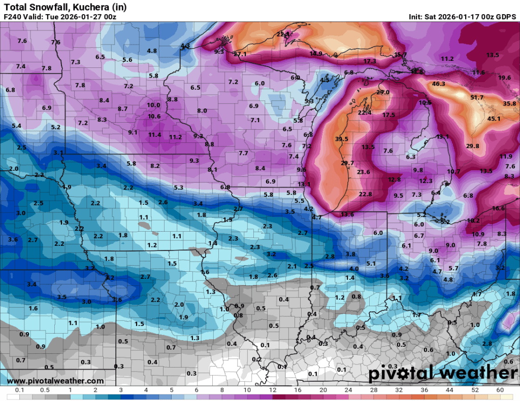
Air this cold is going to be very dry. So once it is in place, I wouldn’t expect much snow. However, as we transition from cold to potentially extreme cold over the next 10 days or so, there should be several chances for snow.
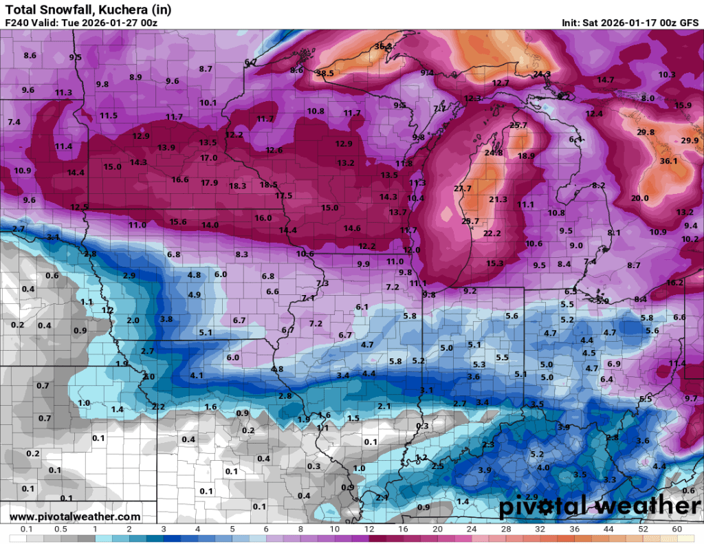
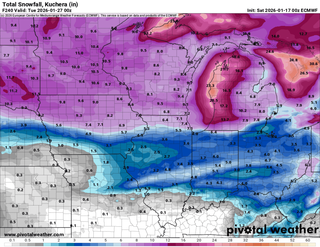
Here are the current model outputs for snow over the next 10 days. I put very little stock in any of these, but am posting so we can compare them to forecasts over the next few days and see how they evolve.

Significant changes like this often coincide with strong low-pressure systems as the “warm” and “cold” air clash. If we get any Gulf connection to provide moisture during the transition, especially just before the extreme cold arrives, we could see a potentially strong storm that would almost certainly include some snow.
I’ll be keeping a close eye on trends as the potential storm evident in repeated hazard outlooks gets closer and our medium-range models begin to reach consensus. But get ready to start hearing about a possible big storm in the Midwest/Great Lakes on social media, as well as the return of the Polar Vortex—and remember, most forecast models are only truly any good 2-3 days out.
What I’ll be looking for over the next few days is timing—when can we expect the big storm to reach the Great Lakes? Then, within 5 days or so (so later next week), I’ll start looking into trends on the track of a potential big storm. In other words, it is far too early to get excited about any precipitation specifics. Temperature forecasts are generally more reliable farther out. Another consideration is that if there is a fresh blanket of snow on the ground, temperatures may go even lower than current forecasts. With clear skies, especially overnight, they could dip even further.
Lots to be excited for if you’re a winter weather lover. The next 10 days look very interesting, with the potential for moderate to major disruptions to travel, schools, and other areas.
Stay tuned,
—pw

Leave a comment