
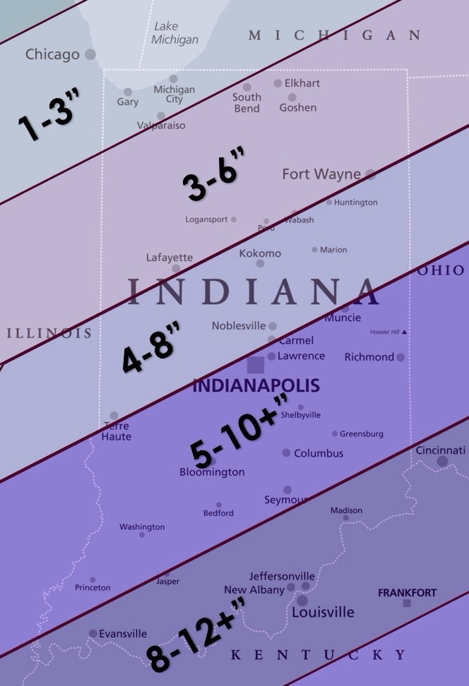
Models have finally settled and are going through all of the phases we are used to seeing, including a decrease in totals across the board as the storm approaches. It will be exceptionally cold with this storm, so we may be able to curb that typical drop somewhat with finer, fluffier snow expected. Still, aside from some wild, improbable atmospheric dynamics suddenly changing, the heaviest snow will stay to our south. In fact, the heaviest snow likely stays within a few counties of the Ohio River.
Locally, I think we’ll see between three and six inches of system snow by Sunday evening, before we could see additional light accumulation from lake effect snow into Monday.
The wind will pick up again as the low slides past, and by tomorrow, a few gusts over 25 mph are possible. This will cause some blowing and drifting issues. I made a trip over to Mishawaka this afternoon, and there was considerably more snow and more drifting.
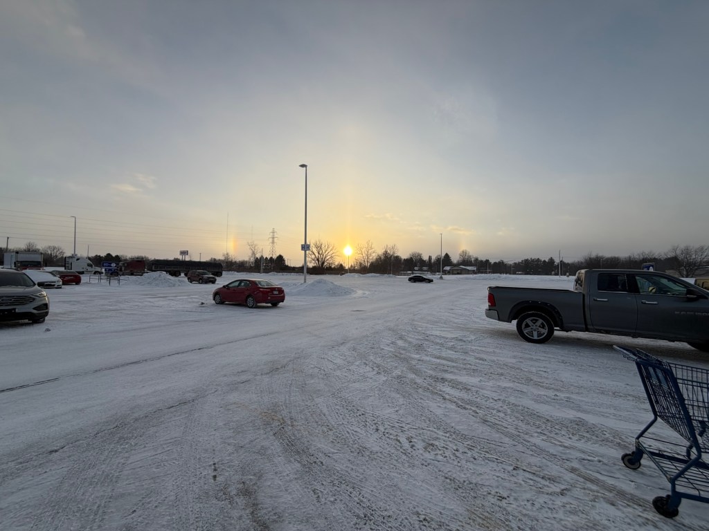
I also saw some awesome sun dogs in a parking lot. These form when ice crystals refract light and form countless tiny prisms in the sky, 22° to the left and right of the sun.
Wind chills all weekend will stay below zero, and air temperatures will struggle to break into double digits.
Looking Ahead
We stay below freezing for at least the next week to ten days. Every few days, a reinforcing blast of cold air is possible, and clipper systems will likely accompany many of them. I love clipper systems because they never go as planned. Snow amounts typically range from 1-3” without any lake enhancement. It’s almost always less snow than expected, but every once in a while, everything comes together, and the accumulation exceeds expectations. Still, any system passing through won’t have much moisture to work with, and amounts shouldn’t exceed an inch or two with any clipper system.
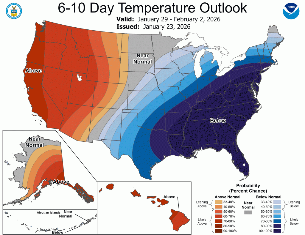
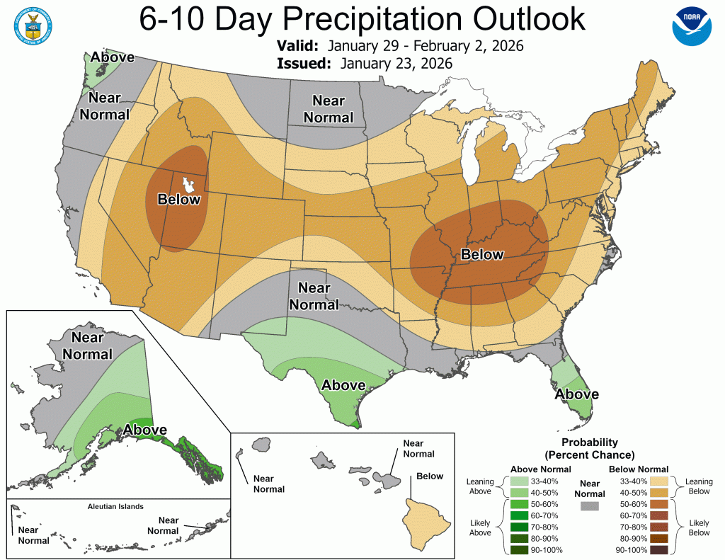
Beyond the next 6 days, the cold looks to hold on. Today’s CPC outlooks show a cold, but quieter end to January.
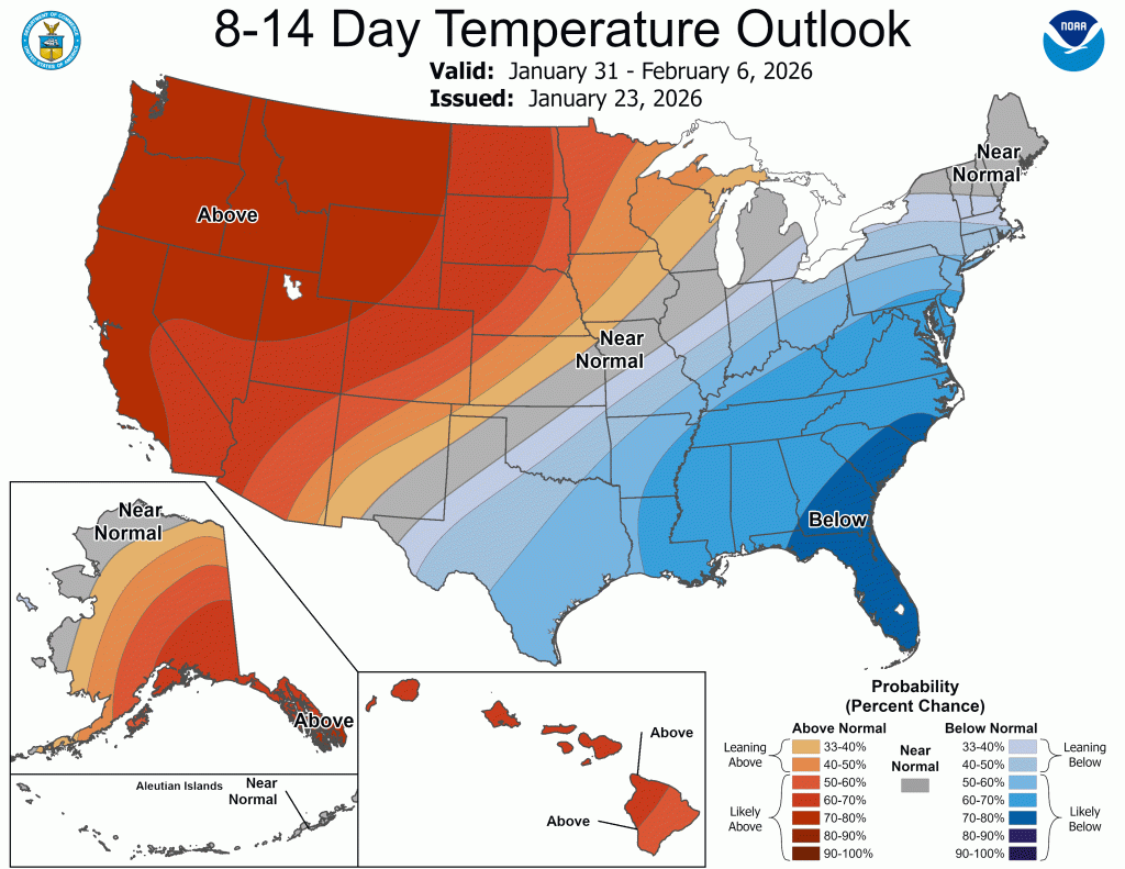
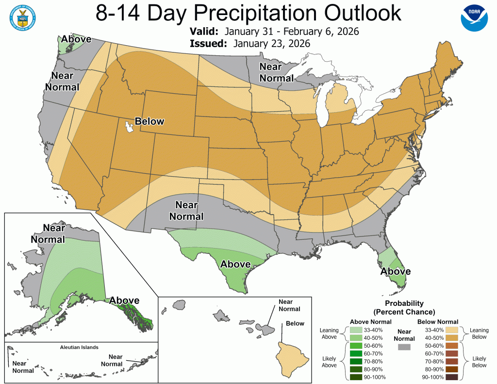
Looking a little farther down the road, in the 8-14 day range, the cold begins to lose its grip, and we inch closer to normal temperatures while probably remaining relatively quiet.
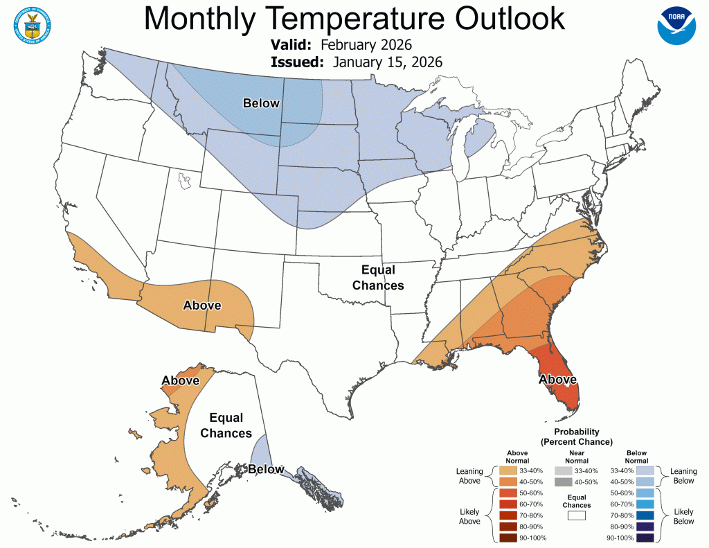
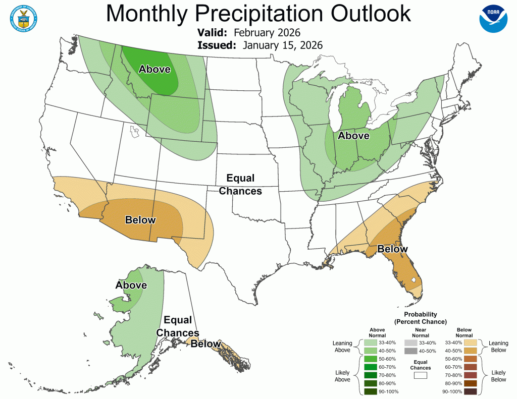
A quick peek at the newest outlook for February shows temperatures remaining close to normal overall, with an active storm track returning—which will almost certainly include more chances for snow.
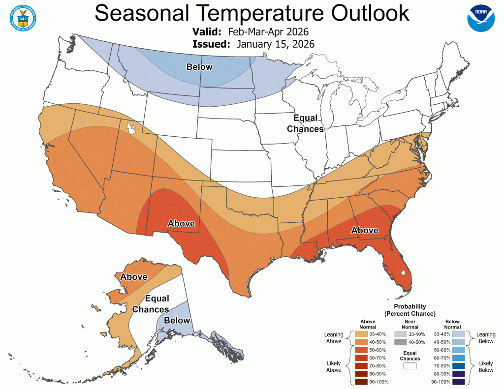
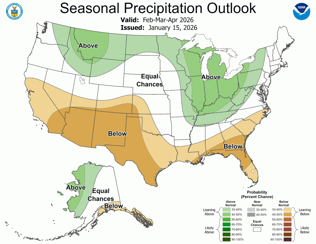
The spring outlook was also updated on the 15th and shows temperatures remaining close to normal, along with an active storm track. We have had back-to-back warm springs, but with our transition from La Niña to neutral, then El Niño, this spring could look a little different.
Updates on the snow leading up to and during the event will mainly follow on our Facebook page. I hope you all manage to stay warm!
–pw

Leave a comment