After nearly a week straight of frigid air, moderate to heavy snow, and dangerous wind chills, there is finally some light at the end of the tunnel. We got some sunshine early today, and despite it still being brutally cold out, it was great to see the sun! Many schools have yet to have a typical day this week, with several still not open. That should change over the next few days as temperatures finally moderate somewhat. We will have to get through one last shot of cold air Friday first, though.
Reviewing last week’s storm…
Despite some lofty, and downright ludicrous, claims among the private sector of the Indianapolis weather community, most in central Indiana ended up with 8–12” of snow. The Indy airport officially reported just over 11” adding the following on their Facebook page: “The recent 11.1″ of snowfall at Indianapolis tied for the Area’s 12th greatest snowstorm, and tied for the 5th greatest in January. The current snow season is only the 4th in 142 years to record above normal snowfall in Nov…Dec…and January, and is only the 9th season to accumulate 27″ of snow by Jan 26.”
The rest of the state saw snow as well. The bullseye was just south of Indy and north of the Ohio River. I was more conservative than most with my snow map, but outside of the expected outliers, I think it performed well.
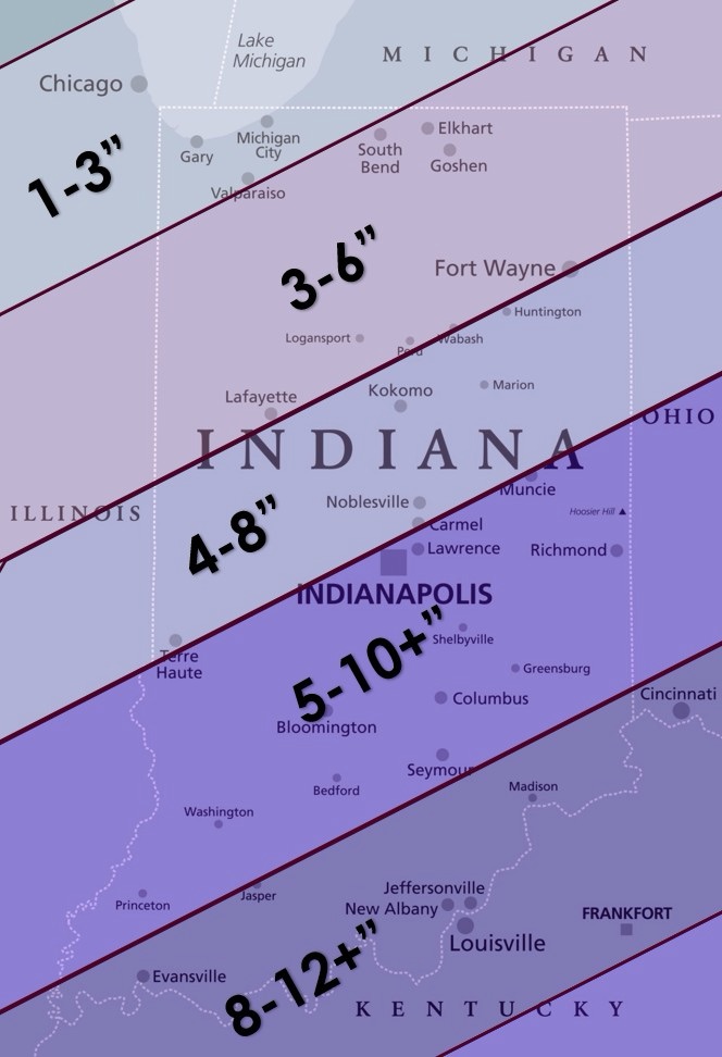
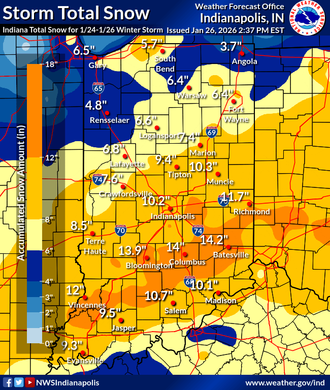
Goshen’s longest-running weather record location reported 4.9” between Sunday’s system snow and the lake effect that followed. I averaged several spots in my yard due to drifting. I ended up a little over 5” as well. I currently have about 8” total on the ground after some more snow yesterday, and the inch or two from before last weekend’s snow. And it’s not going anywhere anytime soon.
Looking Ahead
Looking ahead, while there may be a return to the 20s in the next few days, it seems like we will be below freezing well into February. There aren’t any big storms on the horizon at this time, but some snow is possible next week.
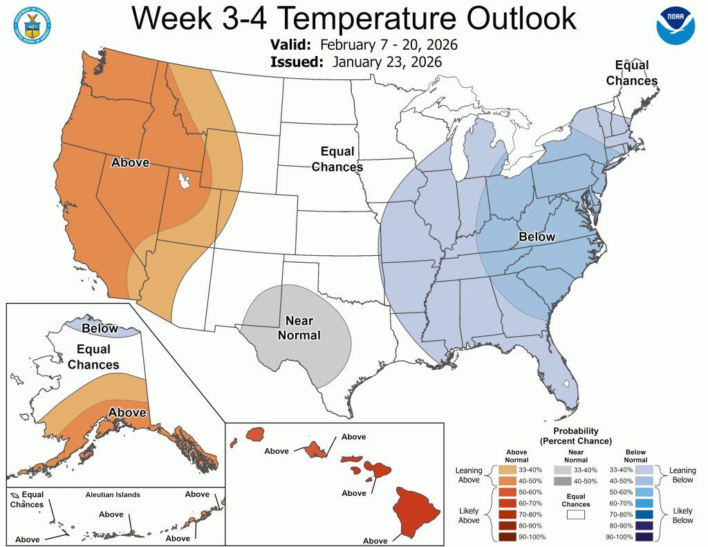
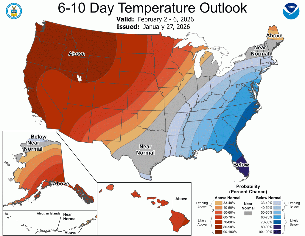
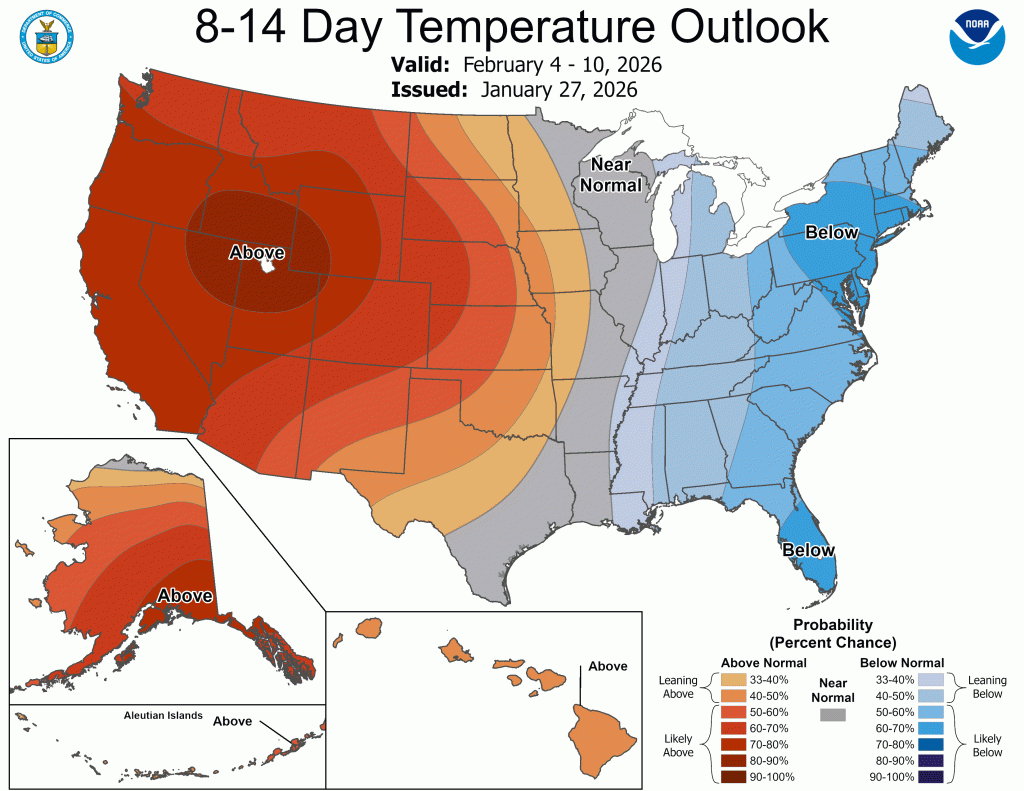
The CPC outlooks indicate normal to below-normal temperatures into the third week of February.

What isn’t showing up just yet is the potential for another breakdown of the polar vortex. The good folks at Severe Weather Europe have been spot on all winter and are highlighting what appears to be another stratospheric warming event. You can read their blog for more specifics on these events, but most are just interested in the impacts they could have on us. Well, we’ve seen this happen three times already this winter. The first was in November and brought us plenty of snow. The second was when we had 60°F temperatures, tornado watches, winter weather advisories, and snow in 24 hours. The last is working its way through now.
We are still a few days from seeing the full extent of the breakdown, but there are signals of more below-normal temperatures into February and a continued active storm track. It’s too early for specifics, but another wave of wintry weather (bitter cold and/or snow) is possible—if not likely.
Winter is far from over, and if the pattern beginning to unfold now matches the few we’ve seen already this winter, we are in store for more wintry weather as we head into February.

Leave a comment