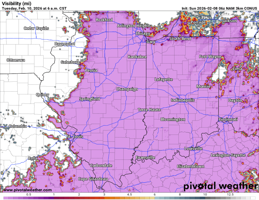
After an eventful stretch of wintry weather, we will finally catch a break, as essentially zero meaningful precipitation is expected, and the only potential weather-related impact in the coming week is fog. Tuesday AM is the one to watch for fog at this point.

Temperatures
A ridge will move in, providing an avenue for slightly warmer air to return to our region. This time around, we won’t make any runs at 60°F, but we will likely crack 40°F early next week. The warmest day will probably be Tuesday when we’ll have the best chance at hitting 40°F. Temps won’t be quite as warm the rest of the week, but should feature highs above freezing. These temperatures will allow considerable snowmelt when combined with some sunshine, so be sure to keep storm drains clear. These temperatures may warm air and snow, leading to some fog at times next week (see above).
Temperatures stay in the 30s for highs and 20s for lows into next weekend.
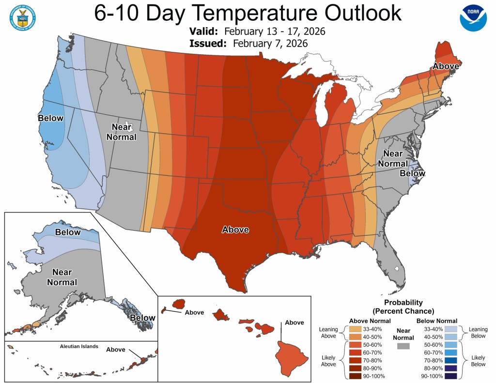
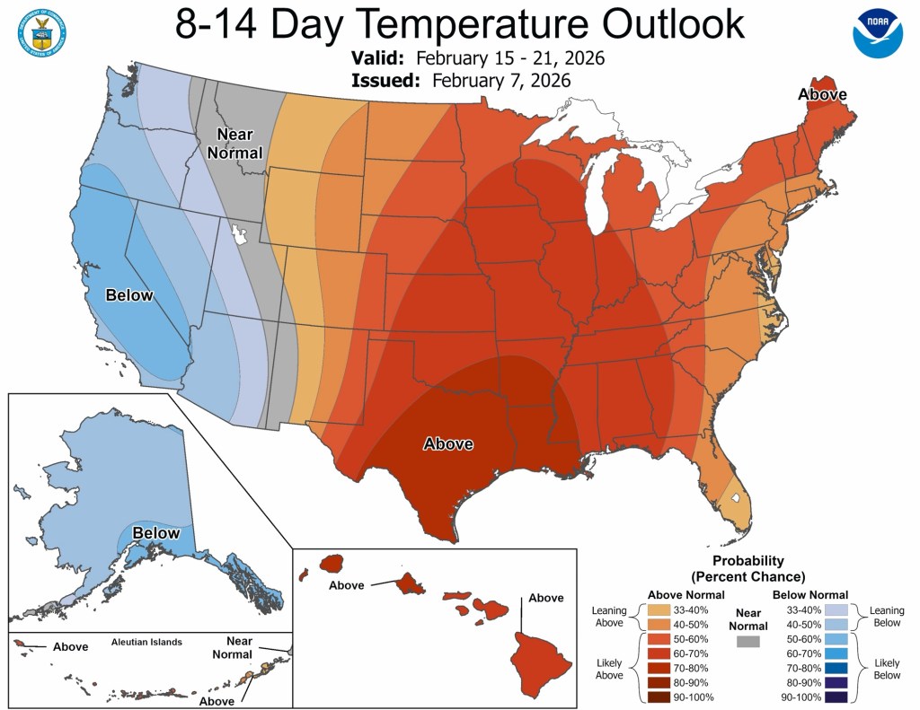
Beyond next weekend and into next week, normal to above-normal temperatures are expected to stick around.
Precipitation
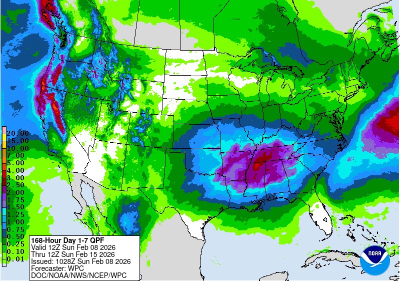
Very little precipitation is expected next week. In the next 5 days, the snow we saw earlier will likely be the only significant amount.
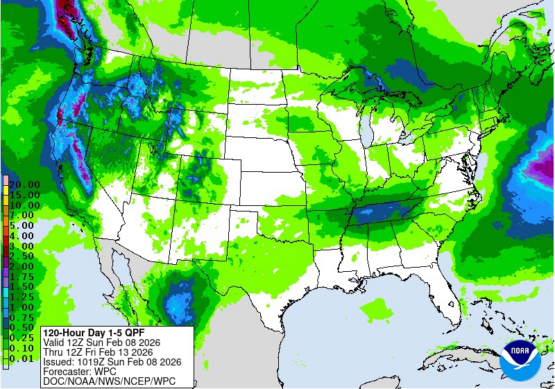
We could see a little more activity next weekend, and precipitation types will depend on when it falls (rain during the day, snow overnight). A large area of heavy precipitation near the Ohio River valley has been in the hazards outlook for a few days and is showing up in the forecast for next weekend. Most of the snow should be long gone down there by then, but parts of Kentucky and Tennessee, especially, could see a slightly higher risk of flooding due to previous snowmelt raising rivers before this rain.
Beyond…
CPC long-range outlooks should be out in about a week and shed some light on March, as well as give us an idea of what to expect this spring. The aforementioned stratospheric warming event is happening now, and a disruption to the polar vortex has begun, too. When these breakdowns occur, the cold air can go either into North America or into Europe. I’m oversimplifying here quite a bit, but that is essentially what happens. So far this winter, the previous PV breakdowns have sent the bulk of the cold air across North America, and we have seen the brunt of it here in the Midwest and Great Lakes.
This latest disruption is forecast to send the bulk of the cold air, at least initially, to Europe. The polar vortex exists well above the surface and has to connect to the surface to funnel the most frigid air to us. Again, I’m oversimplifying, but that is the gist of it. Not only is the bulk of the coldest air going to Europe this time, due to a strong ridge expected over North America, but the coldest air aloft is also expected to become “decoupled” from the surface. As the ridge breaks down (the ridge is helping bring us 40s and even warmer air out in the plains the next week or two), the PV and the surface is expected to re-couple and send us a shot of cold air near the end of February or beginning of March.
We’ve got a lot going in our favor to mitigate the cold and its longevity, so while we may see a few days of cold air, it does not look like this next round will stick around for a week or two, as our last batch did. It’s far too early for any specifics, but more wintry weather would be possible if/when the cold materializes.
Enjoy the quiet week ahead, and if you’re hoping for more school delays, Tuesday morning is your best bet right now.
-pw

Leave a comment