-
Potential Spring Snowstorm
Just when we were getting used to the idea of thunderstorms instead of snowstorms, Mother Nature starts working on her curveball. We will trend colder next week, just in time for spring break and likely just cold enough for heavy,… Continue reading

-
Wednesday (4/2/25) Severe Weather Threat
Early Wednesday PM Update The main focus for severe weather has absolutely shifted well to our south. In fact, parts of our area have been trimmed out of the enhanced risk area thanks to the extended period of cool rain… Continue reading

-
New Logo, New Merch
I’ve been working on a new logo for a while now and really like how it turned out. What do you think? If you’re interested, there are some new items in the store featuring the new logo. Continue reading
-
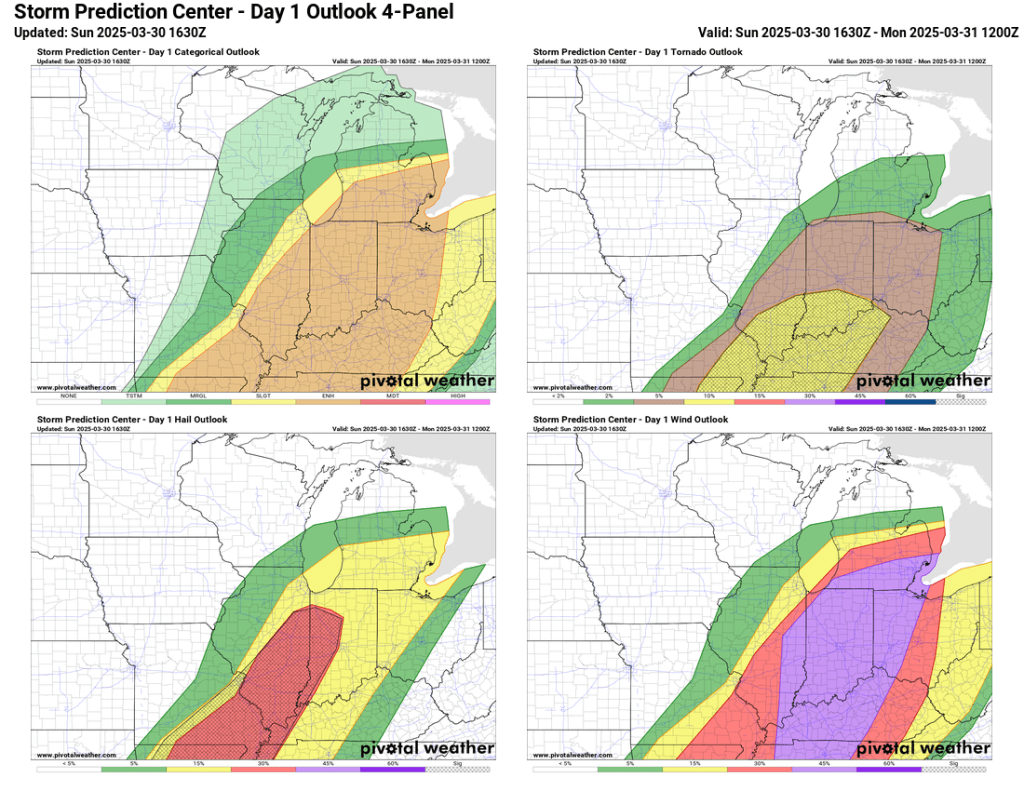
3/30/25 Storms Recap
Many in and around Goshen saw severe wind gusts this afternoon. Storms began firing around noon near St. Louis and developed rapidly as they sped northeastward toward Michiana. We didn’t see much in the way of supercell development as storms… Continue reading

-
Stormy Sunday Evening?
Sun Early PM Update Storms have initiated near St. Louis, MO and will continue to head our way over the next several hours. Skies may clear up a bit over the next few hours, but we won’t completely clear off.… Continue reading
-
Cool For Now…
The sun today wasn’t enough to raise temperatures to what we saw just a few days ago, but today’s low 50s will be the highest for about a week. The week ahead looks cooler than we have been, but temperatures… Continue reading
-
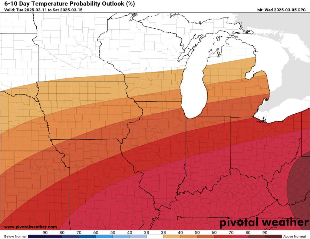
Weather Whiplash
Enjoy the 60s the next two days, as they will be our last for a while. About two weeks ago, I posted about the weakening of the polar vortex and how it could impact us locally. We are finally starting… Continue reading

-
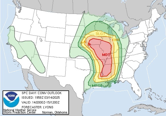
Stormy Night Ahead?
Day one of a two-day severe weather outbreak is underway. Fortunately, most of the bad weather will stay to our west and south. The first day of the outbreak is focused on the middle of the country, but the fringe… Continue reading
-
Spring Preview
A spring preview begins today and will last through the next week. During this time, you can expect primarily pleasant weather with temperatures reaching 60°F or better each day and peaking late this week with highs that could approach 70°F.… Continue reading
-
Brief Warm-up, then what?
I mentioned recently that we have a good chance of seeing our first 60°F day next week—which still appears to be the case. However, we will have a few blustery, raw days to get through. Temps will fall into the… Continue reading