Make a one-time donation
Make a monthly donation
Make a yearly donation
Choose an amount
Or enter a custom amount
Thank you so much for considering!
Your contribution is appreciated.
Your contribution is appreciated.
DonateDonate monthlyDonate yearly-
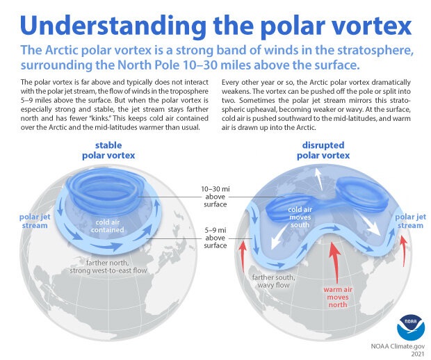
Weather Whiplash
Enjoy the 60s the next two days, as they will be our last for a while. About two weeks ago, I posted about the weakening of the polar vortex and how it could impact us locally. We are finally starting… Continue reading

-
Mild, tranquil stretch ahead
After several weeks of bitter cold, snow, ice, fog, freezing rain, and blowing snow, we are finally in for a break. How long the break will last is to be determined, but we will have at least a few days… Continue reading
-
Lake Effect Snow?
Wednesday PM Update There have been no significant changes to the forecast for another 12 hours or so. Totals have come down across the board, which I think speaks to the continued uncertainty regarding the setup of the lake effect.… Continue reading
-
Looking Ahead
It will be cold this week, but nothing we haven’t seen a time or two already this winter. Outside of a slight chance for snow around mid-week, things look pretty quiet through next weekend. Even better, once we get through… Continue reading
-
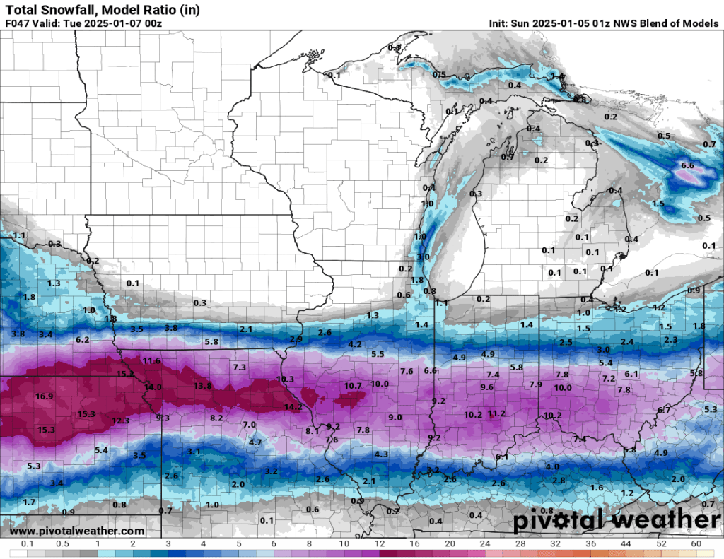
Weekend Storm
Saturday PM Update I held off on updating to make sure I got the latest model runs, and the eastern trend has continued to push any snow away from us. We’ll be lucky to see an inch or two by… Continue reading

-
Icy Saturday?
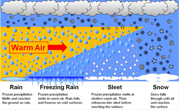
Saturday AM Update The models were consistent overnight, and this morning, nearly all of them except the HRRR kept the majority of the ice to our south and east. That being said, three temperature zones will determine precipitation type: surface,… Continue reading
-
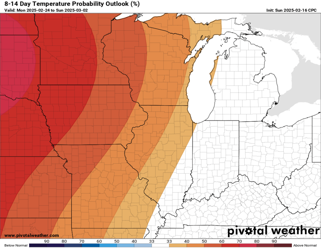
Colder Days Ahead
The Week Ahead… We’ll have to deal with a few nuisance weather impacts over the next few days, but unfortunately, as of this morning, I am not seeing any significant snow in the next week or so. Next weekend is… Continue reading
-
Active Pattern Ahead…
I mentioned a system approaching late this week and early this weekend a few days ago. At the time, the GFS and Euro were split. Now, these models have come into good agreement and our convection allowing models are also… Continue reading
-
Something to watch…
Another winter storm is developing, but who will see snow and how much? Check out the latest blog for more! Continue reading

-
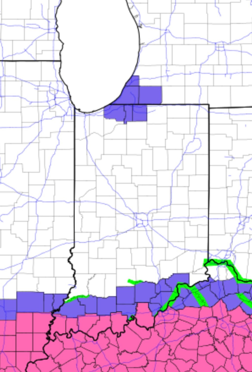
The Week Ahead
All eyes will be on central and southern Indiana tomorrow and Monday, and I know many of us—myself included — have friends and family downstate who are at risk of heavy snow, so I’ll give a quick update. Widespread 5-10”… Continue reading