Make a one-time donation
Make a monthly donation
Make a yearly donation
Choose an amount
Or enter a custom amount
Thank you so much for considering!
Your contribution is appreciated.
Your contribution is appreciated.
DonateDonate monthlyDonate yearly-
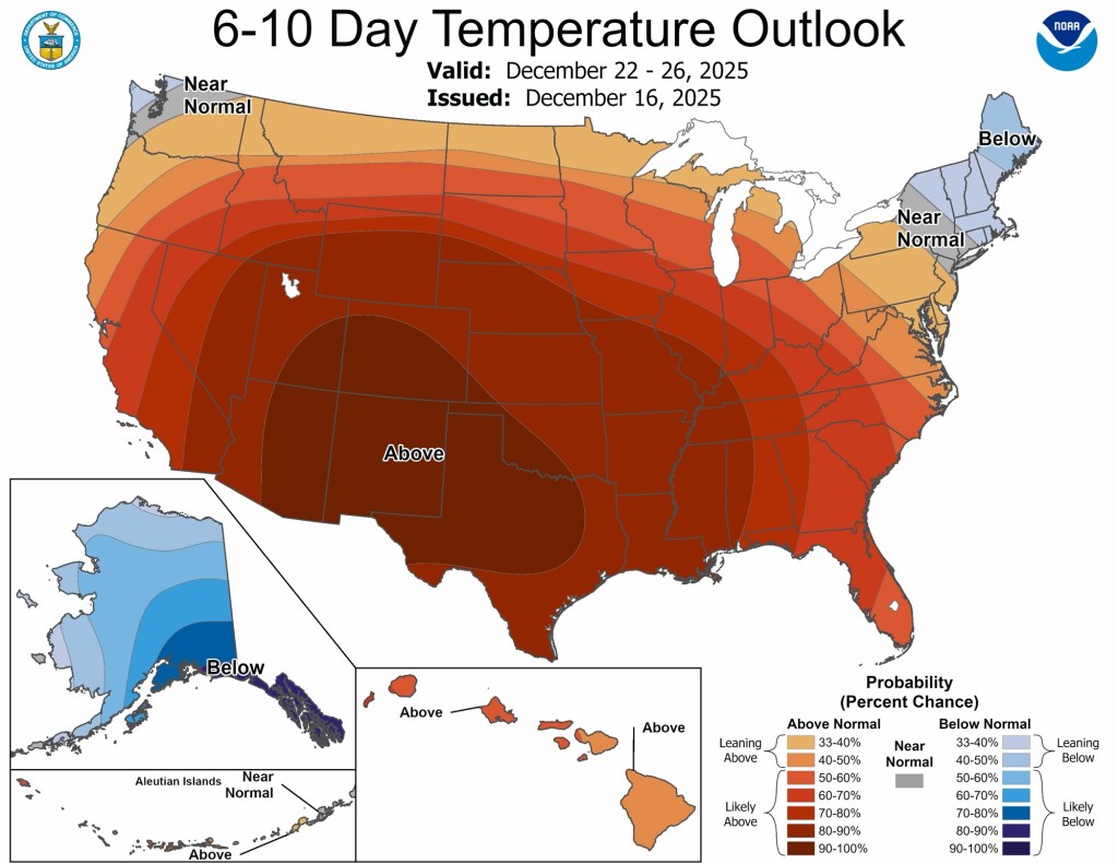
Tranquil, for the most part
Once our clipper system moves through today, things look pretty tame until perhaps the middle of next week when our next potential system may arrive. Temperatures Overall, temperatures over the next week or so look normal to slightly below. Toward… Continue reading
-
Minor Ice Potential Friday
I hope you were able to enjoy the warm air yesterday. My car said it was 54°F yesterday afternoon, but my backyard thermometer peaked at 49.8°F. Either way, it was great! Models have backed off on the truly warm air… Continue reading

-
Quiet for the most part
Outside of some patchy mist and fog tomorrow morning, the only potentially concerning weather on the horizon is the potential for some ice Thursday night and Friday morning. There isn’t a lot of snow left, otherwise we might be talking… Continue reading
-
Autumn Doldrums
We are officially in transition mode, also known as “fall” in northern Indiana. The last three (four?) months have been dominated by above normal temperatures and long stretches of sunny days. That’s probably why the last few dreary days have… Continue reading
-
Fall Pattern (finally) Settling In
Overall, the weather pattern for the next 7+ days looks cooler than it has been, but very pleasant. Unfortunately, the exceedingly dry pattern also looks to continue. We get briefly warmer later this weekend and early next week with highs… Continue reading
-
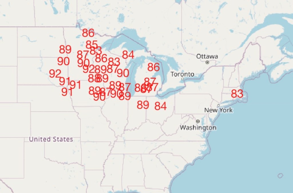
Changes Brewing
Historically warm in the short range, but much closer to normal (and much cooler) by next week. Continue reading
-
Summer Doldrums
July 2025 thus far Goshen, along with much of the Midwest and Great Lakes, has been mired in a prolonged stretch of above normal temperatures with normal to slightly below normal precipitation and varying levels of humidity. None of this… Continue reading
-
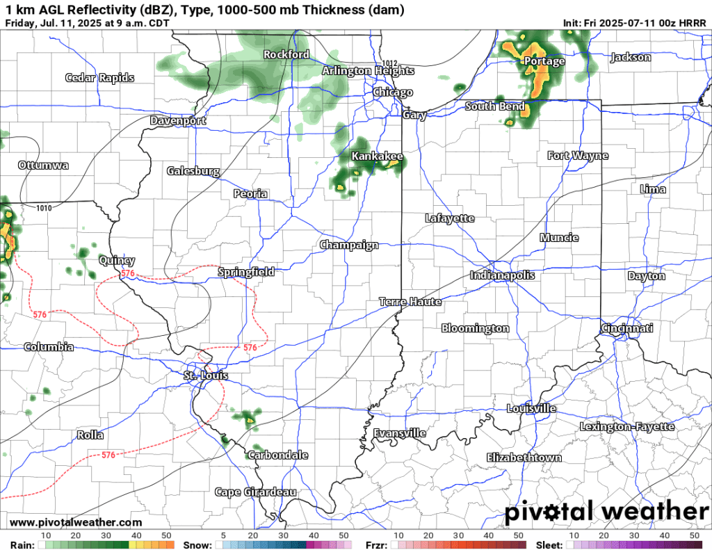
7/11 AM Storm Potential
7/11 PM Update: The SPC has trimmed Goshen from the slight risk area tonight. There is a Tornado Watch to our west, but I expect this to expire and not be expanded east to include us. We will be lucky… Continue reading
-
Potential Severe Weather Event Thursday
Thursday PM Update The latest update from the Storm Prediction Center (SPC) has expanded the area of enhanced risk further south, putting us in a more favorable zone for severe weather. High-risk areas for tornadoes, severe wind gusts, and severe… Continue reading

-
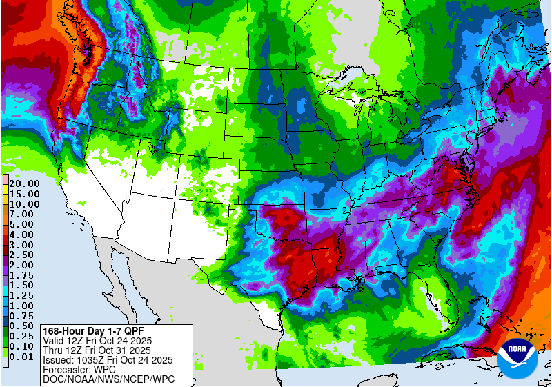
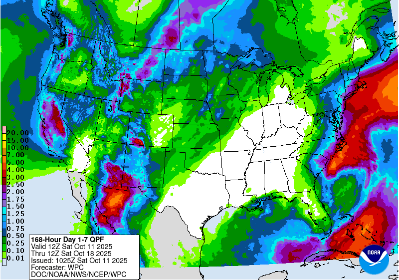
The week ahead
For the next few days, we are mired in a stubborn, gloomy, damp, and cool weather pattern. However, by mid-week, things will dry out and warm up. The bulk of the rain over the next week is expected to fall… Continue reading