Make a one-time donation
Make a monthly donation
Make a yearly donation
Choose an amount
Or enter a custom amount
Thank you so much for considering!
Your contribution is appreciated.
Your contribution is appreciated.
DonateDonate monthlyDonate yearly-
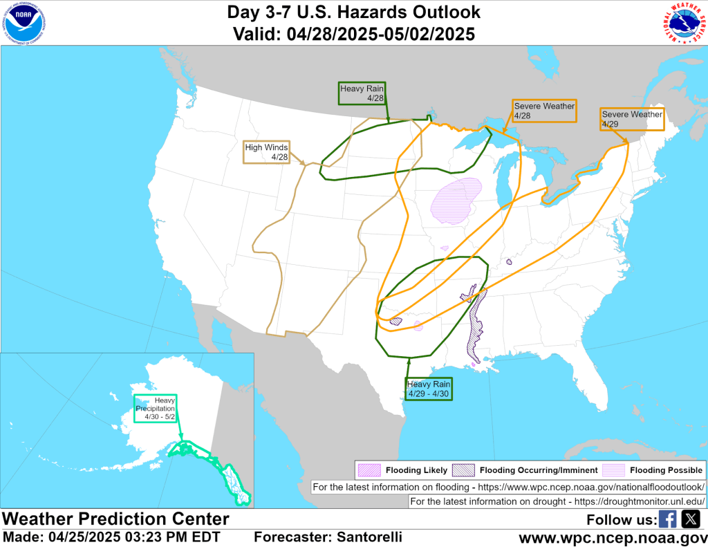
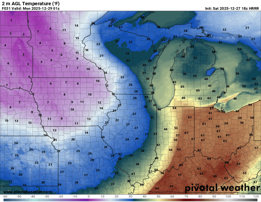
Huge Swings Coming…
Warning: Crazy weather (even for Indiana) ahead! Continue reading
-
Winter Solstice
Days officially start getting longer again starting on Monday! Tomorrow marks our last sunset before 5:16 PM. By the end of the month, sunset is back to 5:23 PM. Sunrises start getting earlier January 6th. Tomorrow is technically our shortest… Continue reading
-
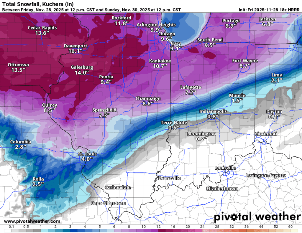
Saturday Snow Storm
Updated 11/29/25 6:00 PM Snow is here and accumulation has begun. I’ll be tracking totals in my backyard below—read on for more details. Accumulation Totals Time: Accumulation since last observation (storm total) 11 AM: 0.5” (0.5”) 2 PM: 1.0” (1.5”)… Continue reading
-
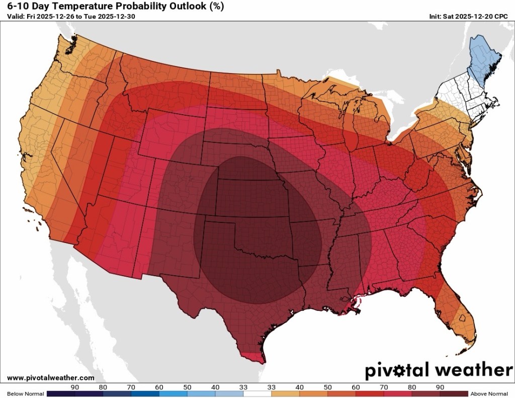
Changes Brewing
Historically warm in the short range, but much closer to normal (and much cooler) by next week. Continue reading
-
Summer Doldrums
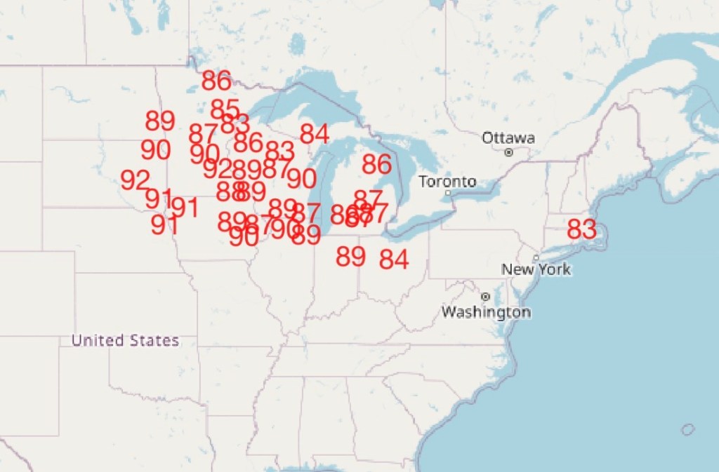
July 2025 thus far Goshen, along with much of the Midwest and Great Lakes, has been mired in a prolonged stretch of above normal temperatures with normal to slightly below normal precipitation and varying levels of humidity. None of this… Continue reading
-
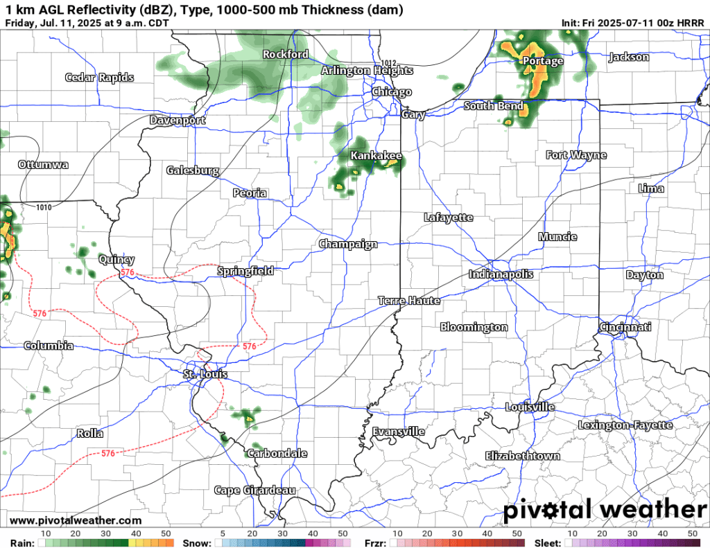
7/11 AM Storm Potential
7/11 PM Update: The SPC has trimmed Goshen from the slight risk area tonight. There is a Tornado Watch to our west, but I expect this to expire and not be expanded east to include us. We will be lucky… Continue reading
-
Severe Storm Threat later
Non-severe showers and storms will continue to push through this morning. If the clouds (and showers) associated with this morning’s system linger, it would lessen the severe threat later this afternoon but not eliminate it. The SPC has slightly expanded… Continue reading
-
Potential Severe Weather Event Thursday
Thursday PM Update The latest update from the Storm Prediction Center (SPC) has expanded the area of enhanced risk further south, putting us in a more favorable zone for severe weather. High-risk areas for tornadoes, severe wind gusts, and severe… Continue reading

-
The week ahead
For the next few days, we are mired in a stubborn, gloomy, damp, and cool weather pattern. However, by mid-week, things will dry out and warm up. The bulk of the rain over the next week is expected to fall… Continue reading
-
Warm trend to continue
While we will see some cool mornings, especially the next few that will flirt with the mid-30s, the theme overall remains warmer than average. The latest CPC outlooks show the warmth lasting well into May. Today will be the coolest… Continue reading