
**Updated 7:30 AM 1/3/25**
Welcome to 2025!
I am back from our mini-vacation in Indy and I am still keeping an eye on our storm this weekend/early next week. A few things:
- It’s still too early to buy any one solution. The system is out over the Pacific Ocean and won’t come ashore until Friday afternoon. We can start taking things seriously then. This remains true (see new outlier below). I will always wait to accept any solution for a winter storm until the storm actually reaches our continent. I’ll have some sort of snow map up by tomorrow evening.
- Current data still keeps the heaviest snow to our south in the GFS model and well to our south in the European model. Overnight, a “boss battle” (that’s for you Wendy. I am loving DCC) began involving the GFS (American weather model) and the ECMWF (European weather model). The GFS shifted noticeably north while the Euro shifted subtly south. The Euro performs better historically and has been consistent for a decent period of time with this storm. The GFS has been all over the place. I think the GFS is an outlier, and the heaviest snow likely stays centered between Lafayette and Bloomington.
- As winter storms approach the Midwest, two things tend to happen in both models: Snow totals “average out” and decrease, and the storm track shifts north (and often west). The northern shift has/is happening with the GFS, but at this point, I think the GFS took it upon itself to polish off all the eggnog before it went bad, and it is now dealing with a nasty post-holiday hangover.
- At this range, you can’t pay attention to any specific model or model run; you have to look at trends. For the 36 hours or so leading up to today, the trend was shifting the snow to our south. Over the last 24 hours or so, the axis of heaviest snow has been moving back to the north (as expected—see number 3). The latest runs from the European model have maintained the main snow area between Lafayette and Bloomington—including Indy. There has been a subtle shift south.
- Snow totals aren’t going to be massive, no matter the scenario. Don’t believe any hype (ahem, garbage) you might find on social media touting FEET of snow. This remains true. 6-8” would be the high end for those seeing the most snow. There could be a few spots that see a little more than this.
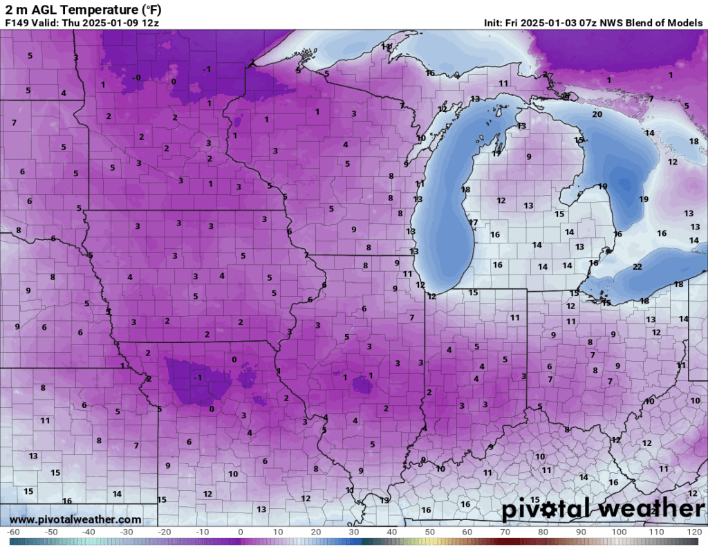
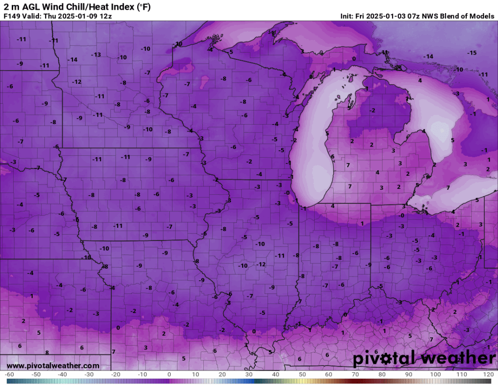
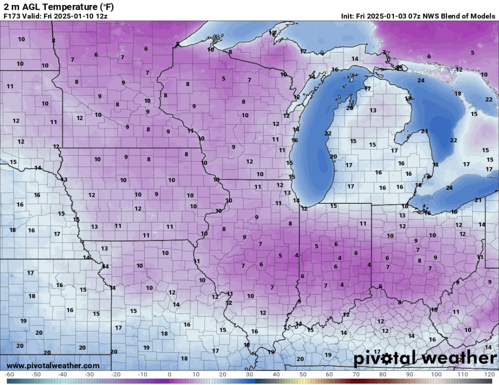
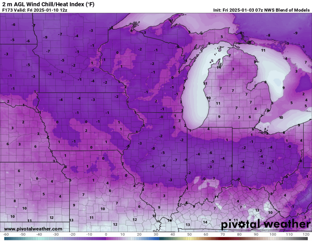
The snow is getting all the attention, and it is justifiably so. However, what could be just as impactful and is more certain, even at this range, is severe cold roughly a week from now. High temperatures late next week are expected only to reach the teens. More importantly, we could see one or two nights/mornings below zero. Add in any wind, and wind chills could easily fall below -20°F at times. Models have somewhat backed off on the cold but aren’t factoring in some (hopefully) snow on the ground that will help lower temps a bit more than you see here. I’m not convinced it will be cold enough to disrupt local schools.
I’ll have another update Friday evening at the earliest, but will continue to monitor trends until then.
–pw

Leave a comment