We are officially in transition mode, also known as “fall” in northern Indiana. The last three (four?) months have been dominated by above normal temperatures and long stretches of sunny days. That’s probably why the last few dreary days have felt especially dreary—or maybe my SAD is settling in early this year. The good news is that we should have a few sunnier days ahead, but they will be chilly nonetheless. Let’s take a look at the next few weeks.
Temperatures
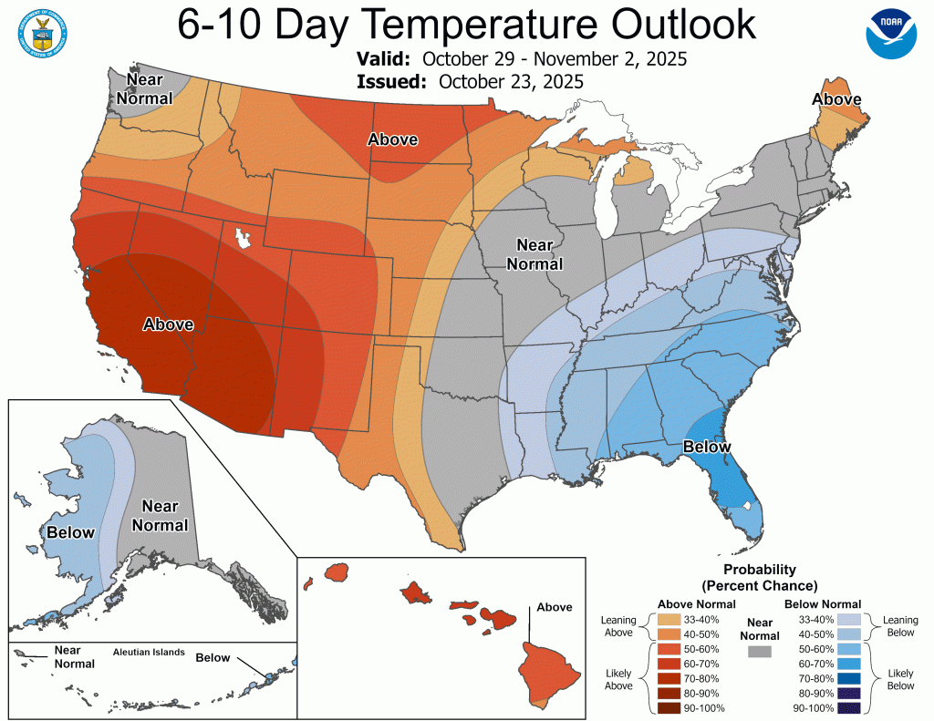
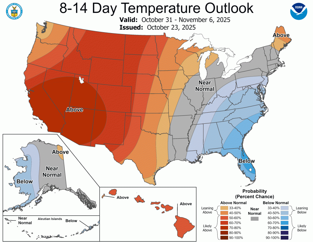
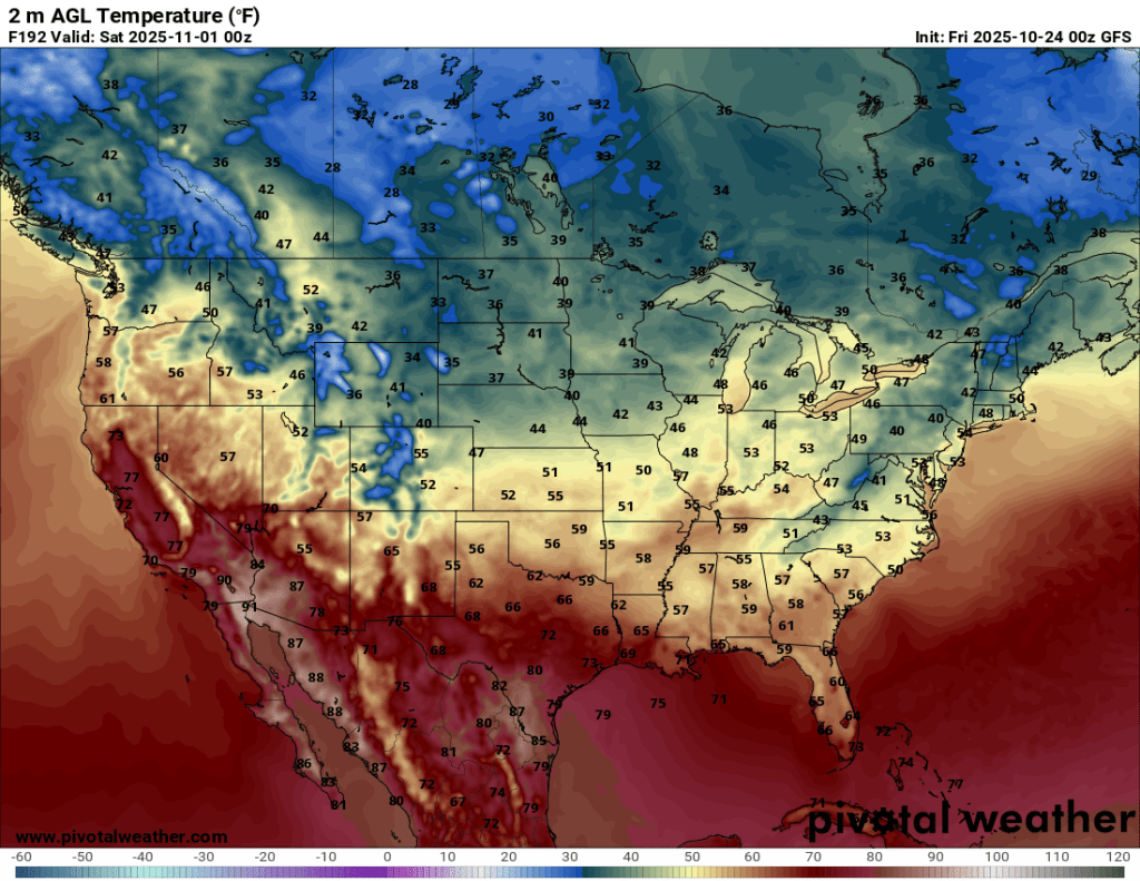
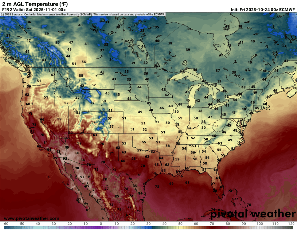
The normal high this time of year is in the upper 50s, but outside of Sunday, we will stay 5-10° below normal in the temperature department over the next week or two. For anyone curious, the normal high in Goshen on November 1st is 55°F with a low of 38°F. By November 30th, those numbers fall to 42°F and 28°F respectively.
The trend over the next two weeks is for the normal to slightly below normal temperatures to continue.
Precipitation
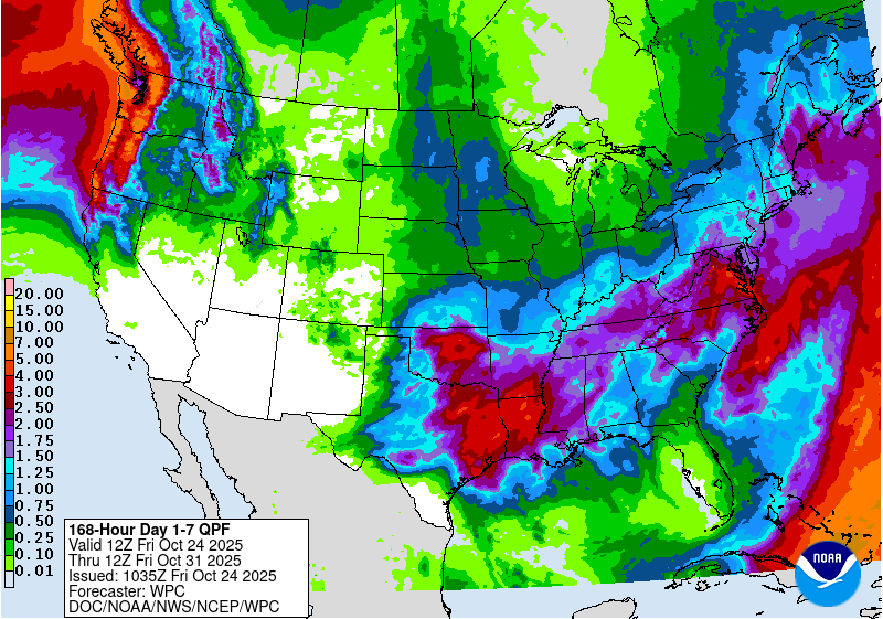
We’ve made up some ground and the drought is expected to clear up between now and the end of the winter, so we can expect more rainy, and hopefully snowy, days to come. Here’s a look at total precipitation so far in 2025:
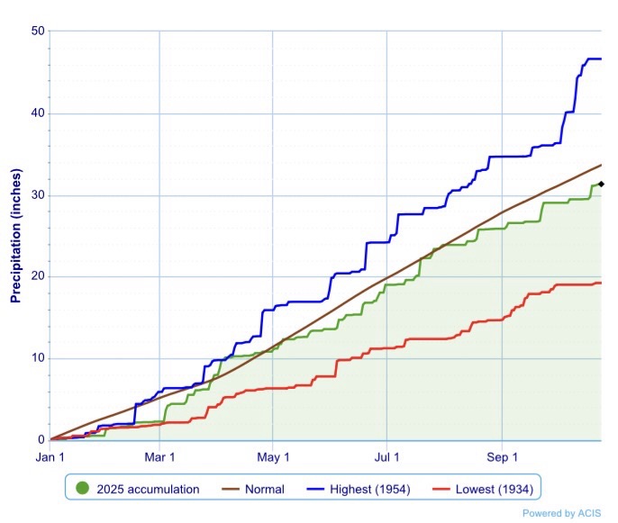
We are still below normal for the year, but not as much as you might think. Our accumulation graph this year is marred by long horizontal stretches with widely scattered, large vertical bumps. It looks like we will continue to make slow, but gradual progress in the precipitation department.
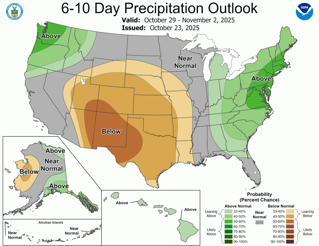
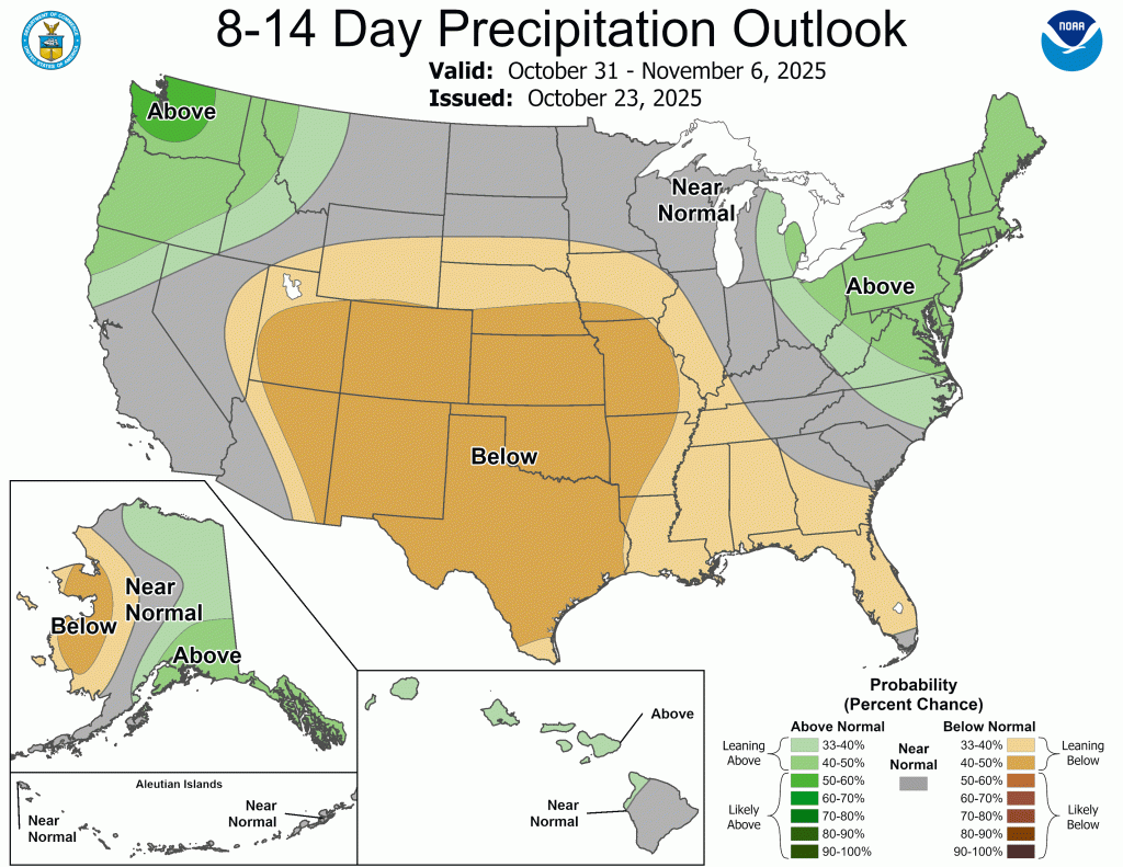
The next week features a few days with chances for precipitation, but like the last few days, it won’t add up to much.

Also, over the last four days, despite hours and hours of wind-driven precipitation, I have only tallied 0.40”. This is the kind of precipitation you can expect over the next week.
First Look: Halloween
Trick or treating is less than a week away. That’s still too far for me to be comfortable with a forecast, but here is a sneak peak at current forecasts for the big night.
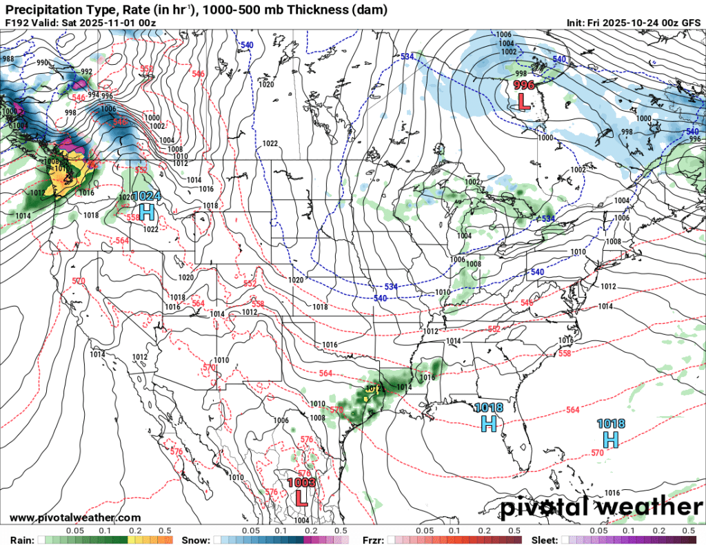
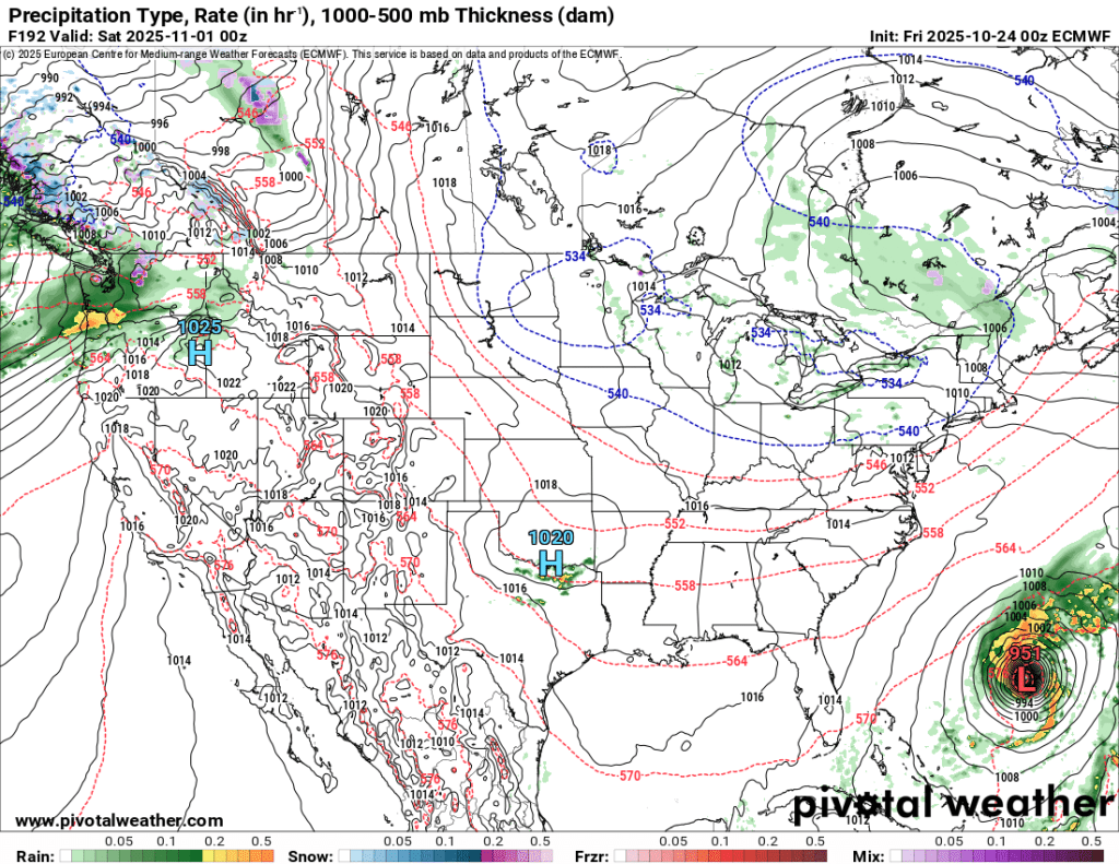
Early indications suggest seasonable temperatures with some scattered (lake effect) showers on Halloween night. Two other observations:
- It might be windy. Both models indicate wind gusts over 20 mph Halloween night. This would align with the kind of weather we saw earlier this week (chilly, wind-driven rain).
- One great illustration of why I don’t trust these forecasts this far out, the Atlantic in the GFS model is empty, while the Euro features a literal hurricane (Tropical Storm Melissa is currently spinning away near Jamaica).
Beyond
NOAA released its winter 2025-2026 outlook recently. This is no different than the 6-10 and 8-14 day maps I show you a couple times a week except that they are for 1-3 months out instead of 1-2 weeks. Here they are:
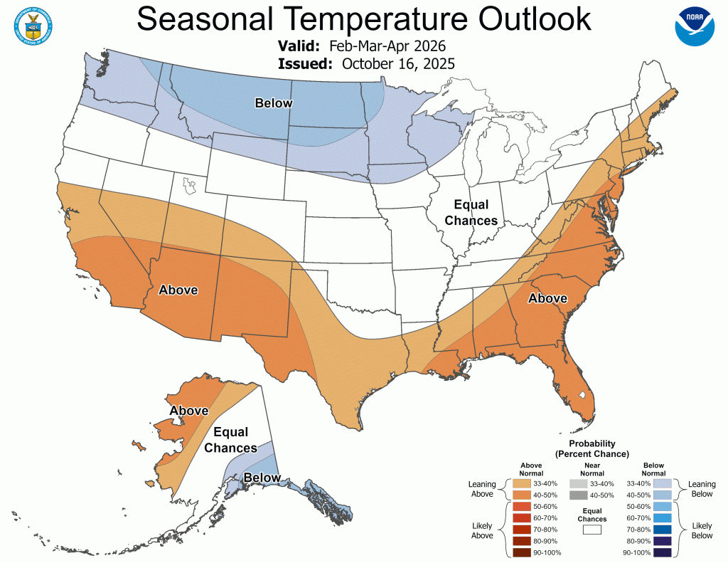
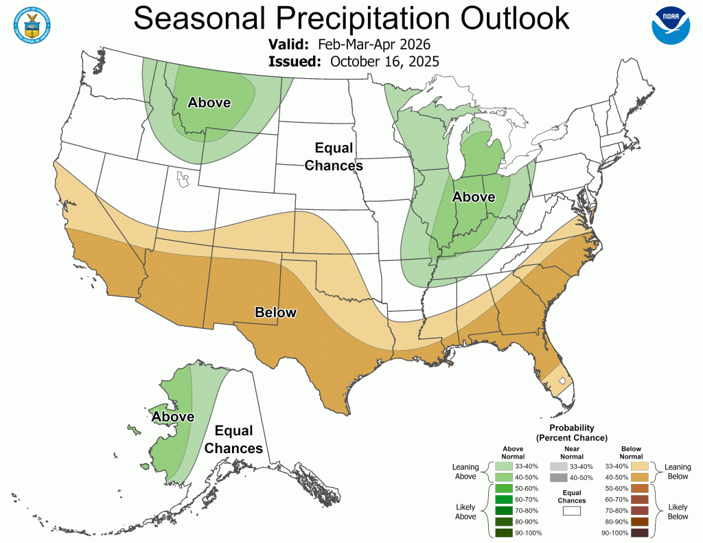
If you’re a winter weather lover like me there is a lot to like here. I’m holding off on my winter forecast until mid to late November, but it’s getting harder and harder not to get excited about the prospect of a snowy winter locally. This NOAA outlook only further supports that thinking.
-pw

Leave a reply to Goshen Weather Cancel reply