It has been months since my last post! I plan to get back into these at least once a week until things pick up this winter, when I’ll be making these blog posts with each potential winter storm. These will also have a bit more of a personal touch to start, so feel free to skip past that if you’re only interested in the weather.
Football, Fall, and Loss
Football season is officially upon us, and for whatever reason, I have been looking forward to it more and more over the last two years. Perhaps it is an age thing (I turn 40 in February), or perhaps it’s just a result of back-to-back exceedingly warm summers, and I am ready for a break from the heat and humidity.
Yesterday, we laid to rest a very good friend of mine. The eulogy was full of equal parts laughter and tears, and the Reverend blushed at times at a few of the stories. If you’ve ever seen my radar posts and wondered what the fishing emoji was for, it was for our favorite spot. His passing was mercifully quick, and the first time in my life I’ve lost someone that close, that unexpectedly, and that quickly. I’m reminded of a line from a RHCPs song: “Say it now, because you never know.” I’ll miss my friend, but won’t forget him.
Next Week’s Forecast
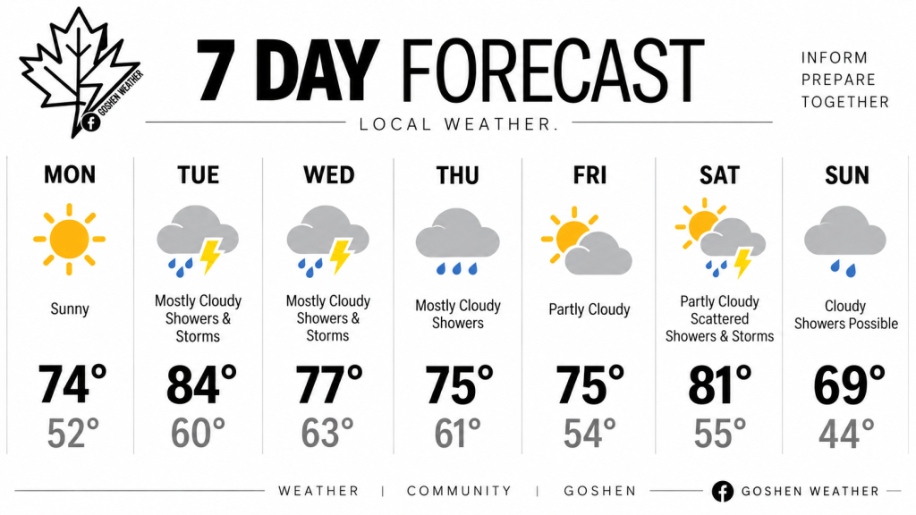
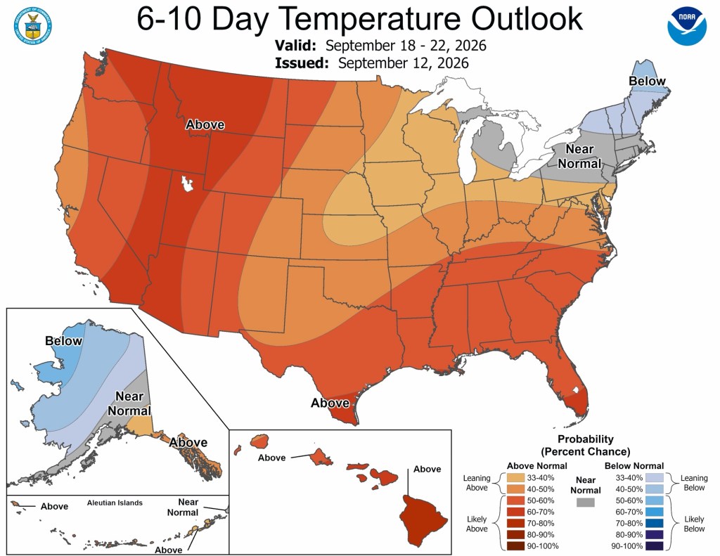
If you are hanging on to warm weather activities on the weekends, I hope you get out and enjoy what’s left of this one. Next weekend looks much cooler, and possibly wetter. I mentioned a pronounced cool-down around and after the 19th, and this still looks to be the case. Highs in the 60s with lows in the 40s are still possible as early as next weekend. For what it’s worth, I do see a slow rebound in temperatures, but there won’t be many “hot” days left this year.
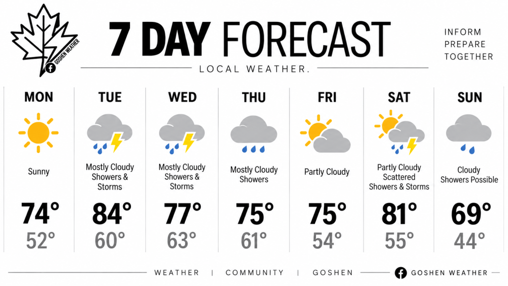
At least one of those remaining hot days will come on Tuesday. After a cool and quiet Monday (highs in the low 70s with no humidity), Tuesday is expected to be hot and humid. Temperatures will likely soar back into the mid to upper 80s with a noticeable jump in humidity, too. Along with the heat and humidity, Tuesday will also bring a chance of rain and storms.
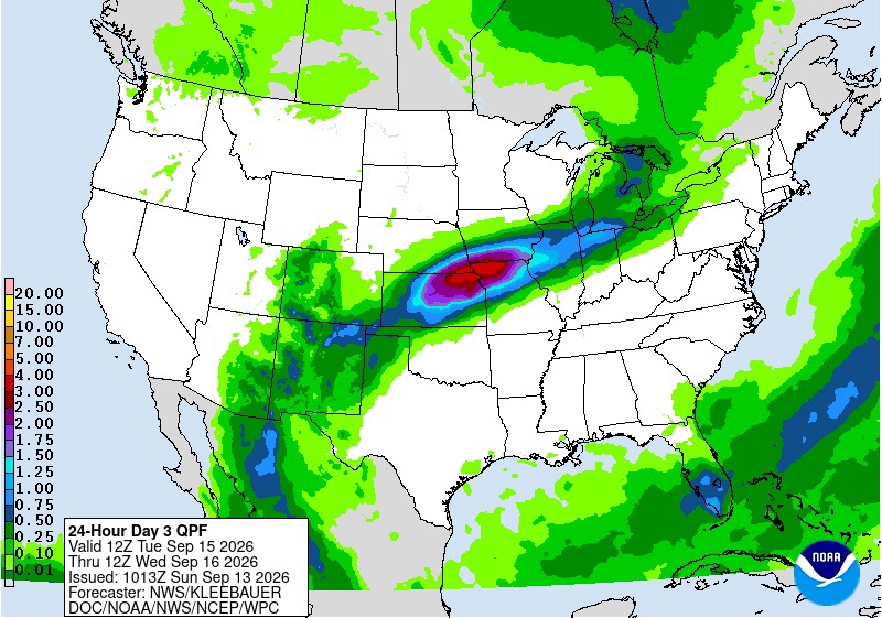
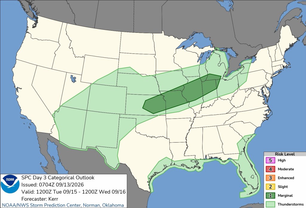
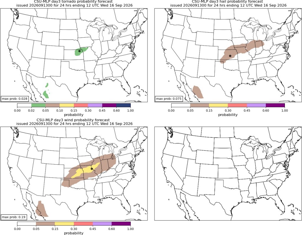
There isn’t a big concern for severe weather on Tuesday at this point in time, but there could be an isolated strong storm or two to watch for. Gusty winds and small hail are possible threats, though brief heavy downpours are the only likely threats.
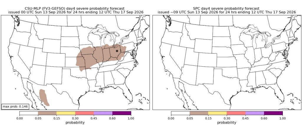
More rain and storms will be possible on Wednesday and Thursday, though Thursday looks like just plain rain.
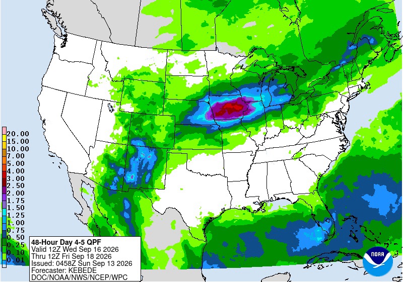
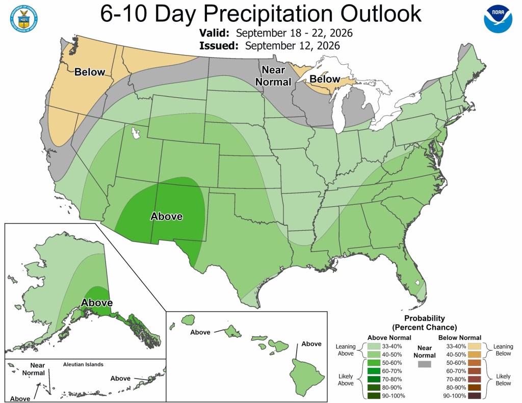
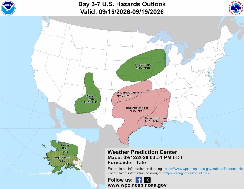
You may have noticed the “bullseye” for rain next week is the upper Midwest and eastern plains states, namely Iowa. Given this forecast, it’s no surprise that this same area is highlighted in the 3-7 day hazards outlook below.
Rain chances continue into next weekend. Confidence in this portion of the forecast is low, and I am cautiously optimistic that Friday night football won’t be a washout, nor will next weekend.
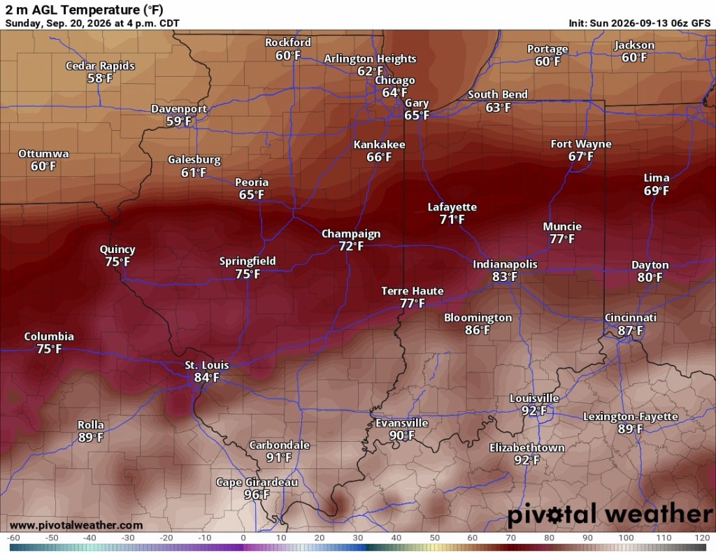
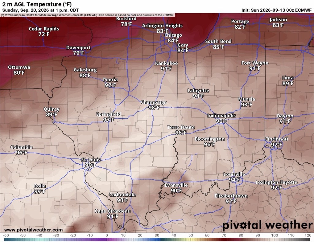
Temperatures come down after Tuesday and settle in the 70s for the rest of the week. Things could start to cool down sometime next weekend. Friday looks seasonably warm, but a sharp cooldown is possible later next weekend. I mentioned that the GFS and Euro were showing different forecasts, and this morning’s latest data shows wildly different outcomes. The GFS has highs in the 60s by Sunday, while the Euro shows mid-80s for the same timeframe. Things should start to come into better focus in the next few days, but for now, confidence is low for next weekend’s forecast.
Have a great week!
-pw

 Goshen Weather
Leave a comment