Friday doesn’t look like a total washout, but Saturday into Sunday might be. Timing will be everything on Friday, too, as it doesn’t look like all-day rain, but rain chances likely increase around and after sunset—which could impact local high school football games. Take a look at the NAM model forecast for Friday in 3-hour increments below by tapping on the photo in the top left, then swiping right to left to advance 3 hours. The NAM 3km is higher resolution and goes hour by hour rather than in 3-hour increments, but Friday night is at the outer edge of its range, and I’d like to see a few more runs before buying it. Regardless, it shows a very similar forecast: Scattered showers early, some dry time in the afternoon, then more showers late.
The other highlight of Friday’s forecast is the temperature. The latest runs have temperatures in the low 60s for most of the afternoon and evening. If it does rain, we’d likely slide closer to 60°F, making for a cool and damp evening.
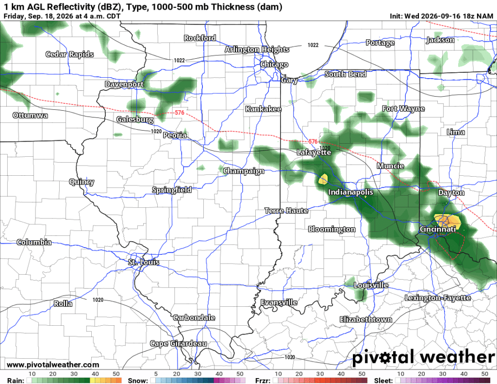
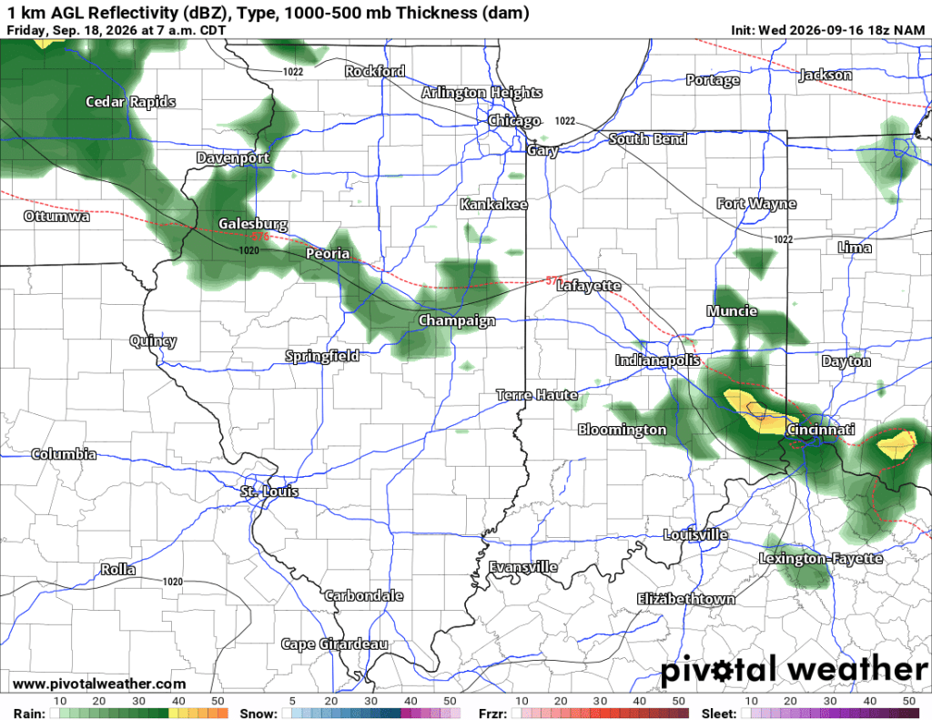
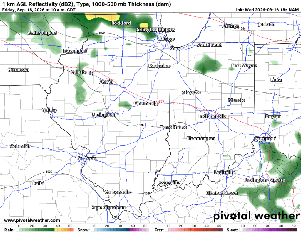
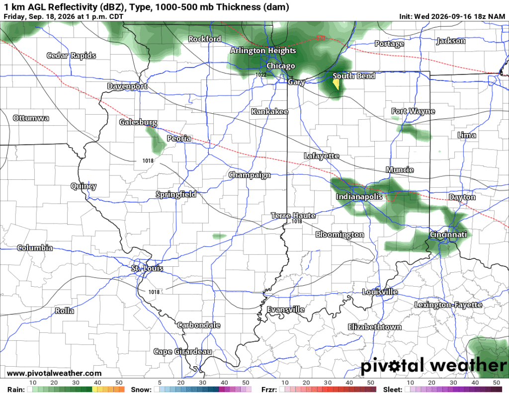
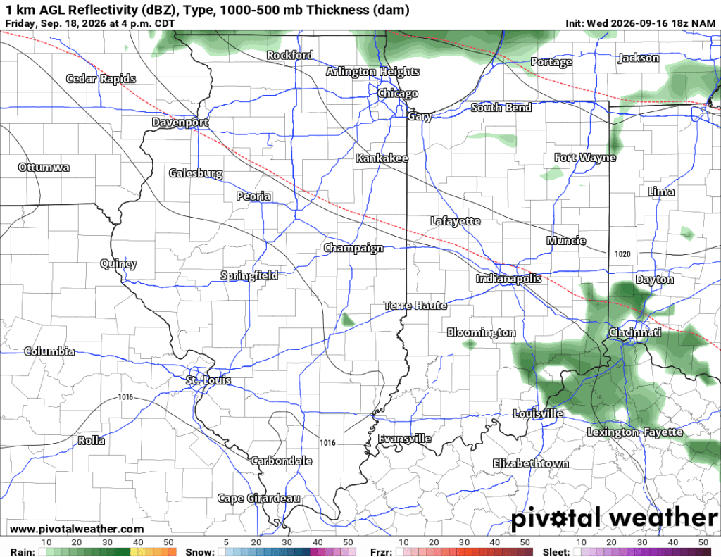
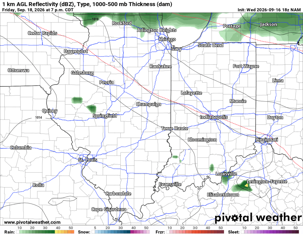
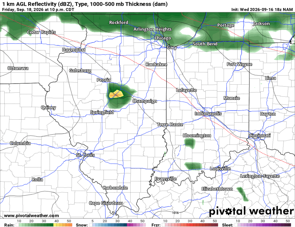
By Friday night, rain chances should pick up. All models show rain at times early and again late Saturday, but my hunch is it’ll be pretty wet all day, with heavier precipitation bookending the day and clouds and drizzle in between.
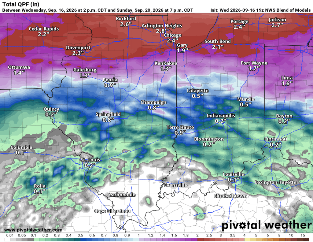
The blended model probably has the best overall grasp of how much rain we see (as it should), and you can see the latest iteration below.
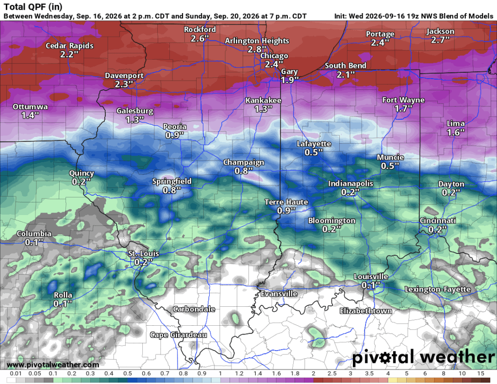
Less than two hours ago, using this afternoon’s data, I posted the NAM and Euro models predicting 3”+ of rain, while the GFS showed only about 0.5”. This evening’s data is coming together with better agreement and lower numbers overall. While this may limit flooding potential, especially given how dry we’ve been recently, it doesn’t mean those tailgating or doing other outdoor activities (I’m supposed to be camping this weekend) should let their guard down.
I’m a big fan of following model trends in forecasting, not individual model runs. Here are the latest ECMWF runs for rainfall amounts between now and 1 PM Saturday. You’ll see a wide range until the last 3- 4 frames or so, when things start to settle down. This model is also starting to show a little more dry time Saturday.
To summarize, models are trending downward on rainfall totals this weekend, but still show several hours of rain from Friday night into Saturday morning, and again by Saturday night. Friday evening looks cool and damp, but Saturday no longer looks nearly as chilly as it did a few days ago. It’s still only Wednesday night, so there is plenty of time for this forecast to change, and I think it will. If you have outdoor plans this weekend, today’s trends are in your favor, in my opinion, but they could easily swing the other way tomorrow as better data becomes available. Stay tuned!
–pw

 Goshen Weather
Leave a comment