Fall (astronomical) officially arrives at 8:04 PM tomorrow, though meteorological fall started September 1st. As such, it’s time to look ahead to what this fall’s weather might include. We still have a very strong El Niño, and its impacts will depend on how strong it becomes. Let’s take a look at the latest CPC Outlooks.
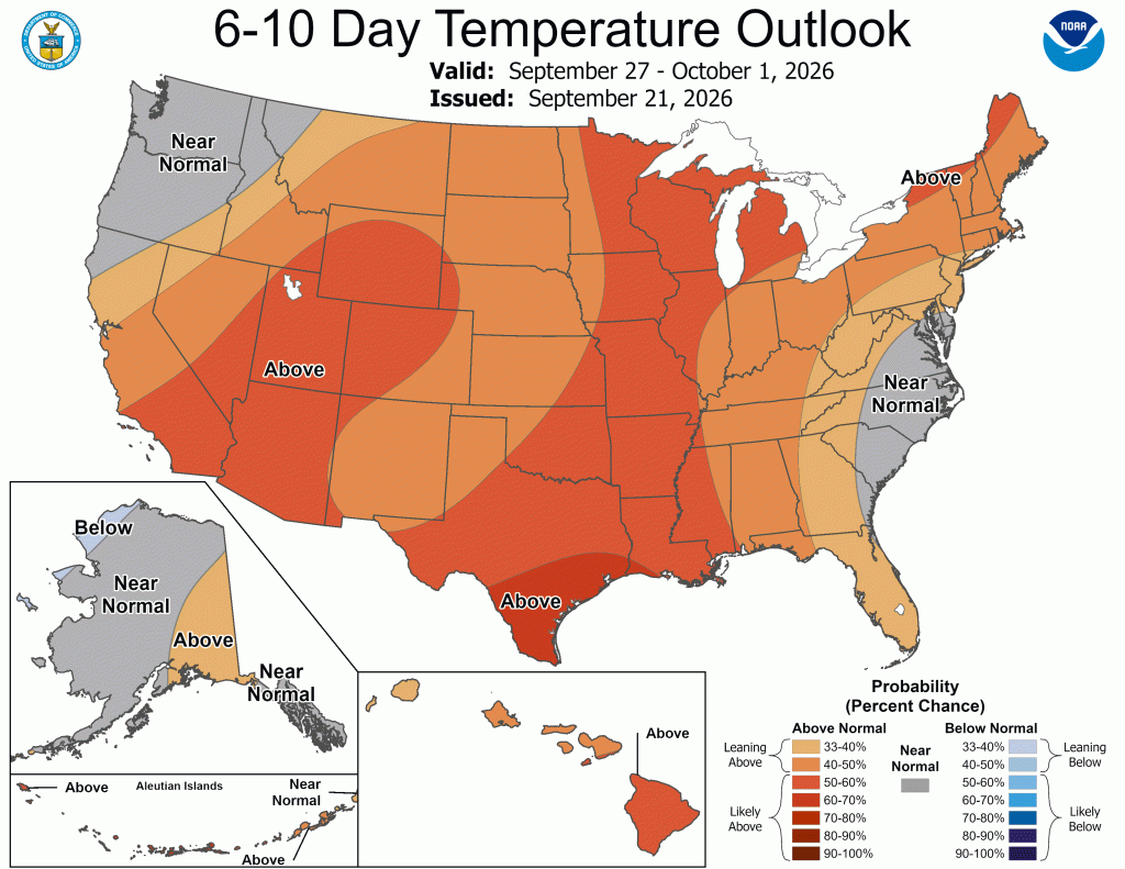
Today’s 6-10 day outlook might look a little surprising, but if you know how to read it and the expected temperatures leading up to it, this map is telling. The next several days should be very cool. In fact, we’ve entered the coolest stretch of weather we’ve seen since spring. Highs over the next few days will stay in the mid-60s to low 70s—nothing to complain about! Our normal high right now is in the mid-70s so that we will be a little below normal for much of the week ahead. So why does the 6-10 day outlook show above-normal temps? That means another warm-up is expected. And, looking a little further down the road, another stretch of temperatures near 80°F looks likely as we head into late September and early October.
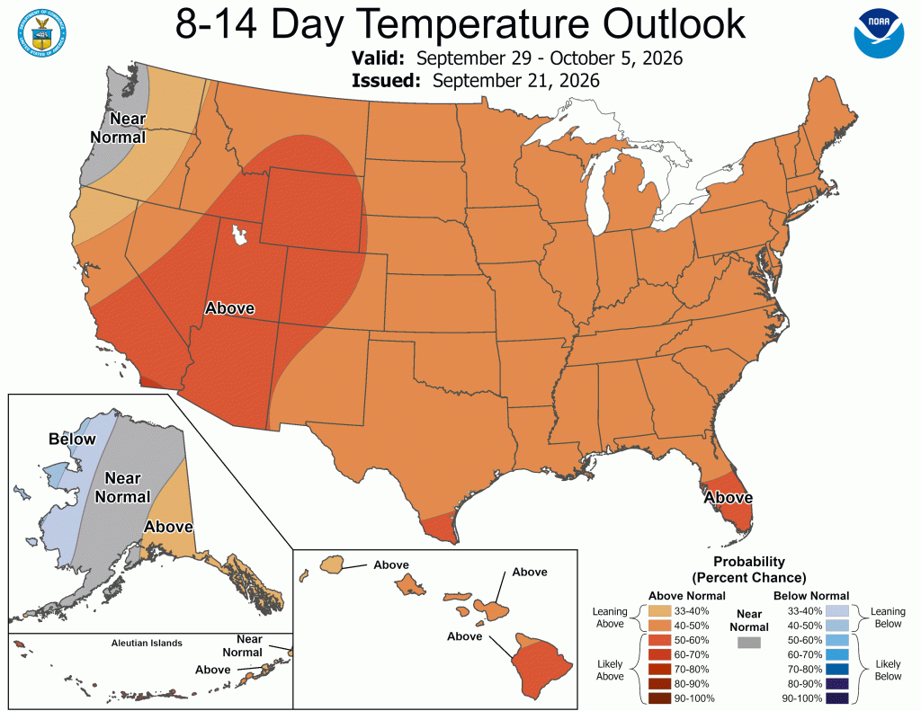
Looking a little further ahead, the 8-14 day outlook shows warm air expanding to cover all but the Pacific Northwest as we move into October.
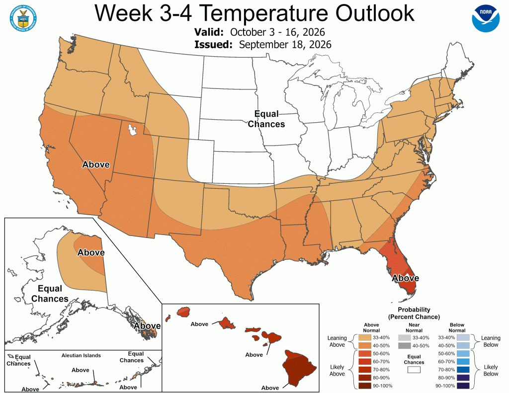
However, the latest 3-4-week temperature outlook ends the above-normal temperatures as we approach mid-October, suggesting another bout of cooler-than-normal weather may help offset the warm start to the month and leave us with “equal chances” for this period. It could also simply signal a return to more seasonable temperatures.
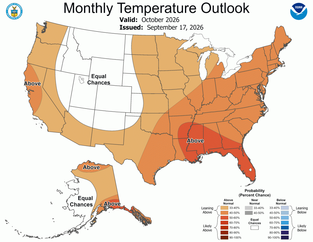
The latest monthly outlook (October 2026) shows much of the country above-normal temperatures, except in the Mountain West region.
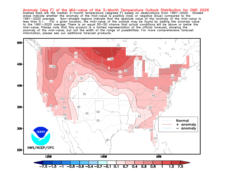
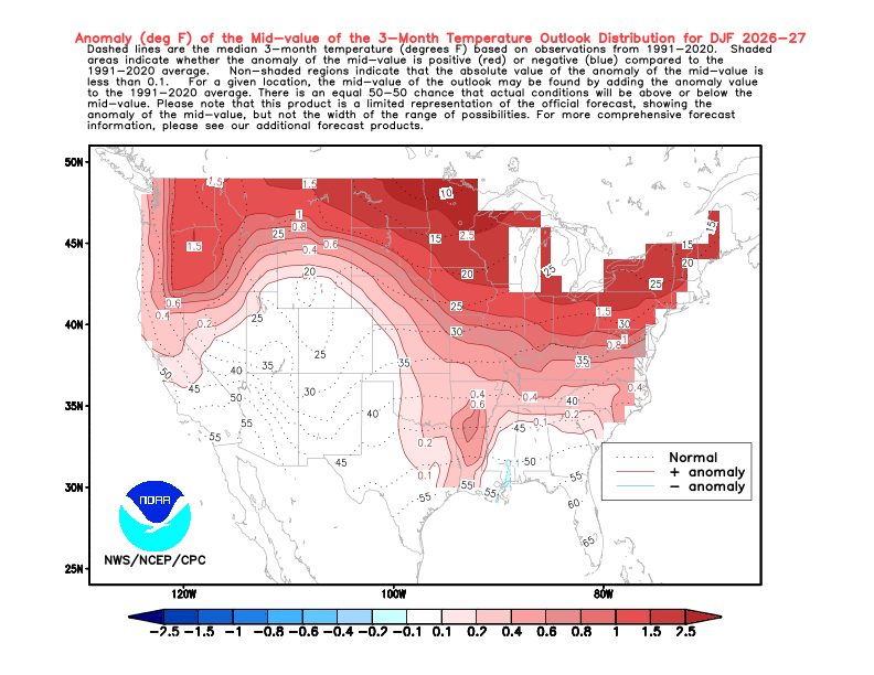
Looking at mid-to-late fall and early winter, our trend of warmer-than-normal overall temperatures is expected to continue—This is expected with an El Niño winter, but it doesn’t mean we won’t get cold. The most likely outcome is normal to slightly above-normal temperatures for much of this time frame, with the occasional short period of above- or below-normal temperatures.
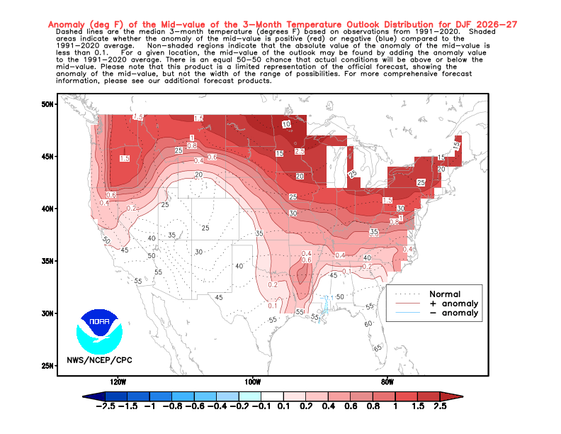
Looking at December-January-February, we see this pattern strengthen even more. Almost every outlet and model is showing temperatures well above normal for our region. This doesn’t mean we won’t see winter, and it doesn’t even mean we won’t see cold snaps. What it is saying is that the odds appear to favor one of the following:
1. Most days being at or above normal.
2. Most days being normal with more above-normal than below-normal days.
3. Most days being above normal.
I suspect option 2 will be the most likely outcome this winter. I think snow may come only a few times this winter, but it could come down hard and fast and may not stay on the ground long, which, combined with a warmer and therefore wetter winter, could lead to greater flood potential in early and late winter into spring. Confidence in any precipitation solution is low—lower than normal, even for an outlook 3+ months down the road.

 Goshen Weather
Leave a comment