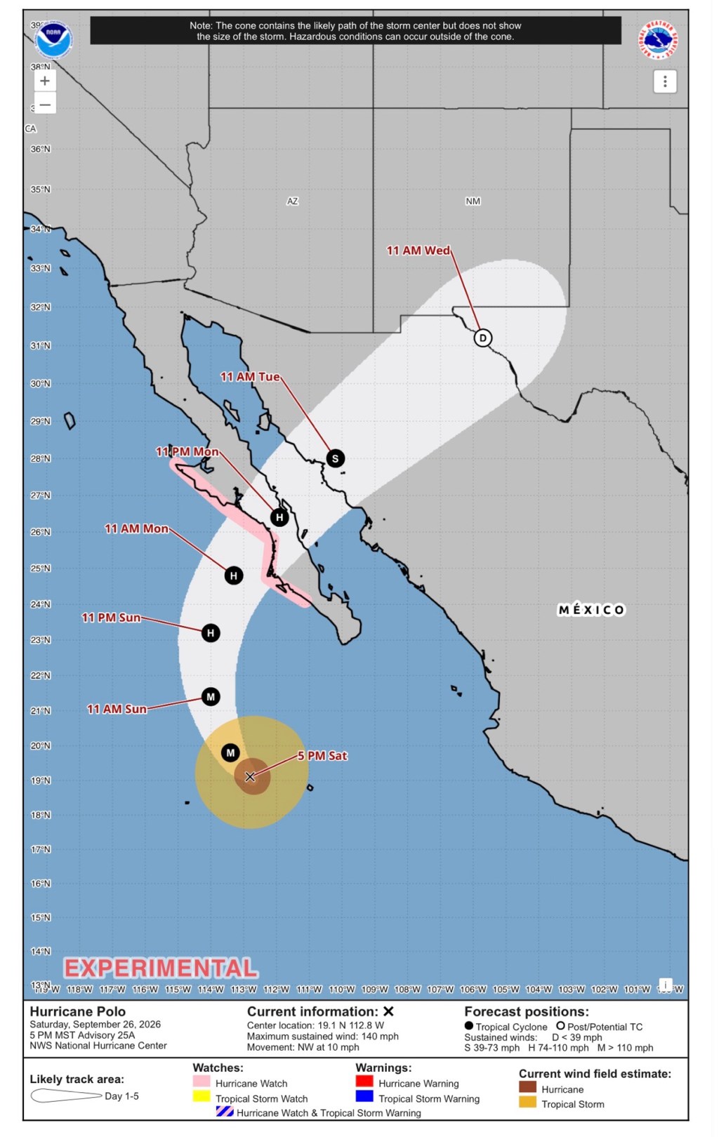
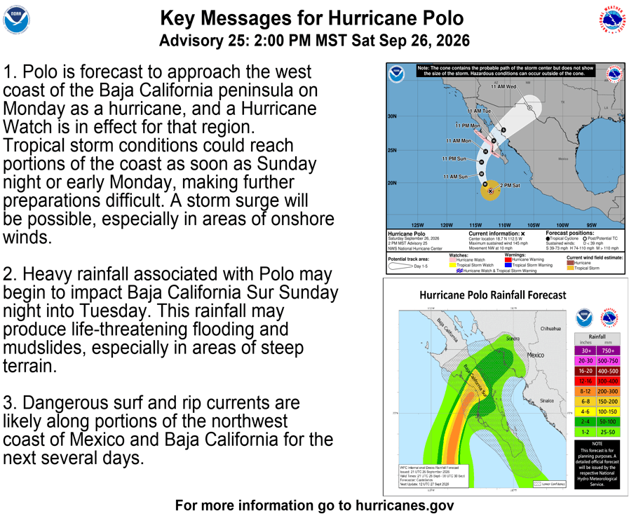
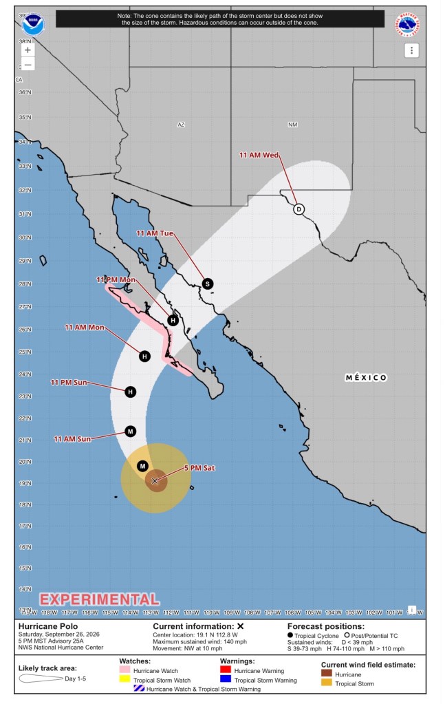
The Pacific Ocean is rockin’ right now with three named hurricanes and two more depressions that could be the next two hurricanes this week. One of those hurricanes is Polo. Hurricane Polo is currently in the Pacific and headed toward the Baja Peninsula of Mexico on Monday. Maximum sustained winds are 140 mph as of the last check. This hurricane is expected to arc northwest, then north, and eventually northeast over the next 24-48 hours. But what happens next could affect our weather next week and beyond.
Will what’s left of the storm stay west and impact the central U.S., or will it continue east, bringing 2-3” of rain to the Midwest and Great Lakes later next week? Either way, the powerful low pressure associated with the storm will pull down some of the coldest air yet this season as it moves east of our area, with northwest and north winds behind it. These cool winds could even bring about our first frost late next week. A lot depends on where this storm tracks, and we simply don’t (and can’t) know how things will play out just yet. It will be fascinating to watch where this storm ends up over the next 2-3 days.
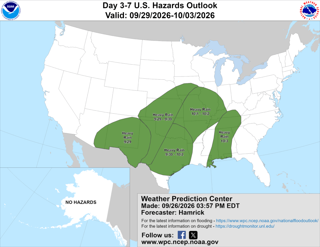
As is often the case, models are handling the potential storm’s local impacts differently. The GFS is keeping most of the activity to the west next week, while the Euro brings 2” or so of rain right into Michiana between Tuesday and Thursday.
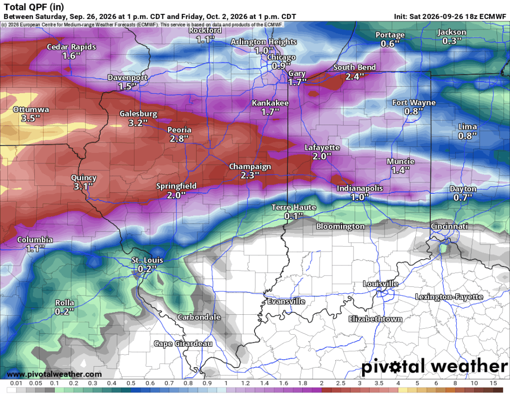
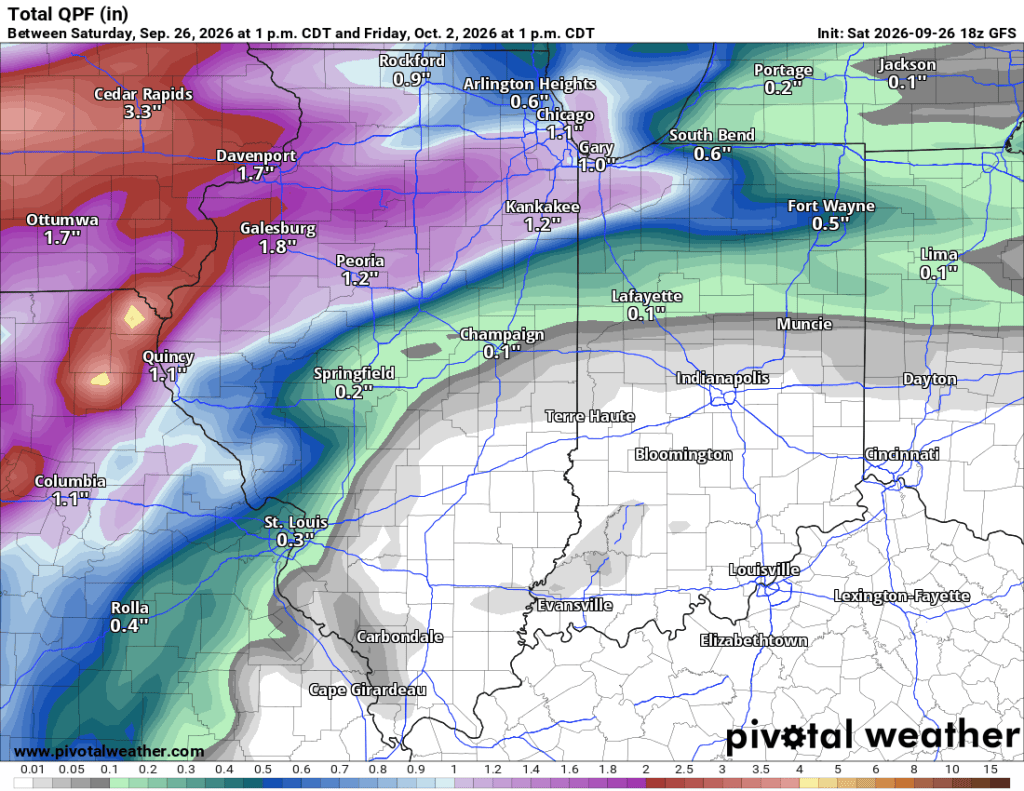
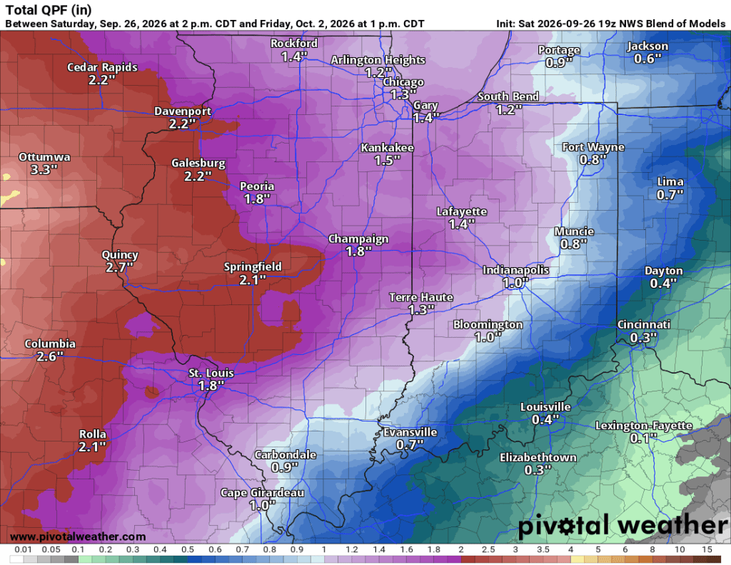
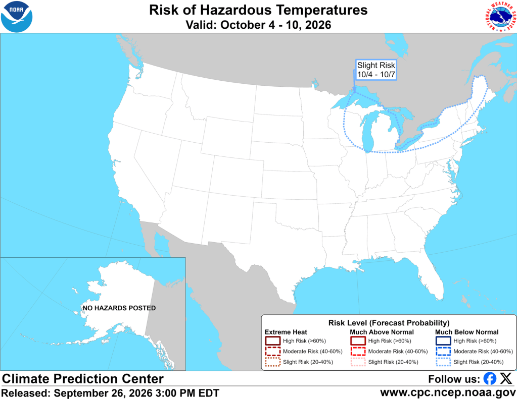
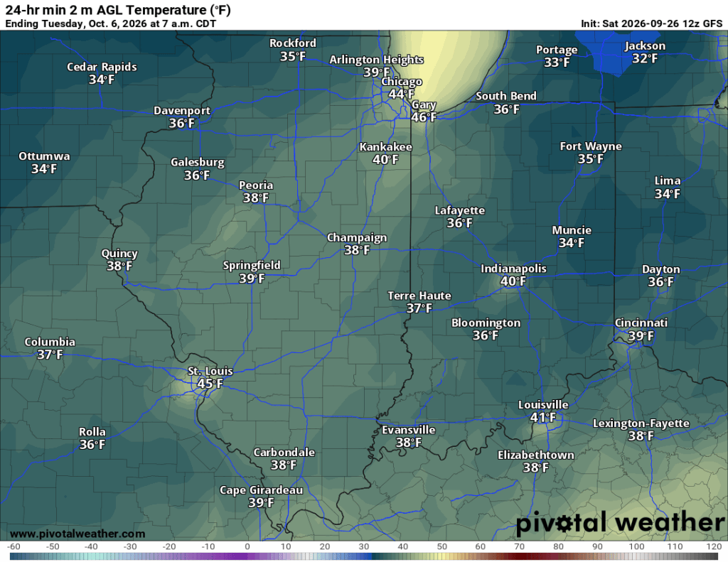
Again, regardless of the exact path of the remnants of Hurricane Polo, we could see the season’s coldest air arrive late next weekend and into the following week. The first frost is possible in this timeframe, though confidence is still low. Nonetheless, pattern drivers suggest we could see quite a cooldown. This is well beyond any recommended forecast range that I’d have any confidence in whatsoever. Still, as I’ve said before, long-range temperature forecasts tend to verify far more often than precipitation ones do. Take a look at the GFS model for the low on October 6th…
It’s been a very quiet Atlantic Hurricane season, but the Pacific Ocean has been busy. Regardless, I certainly didn’t have hurricane remnants and possibly the first frost on my forecast bingo card for today. Models have flip-flopped on the overall pattern for early October, and Pacific hurricanes are likely playing a significant role in disrupting their accuracy. I suspect we will see a brief warm-up before the remnants of Polo make their way past us, but the extent of the warm-up will also depend on the storm’s path. Behind the storm, though, there is widespread agreement on a normal-to-below-normal temperature pattern setting up. And, outside of the potential remnants, a fairly dry pattern looks to continue as well.
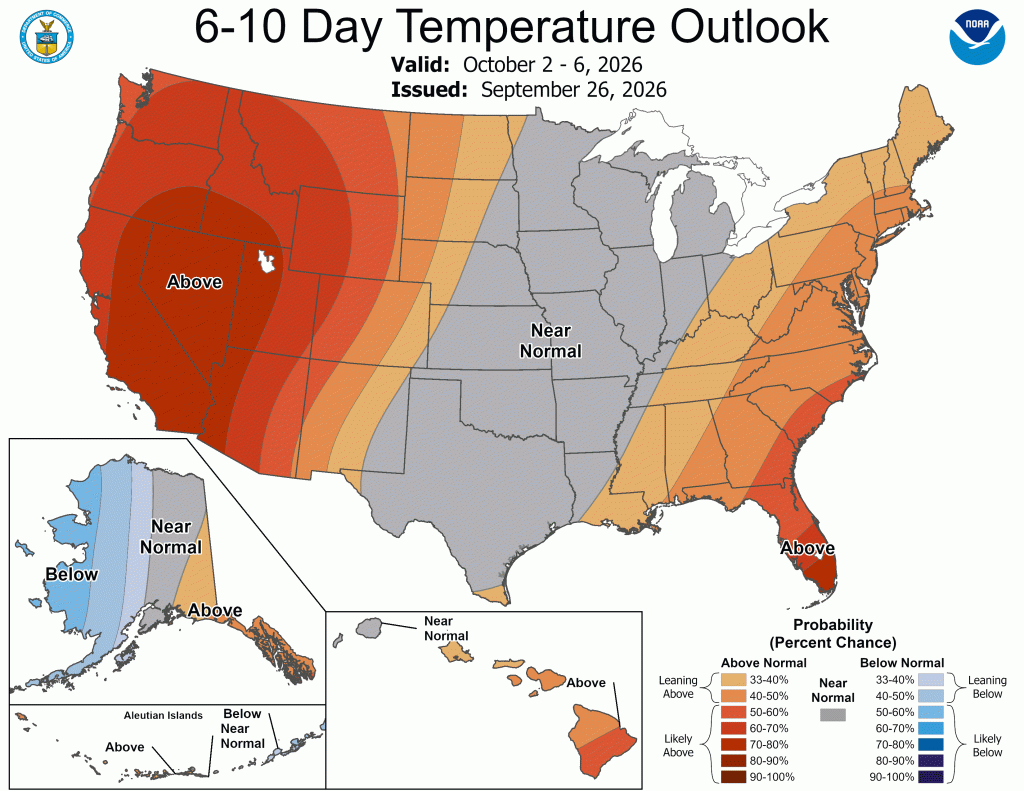
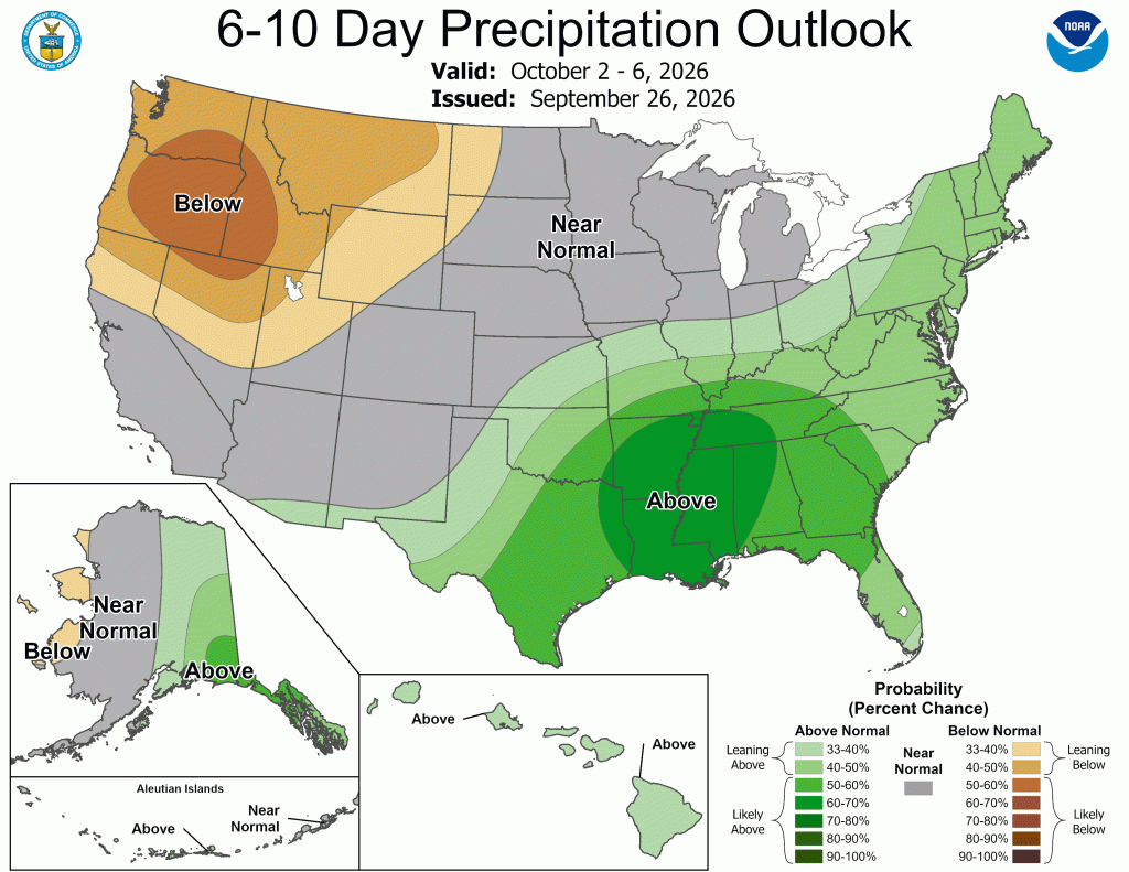
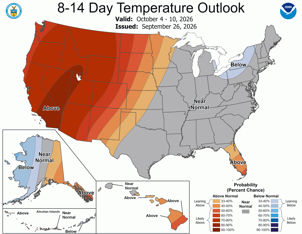
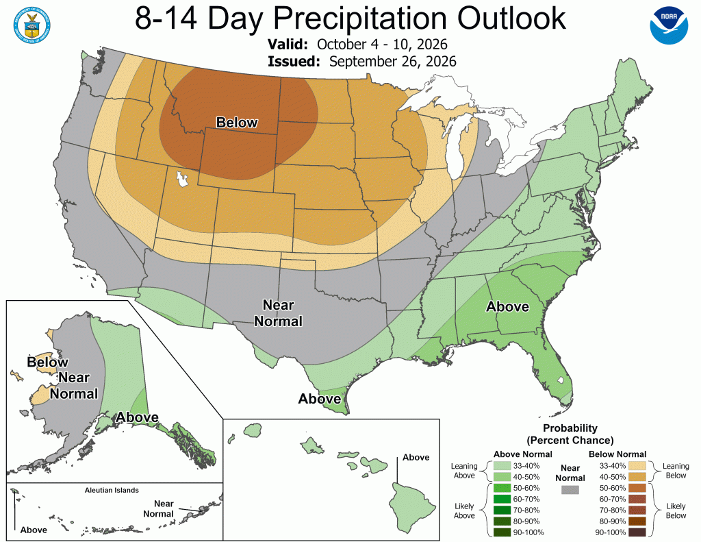
Pay attention to the track of what’s left of Polo for a few reasons this week. If it passes to our south, it may signal the expected path of most storms this winter. It could be a nice “practice run” to see what happens locally before, during, and after the storm. I am particularly interested in temperature swings and wind patterns, as the right combination of the two can lead to significant lake effect snow events. If we stay “mild” this winter, Lake Michigan is unlikely to freeze as much as it normally does, which could extend the lake effect snow season. If storms tend to pass to the south, it could bring more favorable winds for lake effect snow bands to curl southeast off Lake Michigan, which could mean more lake effect snow locally. Of course, if we are above freezing more often than not, it wouldn’t be snow we’d see. Still, this is worth watching and filing away for later.
In the meantime, get out and enjoy the next two days—they look incredible!


Leave a comment